Zirku Airport | |||||||||||
|---|---|---|---|---|---|---|---|---|---|---|---|
| Summary | |||||||||||
| Airport type | Private | ||||||||||
| Operator | Zakum Development Company | ||||||||||
| Location | Zirku Island, UAE | ||||||||||
| Time zone | UAE Standard Time (UTC+04:00) | ||||||||||
| Elevation AMSL | 14 ft / 4 m | ||||||||||
| Coordinates | 24°51′48″N053°04′33″E / 24.86333°N 53.07583°E | ||||||||||
| Map | |||||||||||
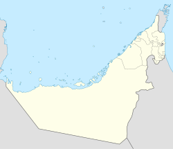 OMAZ Location in the UAE  OMAZ OMAZ (Persian Gulf)  OMAZ OMAZ (Indian Ocean)  OMAZ OMAZ (Middle East)  OMAZ OMAZ (West and Central Asia)  OMAZ OMAZ (Asia) | |||||||||||
 | |||||||||||
| Runways | |||||||||||
| |||||||||||
Zirku Airport( ICAO : OMAZ) is a private airfield operated by the Zakum Development Company. It serves the oil field at Zirku Island, Abu Dhabi, UAE.