A9 (Sydney)

Last updated

A9

AUS Alphanumeric Route A9.svg
The Northern Road looking south at Bringelly Road interchange.jpg
The Northern Road looking south at Bringelly Road interchange
General information
TypeHighway
Length62.6 km (39 mi) [1]
Route number(s) AUS Alphanumeric Route A9.svg A9 (2013–present)
Former
route number
  • AUS Metroad 9.svg Metroad 9 (1998–2013)
  • Australian state route 69.svg State Route 69 (1973–1998)
Major junctions
North endAUS Alphanumeric Route A2.svg Bridge Street
Windsor, Sydney
 
South endAUS Alphanumeric Route B69.svgNarellan Road
Campbelltown, Sydney
Location(s)
Major suburbs Windsor, Kingswood, Luddenham, Narellan, Campbelltown
Highway system
The Northern Road (northbound) at Luddenham The Northern Road (northbound) at Luddenham.JPG
The Northern Road (northbound) at Luddenham

The A9 is the outer western Sydney Bypass connecting Campbelltown to Windsor. It was formerly designated Metroad 9, which was one of Sydney's Metroads.

Contents

“A9” is used as a route number designation for the entire length, however the road falls under numerous local names. From Windsor to Campbelltown:

The A9 applies to Narellan Road from the Hume Motorway interchange to Camden and the complete stretch of The Northern Road from Camden to Windsor via Penrith. It crosses the Great Western Highway and M4 Western Motorway near Penrith.

The A9 is also the major link between the International Regatta Centre at Cranebrook and the M4 Western Motorway. It was upgraded just before the Sydney 2000 Olympics.

History

The passing of the Main Roads Act of 1924 [2] through the Parliament of New South Wales provided for the declaration of Main Roads, roads partially funded by the State government through the Main Roads Board (later the Department of Main Roads, and eventually Transport for NSW). Main Road No. 154 was declared from the intersection with Hume Highway (today Camden Valley Way) in Narellan, via Bringelly and Luddenham to Llandilo (and continuing northwards to the intersection with Windsor Street in Richmond), [3] Main Road No. 178 was declared between Narellan and Campbelltown, [3] and Main Road No. 184 was declared along Macquarie Street, between Richmond and Windsor Roads, through Windsor, [3] on the same day, 8 August 1929. The alignment between Llandilo and Richmond was later realigned to run to Windsor instead.

The route was allocated part of State Route 69 in 1973, [4] linking Singleton to Wollongong via Sydney's western suburbs, along Putty Road, the current A9 route, and Appin Road. It was replaced by Metroad 9 between Windsor and Campbelltown in December 1998, with State Route 69 consequently split into two sections: [5] a northern section along Putty Road connecting Windsor to Singleton, and a southern section along Appin Road connecting Campbelltown to Wollongong via the Princes Motorway.

With the conversion to the newer alphanumeric system in 2013, Metroad 9 was replaced by route A9, and the southern section of State Route 69 (Appin Road) was replaced by route B69; the northern section of State Route 69 (Putty Road) was left unallocated.

Road upgrade

As part of the Western Sydney Infrastructure Plan, 35 km (21.7 mi) of The Northern Road will be upgraded to a minimum of four lanes between The Old Northern Road at Narellan and Jamison Road at South Penrith. [6] [7] The project is being delivered in six stages, with the first stage at Oran Park completed in April 2018. [8] In April 2020, The Northern Road was also realigned between Mersey Road and Eaton Road at Luddenham, to facilitate the construction of Western Sydney Airport. [9] [10] On 16 July 2020, The Northern Road and Bringelly Road interchange opened including a realignment of The Northern Road. [11] On 13 December 2020, The Northern Road was realigned between Elizabeth Drive and Eaton Road was opened to traffic, bypassing Luddenham. [12] The rest of The Northern Road upgrade was completed through 2021, with the final upgrade opened to traffic in December 2021. [13] [14]

Future replacement

As part of economic development of western Sydney, including the construction of the Western Sydney Airport at Badgerys Creek, the road was proposed to be upgraded to a grade separated motorway. The proposal, known as the M9 Outer-Western Sydney Orbital motorway, would link the M31 near Appin with the Central Coast via Camden, Penrith and Windsor.[ citation needed ]

As part of the State Budget 2014–15, the NSW Government announced a $5.5 billion road package for Western Sydney. It includes $4.6 million for planning the M9 Motorway. The preferred corridor for the motorway was expected to be announced later in 2014 before plans are made for reserving land. [15] The corridor is now known as Outer Sydney Orbital with motorway codenames as either M9 or M10. [16]

See also

Australia road sign W5-29.svg   Australian Roadsportal

Related Research Articles

<span class="mw-page-title-main">Hume Highway</span> Major national highway in Australia

Hume Highway, inclusive of the sections now known as Hume Freeway and Hume Motorway, is one of Australia's major inter-city national highways, running for 840 kilometres (520 mi) between Melbourne in the southwest and Sydney in the northeast. Upgrading of the route from Sydney's outskirts to Melbourne's outskirts to dual carriageway was completed on 7 August 2013.

<span class="mw-page-title-main">Pacific Highway (Australia)</span> Highway in New South Wales and Queensland

Pacific Highway is a 790-kilometre-long (491 mi) national highway and major transport route along the central east coast of Australia, with the majority of it being part of Australia's Highway 1. The highway and its adjoining Pacific Motorway between Brisbane and Brunswick Heads and Pacific Motorway between Sydney and Newcastle links the state capitals of Sydney in New South Wales with Brisbane in Queensland, approximately paralleling the Tasman Sea and the Coral Sea of the South Pacific Ocean coast, via regional cities and towns like Gosford, Newcastle, Taree, Port Macquarie, Kempsey, Coffs Harbour, Grafton, Ballina, Byron Bay, Tweed Heads and the Gold Coast, which is part of Queensland. Additionally, between Brunswick Heads and Port Macquarie, the road is also signed as Pacific Motorway, but has not been legally gazetted as such.

<span class="mw-page-title-main">Great Western Highway</span> Highway in New South Wales

Great Western Highway is a 202-kilometre-long (126 mi) state highway in New South Wales, Australia. From east to west, the highway links Sydney with Bathurst, on the state's Central Tablelands.

<span class="mw-page-title-main">A6 (Sydney)</span>

The A6 is an arterial road linking Cumberland Highway at Carlingford and Princes Highway at Heathcote, via Lidcombe and Bankstown. It was formerly designated as Metroad 6, which was one of the Sydney Metroads.

<span class="mw-page-title-main">Cumberland Highway</span>

Cumberland Highway is a 34-kilometre (21 mi) long urban highway located in Sydney, New South Wales, Australia. The highway links Pacific Highway and Pacific Motorway (M1) at Pearces Corner, Wahroonga in the northeast with Hume Highway at Liverpool in the southwest. This name covers a few consecutive roads and is widely known to most drivers, but the entire allocation is also known – and signposted – by the names of its constituent parts: Pennant Hills Road, James Ruse Drive, Briens Road, Old Windsor Road, Hart Drive, Freame Street, Emert Street, Jersey Road, Betts Road, Warren Road, Smithfield Road, Palmerston Road, (New) Cambridge Street, Joseph Street and Orange Grove Road. The entire length of Cumberland Highway is designated part of route A28.

<span class="mw-page-title-main">Macarthur railway station</span> Railway station in Sydney, New South Wales, Australia

Macarthur railway station is located on the Main South line, serving the Sydney suburb of Campbelltown. It is served by Sydney Trains T8 Airport & South and NSW TrainLink Southern Highlands Line services. It is the southern extremity of the electrified Sydney Trains network.

<span class="mw-page-title-main">Luddenham, New South Wales</span> Suburb of Sydney, New South Wales, Australia

Luddenham is a suburb of Sydney, in the state of New South Wales, Australia 42 kilometres west of the Sydney central business district, in the local government areas of the City of Penrith and City of Liverpool. It is part of the Greater Western Sydney region.

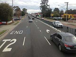
Bringelly is a suburb of Sydney, in the state of New South Wales, Australia. It is located on the Northern Road between Penrith and Camden. It has a public school. Bringelly is also the name of a local hill.

<span class="mw-page-title-main">Putty Road</span> Road in New South Wales

The Putty Road is a rural road that links the northwestern suburbs of Sydney to the Hunter Region in New South Wales, in eastern Australia. The southern terminus of the Putty Road is Wilberforce and the northern terminus is Singleton.

<span class="mw-page-title-main">Appin Road</span> Road in New South Wales, Australia

Appin Road is a New South Wales secondary highway linking Campbelltown and Sydney's western suburbs with Wollongong. It gets its name from Appin, which lies on its path.

<span class="mw-page-title-main">M5 Motorway (Sydney)</span> Motorway in Sydney, Australia

The M5 Motorway is a 29-kilometre (18 mi) motorway located in Sydney, New South Wales that is part of the Sydney Orbital Network.

The Camden Valley Way is a 24-kilometre (15 mi) arterial road between Sydney and the historic town of Camden.

<span class="mw-page-title-main">Windsor Road</span> Road in Sydney, Australia

Windsor Road is a notable road in the Hills District of Sydney. It starts from Windsor, New South Wales and ends at Northmead, New South Wales. However, Windsor Road is not continuous. The northern section of Windsor Road is continuous with Old Windsor Road instead, designated route A2. The southern section of Windsor Road forms a T-junction with route A2 at Kellyville.

<span class="mw-page-title-main">Old Windsor Road</span> Road in Sydney, Australia

Old Windsor Road is a notable and historic road in Sydney, Australia. It starts from Kellyville, New South Wales and ends at Northmead, New South Wales, just north of Parramatta, and acts as part of a main arterial between Parramatta and Windsor. A section at its southeastern end is a constituent part of Cumberland Highway.

<span class="mw-page-title-main">A38 (Sydney)</span>

The A38 is a major arterial route in Sydney, Australia, connecting M2 Hills Motorway in North Ryde to the Pittwater Road (A8) in Dee Why.

<span class="mw-page-title-main">Western Sydney Airport</span> Future airport to serve Sydney, New South Wales, Australia

Western Sydney International Airport, also known as Western Sydney Airport or Badgerys Creek Airport, is a new international airport currently under construction within the suburb of Badgerys Creek, New South Wales, Australia. The airport is planned to have 24-hour and curfew-free operations and will supplement Kingsford Smith Airport, which has reached capacity due to a legislated curfew and flight caps. The first stage of construction on the new airport began on 24 September 2018, and the first stage is expected to be complete and open by December 2026. The site was officially designated by the Federal Government on 15 April 2014, after decades of debate on the location of another airport within Greater Sydney.

Western Sydney Infrastructure Plan (WSIP) is an A$4.1 billion 10-year road investment program in Western Sydney, New South Wales, jointly funded by the federal government and the New South Wales state government. Originally introduced in April 2014 as a $3.5 billion program consisting of key road upgrade projects in Western Sydney, particularly in the south west surrounding the future Western Sydney Airport, the program scope was later expanded and funding was increased to $4.1 billion. The funding is now split among:

The Outer Sydney Orbital is a proposed corridor for a motorway and freight rail line in Western Sydney. The motorway is proposed to be signposted M9 or M10. The proposed orbital will run parallel to The Northern Road.

References

  1. Google (17 August 2022). "A9 road" (Map). Google Maps . Google. Retrieved 17 August 2022.
  2. State of New South Wales, An Act to provide for the better construction, maintenance, and financing of main roads; to provide for developmental roads; to constitute a Main Roads Board Archived 11 August 2022 at the Wayback Machine 10 November 1924
  3. 1 2 3 "Main Roads Act, 1924–1927". Government Gazette of the State of New South Wales. No. 110. National Library of Australia. 17 August 1928. pp. 3814–20. Retrieved 1 August 2022.
  4. State Route 69, Ozroads, Retrieved on 2 August 2013[ self-published source ]
  5. http://ozroads.com.au/NSW/RouteNumbering/Metroads/9/metroad9.htm OzRoads: Metroad 9[ self-published source ]
  6. "The Northern Road upgrade". Roads and Maritime Services. Archived from the original on 17 June 2019. Retrieved 24 September 2019.
  7. "Western Sydney Infrastructure Plan". (Federal) Department of Infrastructure, Transport, Cities and Regional Development. Archived from the original on 10 October 2017. Retrieved 24 September 2019.
  8. "The Northern Road upgrade, The Old Northern Road to Peter Brock Drive". Roads and Maritime Services. Archived from the original on 18 June 2019. Retrieved 24 September 2019.
  9. "New The Northern Road opening between Mersey Road and Eaton Road, Luddenham" (PDF). Transport for NSW – Roads and Maritime. April 2020. Archived (PDF) from the original on 10 June 2020. Retrieved 10 June 2020.
  10. "Drivers get moving on new section of Northern Road". Transport for NSW – Roads and Maritime. 24 April 2020. Retrieved 10 June 2020.
  11. "Opening of the Bringelly Road interchange and new section of The Northern Road between Belmore Road and Thames Road, Bringelly from Thursday 16 July 2020" (PDF). Transport for NSW – Roads and Maritime. July 2020. Retrieved 22 July 2020.
  12. "The Northern Road upgrade – Eaton Road to Elizabeth Drive (bypass of Luddenham town centre)" (PDF). Transport for NSW – Roads and Maritime. 13 December 2020. Retrieved 16 December 2020.
  13. "$1.6 billion Northern Road Upgrade in Western Sydney Complete". Transport for NSW. 30 November 2021. Retrieved 6 December 2021.
  14. "The Northern Road upgrade – completed 2021" (PDF). Transport for NSW – Roads and Waterways. Transport for NSW. December 2021. Retrieved 6 December 2021.
  15. Clennel, Andrew (19 June 2014). "M9 Outer-western Sydney Orbital motorway part of big ticket $5.5b roads package unveiled in today's NSW Budget". The Daily Telegraph. News ltd. Retrieved 21 June 2014.
  16. "Outer Sydney Orbital corridor identification". Transport for NSW. Retrieved 23 September 2020.