Powys is a county and preserved county in Wales. It borders Gwynedd, Denbighshire, and Wrexham to the north; the English ceremonial counties of Shropshire and Herefordshire to the east; Monmouthshire, Blaenau Gwent, Merthyr Tydfil, Caerphilly, Rhondda Cynon Taf, and Neath Port Talbot to the south; and Carmarthenshire and Ceredigion to the west. The largest settlement is Newtown, and the administrative centre is Llandrindod Wells.

The Afon Mawddach is a river in Gwynedd, Wales, which has its source in a wide area SH820300 north of Dduallt in Snowdonia. It is 28 miles (45 km) in length, and is much branched; many of the significant tributaries are of a similar size to the main river. The catchment area is bounded to the east by the Aran Fawddwy massif and to the west and north by the Harlech dome which forms a watershed just south of Llyn Trawsfynydd.

The Afon Rheidol is a river in Ceredigion, Wales, 19 miles (31 km) in length. The source is Plynlimon. Receiving an average annual rainfall of 40 inches (1.02 m), Plynlimon is also the source of both the Wye and the Severn.

ˈ The Afon Ogwen is a river in north-west Wales draining from some of the greatest peaks in Snowdonia before discharging to the sea on the eastern side of Bangor, Gwynedd.

The Cambrian Line, sometimes split into the Cambrian Main Line and Cambrian Coast Line for its branches, is a railway line that runs from Shrewsbury, England, westwards to Aberystwyth and Pwllheli in Wales. Passenger train services are operated by Transport for Wales Rail between the western terminals of Pwllheli, in Gwynedd, and Aberystwyth, in Ceredigion, and the eastern terminal at Shrewsbury, Shropshire, as part of the Wales & Borders franchise. The railway line is widely regarded as scenic, as it passes through the Cambrian Mountains in central Wales, and along the coast of Cardigan Bay in Snowdonia National Park.

Pistyll Rhaeadr is a waterfall 4 miles from the village of Llanrhaeadr-ym-Mochnant in Powys, Wales, and 16 miles west of Oswestry.

The River Dwyryd (Welsh: Afon Dwyryd, meaning a river of two fords, is a river in Gwynedd, Wales which flows principally westwards; draining to the sea into Tremadog Bay, south of Porthmadog.

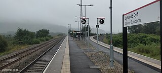
Dovey Junction is a railway station on the Cambrian Line in Wales. It is the junction where the line splits into the line to Aberystwyth and the Cambrian Coast Line to Pwllheli. Passenger services are provided by Transport for Wales. There is a single island platform.

Esgairgeiliog is a village in Powys, Wales, UK. It is situated at the junction of the Afon Glesyrch's and Afon Dulas' valleys.

The River Dyfi, also known as the River Dovey, is an approximately 30-mile (48-kilometre) long river in Wales.

Ffridd Gate was a station on the Corris Railway in Merioneth, Wales, UK. It was built at the level crossing over the B4404 road to Llanwrin, near the hamlet of Fridd. A small hamlet also grew up around the station and a nearby (pre-existent) toll-house. The hamlet and former station are near to the confluence of the Afon Dulas and the River Dyfi, around 2+1⁄4 miles (3.6 km) west of the village of Llanwrin and 1 mile (1.6 km) north of the town of Machynlleth.
The Aberystwith and Welsh Coast Railway was a standard gauge railway company, running a line along the west coast of Wales.

Morben is a hamlet in northern Powys, Wales. Part of the historic county of Montgomeryshire from 1536 to 1974, it lies on the Afon Dyfi and was once the home of a number of riverside quays, including Cei Ward and Y Bwtri. The site of Cei Ward lies alongside the A487 opposite Plas Llugwy, where the road, railway and river run close together. Y Bwtri lay on the bend of the river opposite Pennal and was the site of a shipyard.

The River Dysynni is a river in mid Wales. Its source is the Tal-y-llyn Lake just south of the Cadair Idris massif and its mouth is in the Cardigan Bay area of the Irish Sea to the north of Tywyn. It measures about 16 mi (26 km) in length.

The Afon Fathew is a river in Gwynedd, north-west Wales. The river is downstream from the Dolgoch Falls which is a popular nature site, and is followed for much of its course by the Talyllyn Railway.

The Afon Leri is a river in Ceredigion, Wales. It rises at Llyn Craig-y-Pistyll and is joined at Talybont by Afon Ceulan before passing behind Borth to its mouth in the Dyfi estuary at Ynyslas.

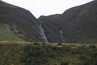
Pistyll y Llyn is one of the tallest waterfalls in Wales and the United Kingdom. It is a horsetail style set of falls which are located in the Cambrian Mountains about 2+1⁄2 miles from Glaspwll in Powys, Wales.

The Newtown and Machynlleth Railway was a railway company in Wales. It built a line from a junction with the Llanidloes and Newtown Railway near Caersws to the market town of Machynlleth; the line opened in 1862. Newtown had become the hub of railway lines in the district. Machynlleth was an important town, and extension from there to Aberystwyth and to the coast northward was in the minds of the promoters.

Newport Bay is a bay on a section of the north Pembrokeshire coast, Wales, which is within the Pembrokeshire Coast National Park. The bay is one of many in the much larger Cardigan Bay, and it stretches from Dinas Island to the headland of Pen-y-bâl, two miles to the east. It is overlooked by the town of Newport and the River Nevern flows into the bay.


