
The River Brenig (Afon Brenig) is a tributary river of the River Teifi and runs through the market town of Tregaron in Ceredigion, Wales.
The River Brenig (Afon Brenig) is a tributary river of the River Teifi and runs through the market town of Tregaron in Ceredigion, Wales.
It is formed from the confluence of the Afon Groes and Afon Berwyn in the foothills of the Cambrian Mountains.[ citation needed ]
The Brenig meets the River Teifi just below Tregaron. [1] : 21

Between 2008 and 2010, a £ 2.7m development project by Environment Agency Wales began in Tregaron to protect the town from the river flooding. This involved lowering the riverbed and building floodgates, as well as implementing improvements to existing floodwalls. [2]
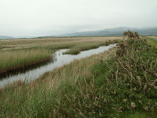
The Brenig is home to otters, with infrastructure being created for the animals in the 2008 project. [2]
The river was once frequented by Atlantic salmon but their numbers have declined. Brown trout are prevalent in the river and larger specimens can be caught in the narrower parts where the water runs deeper. Several 1 pound (0.45 kg) fish have been caught along with a local record 4 pounds (1.8 kg) fish which can be seen mounted in the Talbot Hotel. Recently a 2.5 pounds (1.1 kg) fish was caught in the river. Many eels can also be found.[ citation needed ]
Prior to 1840, sections of the river were canalised to safeguard a local turnpike road. [1] : 25
The area was used as a special stage during the 2015 Wales Rally GB.[ citation needed ]

Ceredigion, historically Cardiganshire, is a county in the west of Wales. It borders Gwynedd across the Dyfi estuary to the north, Powys to the east, Carmarthenshire and Pembrokeshire to the south, and the Irish Sea to the west. Aberystwyth is the largest settlement and, together with Aberaeron, is an administrative centre of Ceredigion County Council.

Cardigan is both a town and a community in the county of Ceredigion, Wales. Positioned on the tidal reach of the River Teifi at the point where Ceredigion meets Pembrokeshire, Cardigan was the county town of the historic county of Cardiganshire. Cardigan is the second-largest town in Ceredigion. The largest town, Aberystwyth, is one of the two administrative centres; the other is Aberaeron.

Newcastle Emlyn is a town on the River Teifi, straddling the counties of Ceredigion and Carmarthenshire in West Wales. It is also a community entirely within Carmarthenshire, bordered by those of Llangeler and Cenarth, also in Carmarthenshire, and by Llandyfriog in Ceredigion. Adpar is the part of town on the Ceredigion side of the River Teifi. It was formerly called Trefhedyn and was an ancient Welsh borough in its own right. The area including Adpar had a population of 1,883 according to the 2011 census.

Tregaron is an ancient market town in Ceredigion, Wales. It is sited astride the River Brenig, a tributary of the River Teifi, and is 11 miles (18 km) north-east of Lampeter. According to the 2011 Census, the population of the ward of Tregaron was 1,213 and 67% of the population could speak Welsh; Tregaron is a community covering 33 square miles (85 km2); two-thirds of the population were born in Wales.

The River Towy is one of the longest rivers flowing entirely within Wales. Its total length is 120 km (75 mi). It is noted for its sea trout and salmon fishing.

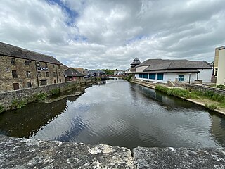
The River Teifi in Wales forms the boundary for most of its length between the counties of Ceredigion and Carmarthenshire, and for the final 3 miles (4.8 km) of its total length of 76 miles (122 km), the boundary between Ceredigion and Pembrokeshire. Its estuary is northwest of Cardigan, known in Welsh as Aberteifi, meaning 'mouth of the Teifi'. Teifi has formerly been anglicised as "Tivy".

The Desert of Wales, or Green Desert of Wales, is an archaic term for an area in central Wales, so called for its lack of roads and towns, and its inaccessibility. The term was coined by English travel writers in the nineteenth century and has no equivalent in the Welsh language. The area corresponds roughly to the upland area called Elenydd in Welsh.

Afon Rheidol is a river in Ceredigion, Wales, 19 miles (31 km) in length. The source is Plynlimon. Receiving an average annual rainfall of 40 inches (1.02 m), Plynlimon is also the source of both the Wye and the Severn.
Cwmann is a small village in Carmarthenshire, Wales, in the community of Pencarreg. It is just on the border with Ceredigion and near Lampeter, with Cwmann being on the Carmarthenshire side of the border. The population in 2011 was around 872.
The River Cleddau consists of the Eastern and Western Cleddau rivers in Pembrokeshire, west Wales. They unite to form the Daugleddau estuary and the important harbour of Milford Haven.

The Afon Lwyd or Afon Llwyd is a 13-mile (21 km) long river in south-east Wales which flows from its source northwest of Blaenavon, through Abersychan, Pontnewynydd, Pontypool, Llanfrechfa and Cwmbran before flowing, at Caerleon, into the River Usk, which subsequently flows into the Bristol Channel to the south of Newport.
The Carmarthen–Aberystwyth line was originally a standard-gauge branch line of the Great Western Railway (GWR) in Wales, connecting Carmarthen and Aberystwyth.

Cors Caron is a raised bog in Ceredigion, Wales. Cors is the Welsh word for "bog". Cors Caron covers an area of approximately 349 hectares. Cors Caron represents the most intact surviving example of a raised bog landscape in the United Kingdom. About 44 different species groups inhabit the area including various land and aquatic plants, fish, insects, crustaceans, lichen, fungi, terrestrial mammals and birds.

Afon Cych is a tributary of the River Teifi in south-west Wales. It is 13 km long, passes through a number of small settlements on the border between Pembrokeshire and Carmarthenshire, and is significant in Welsh legend.
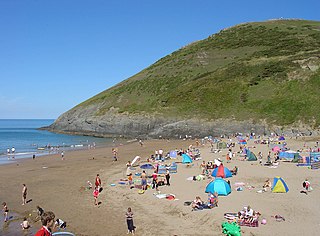
The Ceredigion Coast Path is a waymarked long distance footpath in the United Kingdom, on the coast of Ceredigion, Wales. It is 65 miles (105 km) in length, running along the coast of Cardigan Bay from Cardigan (52.0810°N 4.6608°W) to Ynyslas (52.5271°N 4.0495°W).

The River Dulas is a tributary of the River Teifi and has its source near the village of Llangybi, Ceredigion, Wales. Its confluence with the Teifi is near Lampeter.
Afon Leri is a river in Ceredigion, Wales. It rises at Llyn Craig-y-Pistyll and is joined at Talybont by Afon Ceulan before passing behind Borth to its mouth in the Dyfi estuary at Ynyslas.
Silian, originally Sulien, is a village in the valley of the River Teifi, Ceredigion, Wales. It is located approximately two miles north-west of Lampeter, on a minor road connecting Pont Creuddun on the A482, and Glan Denys on the A485.
The coast of Ceredigion is made up of a long coastal plain that contains high cliffs, coves, large bays and estuaries. The coastal plain gets narrower towards the more mountainous north of the county and is cut by the wide estuaries of the Teifi and the Dyfi. The broad and fertile Teifi valley is ideal for dairy farming and mixed farming. Heavy rainfall washes the minerals out of the soil and results in the mountainous areas of the county having relatively poorer, acidic soils. The plough line can be as low as 700 feet, which restricts cultivation.
The bedrock geology of Ceredigion in west Wales consists wholly of a considerable thickness of Ordovician and Silurian age sedimentary rocks of marine origin. Unconsolidated deposits of Quaternary age include a widespread cover of glacial till, valley floor alluvium and scattered peat deposits in both upland and lowland settings.
52°13′12″N3°56′02″W / 52.22°N 3.934°W
| | This Ceredigion location article is a stub. You can help Wikipedia by expanding it. |
