Related Research Articles

El Niño is the warm phase of the El Niño–Southern Oscillation (ENSO) and is associated with a band of warm ocean water that develops in the central and east-central equatorial Pacific, including the area off the Pacific coast of South America. The ENSO is the cycle of warm and cold sea surface temperature (SST) of the tropical central and eastern Pacific Ocean.

La Niña is an oceanic and atmospheric phenomenon that is the colder counterpart of El Niño, as part of the broader El Niño–Southern Oscillation (ENSO) climate pattern. The name La Niña originates from Spanish for "the girl", by analogy to El Niño, meaning "the boy". In the past, it was also called an anti-El Niño and El Viejo, meaning "the old man."
The quasi-biennial oscillation (QBO) is a quasiperiodic oscillation of the equatorial zonal wind between easterlies and westerlies in the tropical stratosphere with a mean period of 28 to 29 months. The alternating wind regimes develop at the top of the lower stratosphere and propagate downwards at about 1 km (0.6 mi) per month until they are dissipated at the tropical tropopause. Downward motion of the easterlies is usually more irregular than that of the westerlies. The amplitude of the easterly phase is about twice as strong as that of the westerly phase. At the top of the vertical QBO domain, easterlies dominate, while at the bottom, westerlies are more likely to be found. At the 30mb level, with regards to monthly mean zonal winds, the strongest recorded easterly was 29.55 m/s in November 2005, while the strongest recorded westerly was only 15.62 m/s in June 1995.

El Niño–Southern Oscillation (ENSO) is an irregular periodic variation in winds and sea surface temperatures over the tropical eastern Pacific Ocean, affecting the climate of much of the tropics and subtropics. The warming phase of the sea temperature is known as El Niño and the cooling phase as La Niña. The Southern Oscillation is the accompanying atmospheric component, coupled with the sea temperature change: El Niño is accompanied by high air surface pressure in the tropical western Pacific and La Niña with low air surface pressure there. The two periods last several months each and typically occur every few years with varying intensity per period.
The North Atlantic Oscillation (NAO) is a weather phenomenon over the North Atlantic Ocean of fluctuations in the difference of atmospheric pressure at sea level (SLP) between the Icelandic Low and the Azores High. Through fluctuations in the strength of the Icelandic Low and the Azores High, it controls the strength and direction of westerly winds and location of storm tracks across the North Atlantic.

The East Greenland Current (EGC) is a cold, low-salinity current that extends from Fram Strait (~80N) to Cape Farewell (~60N). The current is located off the eastern coast of Greenland along the Greenland continental margin. The current cuts through the Nordic Seas and through the Denmark Strait. The current is of major importance because it directly connects the Arctic to the Northern Atlantic, it is a major contributor to sea ice export out of the Arctic, and it is a major freshwater sink for the Arctic.

The Pacific decadal oscillation (PDO) is a robust, recurring pattern of ocean-atmosphere climate variability centered over the mid-latitude Pacific basin. The PDO is detected as warm or cool surface waters in the Pacific Ocean, north of 20°N. Over the past century, the amplitude of this climate pattern has varied irregularly at interannual-to-interdecadal time scales. There is evidence of reversals in the prevailing polarity of the oscillation occurring around 1925, 1947, and 1977; the last two reversals corresponded with dramatic shifts in salmon production regimes in the North Pacific Ocean. This climate pattern also affects coastal sea and continental surface air temperatures from Alaska to California.
The Siberian High is a massive collection of cold dry air that accumulates in the northeastern part of Eurasia from September until April. It is usually centered on Lake Baikal. It reaches its greatest size and strength in the winter when the air temperature near the center of the high-pressure area is often lower than −40 °C (−40 °F). The atmospheric pressure is often above 1,040 millibars (31 inHg). The Siberian High is the strongest semi-permanent high in the northern hemisphere and is responsible for both the lowest temperature in the Northern Hemisphere, of −67.8 °C (−90.0 °F) on 15 January 1885 at Verkhoyansk, and the highest pressure, 1083.8 mbar at Agata, Krasnoyarsk Krai, on 31 December 1968, ever recorded. The Siberian High is responsible both for severe winter cold and attendant dry conditions with little snow and few or no glaciers across Siberia, Mongolia, and China. During the summer, the Siberian High is largely replaced by the Asiatic low.

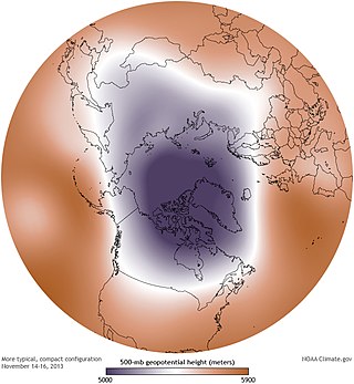
A circumpolar vortex, or simply polar vortex, is a large region of cold, rotating air that encircles both of Earth's polar regions. Polar vortices also exist on other rotating, low-obliquity planetary bodies. The term polar vortex can be used to describe two distinct phenomena; the stratospheric polar vortex, and the tropospheric polar vortex. The stratospheric and tropospheric polar vortices both rotate in the direction of the Earth's spin, but they are distinct phenomena that have different sizes, structures, seasonal cycles, and impacts on weather.

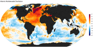
The Atlantic Multidecadal Oscillation (AMO), also known as Atlantic Multidecadal Variability (AMV), is the theorized variability of the sea surface temperature (SST) of the North Atlantic Ocean on the timescale of several decades.

The Indian Ocean Dipole (IOD), also known as the Indian Niño, is an irregular oscillation of sea surface temperatures in which the western Indian Ocean becomes alternately warmer and then colder than the eastern part of the ocean.
The Molloy Deep is a bathymetric feature in the Fram Strait, within the Greenland Sea east of Greenland and about 160 km west of Svalbard. It is the location of the deepest point in the Arctic Ocean. The Molloy Deep, Molloy Hole, Molloy Fracture Zone, and Molloy Ridge were named after Arthur E. Molloy, a U.S. Navy research scientist who worked in the North Atlantic, North Pacific and Arctic Oceans in the 1950s-1970s.

Polar amplification is the phenomenon that any change in the net radiation balance tends to produce a larger change in temperature near the poles than in the planetary average. This is commonly referred to as the ratio of polar warming to tropical warming. On a planet with an atmosphere that can restrict emission of longwave radiation to space, surface temperatures will be warmer than a simple planetary equilibrium temperature calculation would predict. Where the atmosphere or an extensive ocean is able to transport heat polewards, the poles will be warmer and equatorial regions cooler than their local net radiation balances would predict. The poles will experience the most cooling when the global-mean temperature is lower relative to a reference climate; alternatively, the poles will experience the greatest warming when the global-mean temperature is higher.
The Greenland Plate is a supposed tectonic plate bounded to the west by Nares Strait, a probable transform fault; on the southwest by the Ungava transform underlying Davis Strait; on the southeast by the Mid-Atlantic Ridge; and the northeast by the Gakkel Ridge, with its northwest border still being explored. The Greenland craton is made up of some of the oldest rocks on Earth. The Isua greenstone belt in southwestern Greenland contains the oldest known rocks on Earth dated at 3.7–3.8 billion years old.

The West Spitsbergen Current (WSC) is a warm, salty current that runs poleward just west of Spitsbergen,, in the Arctic Ocean. The WSC branches off the Norwegian Atlantic Current in the Norwegian Sea. The WSC is of importance because it drives warm and salty Atlantic Water into the interior Arctic. The warm and salty WSC flows north through the eastern side of Fram Strait, while the East Greenland Current (EGC) flows south through the western side of Fram Strait. The EGC is characterized by being very cold and low in salinity, but above all else it is a major exporter of Arctic sea ice. Thus, the EGC combined with the warm WSC makes the Fram Strait the northernmost ocean area having ice-free conditions throughout the year in all of the global ocean.

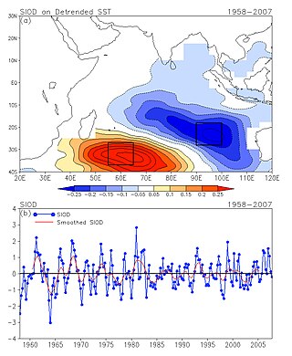
The Subtropical Indian Ocean Dipole (SIOD) is featured by the oscillation of sea surface temperatures (SST) in which the southwest Indian Ocean i.e. south of Madagascar is warmer and then colder than the eastern part i.e. off Australia. It was first identified in the studies of the relationship between the SST anomaly and the south-central Africa rainfall anomaly; the existence of such a dipole was identified from both observational studies and model simulations .

Sea ice in the Arctic has declined in recent decades in area and volume due to climate change. It has been melting more in summer than it refreezes in winter. Global warming, caused by greenhouse gas forcing is responsible for the decline in Arctic sea ice. The decline of sea ice in the Arctic has been accelerating during the early twenty‐first century, with a decline rate of 4.7% per decade. It is also thought that summertime sea ice will cease to exist sometime during the 21st century.

Little Ice Age volcanism refers to the massive volcanic activities during the Little Ice Age. Scientists suggested a hypothesis that volcanism was the major driving force of the global cooling among the other natural factors, i.e. the sunspot activities by orbital forcing and greenhouse gas. The Past Global Change (PAGES), a registered paleo-science association for scientific research and networking on past global changes in the University of Bern, Switzerland, suggested that from 1630 to 1850, a total of 16 major eruptions and cooling events had taken place. When a volcano erupts, ashes burst out of the vent together with magma and forms a cloud in the atmosphere. The ashes act as an isolating layer that block out a proportion of solar radiation, causing global cooling. The global cooling effect impacts ocean currents, atmospheric circulation and cause social impacts such as drought and famine. Wars and rebellions were therefore triggered worldwide in the Little Ice Age. It was suggested that the crisis on Ottoman Empire and Ming-Qing Transition in China were typical examples that closely correlated with Little Ice Age.

Pacific Meridional Mode (PMM) is a climate mode in the North Pacific. In its positive state, it is characterized by the coupling of weaker trade winds in the northeast Pacific Ocean between Hawaii and Baja California with decreased evaporation over the ocean, thus increasing sea surface temperatures (SST); and the reverse during its negative state. This coupling develops during the winter months and spreads southwestward towards the equator and the central and western Pacific during spring, until it reaches the Intertropical Convergence Zone (ITCZ), which tends to shift north in response to a positive PMM.
Rebecca Woodgate is a professor at the University of Washington known for her work on ocean circulation in polar regions.
References
- 1 2 "Rapid ice loss continues through June". Arctic Sea Ice News & Analysis. National Snow and Ice Data Center. 6 July 2010.
- 1 2 3 Masters, Jeff. "The climate is changing: the Arctic Dipole emerges". Weather Underground. Jeff Masters' WunderBlog. Retrieved 18 November 2010.
- ↑ Zhang, Xiangdong; Asgeir Sorteberg; Zhang Jing; Rüdiger Gerdes; Josefino C. Comiso (18 November 2008). "Recent radical shifts of atmospheric circulations and rapid changes in Arctic climate system". Geophysical Research Letters. 35 (L22701): 7. Bibcode:2008GeoRL..3522701Z. doi:10.1029/2008GL035607 . Retrieved 18 November 2010.
- ↑ Kwok, R. (2000). "Recent changes in Arctic Ocean sea ice motion associated with the North Atlantic Oscillation". Geophys. Res. Lett. 27 (6): 775–8. Bibcode:2000GeoRL..27..775K. doi: 10.1029/1999GL002382 . S2CID 54638205.
- ↑ Kwok, R.; Rothrock, D.A. (1999). "Variability of Fram Strait ice flux and North Atlantic Oscillation". J. Geophys. Res. 104 (C3): 5177–89. Bibcode:1999JGR...104.5177K. doi:10.1029/1998JC900103.
- 1 2 Rigor, I.G.; Wallace, J.M.; Colony, R.L. (2002). "Response of sea ice to the Arctic Oscillation". J. Clim. 15 (18): 2648–63. Bibcode:2002JCli...15.2648R. doi: 10.1175/1520-0442(2002)015<2648:ROSITT>2.0.CO;2 .
- ↑ Wang, J.; Ikeda, M. (2000). "Arctic Oscillation and Arctic Sea-Ice Oscillation". Geophys. Res. Lett. 27 (9): 1287–90. Bibcode:2000GeoRL..27.1287W. doi: 10.1029/1999GL002389 .
- 1 2 Zhang, X.; Ikeda, M.; Walsh, J.E. (2003). "Arctic sea ice and freshwater changes driven by the atmospheric leading mode in a coupled sea ice-ocean model". J. Clim. 16 (13): 2159–77. Bibcode:2003JCli...16.2159Z. doi: 10.1175/2758.1 .
- ↑ Watanabe, E.; Hasumi, H. (2005). "Arctic sea ice response to wind stress variations". J. Geophys. Res. 110 (C11): C11007. Bibcode:2005JGRC..11011007W. doi: 10.1029/2004JC002678 .
- ↑ Vinje, T (2001). "Fram Strait ice fluxes and atmospheric circulation: 1950–2000". J. Clim. 14 (16): 3508–17. Bibcode:2001JCli...14.3508V. doi: 10.1175/1520-0442(2001)014<3508:FSIFAA>2.0.CO;2 .
- 1 2 3 Wu, B.; Wang, J.; Walsh, J.E. (2006). "Dipole Anomaly in the Winter Arctic Atmosphere and Its Association with Sea Ice Motion". J. Clim. 19 (2): 210–225. Bibcode:2006JCli...19..210W. doi: 10.1175/JCLI3619.1 .
- ↑ Thompson, D.; Wallace, J.M. (1998). "The Arctic Oscillation signature in the wintertime geopotential height and temperature fields". Geophys. Res. Lett. 25 (9): 1297–1300. Bibcode:1998GeoRL..25.1297T. doi: 10.1029/98GL00950 .
- 1 2 3 Watanabe, E.; Wang, J.; Sumi, A.; Hasumi, H. (2006). "Arctic dipole anomaly and its contribution to sea ice export from the Arctic Ocean in the 20th century". Geophys. Res. Lett. 33 (23): L23703. Bibcode:2006GeoRL..3323703W. doi: 10.1029/2006GL028112 .
- 1 2 3 4 Wang, J.; Zhang, J.; Watanabe, E.; Ikeda, M.; Mizobata, K.; Walsh, J.E.; Bai, X.; Wu, B. (2009). "Is the Dipole Anomaly a major driver to record lows in Arctic summer sea ice extent?" (PDF). Geophys. Res. Lett. 36 (5): L05706. Bibcode:2009GeoRL..36.5706W. doi: 10.1029/2008GL036706 . hdl:2027.42/94959.