
Nicholas County is a county located in the central region of U.S. state of West Virginia. As of the 2020 census, the population was 24,604. Its county seat is Summersville. The county was created in 1818 by the Virginia General Assembly and named for Virginia Governor Wilson Cary Nicholas.

Mercer County is a county in Southern West Virginia on the southeastern border of the U.S. state of West Virginia. At the 2020 census, the population was 59,664. Its county seat is Princeton. The county was originally established in the State of Virginia by act of its General Assembly on March 17, 1837, using lands taken from Giles and Tazewell counties.

Kanawha County is a county in the U.S. state of West Virginia. As of the 2020 census, the population was 180,745, making it West Virginia's most populous county. The county seat is Charleston, which is also the state capital. Kanawha County is part of the Charleston, WV Metropolitan Statistical Area.

Thurmond is a town in Fayette County, West Virginia, United States, on the New River. The population was five at the 2020 census. During the heyday of coal mining in the New River Gorge, Thurmond was a prosperous town with a number of businesses and facilities for the Chesapeake and Ohio Railway.

Marmet is a city in Kanawha County, West Virginia, United States, along the Kanawha River. The population was 1,501 at the 2020 census.

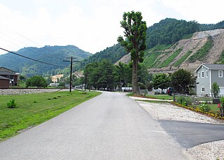
Cucumber is a census-designated place (CDP) in McDowell County, West Virginia, United States. Its population was 74 at the 2020 census. The community is centered on mining. Named either for nearby Cucumber Creek or for the cucumber trees in the area, it is the only community in the United States with this name. Its post office was still active as of October 2011.
McConnell is an unincorporated community and census-designated place (CDP) in Logan County, West Virginia, United States, on the Guyandotte River. As of the 2010 census, its population was 514. It was established in 1933.
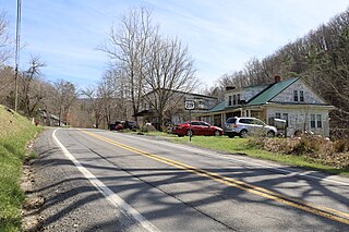
Boulder is an unincorporated community in Barbour County, West Virginia, United States. It is located on county route 11 along the Buckhannon River, about three miles from the community of Audra. While the official name of the community is Boulder, by which it is usually known, the town's now-defunct post office assumed the name of Rangoon due to confusion with the town of Boulder, Colorado.
Prince is a census-designated place (CDP) in Fayette County, West Virginia, United States. As of the 2010 census, its population was 116. Located at an altitude of 1,263 feet (385 m), it is served by an Amtrak station.
Key Rock is an unincorporated community in Wyoming County, West Virginia, United States. The community is home to the Coon Fork Church congregation and the Lester Family Cemetery.
Rock View is an unincorporated community in Wyoming County, West Virginia, United States.

Chelyan is a census-designated place (CDP) in Kanawha County, West Virginia, United States. Chelyan is located on the south bank of the Kanawha River, southeast of Chesapeake. It is served by Exit 85 of the West Virginia Turnpike. As of the 2010 census, its population was 776.
Rock Camp is an unincorporated community in Monroe County, West Virginia, United States. Rock Camp is located on U.S. Route 219, northeast of Peterstown and southwest of Union.
Rock is an unincorporated community in Mercer County, West Virginia, United States. Rock is located along West Virginia Route 71, 2 miles (3.2 km) northeast of Montcalm. Rock has a post office with ZIP code 24747.
Romance is an unincorporated community in Jackson County, West Virginia, United States. It formerly had a post office with a zip code of 25175, but this closed on February 18, 1986. The area between Middle Fork and Advent is also considered Romance.
Falling Rock is an unincorporated community in Kanawha County, West Virginia, United States. Falling Rock is located at the confluence of Falling Rock Creek with the Elk River 3 miles (4.8 km) southwest of Clendenin along US Route 19. Falling Rock has a post office with ZIP code 25079.
Colcord is an unincorporated community in Raleigh County, West Virginia, United States. Colcord is 5.5 miles (8.9 km) east-southeast of Whitesville. Colcord had a post office, which closed on November 30, 2002. The community was named after the proprietor of the Colcord Coal Company.
Neibert is an unincorporated community and census-designated place (CDP) in Logan County, West Virginia, United States. Its population was 183 as of the 2010 census.
Pisgah is an unincorporated community in Preston County, West Virginia, United States.
Rosbys Rock is an unincorporated community in Marshall County, West Virginia, United States.


