
Cowlitz County is a county located in the U.S. state of Washington. As of the 2020 census, its population was 110,730. The county seat is Kelso, and its largest city is Longview. The county was formed in April 1854. Its name derives from the anglicized version of the Cowlitz Indian term Cow-e-liske, meaning either 'river of shifting sands' or 'capturing the medicine spirit.' Cowlitz comprises the Longview, WA Metropolitan statistical area, which is also included in the Portland-Vancouver-Salem, OR-WA Combined statistical area.

Jones County is a county in the central portion of the U.S. state of Georgia. As of the 2010 census, the population was 28,669. The county seat is Gray. The county was created on December 10, 1807, and named after U.S. Representative James Jones.

Ocean Township is a township located in east central Monmouth County, in the U.S. state of New Jersey. It is located on the Jersey Shore. The township is a bedroom suburb of New York City. Ocean Township consists of three main unincorporated communities: Wanamassa, Oakhurst, and Wayside. The township is divided into two ZIP codes, 07755 (Oakhurst) and 07712. Small portions have Allenhurst (07711), Deal (07723) and Long Branch (07740) ZIP codes.

Route 66 is a state highway located in Monmouth County, New Jersey, United States. It runs 3.62 mi (5.83 km) between Route 33 in Tinton Falls and Route 35 at County Route 16 on the border of Ocean Township and Neptune Township, just to the west of Asbury Park. The route serves as an important connector between the Garden State Parkway to the west and Route 18 and Asbury Park to the east. It runs concurrent with County Route 16 from Bowne/Wayside Roads to the eastern terminus at Route 35. Route 66, which varies from a two-lane undivided road to a four-lane divided highway, passes through commercial areas for most of its length with some wooded areas. The route was created in 1953, replacing what had been Route 33A. There is currently a proposal to widen the two-lane portion between Jumping Brook Road and Wayside Road in order to better handle the traffic that uses this road.
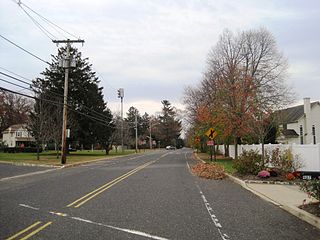
Wayside is an unincorporated community located along the border of Tinton Falls Borough and Ocean Township in Monmouth County, New Jersey, United States. The community is largely residential though some churches, parks, and schools are located in the area. The main arterial roads in the community are Hope Road, Wayside Road, and West Park Avenue. Access to New Jersey Route 18 is available via nearby interchanges with Deal Road, West Park Avenue, and Wayside Road; the Garden State Parkway's exit 105 is also located north of Wayside. The building that once housed the 16-lane Wayside Bowl-O-Drome is still in use, now as an office building.

Sparkill, formerly known as Tappan Sloat, is a suburban hamlet and census-designated place in the Town of Orangetown, Rockland County, New York, United States located north of Palisades; east of Tappan; south of Piermont and west of the Hudson River. As of the 2010 census, the CDP had a population of 1,565. The hamlet is home to St. Thomas Aquinas College and the Dominican Sisters of Sparkill.

The Joseph R. Brown State Wayside Rest is a National Scenic Byway Wayside Rest area. It is located on Renville County Highway 15, south of Sacred Heart, Minnesota, United States.

Chandler State Wayside is a state park in south-central Oregon in the United States. It is named in honor of Solomon and Hattie Chandler, who donated the land for the park. The park covers 85 acres (34 ha) of pine forest along a creek. The park provides restrooms and other basic facilities to accommodate the traveling public. Chandler State Wayside is administered by the Oregon Parks and Recreation Department.

Dyer State Wayside, a rest stop with picnic tables and public toilets, lies about 10 miles (16 km) south of Condon, along Oregon Route 19. It occupies 0.6 acres (0.24 ha) in a narrow canyon along a branch of Thirty Mile Creek at the mouth of Ramsey Canyon.

Alderwood State Wayside is a state park on Oregon Route 36 in the U.S. state of Oregon. Administered by the Oregon Parks and Recreation Department, the day-use wayside covers about 76 acres (31 ha). It is open year-round and attracts about 45,000 visitors annually.

Booth State Scenic Corridor is a state park in the U.S. state of Oregon, administered by the Oregon Parks and Recreation Department.

Ellmaker State Wayside is a state park in the U.S. state of Oregon, administered by the Oregon Parks and Recreation Department. It is located on U.S. Route 20 approximately 1 mile (1.6 km) north of the community of Burnt Woods.
Holman State Wayside is a state park in Polk County, Oregon, United States, on Oregon Route 22 at the foot of the Eola Hills near the community of Eola. The wayside is administered by the Oregon Parks and Recreation Department but was closed to vehicular traffic in 2007 because of ongoing problems with criminal activity.

Washburne State Wayside is a state park 4 miles (6 km) northwest of Junction City, in the U.S. state of Oregon. Administered by the Oregon Parks and Recreation Department, the wayside serves as a rest stop for travelers on Oregon Route 99W and interpretive center for the Applegate Trail. The state bought the land for the park in 1926 from William C. and Mae E. Washburne. It lies on the border between Lane and Benton counties.

Androscoggin Wayside Park is located on the Androscoggin River in Errol, New Hampshire, along Route 16. Located in the Thirteen Mile Woods scenic area of northern New Hampshire, the small park is free to use, open year-round, and offers a picnic area, canoeing, and fishing. It is part of Mollidgewock State Park.
Reynolds Wayside Campground is a state park in Mendocino County, California, United States. The site, which contained a redwood grove, was purchased by Frank W. Reynolds and his wife in 1928 and converted into a resort known as Reynolds Redwood Flat in 1930. After Mr. Reynolds died in 1962, the site was leased until the California state government purchased it in 1966 as a memorial to Reynolds and to protect it from logging. Under state management, 50 campsites were constructed at the site, which was renamed to Reynolds State Recreation Area before taking its present name. In 1976, the campsites were removed and the property was deemed surplus the next year. Much of the site's land was exchanged with a timber company for territory at Sinkyone Wilderness State Park in 1984. As of May 2021, Reynolds Wayside Campground contains 38 acres (15 ha) of land, including area for hiking and access to the Eel River.

Wayside is an unincorporated community in Montgomery County, Kansas, United States. As of the 2020 census, the population of the community and nearby areas was 19. It is located along U.S. Route 75 northeast of Caney and southwest of Independence.

Redmond–Bend Juniper State Scenic Corridor is a collection of ten unimproved land parcels administered for the Oregon Parks and Recreation Department. The parcels are located along U.S. Route 97 between Bend and Redmond, Oregon, United States. It is named for the large western juniper trees found on the parcels. The scenic corridor is completely undeveloped with no trails or park facilities of any kind.

Chesterfield Gorge Natural Area, also known as Chesterfield Gorge State Wayside, is a 13-acre (5.3 ha) state park on Route 9 in Chesterfield, New Hampshire. The park conserves a rocky gorge with waterfalls on Wilde Brook. There is picnicking, a seasonal visitor center, and 0.7-mile (1.1 km) trail on either side of the brook.

Beaver Brook Falls Wayside is a 7.3-acre (3.0 ha) park in Colebrook, New Hampshire, along Route 145. It features a roadside view of the scenic 80-foot (24 m) Beaver Brook Falls. Picnic tables, restroom facilities and a small picnic shelter are available.


