
Pendleton County is a county located in the U.S. state of West Virginia. As of the 2020 census, the population was 6,143, making it the second-least populous county in West Virginia. Its county seat is Franklin. The county was created by the Virginia General Assembly in 1788 from parts of Augusta, Hardy, and Rockingham counties and was named for Edmund Pendleton (1721–1803), a distinguished Virginia statesman and jurist. Pendleton County was strongly pro-Confederate during the American Civil War; however, there were pockets of Unionists who supported the state government in Wheeling.

Forsyth County is located in the northwest Piedmont of the U.S. state of North Carolina. As of the 2020 census, the population was 382,590, making it the fourth-most populous county in North Carolina. Its county seat is Winston-Salem. Forsyth County is part of the Winston-Salem, NC, Metropolitan Statistical Area, which is also included in the Greensboro-Winston-Salem-High Point, NC, Combined Statistical Area. Portions of Forsyth County are in the Yadkin Valley wine region.
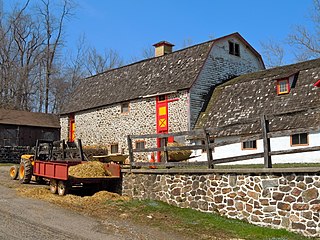
West Bradford Township is a township that is located in Chester County, Pennsylvania, United States. The population was 12,376 atthe time of the 2010 census.

West Brandywine Township is a township in Chester County, Pennsylvania, United States. The population was 7,394 at the 2010 census.
Richhill Township is a township in Greene County, Pennsylvania, United States. The population was 775 at the 2020 census, down from 896 at the 2010 census. Ryerson Station State Park is a Pennsylvania state park on Duke Lake in the township.

Middletown is a town in Frederick County, Virginia, United States, in the northern Shenandoah Valley. The population was 1,265 at the 2010 census, up from 1,015 at the 2000 census.
Elkton is an incorporated town in Rockingham County, Virginia, United States. It is included in the Harrisonburg Metropolitan Statistical Area. The population was 2,762 at the 2010 census. Elkton was named for the Elk Run stream.

Madison is a city and former coal town in Boone County, West Virginia, United States. The population was 2,911 at the 2020 census. It is the county seat of Boone County.

Weston is a city in Lewis County, West Virginia, United States. The population was 3,943 at the 2020 census. It is the county seat of Lewis County, and home to the Museum of American Glass in West Virginia and the Trans-Allegheny Lunatic Asylum.

Parsons is the largest city in and county seat of Tucker County, West Virginia, United States. The population was 1,322 at the 2020 census. Parsons is located at the confluence of the Shavers Fork and the Black Fork, forming the head of the Cheat River.

Aurora is an unincorporated community and census-designated place in southeastern Preston County, West Virginia, United States. As of the 2010 census, its population was 201. Aurora is located on U.S. Route 50 between the Maryland state line and the town of Rowlesburg. Cathedral State Park is located to the east of Aurora's post office.

Chadds Ford is a census-designated place (CDP) in Delaware and Chester counties, Pennsylvania, United States, comprising the unincorporated communities of Chadds Ford and Chadds Ford Knoll. It was first listed as a CDP prior to the 2020 census.
Pageton is a census-designated place (CDP) in McDowell County, West Virginia, United States. As of the 2010 census, its population was 187. Pageton is located on the Tug Fork Branch of the Norfolk and Western Railway, along the Pocahontas seam of rich bituminous coal. Pageton is located on State Route 161 between Thorpe and Anawalt.
Arcola is a census-designated place in Loudoun County, Virginia, United States. The population as of the 2010 United States Census was 233.

Hanover is an unincorporated community and census-designated place (CDP) in Hanover County, Virginia, United States. It is the county seat and is located at the junction of U.S. Route 301 and State Route 54 south of the Pamunkey River. While historically known as Hanover Courthouse, the U.S. Geological Survey, Census Bureau, Postal Service and residents refer to it as "Hanover". The population as of the 2010 census was 252.
Talleyville is an unincorporated community in New Castle County, Delaware, United States. Talleyville is located at the intersection of U.S. Route 202, Mt. Lebanon Road, and Silverside Road to the north of Wilmington. Its ZIP code is 19803.
Maybeury is a census-designated place (CDP) in McDowell County, West Virginia, United States, located on U.S. Route 52 between Northfork and Bramwell. As of the 2010 census, its population was 234.
Bartow is a census-designated place (CDP) in Pocahontas County, West Virginia, United States. The population was 111 at the 2010 census.
Dailey is a census-designated place (CDP) in Randolph County, West Virginia, United States. Dailey is located on U.S. routes 219 and 250, 3 miles (4.8 km) south-southwest of Beverly. Dailey has a post office with ZIP code 26259. As of the 2010 census, its population was 114.
Vivian is a census-designated place (CDP) in McDowell County, West Virginia, United States. Vivian is located along U.S. Route 52, 1 mile (1.6 km) southeast of Kimball. As of the 2010 census, its population was 82.

