
Pendleton County is a county located in the U.S. state of West Virginia. As of the 2020 census, the population was 6,143, making it the second-least populous county in West Virginia. Its county seat is Franklin. The county was created by the Virginia General Assembly in 1788 from parts of Augusta, Hardy, and Rockingham Counties and was named for Edmund Pendleton (1721–1803), a distinguished Virginia statesman and jurist. Pendleton County was strongly pro-Confederate during the American Civil War; however, there were pockets of Unionists who supported the state government in Wheeling.

Jefferson County is located in the Shenandoah Valley in the Eastern Panhandle of West Virginia, and is the easternmost county of the U.S. state of West Virginia. As of the 2020 census, the population was 57,701. Its county seat is Charles Town. The county was founded in 1801, and today is part of the Washington metropolitan area.

Doddridge County is a county in the U.S. state of West Virginia. As of the 2020 census, the population was 7,808. Its county seat is West Union.

Lexington is an independent city in the Commonwealth of Virginia. At the 2020 census, the population was 7,320. It is the county seat of Rockbridge County, although the two are separate jurisdictions. The Bureau of Economic Analysis combines the city of Lexington with Rockbridge County for statistical purposes. Lexington is about 57 miles (92 km) east of the West Virginia border and is about 50 miles (80 km) north of Roanoke, Virginia. It was first settled in 1778.

Caroline County is a United States county located in the eastern part of the Commonwealth of Virginia. The northern boundary of the county borders on the Rappahannock River, notably at the historic town of Port Royal. The Caroline county seat is Bowling Green.
Augusta County is a county in the Shenandoah Valley on the western edge of the Commonwealth of Virginia. The second-largest county of Virginia by total area, it completely surrounds the independent cities of Staunton and Waynesboro. Its county seat is Staunton, but most of the administrative services have offices in neighboring Verona.

Umatilla County is one of the 36 counties in the U.S. state of Oregon. As of the 2020 census, the population was 80,075. Hermiston is the largest city in Umatilla County, but Pendleton remains the county seat. Umatilla County is part of the Hermiston-Pendleton, OR Micropolitan Statistical Area, which has a combined population of 92,261. It is included in the eight-county definition of Eastern Oregon.

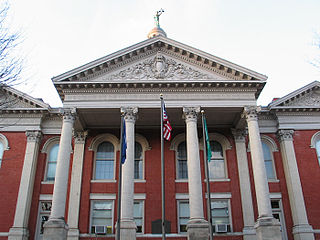
Franklin is a town in Pendleton County, West Virginia, United States. The population was 486 at the 2020 census. It is the county seat of Pendleton County. Franklin was established in 1794 and named for Francis Evick, an early settler.
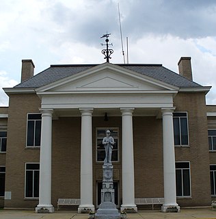
Tazewell County is a county located in the southwestern portion of the U.S. state of Virginia. As of the 2010 census, the population was 40,429. Its county seat is Tazewell.

Disputanta is an unincorporated community and census-designated place in Prince George County, Virginia, United States in the Richmond-Petersburg region and is a portion of the Richmond Metropolitan Statistical Area (MSA). The postal ZIP Code of Disputanta, Virginia is 23842. It was first listed as a CDP in the 2020 census with a population of 373.
Circleville is an unincorporated community located in Pendleton County, West Virginia, United States. Circleville was originally named Zyrkleville after John Zyrkle, who ran a dry goods store in the town. The old Circleville School is listed on the National Register of Historic Places.

White Hall is an unincorporated farming community in northern Frederick County, Virginia, established in the late 1810s and located near the crossroads of Apple Pie Ridge Road with Green Spring and White Hall Roads, astride Apple Pie Ridge.
Rippon is an unincorporated community in Jefferson County, West Virginia, United States, located south of Charles Town and designated as a village by the Jefferson County Commission. The village of Rippon developed in the mid-19th century at the crossroads of the Berryville and Charles Town Turnpike, Withers-LaRue Road, and Myerstown Road. The town was named after nearby Ripon Lodge, although an extra "p" was added to avoid confusion with a town in Wisconsin. According to the 2000 census, the town has a population of 223.

Upper Tract is an unincorporated community in Pendleton County, West Virginia, United States.
French Creek is an unincorporated community in Upshur County, West Virginia, United States.

Delaplane is an unincorporated community in northern Fauquier County, Virginia, approximately 50 miles (80 km) due west of Washington, D.C. Delaplane is situated along U.S. Route 17, U.S. Route 50, and Interstate 66; bordering Upperville, Virginia to the north, Hume, Virginia to the south, Paris, Virginia to the west, and Rectortown, Virginia to the east. Delaplane, Virginia has a ZIP Code of 20144.
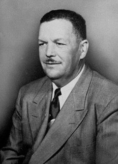
Vernon Ferdinand Dahmer Sr. was an American civil rights movement leader and president of the Forrest County chapter of the NAACP in Hattiesburg, Mississippi. He was murdered by the White Knights of the Ku Klux Klan for his work on recruiting Black Americans to vote.

Linville is a Census-designated place located in Rockingham County, in the U.S. state of Virginia. It is located 6 miles north of Harrisonburg, Virginia. It is for the first time listed as CDP for the United States Census 2020. It contains the Linville United Church of Christ.

Ananias Pitsenbarger Farm is an historic home and farm complex located in the unincorporated community of Dahmer, near Franklin, Pendleton County, West Virginia. The original section of the house was built in 1845, and includes the 2+1⁄2-story section on the north end, with a later 1+1⁄2-story addition built about 1900. The house rests on a foundation of coursed rubble stone and is clad in weatherboard siding. It has a standing-seam metal gable roof. Also on the property are 15 log and frame contributing outbuildings. They include the cellar house, two hog pens, a stable, woodworking shop, carriage house, chicken coop, granary, shed, privy constructed by the Works Progress Administration, spring house, three small hay barns, and a large double-crib log hay barn. Also on the property is the Pitsenbarger Cemetery.
Pitsenbarger may refer to


