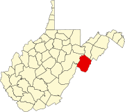
Pendleton County is a county located in the U.S. state of West Virginia. As of the 2010 census, the population was 7,695, making it the fifth-least populous county in West Virginia. Its county seat is Franklin. The county was created by the Virginia General Assembly in 1788 from parts of Augusta, Hardy, and Rockingham Counties and was named for Edmund Pendleton (1721–1803), a distinguished Virginia statesman and jurist. Pendleton County was strongly pro-Confederate during the American Civil War; however, there were pockets of Unionists who supported the state government in Wheeling.

The Monongahela National Forest is a national forest located in the Allegheny Mountains of eastern West Virginia, USA. It protects over 921,000 acres of federally managed land within a 1,700,000 acres proclamation boundary that includes much of the Potomac Highlands Region and portions of 10 counties.

The South Branch Potomac River has its headwaters in northwestern Highland County, Virginia near Hightown along the eastern edge of the Allegheny Front. After a river distance of 139 miles (224 km), the mouth of the South Branch lies east of Green Spring in Hampshire County, West Virginia where it meets the North Branch Potomac River to form the Potomac.

Seneca Rocks is a large crag and local landmark in Pendleton County in the Eastern Panhandle of West Virginia, United States. The south peak is one of a small number of peaks inaccessible except by technical rock climbing techniques on the East Coast of the United States. One of the best-known scenic attractions in West Virginia, the sheer rock faces are a popular challenge for rock climbers.
The Potomac Highlands of West Virginia centers on five West Virginian counties in the upper Potomac River watershed in the western portion of the state's Eastern Panhandle, bordering Maryland and Virginia. Because of geographical proximity, similar topography and landscapes, and shared culture and history, the Potomac Highlands region also includes Pocahontas, Randolph, and Tucker counties, even though they are in the Monongahela River or New River watersheds and not that of the Potomac River.
Lunice Creek is a 7.3-mile-long (11.7 km) tributary of the South Branch Potomac River, belonging to the Potomac River and Chesapeake Bay watersheds. The creek is located in Grant County, West Virginia. Lunice Creek is created by its North and South Forks and empties into the South Branch at Petersburg.

Cherry Run is a 7.2-mile-long (11.6 km) meandering stream that forms the northern section of the boundary between Morgan and Berkeley counties in West Virginia's Eastern Panhandle. While it is mostly non-navigable, Cherry Run provides many pools of varying depths for fishing and swimming. As a tributary of the Potomac River, Cherry Run is part of the Potomac and Chesapeake Bay watersheds.

Holton is a small unincorporated community in northeastern Morgan County in the U.S. state of West Virginia. Holton lies on Martinsburg Road at its junction with Cherry Run Road along Cherry Run and the Berkeley County line. Holton had its own post office in operation between 1889 and 1903. Pleasant View Elementary School, one of three elementary schools still operational in Morgan County as of 2020, is located in Holton.
Dover is an unincorporated community in Loudoun County, Virginia, United States. Dover is located east of Middleburg at the intersection of U.S. Route 50, Champe Ford Road, and Cobb House Road. The Little River begins following Route 50 at this point.

Seneca Creek is a 19.6-mile-long (31.5 km) tributary of the North Fork of the South Branch of the Potomac River located entirely within Pendleton County, West Virginia, USA.

North Fork Mountain is a quartzite-capped mountain ridge in the Ridge and Valley physiographic province of the Allegheny Mountains of eastern West Virginia, USA. Kile Knob, at 4,588 feet, is the mountain's highest point, and Panther Knob and Pike Knob are nearly as high.

The Silurian Tuscarora Formation — also known as Tuscarora Sandstone or Tuscarora Quartzite — is a mapped bedrock unit in Pennsylvania, Maryland, West Virginia, and Virginia, USA.
The River Knobs — formerly known as East Seneca Ridge — are a ridge and series of knobs in western Pendleton County, West Virginia, USA, along a stretch of the North Fork South Branch Potomac River. Although the Knobs are dwarfed by Spruce Mountain to the west and by North Fork Mountain to the east, they are notable for their series of prominent "razorback" ridges or "fins". The largest and most famous of these blade-like crags is Seneca Rocks.
Big Springs is an unincorporated community in Calhoun County, West Virginia, United States. It lies along West Virginia Route 16 to the north of the town of Grantsville, the county seat of Calhoun County. Its elevation is 771 feet. It has a post office with the ZIP code 26137.

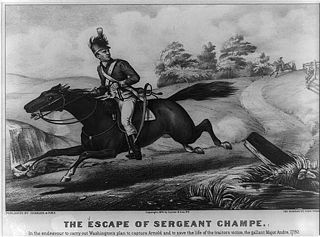
Sergeant Major John Champe was a Revolutionary War senior enlisted soldier in the Continental Army who became a double agent in a failed attempt to capture the American traitor General Benedict Arnold (1741-1801).

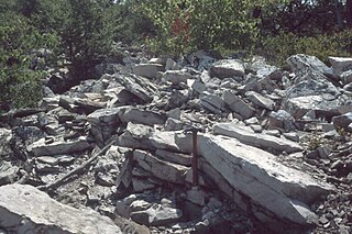
Champe Rocks are a pair of large crags in Pendleton County in the Eastern Panhandle of West Virginia, USA. Easily visible from West Virginia Route 28, they are situated within the Spruce Knob-Seneca Rocks National Recreation Area. They are — along with the nearby and more celebrated Seneca Rocks — the most imposing examples in eastern West Virginia of several formations of the white/gray Tuscarora quartzite and are a popular challenge for rock climbers.

Nelson Rocks is a large privately owned rock formation located in the North Fork Valley of Pendleton County, West Virginia, United States. The area is operated under the name of NROCKS Outdoor Adventures, and was previously known as Nelson Rocks Outdoor Center (NROC).
New Market West is a suburban housing community in Frederick County, in the U.S. state of Maryland. The community is located in the foothills of the Blue Ridge Mountains and is adjacent to the town of New Market.

Big Run is a river of 13 miles in length, located one-and-a-half miles west of Spruce Knob in Monongahela National Forest, in Pendleton County, West Virginia. It is a tributary of the North Fork South Branch Potomac River.


