
Bilsey Hill is a 3-hectare (7.4-acre) geological Site of Special Scientific Interest south of Blakeney in Norfolk. It is a Geological Conservation Review site and it is in the Norfolk Coast Area of Outstanding Natural Beauty.

Bramerton Pits is a 0.7-hectare (1.7-acre) geological Site of Special Scientific Interest north of the village of Bramerton in Norfolk on the southern banks of the River Yare. It is a Geological Conservation Review site.

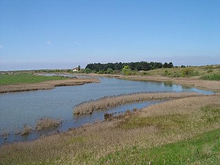
Salthouse Marshes is a 66-hectare (160-acre) nature reserve west of Sheringham in Norfolk. It is managed by the Norfolk Wildlife Trust. It is part of the North Norfolk Coast Site of Special Scientific Interest, Geological Conservation Review site, Nature Conservation Review site, Grade I. Ramsar site, Special Areas of Conservation and Special Protection Area. It is also in the Norfolk Coast Area of Outstanding Natural Beauty.
Holme Dunes is a 192-hectare (470-acre) nature reserve near Holme-next-the-Sea in Norfolk. It is managed by the Norfolk Wildlife Trust, and is a National Nature Reserve. It is part of the North Norfolk Coast Site of Special Scientific Interest, Geological Conservation Review site, Nature Conservation Review site, Grade I, Ramsar site, Special Areas of Conservation and Special Protection Area. It is also in the Norfolk Coast Area of Outstanding Natural Beauty.

Crag Farm Pit, Sudbourne is a 4.8-hectare (12-acre) geological Site of Special Scientific Interest east of Sudbourne in Suffolk. It is a Geological Conservation Review site, and within the Suffolk Coast and Heaths Area of Outstanding Natural Beauty.

Neutral Farm Pit, Butley is a 1.1-hectare (2.7-acre) geological Site of Special Scientific Interest in Butley, east of Woodbridge in Suffolk. It is a Geological Conservation Review site, and is in the Suffolk Coast and Heaths Area of Outstanding Natural Beauty.

Red House Farm Pit is a 0.5-hectare (1.2-acre) geological Site of Special Scientific Interest east of Wickham Market in Suffolk. It is a Geological Conservation Review site, and in the Suffolk Coast and Heaths Area of Outstanding Natural Beauty.

Aldeburgh Brick Pit is a 0.9-hectare (2.2-acre) geological Site of Special Scientific Interest in Aldeburgh in Suffolk. It is a Geological Conservation Review site, and it is in the Suffolk Coast and Heaths Area of Outstanding Natural Beauty.

Holkham Brick Pit is a 0.5-hectare (1.2-acre) geological Site of Special Scientific Interest west of Wells-next-the-Sea in Norfolk. It is a Geological Conservation Review site, and it is in the Norfolk Coast Area of Outstanding Natural Beauty.

Morston Cliff is a 1-hectare (2.5-acre) geological Site of Special Scientific Interest east of Wells-next-the-Sea in Norfolk. It is a Geological Conservation Review site. It is part of Blakeney National Nature Reserve, which is managed by the National Trust, and of the Norfolk Coast Area of Outstanding Natural Beauty.

Wells Chalk Pit is a 4-hectare (9.9-acre) biological and geological Site of Special Scientific Interest on the eastern outskirts of Wells-next-the-Sea in Norfolk. It is a Geological Conservation Review site, and it is in the Norfolk Coast Area of Outstanding Natural Beauty.
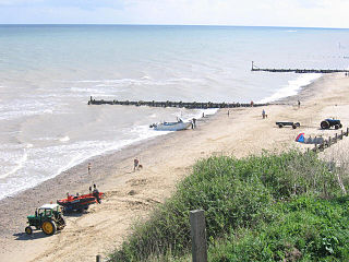
Mundesley Cliffs is a 29.3-hectare (72-acre) geological Site of Special Scientific Interest north-east of North Walsham in Norfolk. It is a Geological Conservation Review site and it is in the Norfolk Coast Area of Outstanding Natural Beauty.

Sidestrand and Trimingham Cliffs is a 133.9-hectare (331-acre) biological and geological Site of Special Scientific Interest south-east of Cromer in Norfolk. It is a Geological Conservation Review site. It is in the Norfolk Coast Area of Outstanding Natural Beauty.

Weybourne Cliffs is a 40.9-hectare (101-acre) biological and geological Site of Special Scientific Interest at Weybourne, west of Sheringham in the English county of Norfolk. It is a Geological Conservation Review site. It is in the Norfolk Coast Area of Outstanding Natural Beauty.

Winterton-Horsey Dunes is a 427-hectare (1,060-acre) biological and geological Site of Special Scientific Interest north of Great Yarmouth in Norfolk. It is a Special Area of Conservation and a Nature Conservation Review site, Grade I. Winterton Dunes is a National Nature Reserve Winterton Ness is a Geological Conservation Review site. The whole site is in the Norfolk Coast Area of Outstanding Natural Beauty.

Wiveton Downs is a 28.9-hectare (71-acre) biological and geological Site of Special Scientific Interest at Wiveton, west of Sheringham in the English county of Norfolk. Part of it is a Geological Conservation Review site, and an area of 6.5-hectare (16-acre) is a Local Nature Reserve. It is in the Norfolk Coast Area of Outstanding Natural Beauty.

Glandford (Hurdle Lane) is a 9.4-hectare (23-acre) geological Site of Special Scientific Interest west of Sheringham in Norfolk. It is a Geological Conservation Review site and it is in the Norfolk Coast Area of Outstanding Natural Beauty.

Glandford (Letheringsett Road) is a 1.1-hectare (2.7-acre) geological Site of Special Scientific Interest west of Sheringham in Norfolk. It is a Geological Conservation Review site and it is in the Norfolk Coast Area of Outstanding Natural Beauty.
Weybourne Town Pit is a 0.7-hectare (1.7-acre) geological Site of Special Scientific Interest west of Sheringham in Norfolk. It is a Geological Conservation Review site and it is in the Norfolk Coast Area of Outstanding Natural Beauty.
