
Bawsey is a 2.6-hectare (6.4-acre) geological Site of Special Scientific Interest east of Kings' Lynn in Norfolk, England. It is a Geological Conservation Review site.

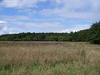
Ringstead Downs is a 6.9-hectare (17-acre) biological Site of Special Scientific Interest east of Hunstanton in Norfolk, England. It is in the Norfolk Coast Area of Outstanding Natural Beauty, and it is the western part of the 11-hectare (27-acre) Ringstead Downs nature reserve, which is managed by the Norfolk Wildlife Trust.

Grimston Warren Pit is a 6.6-hectare (16-acre) geological Site of Special Scientific Interest east of King's Lynn in Norfolk, England. It is a Geological Conservation Review site.

Wiggenhall St Germans SSSI is a 5.2-hectare (13-acre) geological Site of Special Scientific Interest south of King's Lynn in Norfolk, England. It is a Geological Conservation Review site.
Setchey SSSI is a 33.4-hectare (83-acre) geological Site of Special Scientific Interest south of King's Lynn in Norfolk, England. It is a Geological Conservation Review site.

Blackborough End Pit is a 13.2-hectare (33-acre) geological Site of Special Scientific Interest south-east of King's Lynn in Norfolk, England. It is a Geological Conservation Review site.

Ant Broads and Marshes is a 745.3-hectare (1,842-acre) biological Site of Special Scientific Interest north-east of Norwich in Norfolk, England. Most of it is a Nature Conservation Review site, Grade 1, and it is part of the Broadland Ramsar and Special Protection Area, and The Broads Special Area of Conservation. Part of it is the Barton Broad nature reserve, which is managed by the Norfolk Wildlife Trust, and two areas are National Nature Reserves.
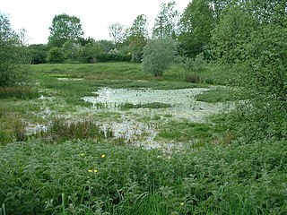
Cranberry Rough is an 81.1-hectare (200-acre) biological and geological Site of Special Scientific Interest in the parish of Hockham, east of Attleborough in Norfolk, England. It is a Nature Conservation Review site, Grade 2, and the Great Eastern Pingo Trail, which is a Local Nature Reserve, goes through the site. Part of it is a Geological Conservation Review site, and it is part of the Breckland Special Protection Area.
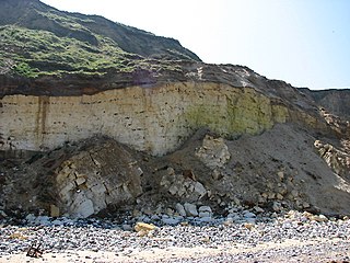
East Runton Cliffs is a 20.6-hectare (51-acre) geological Site of Special Scientific Interest west of Cromer in Norfolk, England. It is a Geological Conservation Review site.
East Walton and Adcock's Common is a 62.4-hectare (154-acre) biological and geological Site of Special Scientific Interest south-east of King's Lynn in Norfolk, England. It is a Geological Conservation Review site and part of Norfolk Valley Fens Special Area of Conservation

Holkham Brick Pit is a 0.5-hectare (1.2-acre) geological Site of Special Scientific Interest west of Wells-next-the-Sea in Norfolk, England. It is a Geological Conservation Review site, and it is in the Norfolk Coast Area of Outstanding Natural Beauty.

Morston Cliff is a 1-hectare (2.5-acre) geological Site of Special Scientific Interest east of Wells-next-the-Sea in Norfolk, England. It is a Geological Conservation Review site. It is part of Blakeney National Nature Reserve, which is managed by the National Trust, and of the Norfolk Coast Area of Outstanding Natural Beauty.

Wells Chalk Pit is a 4-hectare (9.9-acre) biological and geological Site of Special Scientific Interest on the eastern outskirts of Wells-next-the-Sea in Norfolk, England. It is a Geological Conservation Review site, and it is in the Norfolk Coast Area of Outstanding Natural Beauty.

Hunstanton Cliffs is a 4.6-hectare (11-acre) biological and geological Site of Special Scientific Interest in Hunstanton in Norfolk, England. It is a Geological Conservation Review site.

Overstrand Cliffs is a 57.8-hectare (143-acre) biological and geological Site of Special Scientific Interest in Cromer in Norfolk, England. It is a Special Area of Conservation and part of it is a Geological Conservation Review site.

Sidestrand and Trimingham Cliffs is a 133.9-hectare (331-acre) biological and geological Site of Special Scientific Interest south-east of Cromer in Norfolk, England. It is a Geological Conservation Review site. It is in the Norfolk Coast Area of Outstanding Natural Beauty.

West Runton Cliffs is a 17.8-hectare (44-acre) geological Site of Special Scientific Interest east of Sheringham in Norfolk, England. It is a Geological Conservation Review site.

Wiveton Downs is a 28.9-hectare (71-acre) biological and geological Site of Special Scientific Interest at Wiveton, west of Sheringham in the English county of Norfolk. Part of it is a Geological Conservation Review site, and an area of 6.5-hectare (16-acre) is a Local Nature Reserve. It is in the Norfolk Coast Area of Outstanding Natural Beauty.

Wretton SSSI is a 20.6-hectare (51-acre) geological Site of Special Scientific Interest north-east of Downham Market in Norfolk, England. It is a Geological Conservation Review site.
