
The Norfolk Wildlife Trust (NWT) is one of 46 wildlife trusts covering Great Britain, Northern Ireland, Isle of Man and Alderney. Founded in 1926, it is the oldest of all the trusts. It has over 35,500 members and eight local groups and it manages more than fifty nature reserves and other protected sites. It also gives conservation advice to individuals and organisations, provides educational services to young people on field trips and organises entertainment and information events at nature reserves. The NWT reserves include twenty-six Sites of Special Scientific Interests, nine national nature reserves, twelve Nature Conservation Review sites, sixteen Special Areas of Conservation, twelve Special Protection Areas, eleven Ramsar sites, two local nature reserves, four Geological Conservation Review sites and five which are in Areas of Outstanding Natural Beauty.

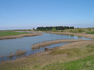
Hickling Broad is a 600-hectare (1,500-acre) nature reserve 4 km south-east of Stalham, north-east of Norwich in Norfolk. It is managed by the Norfolk Wildlife Trust. It is a National Nature Reserve and part of the Upper Thurne Broads and Marshes Site of Special Scientific Interest and Hickling Broad and Horsey Mere Nature Conservation Review site, Grade I. It is in the Norfolk Coast Area of Outstanding Natural Beauty, and part of the Broadland Ramsar site and Special Protection Area, and The Broads Special Area of Conservation.

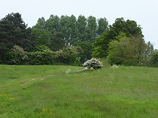
Kelling Heath is an 89.4-hectare (221-acre) biological Site of Special Scientific Interest between Holt and Weybourne in Norfolk, England. It is in the Norfolk Coast Area of Outstanding Natural Beauty.

Queendown Warren is a 22.2-hectare (55-acre) biological Site of Special Scientific Interest south-east of Rainham in Kent. It is a Local Nature Reserve, a Nature Conservation Review site, Grade 2, and a Special Area of Conservation. It is in the Kent Downs Area of Outstanding Natural Beauty. It is managed by the Kent Wildlife Trust, and part of it is owned by Plantlife.

Westfield Wood is a 5-hectare (12-acre) nature reserve north of Maidstone in Kent, which is managed by the Kent Wildlife Trust. It is part of the Wouldham to Detling Escarpment Site of Special Scientific Interest and Nature Conservation Review site, Grade I. It is also in the North Downs Woodlands Special Area of Conservation and the Kent Downs Area of Outstanding Natural Beauty.

Salthouse Marshes is a 66-hectare (160-acre) nature reserve west of Sheringham in Norfolk. It is managed by the Norfolk Wildlife Trust. It is part of the North Norfolk Coast Site of Special Scientific Interest, Geological Conservation Review site, Nature Conservation Review site, Grade I. Ramsar site, Special Areas of Conservation and Special Protection Area. It is also in the Norfolk Coast Area of Outstanding Natural Beauty.
Holme Dunes is a 192-hectare (470-acre) nature reserve near Holme-next-the-Sea in Norfolk. It is managed by the Norfolk Wildlife Trust, and is a National Nature Reserve. It is part of the North Norfolk Coast Site of Special Scientific Interest, Geological Conservation Review site, Nature Conservation Review site, Grade I, Ramsar site, Special Areas of Conservation and Special Protection Area. It is also in the Norfolk Coast Area of Outstanding Natural Beauty.

Otford to Shoreham Downs is a 145.1-hectare (359-acre) biological Site of Special Scientific Interest between Kemsing and Eynesford in Kent. It is part of Kent Downs Area of Outstanding Natural Beauty and part it is Fackenden Down, a nature reserve managed by the Kent Wildlife Trust

Wouldham to Detling Escarpment is a 311.2-hectare (769-acre) biological and geological Site of Special Scientific Interest which stretches from Wouldham to Detling, north of Maidstone in Kent. Part of it is a Geological Conservation Review site, and it is part of the North Downs Woodlands Special Area of Conservation and the Kent Downs Area of Outstanding Natural Beauty. It is a Nature Conservation Review site, Grade I and it includes three Kent Wildlife Trust nature reserves and a Local Nature Reserve,
Hunstanton Park Esker is a 17.3-hectare (43-acre) geological Site of Special Scientific Interest east of Hunstanton in Norfolk, England. The esker extends 1.5 km from north of Ringstead Downs to Hunstanton Hall. It is a Geological Conservation Review site.

Cockthorpe Common, Stiffkey is a 7.1-hectare (18-acre) biological Site of Special Scientific Interest east of Wells-next-the-Sea in Norfolk, England. It is in the Norfolk Coast Area of Outstanding Natural Beauty.

Holkham Brick Pit is a 0.5-hectare (1.2-acre) geological Site of Special Scientific Interest west of Wells-next-the-Sea in Norfolk, England. It is a Geological Conservation Review site, and it is in the Norfolk Coast Area of Outstanding Natural Beauty.

Morston Cliff is a 1-hectare (2.5-acre) geological Site of Special Scientific Interest east of Wells-next-the-Sea in Norfolk, England. It is a Geological Conservation Review site. It is part of Blakeney National Nature Reserve, which is managed by the National Trust, and of the Norfolk Coast Area of Outstanding Natural Beauty.

Wells Chalk Pit is a 4-hectare (9.9-acre) biological and geological Site of Special Scientific Interest on the eastern outskirts of Wells-next-the-Sea in Norfolk, England. It is a Geological Conservation Review site, and it is in the Norfolk Coast Area of Outstanding Natural Beauty.

Felbrigg Woods is a 164.6-hectare (407-acre) biological Site of Special Scientific Interest south-west of Cromer in Norfolk, England. It is the main part of the grounds of Felbrigg Hall, a National Trust property which is listed on the Register of Historic Parks and Gardens of Special Historic Interest in England. It is a Nature Conservation Review site, Grade 2, and it is in the Norfolk Coast Area of Outstanding Natural Beauty.
Upper Thurne Broads and Marshes is a 1,185.9-hectare (2,930-acre) biological Site of Special Scientific Interest north of Great Yarmouth in Norfolk, England. Part of it is a Nature Conservation Review site, Grade I, and it is in the Norfolk Coast Area of Outstanding Natural Beauty. It is part of the Broadland Ramsar site and Special Protection Area, and The Broads Special Area of Conservation. Two areas, Hickling Broad and Martham Broad, are national nature reserves managed by the Norfolk Wildlife Trust.

Winterton-Horsey Dunes is a 427-hectare (1,060-acre) biological and geological Site of Special Scientific Interest north of Great Yarmouth in Norfolk, England. It is a Special Area of Conservation and a Nature Conservation Review site, Grade I. Winterton Dunes is a National Nature Reserve Winterton Ness is a Geological Conservation Review site. The whole site is in the Norfolk Coast Area of Outstanding Natural Beauty.

Wiveton Downs is a 28.9-hectare (71-acre) biological and geological Site of Special Scientific Interest at Wiveton, west of Sheringham in the English county of Norfolk. Part of it is a Geological Conservation Review site, and an area of 6.5-hectare (16-acre) is a Local Nature Reserve. It is in the Norfolk Coast Area of Outstanding Natural Beauty.
Weybourne Town Pit is a 0.7-hectare (1.7-acre) geological Site of Special Scientific Interest west of Sheringham in Norfolk, England. It is a Geological Conservation Review site and it is in the Norfolk Coast Area of Outstanding Natural Beauty.
