Buffelsdraai | |
|---|---|
 Buffelsdraai  Buffelsdraai | |
| Coordinates: 29°38′42″S30°58′41″E / 29.645°S 30.978°E | |
| Country | South Africa |
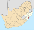
| Province | KwaZulu-Natal |
| Municipality | eThekwini |
| Area | |
• Total | 2.28 km2 (0.88 sq mi) |
| Population (2011) [1] | |
• Total | 3,078 |
| • Density | 1,400/km2 (3,500/sq mi) |
| Racial makeup (2011) | |
| • Black African | 98.9% |
| • Coloured | 0.1% |
| • Indian/Asian | 0.6% |
| • White | 0.3% |
| • Other | 0.1% |
| First languages (2011) | |
| • Zulu | 78.3% |
| • Xhosa | 13.9% |
| • English | 3.1% |
| • Southern Ndebele | 1.1% |
| • Other | 3.5% |
| Time zone | UTC+2 (SAST) |
| PO box | 4340 |
Buffelsdraai is a township in eThekwini in the KwaZulu-Natal province of South Africa.