Windermere is a town in Orange County, Florida, United States. As of the 2020 census, the town population was 3,030. It is part of the Orlando Metropolitan Statistical Area.

The Lake District, also known as the Lakes or Lakeland, is a mountainous region in North West England. A popular holiday destination, it is famous for its lakes, forests and mountains, and its associations with William Wordsworth and other Lake Poets and also with Beatrix Potter and John Ruskin. The Lake District National Park was established in 1951 and covers an area of 2,362 square kilometres (912 sq mi). It was designated a UNESCO World Heritage Site in 2017.

Ambleside is a town and former civil parish, now in the parish of Lakes, in Cumbria, in North West England. Historically in Westmorland, it marks the head of Windermere, England's largest natural lake. In the Lake District National Park, it is south of the highest road pass in the Lake District, Kirkstone Pass and both places are the meeting point of well-marked paths and mountain hiking trails. In 2020 it had an estimated population of 2596. In 1961 the parish had a population of 2562.

Windermere is the largest natural lake in England. More than 11 miles (18 km) in length, and almost 1 mile (1.5 km) at its widest, it is a ribbon lake formed in a glacial trough after the retreat of ice at the start of the current interglacial period. It has been one of the country's most popular places for holidays and summer homes since the arrival of the Kendal and Windermere Railway's branch line in 1847. Forming part of the border between the historic counties of Lancashire and Westmorland, Windermere is today within the administrative county of Cumbria and the Lake District National Park.

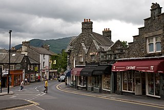
Windermere is a town and civil parish in the South Lakeland District of Cumbria, England. In the 2001 census the parish had a population of 8,245, increasing at the 2011 census to 8,359. It lies about half a mile (1 km) east of the lake, Windermere. Although the town Windermere does not touch the lake, it has now grown together with the older lakeside town of Bowness-on-Windermere, though the two retain distinguishable town centres. Tourism is popular in the town owing to its proximity to the lake and local scenery. Boats from the piers in Bowness sail around the lake, many calling at Ambleside or at Lakeside where there is a restored railway. Windermere Hotel opened at the same time as the railway.

Furness is a peninsula and region of Cumbria in northwestern England. Together with the Cartmel Peninsula it forms North Lonsdale, historically an exclave of Lancashire.

Bowness-on-Windermere is a town and former civil parish, now in the parish of Windermere, in South Lakeland, Cumbria, England. Due to its position on the banks of Windermere, the town has become a tourist honeypot. Although their mutual growth has caused them to become one large settlement, the town is distinct from the town of Windermere as the two still have distinguishable town centres. Historically part of Westmorland, in 2012, Bowness was one of the official stop off points for the Olympic torch before it made its way to the Olympic Games opening ceremony. In 1951 the parish had a population of 3345.

Gummer's How is a hill in the southern part of the Lake District, on the eastern shore of Windermere, near its southern end. How, derived from the Old Norse word haugr, is a common local term for a hill or mound.

The Windermere branch line, also called the Lakes line is a branch railway line which runs from Oxenholme on the West Coast Main Line to Windermere via Kendal in the county of Cumbria, North West England.

Oxenholme Lake District railway station is a railway station in Oxenholme, near Kendal, in Cumbria, England. The station is situated on the West Coast Main Line and is also the start of the Windermere Branch Line to Windermere. All platforms are electrified; however, platform 3 on the Windermere branch has limited capacity for longer trains. The station serves as a main line connection point for Kendal and Windermere and is managed by Avanti West Coast. The station is owned by Network Rail.

Burneside railway station is in Burneside, Cumbria, England. The station is situated on the Windermere Branch Line from Oxenholme to Windermere. To the east of the station can be found the only two semaphore signals on the line guarding the manually operated road crossing. The station is owned by Network Rail and is operated by Northern who provide all passenger train services.

Staveley railway station is a railway station in Staveley in Cumbria, England. The station is on the Windermere Branch Line connecting Oxenholme and Windermere. The station is owned by Network Rail and is operated by Northern Trains who provide all passenger train services, Staveley was a request stop until December 2012.

The A592 road is a major route running north–south through the English Lake District.

Near Sawrey and Far Sawrey are two neighbouring villages in the Furness area of Cumbria, England. They are located in the Lake District between the village of Hawkshead and the lake of Windermere. The two lie on the B5285, which runs from Hawkshead to the west bank of the Windermere Ferry, a car ferry across Windermere 1 mile to the east of the villages.

The A591 is a major road in Cumbria, in the north-west of England, which lies almost entirely within the Lake District national park. A 2009 poll by satellite navigation firm Garmin named the stretch of the road between Windermere and Keswick as the most popular road in Britain. The 29.8 mile stretch between Kendal and Keswick was also named the UK's best driving road, according to a specially devised driving ratio formulated by car rental firm Avis.
The Banff-Windermere Highway, also known as the Banff-Windermere Parkway, is a 105 km (65 mi) highway which runs through the Canadian Rockies in British Columbia and Alberta in Canada. It runs from Radium Hot Springs, British Columbia to Castle Junction, Alberta, passing through Kootenay National Park and Banff National Park. It is designated as part of British Columbia Highway 93 and Alberta Highway 93.

Brant Fell is a hill in the English Lake District, near Bowness-on-Windermere, Cumbria. It is the subject of a chapter of Wainwright's book The Outlying Fells of Lakeland. It reaches 629 feet (192 m). Wainwright's route leaves Bowness along the path of the Dales Way, makes an anticlockwise loop over the viewpoint of Post Knott to the summit, and either returns along the Dales Way or follows a woodland path to Helm Road from where another viewpoint, Biskey Howe, is only a slight detour before continuing down Helm Road to Bowness. He commends its "fine prospect of Windermere".

Windermere is a rural locality in the Bundaberg Region, Queensland, Australia. In the 2016 census Windermere had a population of 184 people.

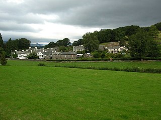
Troutbeck Bridge is a village in South Lakeland, Cumbria, England. It is situated 1 mile north of Windermere on the A591 road running through the Lake District and was historically in the county of Westmorland. The main secondary school for Windermere and Ambleside, The Lakes School, is located in the village, as is the postal sorting office for the area. Troutbeck Bridge takes its name from where the road crosses the Trout Beck.

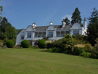
The Brockhole Lake District Visitor Centre, also known as the Brockhole National Park Visitor Centre, is a visitor centre and tourist attraction managed by the Lake District National Park Authority. It is situated on the shore of Lake Windermere, roughly equidistant between the towns of Bowness-on-Windermere and Ambleside. It includes the Brockhole house and 30 acres (12 ha) of grounds, including 10 acres (4.0 ha) of formal gardens and an adventure playground. The centre organises a number of activities, including orienteering, kayaking and open water swimming, as well as regular exhibitions.


