Durban North

Last updated
Durban North
Umgeni Park, b, Durban-Noord, Durban.jpg
Umgeni Park on the north bank of the Umgeni River's Blue Lagoon
South Africa KwaZulu-Natal location map.svg
Red pog.svg
Durban North
South Africa adm location map.svg
Red pog.svg
Durban North
Coordinates: 29°48′00″S31°01′59″E / 29.8°S 31.033°E / -29.8; 31.033
Country South Africa
Province KwaZulu-Natal
Municipality eThekwini
Main Place Durban
Government
  CouncillorShaun Ryley (DA)
Time zone UTC+2 (SAST)
Postal code (street)
4051
PO box
4016
Tower blocks of Prospect Hall north of the Blue Lagoon Blue Lagoon, b, Umgenirivier, Durban.jpg
Tower blocks of Prospect Hall north of the Blue Lagoon

Durban North is an area to the north of Durban in the eThekwini Metropolitan Municipality, KwaZulu-Natal, South Africa. Durban North lies between the N2 freeway and the eastern seashore, with the Umgeni River forming its southern boundary. It has residential suburbs that are some of Durban's most affluent [1] and is flanked by La Lucia in the north.

Contents

History

In 1927 the Durban North Estates Company, a property development company, bought a large tract of land north of the Umgeni River known as the Prospect Hall Sugar Estate. [2] Plans were laid out for the development of the land into a residential suburb, and roads were built, beginning with Northway, to be the main arterial through the new suburb. [2] At the time, access to the land across the Umgeni was limited to the Connaught Bridge further upstream. In November 1927, the company completed the iron girder Athlone Bridge across the Umgeni River to link the new suburb at Northway to the established area of Stamford Hill in the South. [3] [4] Following the completion of the bridge and enhanced access to the city, Durban North rapidly developed, followed by Virginia in the 1950s, and Glenashley in the 1970s. [2]

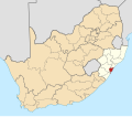
Location and suburbs

Durban North begins on the northern bank of the Umgeni River with the suburbs of Umgeni Park, Prospect Hall and Athlone. Along the eastern coastline northwards towards La Lucia are the suburbs of Beachwood, Virginia and Glenashley. Central Durban North is now officially known as Broadway, and is the commercial and educational hub of the area. To the west at the boundary with Avoca and are the suburbs of Parkhill, Red Hill, Glen Anil, Glen Hills, Greenwood Park, Kenville and the industrial area, Briardene. [5]

Roads and airport

The M12 Kenneth Kaunda Road/Umhlanga Rocks drive links the western suburbs of Durban North to the uMhlanga Ridge. The Ruth First Highway (M4) connects Durban North to the city and Umhlanga Rocks along the coast. Virginia Airport is situated along the northern shoreline.

Recreation facilities, beaches and nature reserves

The Beachwood Mangroves Nature Reserve conserves the mangrove swamps of Beachwood on the northern bank of the Blue Lagoon. Rocket Hut Beach is adjacent to the reserve and is known for its fishing and was the scene of a shark attack in 1947 and 1954. [6] [7]

Beachwood Country Club abuts the mangrove swamp, with a non-swimming beach known as Beachwood. The golf course at Beachwood was redesigned by Gary Player in 1994. [8] Virginia Beach is just north of Beachwood, alongside the Virginia Airport. [9] Glenashley Beach is popular with locals, although it is officially a non-swimming beach.

The Umgeni River Bird Park is located on the banks of the Umgeni River in Umgeni Park. Virginia Bush Nature Reserve is located in the suburb of Virginia, [10] while Seaton Park Nature Reserve is found in Park Hill. Durban North has a municipal swimming pool [11] and a number of parks serviced by the eThekwini Municipality, including the Durban North Japanese Gardens.

Sports clubs

Northwood Crusaders, established in 1964, is a sportsground catering to the community and old boys of Northwood School. Crusaders, as it is popularly known, has extensive sporting facilities for cricket, rugby, soccer, and athletics. [12] At the site of the old Glenwood Old Boys' Club is Riverside Sports, which offers rugby and soccer fields along with two artificial turfs for hockey. [13] Durban North is home to the Regent Harriers, an informal running club that has been meeting since 1960. [14] [15]

Education

There are a number of independent and government schools in the area. Independent higher education provider Varsity College has a campus in Durban North. [16]

Government Schools

Private schools

Related Research Articles

<span class="mw-page-title-main">Durban</span> Third largest city in South Africa

Durban is the third-most populous city in South Africa after Johannesburg and Cape Town, and the largest city in KwaZulu-Natal. Durban forms part of the eThekwini Metropolitan Municipality, which includes neighbouring towns and has a population of about 4 million, making the combined municipality one of the largest cities on the Indian Ocean coast of the African continent. Durban was also one of the host cities of the 2010 FIFA World Cup.

Hillcrest is a town in the KwaZulu-Natal province of South Africa that forms part of the eThekwini Metropolitan Municipality and is situated approximately 32 km north-west of Durban and 53 km south-east of Pietermaritzburg.

<span class="mw-page-title-main">Amanzimtoti</span> Settlement in South Africa

Amanzimtoti, locally nicknamed Toti, and officially renamed to eManzimtoti, is a coastal town just south of Durban in KwaZulu-Natal, South Africa. Located at the mouth of the aManzimtoti River, the town is well known for its warm climate and numerous beaches, and is a popular tourist destination, particularly with surfers. Although Amanzimtoti is now incorporated into the eThekwini Metropolitan Municipality or the Greater Durban metropolitan area, it is also a town in its own right.

Pinetown is a city that forms part of the eThekwini Metropolitan Municipality, based just inland from Durban in KwaZulu-Natal, South Africa. The town is situated 16 km north-west of Durban and 64 km south-east of Pietermaritzburg.

Westville is an area in KwaZulu-Natal, South Africa, and is just west and 10 km inland from the Durban CBD. It was a formerly independent municipality however it became part of the eThekwini Metropolitan Municipality in 2002.

eMdloti Place in KwaZulu-Natal, South Africa

eMdloti, alternatively rendered Umdloti and also known as Umdloti Beach, is a small resort village situated along the KwaZulu-Natal North Coast, South Africa. It lies at the mouth of the Mdloti River approximately 24 km north-east of Durban and 11 km north-east of uMhlanga and now forms part of eThekwini, the Greater Durban Metropolitan Municipality.

<span class="mw-page-title-main">N2 (South Africa)</span> National road in South Africa

The N2 is a national route in South Africa that runs from Cape Town through George, Gqeberha, East London, Mthatha, Port Shepstone and Durban to Ermelo. It is the main highway along the Indian Ocean coast of the country. Its current length of 2,255 kilometres (1,401 mi) makes it the longest numbered route in South Africa.

uMhlanga, KwaZulu-Natal Place in KwaZulu-Natal, South Africa

uMhlanga, alternatively rendered Umhlanga, is a residential, commercial and resort town north of Durban on the coast of KwaZulu-Natal, South Africa. It is part of the eThekwini Metropolitan Municipality, which was created in 2000 and includes the greater Durban area. The name means "place of reeds" in the Zulu language, and the correct pronunciation of "hl" in uMhlanga is similar to the Welsh "ll".

La Lucia is a wealthy suburb located in uMhlanga in the KwaZulu-Natal province of South Africa and is situated approximately 14 kilometres north of the Durban CBD. It was named after Lucia Michel. She and her husband Albert Michel founded the sugar cane farm La Lucia.

The M4 is a north–south metropolitan route in the eThekwini Metropolitan Municipality and partially in the KwaDukuza Local Municipality, South Africa. It runs from the N2 at the defunct Durban International Airport to Ballito via the Durban Central Business District (CBD) and uMhlanga. The sections between the airport and the southern edge of the CBD, and between the northern edge of the CBD and the exit to uMhlanga are classified as freeway. On the section from the southern edge of the CBD to the Bram Fischer Street/Soldier's Way junction, the M4 is cosigned with the R102.

<span class="mw-page-title-main">Morningside, Durban</span> Place in KwaZulu-Natal, South Africa

Morningside is an affluent suburb of Durban, KwaZulu-Natal, South Africa.

Umbogintwini is a suburb located approximately 23 km south-west of Durban, in the KwaZulu-Natal province of South Africa and forms part of the eThekwini Metropolitan Municipality.

<span class="mw-page-title-main">Beachwood Mangroves Nature Reserve</span> Nature reserve at the Umgeni River mouth, north of Durban, South Africa

Beachwood Mangroves Nature Reserve is located at the mouth of the Umgeni River in Durban North, a suburb of Durban, South Africa. The nature reserve, proclaimed in 1977, protects 76 hectares of a natural estuarine system, and was declared a national monument in 1980.

Yellowwood Park is a quiet suburb of the city of Durban, South Africa, established in 1960. It is 14 km southwest of central Durban.

Athlone Park is a small coastal suburb located between Durban and Amanzimtoti in KwaZulu-Natal, South Africa. Considered as one of Amanzimtoti’s most sought-after suburbs, Athlone Park forms part the eThekwini Metropolitan Municipality as a Southern Suburb

<span class="mw-page-title-main">Umgeni Park</span> Place in KwaZulu-Natal, South Africa

Umgeni Park is a residential area in northern Durban, KwaZulu-Natal, South Africa. Together with its neighbouring Durban North suburb of Athlone, the area is also known as Riverside, due to its location along the northern banks of the Umgeni River. The area is marked by its cluster developments and townhouse complexes, as well as free standing homes. On the western boundary of the suburb is the Briardene Informal Settlement and the Umgeni Park light industrial area.

Athlone is an area of Durban, South Africa. The area is located to the north of the Umgeni River, and together with neighboring Umgeni Park is known colloquially as Riverside. The Athlone Bridge built in 1927 over the Umgeni River, links the suburb and greater Durban North to the central suburb of Stamford Hill.

The M12 is a major metropolitan route in the eThekwini Metropolitan Municipality in South Africa, beginning in uMhlanga Rocks and heading southwards through Durban North and Stamford Hill before ending just north of the Durban CBD.

Springfield Park, officially known as Umgeni Business Park is an industrial suburb of Durban in KwaZulu-Natal, South Africa located north-east of the city centre.

References

  1. "SA'S BEST SUBURBS: Leafy and gated". Financial Mail. Retrieved 2016-09-23.
  2. 1 2 3 City of Durban Report on the planning of Durban North - C.G. Hands City Engineer, Durban, March 1975
  3. "Athlone Bridge, July 1929. The opening of the Athlone Bridge across..." Getty Images. Retrieved 2020-07-20.
  4. "What happened in Durban 50 years ago 1966 – Facts About Durban". www.fad.co.za. Retrieved 2020-07-20.
  5. "eThekwini Municipality Corporate GIS Map Viewer". eThekwini Municipality. Retrieved 2021-01-04.
  6. "shark attack in Rocket Hut Beach Durban in 1954". www.goshark.co.za. Retrieved 2021-01-04.
  7. "shark attack in Rocket Hut Beach Durban in 1947". www.goshark.co.za. Retrieved 2021-01-04.
  8. "History of Beachwood". The Durban Country Club. Retrieved 2021-01-04.
  9. "Virginia Beach". TravelGround. Retrieved 2021-01-04.
  10. "Virginia Bush Nature Reserve". www.durban.gov.za. Retrieved 2016-06-22.
  11. "Durban North Swimming Pool on Kznkids". Kznkids.co.za. Retrieved 2016-06-22.
  12. "Sport & Sports Clubs". KZN: A Photographic and Historical Record. Retrieved 2021-01-04.
  13. "Riverside Sports | A World Class, Modern Sports Facility". Riverside Sports. Retrieved 2021-01-04.
  14. "Regents Harriers - What's On". www.whatson.co.za. Retrieved 2021-01-04.
  15. "history - regentsharriers". sites.google.com. Retrieved 2021-01-04.
  16. "Varsity College Durban North campus". www.varsitycollege.co.za. Retrieved 2016-05-20.