Reservoir Hills | |
|---|---|
 Reservoir Hills  Reservoir Hills | |
| Coordinates: 29°47′38″S30°56′17″E / 29.794°S 30.938°E | |
| Country | South Africa |
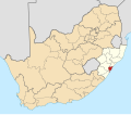
| Province | KwaZulu-Natal |
| Municipality | eThekwini |
| Main Place | Durban |
| Area | |
• Total | 9.51 km2 (3.67 sq mi) |
| Population (2011) [1] | |
• Total | 19,143 |
| • Density | 2,000/km2 (5,200/sq mi) |
| Racial makeup (2011) | |
| • Black African | 34% [2] |
| • Coloured | 2.2% [3] |
| • Indian/Asian | 61% [4] |
| • White | 0.5% [5] |
| • Other | 1.2% [6] |
| First languages (2011) | |
| • Zulu | 20.6% |
| • English | 65.8% |
| • Xhosa | 5.6% |
| • Afrikaans | 1.8% |
| • Other | 6.2% |
| Time zone | UTC+2 (SAST) |
| Postal code (street) | 4091 |
| PO box | 4090 |
| Area code | 031 |
Reservoir Hills is a suburb of Durban, KwaZulu-Natal, South Africa. It is administered by the eThekwini Metropolitan Municipality and its postal code is 4091. It was named after the local reservoir located at the highest peak and the vast rolling hills. Reservoir Hills was an affluent, predominantly Indian suburb during the apartheid era.
It is located north of Westville (which was a predominantly White suburb prior to democracy in South Africa) and Palmiet, east of Clermont, south of Newlands West and west of the Papwa Sewgolum Golf Course.