Related Research Articles

Marengo County is a county located in the west central portion of the U.S. state of Alabama. As of the 2020 census, the population was 19,323. The largest city is Demopolis, and the county seat is Linden. It is named in honor of the Battle of Marengo near Turin, Italy, where French leader Napoleon Bonaparte defeated the Austrians on June 14, 1800.

Demopolis is the largest city in Marengo County, in west-central Alabama. The population was 7,162 at the time of the 2020 United States census, down from 7,483 at the 2010 census.
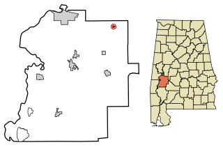
Faunsdale is a town in Marengo County, Alabama, United States. At the 2020 census the population was 90, down from 98 in 2010. Faunsdale is home to a community of Holdeman Mennonites, the such community outside of Greensboro, Alabama. The town has the only Holdeman Mennonite Church in the area, Cedarcrest Mennonite Church.

The Territory of Mississippi was an organized incorporated territory of the United States that was created under an organic act signed into law by President John Adams on April 7, 1798, and was dissolved on December 10, 1817, when the western half of the territory was admitted to the Union as the State of Mississippi. The eastern half was redesignated as the Alabama Territory until it was admitted to the Union as the State of Alabama on December 14, 1819. The Chattahoochee River played a significant role in the definition of the territory's borders. The population rose in the early 1800s from settlement, with cotton being an important cash crop.

The Tombigbee River is a tributary of the Mobile River, approximately 200 mi (325 km) long, in the U.S. states of Mississippi and Alabama. Together with the Alabama, it merges to form the short Mobile River before the latter empties into Mobile Bay on the Gulf of Mexico. The Tombigbee watershed encompasses much of the rural coastal plain of western Alabama and northeastern Mississippi, flowing generally southward. The river provides one of the principal routes of commercial navigation in the southern United States, as it is navigable along much of its length through locks and connected in its upper reaches to the Tennessee River via the Tennessee-Tombigbee Waterway.
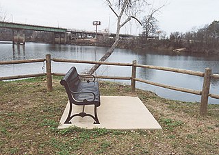
The Black Warrior River is a waterway in west-central Alabama in the southeastern United States. The river rises in the extreme southern edges of the Appalachian Highlands and flows 178 miles (286 km) to the Tombigbee River, of which the Black Warrior is the primary tributary. The river is named after the Mississippian paramount chief Tuskaloosa, whose name was Muskogean for 'Black Warrior'. The Black Warrior is impounded along nearly its entire course by a series of locks and dams to form a chain of reservoirs that not only provide a path for an inland waterway, but also yield hydroelectric power, drinking water, and industrial water.
The Natchez District was one of two areas established in the Kingdom of Great Britain's West Florida colony during the 1770s – the other being the Tombigbee District. The first Anglo settlers in the district came primarily from other parts of British America. The district was recognized to be the area east of the Mississippi River from Bayou Sara in the south and Bayou Pierre in the north.

The Fort Mims massacre took place on August 30, 1813, during the Creek War, when a force of Creek Indians belonging to the Red Sticks faction, under the command of head warriors Peter McQueen and William Weatherford, stormed the fort and defeated the militia garrison. Afterward, a massacre ensued and almost all of the remaining Creek métis, white settlers, and militia at Fort Mims were killed. The fort was a stockade with a blockhouse surrounding the house and outbuildings of the settler Samuel Mims, located about 35 miles directly north of present-day Mobile, Alabama.

The Vine and Olive Colony was an effort by a group of French Bonapartists who, fearing for their lives after the fall of Napoleon Bonaparte and the Bourbon Restoration, attempted to establish an agricultural settlement growing wine grapes and olive trees in the Alabama wilderness. The area that they settled later became the counties of Marengo and Hale.

Faunsdale Plantation is a historic forced-labor plantation near the town of Faunsdale, Alabama, United States. This plantation is in the Black Belt, a section of the state developed for cotton plantations. Until the U.S. Civil War, planters held as many as 186 enslaved African Americans as laborers to raise cotton as a commodity crop.

The African slave trade was first brought to Alabama when the region was part of the French Louisiana Colony.

Cedar Crest, also known as Cedar Crest Farms, is a Greek Revival plantation house located near Faunsdale, Alabama. It was built for Kimbrough Cassels Dubose in 1850 by Albert Prince, a slave. Dubose, born in Darlington District, South Carolina was educated at the preparatory school of Prof. Stafford who later was of the faculty of the University of Alabama. His wife was Miss Elizabeth Boykin Witherspoon also of Darlington District, South Carolina, and they had seven sons and four daughters: John Witherspoon, James Henry, Jr., Eugene, Nicholas William, Francis Marion, Lemuel Benton and Edwin Dargan-the daughters Louisa, Rosalie, Augusta and Adele. The plantation was worked by the forced labor of as many as 130 enslaved persons. The house is one-and-a-half stories with side gables, but has been simplified. It originally had side wings, with adjoining porches across the front. These were removed in 1939, leaving the small central front portico. Another historic plantation house, Altwood, was moved from a nearby location to the Cedar Crest grounds in 1988. The house was added to the National Register of Historic Places on August 5, 1993, as a part of the Plantation Houses of the Alabama Canebrake and Their Associated Outbuildings Multiple Property Submission.

Cuba Plantation is a historic plantation house located in Faunsdale, Alabama. It was built in 1850 by Andrew Pickens Calhoun as an overseer's house for this, his second slave plantation. He added about 420 acres to Cuba Plantation, purchased from William Henry Tayloe, son of John Tayloe III of The Octagon House-called Adventure. His primary plantation was the nearby Tulip Hill. Andrew Calhoun was the son of John C. Calhoun, seventh Vice President of the United States, who frequented the Octagon House while in Washington, D.C. as Secretary of War and later an independent outlier of the anti-Jacksonian Whig Party, later realigning himself with the Democrats' policies. It was sold in 1863 to Tristram Benjamin Bethea, who resided in Montgomery County, Alabama. Originally a one-story structure, the house was later enlarged on the ground floor and a second story added by the Bethea family. The house was added to the National Register of Historic Places on July 13, 1993, as a part of the Plantation Houses of the Alabama Canebrake and Their Associated Outbuildings Multiple Property Submission.

Hawthorne, also known as the Browder Place, is a historic Italianate plantation house and historic district in Prairieville, Alabama, USA. This area of Hale County was included in Marengo County before the creation of Hale in 1867. Hawthorne is included in the Plantation Houses of the Alabama Canebrake and Their Associated Outbuildings Multiple Property Submission. It was added to the National Register of Historic Places on July 7, 1994, due to its architectural significance.

A canebrake or canebreak is a thicket of any of a variety of Arundinaria grasses: A. gigantea, A. tecta and A. appalachiana. As a bamboo, these giant grasses grow in thickets up to 24 feet (7.3 m) tall. A. gigantea is generally found in stream valleys and ravines throughout the southeastern United States. A. tecta is a smaller stature species found on the Atlantic and Gulf Coastal Plains. Finally, A. appalachiana is found in more upland areas at the southern end of the Appalachian mountains. Cane does not do well on sites that meet wetland classification; instead canebrakes are characteristic of moist lowland, floodplain areas that are not as saturated as true wetlands.

William Henry Tayloe was an American plantation owner, horse breeder, businessman and land speculator during the first half of the 19th century. He inherited a vast estate from his father and expanded his holdings, pioneering new territory in the Canebrake region of Alabama.

Henry Augustine Tayloe was an American planter, slaveholder, horse breeder and racer, and land speculator in Alabama during the 19th century.

Fort Madison was a stockade fort built in August 1813 in present-day Clarke County, Alabama, during the Creek War, which was part of the larger War of 1812. The fort was built by the United States military in response to attacks by Creek warriors on encroaching American settlers. The fort shared many similarities to surrounding stockade forts in its construction but possessed a number of differences in its defenses. The fort housed members of the United States Army and settlers from the surrounding area, and it was used as a staging area for raids on Creek forces and supply point on further military expeditions. Fort Madison was subsequently abandoned at the conclusion of the Creek War and only a historical marker exists at the site today.
References
- 1 2 3 4 Hall, John C. (17 August 2007). "Canebrakes". The Encyclopedia of Alabama. Retrieved 17 December 2008.
- ↑ "Plantation Houses of the Alabama Canebrake and their associated outbuildings (1818-1942)". Multiple Property Documentation Form. National Register of Historic Places. 8 February 1993. Retrieved 17 December 2008.
- ↑ "Alabama's Canebrake". West Alabama Regional Alliance. Archived from the original on 23 June 2011. Retrieved 17 December 2008.
- ↑ Bill, Finch (15 August 2008). "Lost in the Canebrake". Press-Register . Archived from the original on 9 June 2011. Retrieved 17 December 2008.
- ↑ DuBose, John Witherspoon (Winter 1947). "Chronicles of the Canebrake, 1817-1860". The Alabama Historical Quarterly. 9 (4): 475–613.
| | This Alabama state location article is a stub. You can help Wikipedia by expanding it. |