Escambia County | |
|---|---|
 Escambia County, Alabama Courthouse | |
 Seal | |
 Location within the U.S. state of Alabama | |
 Alabama's location within the U.S. | |
| Coordinates: 31°07′36″N87°09′44″W / 31.126666666667°N 87.162222222222°W | |
| Country | |
| State | |
| Founded | December 10, 1868 |
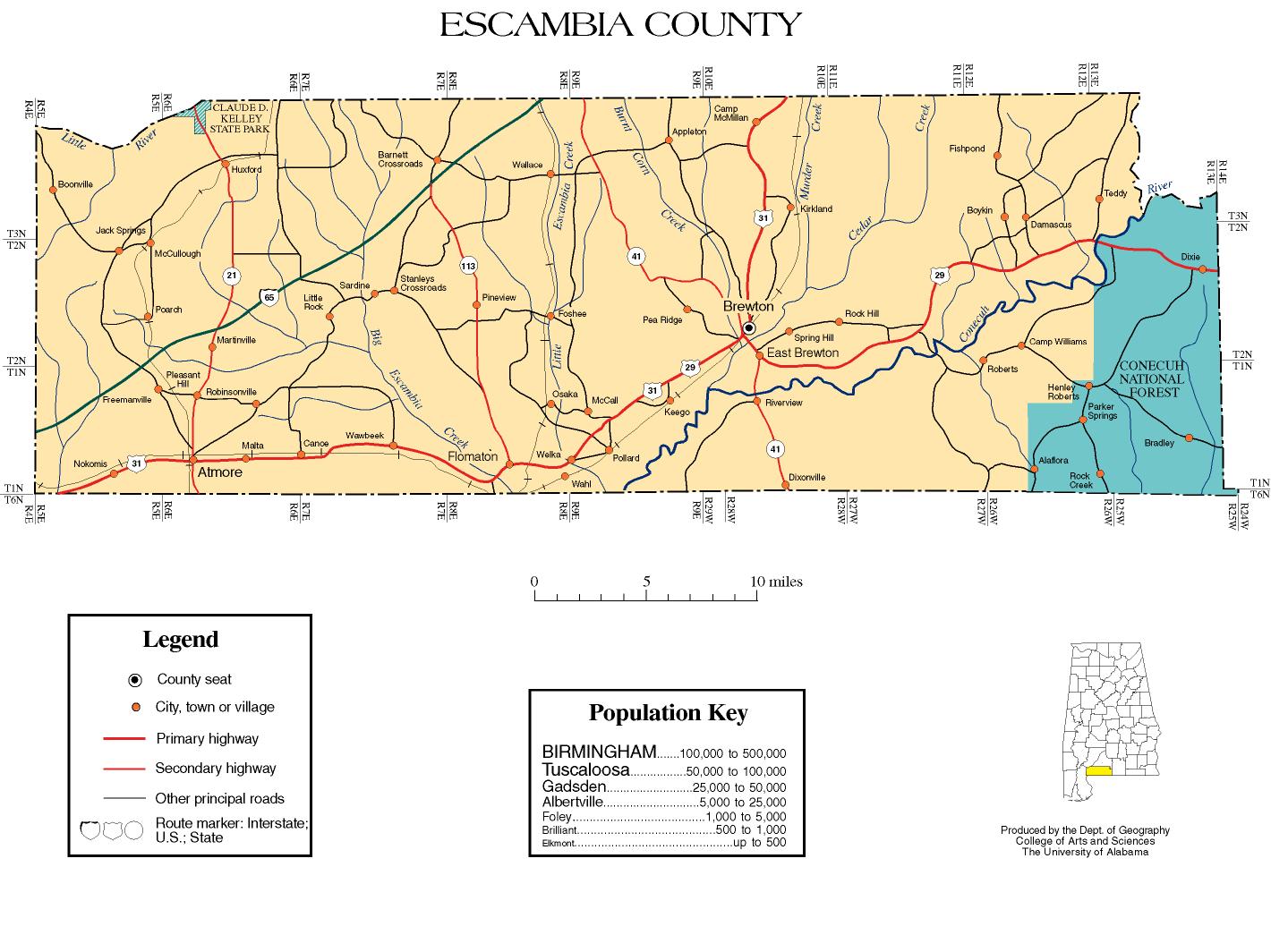
| Seat | Brewton |
| Largest city | Atmore |
| Area | |
• Total | 953 sq mi (2,470 km2) |
| • Land | 945 sq mi (2,450 km2) |
| • Water | 8.1 sq mi (21 km2) 0.8% |
| Population (2020) | |
• Total | 36,757 |
• Estimate (2024) | 36,630 |
| • Density | 39/sq mi (15/km2) |
| Time zone | UTC−6 (Central) |
| • Summer (DST) | UTC−5 (CDT) |
| Congressional district | 1st |
| Website | www |
| |
Escambia County is a county located in the south central portion of the U.S. state of Alabama. As of the 2020 census, the population was 36,757. [1] Its county seat is Brewton. [2]
Contents
- Etymology
- History
- Geography
- Major highways
- Adjacent counties
- National protected area
- Demographics
- 2020 census
- 2010 census
- 2000 census
- Government and infrastructure
- Communities
- Cities
- Towns
- Unincorporated communities
- Former town
- Indian reservation
- Education
- Historic sites
- Notable residents
- See also
- References
- External links
Escambia County is coextensive with the Atmore, AL Micropolitan Statistical Area; which is itself a constituent part of the larger Pensacola-Ferry Pass, FL-AL Combined Statistical Area. [3]
The county is the base of the state's only federally recognized Native American tribe, the Poarch Band of Creek Indians. They have developed gaming casinos and a hotel on their reservation here, but also a much larger business extending to locations in other states and the Caribbean.