Marengo County, Alabama

Last updated

Marengo County
Marengo Alabama Courthouse.jpg
Marengo County Courthouse in Linden
Map of Alabama highlighting Marengo County.svg
Location within the U.S. state of Alabama
Alabama in United States.svg
Alabama's location within the U.S.
Coordinates: 32°14′31″N87°47′22″W / 32.241944444444°N 87.789444444444°W / 32.241944444444; -87.789444444444
CountryFlag of the United States.svg United States
StateFlag of Alabama.svg  Alabama
FoundedFebruary 6, 1818
Named for Battle of Marengo [1]
Seat Linden
Largest city Demopolis
Area
  Total983 sq mi (2,550 km2)
  Land977 sq mi (2,530 km2)
  Water5.8 sq mi (15 km2)  0.6%
Population
 (2020)
  Total19,323
  Estimate 
(2023)
18,684 Decrease2.svg
  Density20/sq mi (7.6/km2)
Time zone UTC−6 (Central)
  Summer (DST) UTC−5 (CDT)
Congressional district 7th
Website marengocountyal.com
  • County Number 48 on Alabama Licence Plates

Marengo County is a county located in the west central portion of the U.S. state of Alabama. As of the 2020 census, the population was 19,323. [2] The largest city is Demopolis, and the county seat is Linden. [1] It is named in honor of the Battle of Marengo near Turin, Italy, where French leader Napoleon Bonaparte defeated the Austrians on June 14, 1800.

Contents

History

Marengo County was created by the Alabama Territorial legislature on February 6, 1818, from land acquired from the Choctaw by the Treaty of Fort St. Stephens on October 24, 1816. [3] Like the other four of the "Five Civilized Tribes", over the course of the following twenty years the Choctaw were largely forced west of the Mississippi River and into what is now Oklahoma during the period of Indian Removal conducted by the federal government.

The county was named to commemorate Napoleon's victory at the Battle of Marengo over Austrian armies on June 14, 1800. [1] This name was chosen in honor of the first European settlers, Bonapartists exiled from France after Napoleon's downfall. In 1817 a number of French settled the area around Demopolis. They were trying to develop a Vine and Olive Colony. [3] [4] Other ethnic French who settled here were refugees from the colony of Saint-Domingue, where enslaved Africans and "free people of color" had routed Napoleon's troops and white colonists, and declared independence in 1804. They established the territory as Haiti, the second republic in the western hemisphere.

The county seat was originally known as the Town of Marengo, but in 1823 the name was changed to Linden. [1] Linden is a shortened version of Hohenlinden, scene of the Battle of Hohenlinden, a French victory in Bavaria on December 3, 1800, during Napoleon's campaign. [1]

Barney's Upper Place, an I-house in Putnam that was built in 1833. Barney Upper Place.jpg
Barney's Upper Place, an I-house in Putnam that was built in 1833.

Situated in Alabama's Black Belt and having a naturally rich soil, the county was developed by planters for numerous cotton plantations, dependent on the forced labor of large gangs of enslaved African Americans. [3] The enslaved comprised the majority of the county population decades before the American Civil War. In 1860 the population consisted of 24,409 slaves, 6761 free whites (including 944 slave owners), and one "free person of color," for a total combined population of 31,171. [5] At this time there were 778 plantations and farms in the county. [5]

The fourth-oldest Jewish congregation in Alabama, B'nai Jeshurun, was established in Demopolis in 1858 by immigrants and migrants from other Southern cities. [6]

After the Civil War, the economy continued to be based on agriculture. In the transition to free labor, many freedmen turned to sharecropping or tenant farming as a way to establish some independence. They did not want to work in white-controlled field gangs. [3]

The county population began to diminish rapidly during and after World War II. People left the farms for manufacturing jobs elsewhere, particularly with the wartime buildup of the defense industry on the West Coast. [3] The movement of African Americans out of Alabama and other parts of the South was considered part of the Great Migration, by which 5 million left the region from 1940 to 1970. In addition to seeking jobs, they sought better conditions than the disfranchisement and Jim Crow oppression they faced in Alabama and other states of the South.

Most of the former cotton fields were gradually converted to pastures for cattle and horses, developed into tree plantations for timber and paper production, or transformed into commercial ponds for farming grain-fed catfish. [3] Beginning in the 1960s, industry began to move into the area. The work force was employed in paper mills, lumber mills, and chemical plants. [3]

County courthouse fires occurred in 1848 and 1965. Each time most of the court records were saved, as they were in a protected vault. [1]

Geography

Gaineswood (built 1843-61), a National Historic Landmark in Demopolis. Gaineswood in October 2011 01.JPG
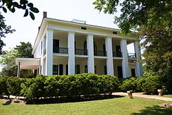
Gaineswood (built 1843–61), a National Historic Landmark in Demopolis.
Boddie Law Office-Town Hall (built 1858) in Dayton. On the Alabama Register of Landmarks and Heritage. Boddie Law Office 01.jpg
Boddie Law Office-Town Hall (built 1858) in Dayton. On the Alabama Register of Landmarks and Heritage.

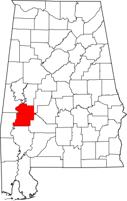
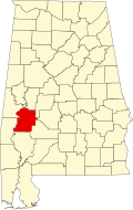
Marengo County is situated in the west-central area of the state. [1] According to the United States Census Bureau, the county has a total area of 983 square miles (2,550 km2), of which 977 square miles (2,530 km2) is land and 5.8 square miles (15 km2) (0.6%) is water. [7] The entire western county border is formed by the Tombigbee River and a small northwestern portion is formed by the Black Warrior River.

Major highways

Adjacent counties

Demographics

Historical population
CensusPop.Note
1820 2,933
1830 7,700162.5%
1840 17,264124.2%
1850 27,83161.2%
1860 31,17112.0%
1870 26,151−16.1%
1880 30,89018.1%
1890 33,0957.1%
1900 38,31515.8%
1910 39,9234.2%
1920 36,065−9.7%
1930 36,4261.0%
1940 35,736−1.9%
1950 29,494−17.5%
1960 27,098−8.1%
1970 23,819−12.1%
1980 25,0475.2%
1990 23,084−7.8%
2000 22,539−2.4%
2010 21,027−6.7%
2020 19,323−8.1%
2023 (est.)18,684 [8] −3.3%
U.S. Decennial Census [9]
1790–1960 [10] 1900–1990 [11]
1990–2000 [12] 2010–2020 [2]

2020 Census

Marengo County, Alabama – Racial and Ethnic Composition
(NH = Non-Hispanic)
Note: the US Census treats Hispanic/Latino as an ethnic category. This table excludes Latinos from the racial categories and assigns them to a separate category. Hispanics/Latinos may be of any race.
Race / EthnicityPop 2000 [13] Pop 2010 [14] Pop 2020 [15] % 2000% 2010% 2020
White alone (NH)10,5829,6078,37546.95%45.69%43.34%
Black or African American alone (NH)11,58110,83810,13351.38%51.54%52.44%
Native American or Alaska Native alone (NH)193160.08%0.15%0.03%
Asian alone (NH)3753540.16%0.25%0.28%
Pacific Islander alone (NH)2910.01%0.04%0.01%
Some Other Race alone (NH)81410.04%0.00%0.21%
Mixed Race/Multi-Racial (NH)911363450.40%0.65%1.79%
Hispanic or Latino (any race)2193523680.97%1.67%1.90%
Total22,53921,02719,323100.00%100.00%100.00%

As of the census of 2020, there were 19,323 people, 7,361 households, and 3,833 families residing in the county.

2010 census

As of the census of 2010, there were 21,027 people living in the county. 51.7% were Black or African American, 46.4% White, 0.3% Asian, 0.2% Native American, 0.1% Pacific Islander, 0.7% of some other race and 0.8% of two or more races. 1.7% were Hispanic or Latino (of any race).

2000 census

As of the census of 2000, there were 22,539 people, 8,767 households, and 6,277 families living in the county. The population density was 23 people per square mile (8.9 people/km2). There were 10,127 housing units at an average density of 10 units per square mile (3.9 units/km2). The racial makeup of the county was 51.71% Black or African American, 47.28% White, 0.08% Native American, 0.18% Asian, 0.01% Pacific Islander, 0.25% from other races, and 0.47% from two or more races. 0.97% of the population were Hispanic or Latino of any race.

There were 8,767 households, out of which 34.70% had children under the age of 18 living with them, 48.40% were married couples living together, 19.40% had a female householder with no husband present, and 28.40% were non-families. 26.50% of all households were made up of individuals, and 12.10% had someone living alone who was 65 years of age or older. The average household size was 2.55 and the average family size was 3.08.

In the county, the population was spread out, with 28.50% under the age of 18, 8.00% from 18 to 24, 26.00% from 25 to 44, 22.90% from 45 to 64, and 14.60% who were 65 years of age or older. The median age was 36 years. For every 100 females there were 88.30 males. For every 100 females age 18 and over, there were 82.20 males.

The median income for a household in the county was $27,025, and the median income for a family was $35,475. Males had a median income of $36,053 versus $19,571 for females. The per capita income for the county was $15,308. About 22.20% of families and 25.90% of the population were below the poverty line, including 33.70% of those under age 18 and 25.30% of those age 65 or over.

According to the New York Times , by 2017, the rural Black Belt (called that for its soil) that stretches across the middle of the state is home to largely poor counties that are predominantly African-American. These counties include Dallas, Lowndes, Marengo and Perry." [16]

Education

For the 2014–15 school year, the Marengo County School District is operating three K–12 schools, one each in Dixons Mills, Sweet Water, and Thomaston. [17] One former county school in the Demopolis area was closed by the school board following the 2013–14 school year. Demopolis and Linden have city-run school systems, the Demopolis City School District and Linden City Schools. [18]

Culture

Events

Places of interest

Marengo County is home to the Alabama Rural Heritage Center and Chickasaw State Park. The Tombigbee River and Black Warrior River form portions of the western and northern county borders and provide recreational opportunities. Marengo County has 28 sites listed on the National Register of Historic Places, one of which is also a National Historic Landmark. [23] Additionally, 19 sites are listed on the Alabama Register of Landmarks and Heritage. [24]

Government

Like the rest of the Black Belt, Marengo County leans Democratic. However, it often produces narrow margins for winning candidates; no presidential candidate has won more than 54% of the vote in Marengo since Richard Nixon in 1972. In 2020, Donald Trump lost the county by only 145 votes.

United States presidential election results for Marengo County, Alabama [25]
Year Republican Democratic Third party
No.%No.%No.%
2020 5,34349.02%5,48850.35%690.63%
2016 5,23347.60%5,61551.07%1461.33%
2012 5,33646.23%6,16753.43%400.35%
2008 5,51648.09%5,92651.66%290.25%
2004 5,25550.91%5,03748.80%300.29%
2000 4,69048.81%4,84150.39%770.80%
1996 4,01343.18%4,89952.71%3824.11%
1992 4,47039.75%5,63250.09%1,14210.16%
1988 4,24148.61%4,40250.45%820.94%
1984 5,26151.51%4,81147.11%1411.38%
1980 4,04841.90%5,17853.60%4344.49%
1976 3,84143.87%4,73154.04%1832.09%
1972 5,15665.05%2,64533.37%1251.58%
1968 4574.99%3,47938.01%5,21857.00%
1964 3,67782.33%00.00%78917.67%
1960 1,23544.25%1,43651.45%1204.30%
1956 1,00933.06%1,85860.88%1856.06%
1952 1,36243.21%1,79056.79%00.00%
1948 673.45%00.00%1,87696.55%
1944 894.83%1,74694.69%90.49%
1940 702.97%2,28496.94%20.08%
1936 331.42%2,28798.54%10.04%
1932 502.28%2,09795.45%502.28%
1928 75228.38%1,89871.62%00.00%
1924 171.35%1,24398.42%30.24%
1920 422.97%1,37097.03%00.00%
1916 191.26%1,49198.61%20.13%
1912 90.64%1,38697.88%211.48%
1908 785.45%1,33393.15%201.40%
1904 564.61%1,14994.65%90.74%

Communities

Jefferson Methodist Church (built 1856) in Jefferson. On the National Register of Historic Places as part of the Jefferson Historic District. Jefferson Historic District 02.JPG
Jefferson Methodist Church (built 1856) in Jefferson. On the National Register of Historic Places as part of the Jefferson Historic District.
Lyon Hall (built 1853) in Demopolis. On the National Register of Historic Places. Lyon Hall in 2011.JPG
Lyon Hall (built 1853) in Demopolis. On the National Register of Historic Places.

Cities

Towns

Census-designated places

Unincorporated communities

Ghost town

See also

Related Research Articles

<span class="mw-page-title-main">Calhoun County, Alabama</span> County in Alabama, United States

Calhoun County is a county in the east central part of the U.S. state of Alabama. As of the 2020 census, the population was 116,441. Its county seat is Anniston. It is named in honor of John C. Calhoun, a US Senator from South Carolina.

<span class="mw-page-title-main">Choctaw County, Alabama</span> County in Alabama, United States

Choctaw County is a county located in the southwestern portion of the U.S. state of Alabama. As of the 2020 census, the population was 12,665. The county seat is Butler. The county was established on December 29, 1847, and named for the Choctaw tribe of Native Americans.

<span class="mw-page-title-main">Clarke County, Alabama</span> County in Alabama, United States

Clarke County is a county located in the southwestern part of the U.S. state of Alabama. As of the 2020 census, the population was 23,087. The county seat is Grove Hill. The county's largest city is Jackson. The county was created by the legislature of the Mississippi Territory in 1812. It is named in honor of General John Clarke of Georgia, who was later elected governor of that state.

<span class="mw-page-title-main">Morgan County, Alabama</span> County in Alabama, United States

Morgan County is a county in the north-central part of the U.S. state of Alabama. As of the 2020 census, its population was 123,421. The county seat is Decatur. On June 14, 1821, it was renamed in honor of American Revolutionary War General Daniel Morgan of Virginia. It is a prohibition or dry county, although alcohol sales are allowed in the cities of Decatur, Hartselle, and Priceville. Morgan County is included in the Decatur, AL Metropolitan Statistical Area, which is also included in the Huntsville-Decatur-Albertville, AL Combined Statistical Area. It is a part of the North, Northwest, and North-Central regions of Alabama.

<span class="mw-page-title-main">Covington County, Alabama</span> County in Alabama, United States

Covington County, is a county located in the south central portion of the U.S. state of Alabama. As of the 2020 census the population was 37,570. Its county seat is Andalusia. Its name is in honor of Brigadier General Leonard Covington of Maryland and Mississippi, who died in the War of 1812.

<span class="mw-page-title-main">Dallas County, Alabama</span> County in Alabama, United States

Dallas County is a county located in the central part of the U.S. state of Alabama. As of the 2020 census, its population was 38,462. The county seat is Selma. Its name is in honor of United States Secretary of the Treasury Alexander J. Dallas, who served from 1814 to 1816.

<span class="mw-page-title-main">Escambia County, Alabama</span> County in Alabama, United States

Escambia County is a county located in the south central portion of the U.S. state of Alabama. As of the 2020 census, the population was 36,757. Its county seat is Brewton.

<span class="mw-page-title-main">Hale County, Alabama</span> County in Alabama, United States

Hale County is a county located in the west central portion of the U.S. state of Alabama. As of the 2020 census, the population was 14,785. Its county seat is Greensboro. It is named in honor of Confederate officer Stephen Fowler Hale.

<span class="mw-page-title-main">Mobile County, Alabama</span> County in Alabama, United States

Mobile County is located in the southwestern corner of the U.S. state of Alabama. It is the third-most populous county in the state after Jefferson and Madison counties. As of the 2020 census, its population was 414,809. Its county seat is Mobile, which was founded as a deepwater port on the Mobile River. The only such port in Alabama, it has long been integral to the economy for providing access to inland waterways as well as the Gulf of Mexico.

<span class="mw-page-title-main">Perry County, Alabama</span> County in Alabama, United States

Perry County is a county located in the Black Belt region in the central part of the U.S. state of Alabama. As of the 2020 census, the population was 8,511. Its county seat is Marion. The county was established in 1819 and is named in honor of Commodore Oliver Hazard Perry of Rhode Island and the United States Navy. As of 2020, Perry County was the only county in Alabama, and one of 40 in the United States, not to have access to any wired broadband connections.

<span class="mw-page-title-main">Sumter County, Alabama</span> County in Alabama, United States

Sumter County is a county located in the west central portion of Alabama. At the 2020 census, the population was 12,345. Its county seat is Livingston. Its name is in honor of General Thomas Sumter of South Carolina. The University of West Alabama is in Livingston.

<span class="mw-page-title-main">Washington County, Alabama</span> County in Alabama, United States

Washington County is a county located in the southwestern part of the U.S. state of Alabama. As of the 2020 census, the population was 15,388. The county seat is Chatom. The county was named in honor of George Washington, the first President of the United States. In September 2018 The United States Office of Management and Budget (OMB) added Washington County to the Mobile, Alabama Metropolitan Statistical Area. It is also part of the larger Mobile-Daphne-Fairhope, AL Combined Statistical Area.

<span class="mw-page-title-main">Dayton, Alabama</span> Town in Alabama, United States

Dayton is a town in Marengo County, Alabama, United States. The population was 28 at the 2020 census.

<span class="mw-page-title-main">Demopolis, Alabama</span> City in Alabama, United States

Demopolis is the largest city in Marengo County, in west-central Alabama. The population was 7,162 at the 2020 census.

<span class="mw-page-title-main">Faunsdale, Alabama</span> Town in Alabama, United States

Faunsdale is a town in Marengo County, Alabama, United States. At the 2020 census the population was 90, down from 98 in 2010. Faunsdale is home to a community of Holdeman Mennonites, the only such community outside of Greensboro, Alabama. The town has the only Holdeman Mennonite Church in the area, Cedarcrest Mennonite Church.

<span class="mw-page-title-main">Linden, Alabama</span> City in Alabama, United States

Linden is a city in and the county seat of Marengo County, Alabama, United States. The population was 1,930 at the 2020 census, down from 2,123 at the 2010 census.

<span class="mw-page-title-main">Providence, Alabama</span> Town in Alabama, United States

Providence is a town in Marengo County, Alabama, United States. As of the 2020 United States census, the population was 167, down from 223 at the 2010 census. It incorporated sometime in the 1970s.

<span class="mw-page-title-main">Sweet Water, Alabama</span> Town in Alabama, United States

Sweet Water is a town in Marengo County, Alabama, United States. It was founded during the 1840s and named for Sweet Water Creek, which runs through a section of the community. The population was 228 at the 2020 census, down from 258 at the 2010 census.

<span class="mw-page-title-main">Thomaston, Alabama</span> Town in Alabama, United States

Thomaston is a town in Marengo County, Alabama, United States. At the 2020 census the population was 326, down from 417 at the 2010 census.

<span class="mw-page-title-main">Livingston, Alabama</span> City in Alabama, United States

Livingston is a city in and the county seat of Sumter County, Alabama, United States and the home of the University of West Alabama. By an act of the state legislature, it was incorporated on January 10, 1835. At the 2010 census the population was 3,485, up from 3,297 in 2000. It was named in honor of Edward Livingston, of the Livingston family of New York.

References

  1. 1 2 3 4 5 6 7 "Alabama Counties: Marengo County". Alabama Department of Archives and History. Retrieved November 30, 2007.
  2. 1 2 "State & County QuickFacts". United States Census Bureau. Retrieved September 10, 2023.
  3. 1 2 3 4 5 6 7 Marengo County Heritage Book Committee. The Heritage of Marengo County, Alabama, pages 1-4. Clanton, Alabama: Heritage Publishing Consultants, 2000. ISBN   1-891647-58-X
  4. Smith, Winston. Days of Exile: The Story of the Vine and Olive Colony in Alabama, page 9. Tuscaloosa, Alabama: W. B. Drake and Son, 1967.
  5. 1 2 "Census Data for the Year 1860". Inter-University Consortium for Political and Social Research. Archived from the original on May 6, 2007. Retrieved November 30, 2007.
  6. "Alabama". Encyclopedia of Southern Jewish Communities. Goldring / Woldenberg Institute of Southern Jewish Life . Retrieved October 5, 2010.
  7. "2010 Census Gazetteer Files". United States Census Bureau. August 22, 2012. Retrieved August 22, 2015.
  8. "Annual Estimates of the Resident Population for Counties: April 1, 2020 to July 1, 2023". United States Census Bureau. Retrieved March 27, 2024.
  9. "U.S. Decennial Census". United States Census Bureau. Retrieved August 22, 2015.
  10. "Historical Census Browser". University of Virginia Library. Retrieved August 22, 2015.
  11. Forstall, Richard L., ed. (March 24, 1995). "Population of Counties by Decennial Census: 1900 to 1990". United States Census Bureau. Retrieved August 22, 2015.
  12. "Census 2000 PHC-T-4. Ranking Tables for Counties: 1990 and 2000" (PDF). United States Census Bureau. April 2, 2001. Retrieved August 22, 2015.
  13. "P004 HISPANIC OR LATINO, AND NOT HISPANIC OR LATINO BY RACE – 2000: DEC Summary File 1 – Marengo County, Alabama". United States Census Bureau .
  14. "P2 HISPANIC OR LATINO, AND NOT HISPANIC OR LATINO BY RACE – 2010: DEC Redistricting Data (PL 94-171) – Marengo County, Alabama". United States Census Bureau .
  15. "P2 HISPANIC OR LATINO, AND NOT HISPANIC OR LATINO BY RACE - 2020: DEC Redistricting Data (PL 94-171) – Marengo County, Alabama". United States Census Bureau .
  16. Martin, Jonathan; Blinder, Alan (December 12, 2017). "Alabama Senate Race Between Roy Moore and Doug Jones Ends With More Controversy".
  17. "Schools". Marengo County Schools. School In Sites. Retrieved October 2, 2010.
  18. "Marengo County". Encyclopedia of Alabama. Auburn University . Retrieved October 2, 2010.
  19. 1 2 3 4 5 "Demopolis". Alabama Tourism Department - Official Web Site. Archived from the original on November 24, 2008. Retrieved December 6, 2008.
  20. "Faunsdale Biker Rally - Alabama's wildest biker event". Bama Rides. April 26, 2008. Archived from the original on August 19, 2008. Retrieved October 7, 2008.
  21. "Annual Faunsdale Crawfish Festival". Alabama Tourism Department - Official Web Site. Archived from the original on November 25, 2008. Retrieved December 6, 2008.
  22. "Rural Heritage Day & Pepper Jelly Festival, 2nd". Alabama Tourism Department - Official Web Site. Archived from the original on November 24, 2008. Retrieved December 6, 2008.
  23. "National Register Information System". National Register of Historic Places . National Park Service. April 15, 2008.
  24. "The Alabama Register of Landmarks & Heritage". preserveala.org. Alabama Historical Commission. May 31, 2011. Archived from the original (PDF) on June 6, 2011. Retrieved June 6, 2011.
  25. "Dave Leip's Atlas of U.S. Presidential Elections" . Retrieved November 21, 2016.

32°14′31″N87°47′22″W / 32.24194°N 87.78944°W / 32.24194; -87.78944