Carindale, Queensland

Last updated

Carindale
Brisbane,  Queensland
Carindalecreekroad.jpg
Westfield Carindale from Creek Road
Australia Queensland location map.svg
Red pog.svg
Carindale
Carindale, Queensland
Coordinates 27°30′37″S153°06′45″E / 27.5102°S 153.1125°E / -27.5102; 153.1125 (Carindale (centre of suburb))
Population16,535 (SAL 2021) [1]
Established1980 [2]
Postcode(s) 4152 [3]
Area10.3 km2 (4.0 sq mi)
Time zone AEST (UTC+10:00)
Location13.1 km (8 mi) SE of Brisbane GPO
LGA(s) City of Brisbane
(Chandler Ward) [4]
State electorate(s) Chatsworth
Federal division(s) Bonner
Suburbs around Carindale:
Carina Tingalpa Belmont
Carina Heights Carindale Belmont
Mount Gravatt East Mansfield Mackenzie

Carindale is a suburb of the City of Brisbane, Queensland, Australia. It is located 13.1 kilometres (8.1 mi) by road south-east of the Brisbane GPO, [5] and borders Belmont, Carina, Carina Heights, Mackenzie, Mansfield, Mount Gravatt East, and Tingalpa. In the 2021 census, Carindale had a population of 16,535 people. [6]

Contents

Notable features of the suburb include a large shopping centre – Westfield Carindale, the Pacific Golf Club, Belmont State School, Belmont Bushland Reserve, Belmont Private Hospital (psychiatric only) and Bulimba Creek. The Gateway Motorway borders the suburb. In addition to Indooroopilly on the west; Chermside on the north-side; and Upper Mount Gravatt on the south side, the suburb has been described as a mini-CBD. [ citation needed ]

Toponymy

Carindale was the name of a housing estate constructed in the area in 1976 and was taken as the official name of the suburb when it separated from Belmont in 1980. [7] The name itself is a combination of "Carin" from the nearby suburb of Carina, and "Dale" meaning valley. [7]

History

The area was first settled by Europeans in the 1850s, with activity focussing on timber and agriculture. [2] [8]

Belmont State School opened on 5 June 1876. [9] [10] It is now within the suburb boundaries of Carindale. [11]

Carina State School opened on 30 January 1917. [9] [12] It is now within the suburb boundaries of Carindale. [11]

St Gabriel The Archangel's Anglican Church was dedicated in 1958. A new church was dedicated in 1991 and consecrated in 2010. [13]

In 1973, Carindale Nursing Home was opened in Foxglove St, Mt Gravatt East. [14] In 1978, permission was granted to the developers to use Carindale as the name of the new shopping centre. [15] In 1980, the suburb of Carindale was created.[ citation needed ]

Christian Outreach College opened on 16 May 1978 in West End. [9] It relocated to Mansfield in 1982 but is now within the suburb boundaries of Carindale. It is now known as Citepointe Christian College. [16] [17]

The Carindale Library opened in 1999 with a major refurbishment in 2012. [18]

Demographics

At the 2011 census, Carindale had a population of 15,577 people. [19]

In the 2016 census, Carindale recorded a population of 15,740 people, 51.4% female and 48.6% male. [20] The median age of the Carindale population was 42 years of age, 4 years above the Australian median. 65.3% of people living in Carindale were born in Australia, compared to the national average of 66.7%; the next most common countries of birth were New Zealand 3.5%, England 3.2%, China 2.8%, South Africa 2.4%, and India 1.7%. 71.5% of people spoke only English at home; the next most popular languages were Mandarin 4.2%, Greek 3.6%, Cantonese 3.3%, Italian 1.7%, 1.1% Afrikaans. [20] According to the 2016 census, Carindale includes the largest Greek Australian community of any suburb in Queensland, numbering 746 individuals and making up 4.7% of the suburb's population. [21]

In the 2021 census, Carindale had a population of 16,535 people. [6]

Education

Belmont State School is a government primary (Prep-6) school for boys and girls at Old Cleveland Road ( 27°30′11″S153°06′56″E / 27.5030°S 153.1156°E / -27.5030; 153.1156 (Belmont State School) ). [22] In 2018, the school had an enrolment of 911 students with 63 teachers (57 full-time equivalent) and 33 non-teaching staff (21 full-time equivalent). [23] It includes a special education program. [22]

Carina State School is a government primary (Prep-6) school for boys and girls at 1413 Creek Road ( 27°29′36″S153°06′06″E / 27.4933°S 153.1018°E / -27.4933; 153.1018 (Carina State School) ). [22] [24] In 2018, the school had an enrolment of 324 students with 32 teachers (22 full-time equivalent) and 19 non-teaching staff (12 full-time equivalent). [23]

Citipointe Christian College (formerly The Christian Outreach College Brisbane) is a private primary and secondary (Prep-12) school for boys and girls at 322 Wecker Road ( 27°32′05″S153°06′48″E / 27.5348°S 153.1132°E / -27.5348; 153.1132 (Citipointe Christian College The Christian Outreach College Brisbane) ). [22] [25] In 2018, the school had an enrolment of 1,648 students with 146 teachers (131 full-time equivalent) and 91 non-teaching staff (60 full-time equivalent). [23]

There are no government secondary schools in Carindale. The nearest government secondary schools are Whites Hill State College in Camp Hill to the west, Cavendish Road State High School in Holland Park to th south-west, and Mansfield State High School in neighbouring Mansfield to the south. [11]

Amenities

The suburb is home to one of the largest Westfield shopping centres in Brisbane, Westfield Carindale. This large shopping complex has over 400 stores.

Governance

Carindale is represented by Ross Vasta, Steve Minnikin, and Ryan Murphy at the federal, state, and local levels respectively.

Transport

Public transport runs frequently to and from Carindale and Brisbane CBD via Old Cleveland Road and Creek Road, leading to the South East Busway.

Related Research Articles

<span class="mw-page-title-main">Mansfield, Queensland</span> Suburb of Brisbane, Queensland, Australia

Mansfield is a suburb in the City of Brisbane, Queensland, Australia. In the 2016 census, Mansfield had a population of 8,695 people.

<span class="mw-page-title-main">Coorparoo, Queensland</span> Suburb of Brisbane, Queensland, Australia

Coorparoo is a suburb in the inner City of Brisbane, Queensland, Australia. In the 2021 census, Coorparoo had a population of 18,132 people.

<span class="mw-page-title-main">Tingalpa, Queensland</span> Suburb of Brisbane, Queensland, Australia

Tingalpa is a suburb in the City of Brisbane, Queensland, Australia. In the 2016 census, Tingalpa had a population of 8,290 people.

<span class="mw-page-title-main">Mount Gravatt, Queensland</span> Suburb of Brisbane, Queensland, Australia

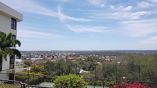
Mount Gravatt is a southern suburb of the City of Brisbane, Queensland, Australia and a prominent hill and lookout within this suburb. In the 2016 census, Mount Gravatt had a population of 3,366 people.

<span class="mw-page-title-main">Stretton, Queensland</span> Suburb of Brisbane, Queensland, Australia

Stretton is a southern suburb in the City of Brisbane, Queensland, Australia. In the 2016 census, Stretton had a population of 4,334. The suburb is known for its Hollywood-sized mansions on nearby streets off Gowan and Compton Roads.

<span class="mw-page-title-main">Carina, Queensland</span> Suburb of Brisbane, Queensland, Australia

Carina is a suburb in the City of Brisbane, Queensland, Australia. In the 2016 census, Carina had a population of 11,019 people.

<span class="mw-page-title-main">Camp Hill, Queensland</span> Suburb of Brisbane, Queensland, Australia

Camp Hill is a suburb in the City of Brisbane, Queensland, Australia. In the 2021 census, Camp Hill had a population of 12 145 people.

<span class="mw-page-title-main">Upper Mount Gravatt, Queensland</span> Suburb of Brisbane, Queensland, Australia

Upper Mount Gravatt is a southern suburb in the City of Brisbane, Queensland, Australia. In the 2016 census, Upper Mount Gravatt had a population of 9,241 people.

<span class="mw-page-title-main">Seven Hills, Queensland</span> Suburb of Brisbane, Queensland, Australia

Seven Hills is a suburb in the City of Brisbane, Queensland, Australia. In the 2021 census, Seven Hills had a population of 2,732 people.

<span class="mw-page-title-main">Mackenzie, Queensland</span> Suburb of City of Brisbane, Queensland, Australia

Mackenzie is a south-eastern suburb in the City of Brisbane, Queensland, Australia. In the 2016 census, Mackenzie had a population of 2,094 people.

<span class="mw-page-title-main">Holland Park West, Queensland</span> Suburb of Brisbane, Queensland, Australia

Holland Park West is a suburb in the City of Brisbane, Queensland, Australia. In the 2016 census, Holland Park West had a population of 6,376 people.

<span class="mw-page-title-main">Belmont, Queensland</span> Suburb of Brisbane, Queensland, Australia

Belmont is an outer suburb in the City of Brisbane, Queensland, Australia. In the 2016 census, Belmont had a population of 4,374 people.

<span class="mw-page-title-main">Mount Gravatt East, Queensland</span> Suburb of Brisbane, Queensland, Australia

Mount Gravatt East is a southern suburb in the City of Brisbane, Queensland, Australia. In the 2016 census, Mount Gravatt East had a population of 11,838 people.

<span class="mw-page-title-main">Cannon Hill, Queensland</span> Suburb of Brisbane, Queensland, Australia

Cannon Hill is a suburb in the City of Brisbane, Queensland, Australia. In the 2016 census, Cannon Hill had a population of 5,533 people.

<span class="mw-page-title-main">Carina Heights, Queensland</span> Suburb of Brisbane, Queensland, Australia

Carina Heights is both a hill and a suburb in the City of Brisbane, Queensland, Australia. In the 2016 census, Carina Heights had a population of 6,732 people.

<span class="mw-page-title-main">Rochedale, Queensland</span> Suburb of Brisbane, Queensland, Australia

Rochedale ( "roach-dale") is an outer southern suburb in the City of Brisbane, Queensland, Australia. In the 2016 census, Rochedale had a population of 3,175 people.

Citipointe Church, formerly Christian Outreach Centre Mansfield, is a Pentecostal Christian church founded in 1974. It is the founding church of the Christian Outreach Centre network, now known as the International Network of Churches. The founding campus is located in the Brisbane suburb of Carindale, Queensland, in Australia. The church has multiple locations in south-east Queensland, as well as in New Zealand, Bulgaria and the US.

<span class="mw-page-title-main">Upper Coomera, Queensland</span> Suburb of Gold Coast, Queensland, Australia

Upper Coomera is a suburb in the City of Gold Coast, Queensland, Australia. In the 2021 census, Upper Coomera had a population of 27,180 people.

<span class="mw-page-title-main">City of Brisbane</span> Local government area in Queensland, Australia

The City of Brisbane is a local government area (LGA) which comprises the inner portion of the metropolitan area of Brisbane, the capital of Queensland, Australia. Its governing body is the Brisbane City Council.

<span class="mw-page-title-main">Old Cleveland Road</span> Road in Brisbane, Australia

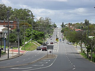
Old Cleveland Road is a major road in Brisbane, Queensland. It runs 19.3 kilometres (12.0 mi) from Stones Corner to Capalaba in Brisbane, with most of the route signed as State Route 22. Sections of the road are also part of State Routes 30, 54, and 55. The road is the main route from inner Brisbane to Capalaba and Cleveland since New Cleveland Road only links Tingalpa with Capalaba.

References

  1. Australian Bureau of Statistics (28 June 2022). "Carindale (suburb and locality)". Australian Census 2021 QuickStats. Retrieved 28 June 2022.  OOjs UI icon edit-ltr-progressive.svg
  2. 1 2 "Carindale, QLD 4152". LJ Hooker. Archived from the original on 12 April 2015. Retrieved 11 October 2013.
  3. "Find a postcode". Australia Post. Archived from the original on 24 August 2011. Retrieved 11 January 2014.
  4. "Chandler Ward". Brisbane City Council. Archived from the original on 4 January 2014. Retrieved 11 January 2014.
  5. Google (31 May 2022). "Brisbane GPO to Carindale" (Map). Google Maps . Google. Retrieved 31 May 2022.
  6. 1 2 Australian Bureau of Statistics (28 June 2022). "Carindale (SAL)". 2021 Census QuickStats. Retrieved 28 February 2023. OOjs UI icon edit-ltr-progressive.svg
  7. 1 2 Centre for the Government of Queensland. "Carindale". Archived from the original on 5 January 2014. Retrieved 11 January 2014.
  8. "CARINDALE SHOPPING CENTRE". State Library of Queensland. Archived from the original on 26 March 2012. Retrieved 11 October 2013.
  9. 1 2 3 Queensland Family History Society (2010), Queensland schools past and present (Version 1.01 ed.), Queensland Family History Society, ISBN   978-1-921171-26-0
  10. "Our school". Belmont State School. 8 April 2020. Archived from the original on 29 March 2022. Retrieved 31 May 2022.
  11. 1 2 3 "Queensland Globe". State of Queensland . Retrieved 5 August 2023.
  12. "History". Carina State School. 16 July 2019. Archived from the original on 1 March 2022. Retrieved 31 May 2022.
  13. "Year Book" (PDF). Anglican Archdiocese of Brisbane. 2019. p. 137. Archived (PDF) from the original on 15 September 2020. Retrieved 15 September 2020.
  14. "Carindale Lodge". Archived from the original on 22 February 2017. Retrieved 22 February 2017.
  15. "Westfield Carindale". Archived from the original on 19 February 2017. Retrieved 22 February 2017.
  16. "Staff". Citipointe Christian College. Archived from the original on 11 March 2022. Retrieved 31 May 2022.
  17. "History of Christian Outreach College Brisbane". Archived from the original on 24 March 2009. Retrieved 11 January 2009.
  18. "Public Libraries Statistical Bulletin 2016-17" (PDF). Public Libraries Connect. State Library of Queensland. November 2017. Archived (PDF) from the original on 30 January 2018. Retrieved 30 January 2018.
  19. Australian Bureau of Statistics (31 October 2012). "Carindale, Qld (State Suburb)". 2011 Census QuickStats. Retrieved 11 October 2013. OOjs UI icon edit-ltr-progressive.svg
  20. 1 2 Australian Bureau of Statistics (27 June 2017). "Carindale (SSC)". 2016 Census QuickStats. Retrieved 20 October 2018. OOjs UI icon edit-ltr-progressive.svg
  21. "2016Census_G_QLD_SSC – Census DataPacks – General Community Profile". Australian Bureau of Statistics – Census 2016. Archived from the original on 29 July 2017. Retrieved 18 July 2017.
  22. 1 2 3 4 "State and non-state school details". Queensland Government. 9 July 2018. Archived from the original on 21 November 2018. Retrieved 21 November 2018.
  23. 1 2 3 "ACARA School Profile 2018". Australian Curriculum, Assessment and Reporting Authority. Archived from the original on 27 August 2020. Retrieved 28 January 2020.
  24. "Carina State School". Carina State School. 28 May 2019. Archived from the original on 10 March 2022. Retrieved 31 May 2022.
  25. "Citipointe Christian College The Christian Outreach College Brisbane". Archived from the original on 23 October 2018. Retrieved 21 November 2018.
  26. "Library opening hours and locations". Brisbane City Council . 3 January 2018. Archived from the original on 30 January 2018. Retrieved 30 January 2018.
  27. "St Gabriel's Parish". Archived from the original on 25 September 2020. Retrieved 25 September 2020.

Commons-logo.svg Media related to Carindale, Queensland at Wikimedia Commons