Stafford Heights Brisbane, Queensland | |||||||||||||||
---|---|---|---|---|---|---|---|---|---|---|---|---|---|---|---|
Coordinates | 27°23′44″S153°00′38″E / 27.3955°S 153.0105°E | ||||||||||||||
Population | 6,833 (2016 census) [1] | ||||||||||||||
• Density | 2,440/km2 (6,320/sq mi) | ||||||||||||||
Area | 2.8 km2 (1.1 sq mi) | ||||||||||||||
Time zone | AEST (UTC+10:00) | ||||||||||||||
Location | 10.2 km (6 mi) N of Brisbane GPO | ||||||||||||||
LGA(s) | City of Brisbane (Marchant Ward and [2] McDowall Ward) [3] | ||||||||||||||
State electorate(s) | |||||||||||||||
Federal division(s) | Lilley | ||||||||||||||
|
Stafford Heights is a northern suburb in the City of Brisbane, Queensland, Australia. [4] In the 2016 census, Stafford Heights had a population of 6,833 people. [1]
Stafford Heights is 10.2 kilometres (6.3 mi) north of the Brisbane GPO by road. [5]
Stafford Heights is generally hilly, and has one major waterway, Downfall Creek. Stafford Heights is north of Stafford.
Stafford Heights is named because it is on higher ground than its neighbouring Stafford. The Heights name was used locally as a neighbourhood name from the 1950s, but it became a gazetted suburb in 1975. Stafford was a name adopted by local consent in 1885–1886, after Staffordshire in England. [4]
Stafford Heights State School opened on 3 April 1956. [6]
Somerset Hills State School opened on 24 January 1966. [6]
Somerset Hills Estate, a subdivision of 243 lots was drawn in 1950 by Clem Jones Pty Ltd; Somerset Hills State School was likely named after this estate. [7]
A small part of north-east Stafford Heights is part of Paramount Estate, a plan which involved naming the streets after the last names of actors at around the 1970s.[ example needed ] The majority of Paramount Estate lies in McDowall.[ citation needed ]
Since the 1970s, the population of this suburb has been slow declining, as is shown by the census figures for population.[ citation needed ][ dubious ]
In 2002, Queen of Apostles Catholic Primary School opened its lower campus for younger students. Its original "upper" campus opened on 30 January 1962 in Stafford to the south. [6] [8] [9]
In the 2011 census, the population of Stafford Heights was 6,780, 51.8% female and 48.2% male. The median age of the Stafford Heights population was 38 years, 1 year above the Australian median. 76.9% of people living in Stafford Heights were born in Australia, compared to the national average of 69.8%; the next most common countries of birth were New Zealand 3.8%, England 2.6%, Italy 1.7%, Philippines 1%, India 0.5%. 84.7% of people spoke only English at home; the next most common languages were 2.9% Italian, 0.5% Greek, 0.4% Tagalog, 0.4% Cantonese, 0.4% Arabic.[ citation needed ]
In the 2016 census, Stafford Heights had a population of 6,833 people. [1]
Stafford Heights State School is a government primary (Prep-6) school for boys and girls at 95 Redwood Street ( 27°24′07″S153°00′14″E / 27.4019°S 153.0040°E ). [10] [11] In 2018, the school had an enrolment of 134 students with 14 teachers (10 full-time equivalent) and 14 non-teaching staff (8 full-time equivalent). [12]
Somerset Hills State School is a government primary (Prep-6) school for boys and girls on the corner of Webster Road and Kitchener Road ( 27°23′52″S153°01′08″E / 27.3979°S 153.0190°E ). [10] [13] In 2022, the school had an enrolment of 114 students with 16 teachers (12 full-time equivalent) and 13 non-teaching staff (9 full-time equivalent). [12] [10] Students experience inclusive education when they can access and fully participate in learning, alongside their similar-aged peers, supported by reasonable adjustments and teaching strategies tailored to meet their individual needs.
Queen of Apostles Catholic Primary School is a Catholic primary (Prep-6) school for boys and girls. The school has two campuses. The lower campus (Prep-2) is at 46 Chuter Street in Stafford Heights ( 27°23′35″S153°00′28″E / 27.3931°S 153.0079°E ), while the upper campus (3-6) is at 10 Thuruna Street in neighbouring Stafford to the south. [14] [15] In 2018, the school had an enrolment of 486 students with 40 teachers (28 full-time equivalent) and 35 non-teaching staff (17 full-time equivalent). [16]
There are no secondary schools in Stafford Heights. The nearest government secondary schools are Craigslea State High School in neighbouring Chermside West to the north, Everton Park State High School in neighbouring Everton Park to the south-west, and Wavell State High School in Wavell Heights to the east. [17]
There are a number of parks in the area:
Mansfield is a suburb in the City of Brisbane, Queensland, Australia. In the 2016 census, Mansfield had a population of 8,695 people.
Geebung is a suburb in the City of Brisbane, Queensland, Australia. In the 2016 census, Geebung had a population of 4,626 people.
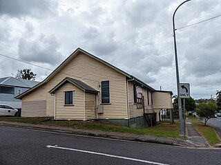
Bracken Ridge is a northern suburb in the City of Brisbane, Queensland, Australia. In the 2016 census, Bracken Ridge had a population of 16,936 people.
Dutton Park is an inner southern suburb in the City of Brisbane, Queensland, Australia. In the 2016 census, Dutton Park had a population of 2,024 people.
Algester is a southern suburb in the City of Brisbane, Queensland, Australia. In the 2016 census, Algester had a population of 8,433 people.
Mount Gravatt is a southern suburb of the City of Brisbane, Queensland, Australia and a prominent hill and lookout within this suburb. In the 2016 census, Mount Gravatt had a population of 3,366 people.
Kedron is a northern suburb in the City of Brisbane, Queensland, Australia. In the 2016 census, Kedron had a population of 9,359 people. It is home to the Queensland Fire and Emergency Services headquarters.
Kelvin Grove is an inner northern suburb in the City of Brisbane, Queensland, Australia. In the 2016 census, Kelvin Grove had a population of 7,927 people.
Wavell Heights is a suburb in the City of Brisbane, Queensland, Australia. In the 2016 census, Wavell Heights had a population of 9,684 people.
Stafford is a suburb in the City of Brisbane, Queensland, Australia. In the 2021 census, Stafford had a population of 6,561 people.
Camp Hill is a suburb in the City of Brisbane, Queensland, Australia. In the 2021 census, Camp Hill had a population of 12 145 people.
Carindale is a suburb of the City of Brisbane, Queensland, Australia. It is located 13.1 kilometres (8.1 mi) by road south-east of the Brisbane GPO, and borders Belmont, Carina, Carina Heights, Mackenzie, Mansfield, Mount Gravatt East, and Tingalpa. In the 2021 census, Carindale had a population of 16,535 people.
Brighton is a coastal northern suburb of the City of Brisbane, in the state of Queensland, in Australia. In the 2021 census, Brighton had a population of 9,664 people.
Alexandra Hills is a residential locality in the City of Redland, Queensland, Australia. In the 2021 census, Alexandra Hills had a population of 16,472 people.
Everton Park is a northern suburb of the City of Brisbane, Queensland, Australia. In the 2021 census, Everton Park had a population of 10,111 people.
Wilston is a northern suburb in the City of Brisbane, Queensland, Australia. In the 2016 census, Wilston had a population of 3,937 people.
Grange is a northern suburb in the City of Brisbane, Queensland, Australia. In the 2016 census, Grange had a population of 4,318 people.
Manly West is a suburb in the City of Brisbane, Queensland, Australia. In the 2016 census, Manly West had a population of 11,978 people.
Salisbury is a southern suburb in the City of Brisbane, Queensland, Australia. In the 2021 census, Salisbury had a population of 6,790 people.
Pallara is an outer southern suburb in the City of Brisbane, Queensland, Australia. In the 2021 census, Pallara had a population of 3,861 people.