List of Brisbane suburbs

Last updated

Satellite image of the Brisbane Metropolitan Area. Centred on the City of Brisbane, it captures from the Redcliffe Peninsula in the north, D'Aguilar National Park to the west, east to Moreton and Stradbroke Islands, and Logan City in the south. Brisbane Aerial From Satellite.jpg
Satellite image of the Brisbane Metropolitan Area. Centred on the City of Brisbane, it captures from the Redcliffe Peninsula in the north, D'Aguilar National Park to the west, east to Moreton and Stradbroke Islands, and Logan City in the south.
Brisbane Central Business District seen from Mount Coot-tha Lookout Skylines in Brisbane seen from Mount Coot-tha Lookout in February 2021, 01.jpg
Brisbane Central Business District seen from Mount Coot-tha Lookout

This is a list of the almost 450 suburbs in the Brisbane metropolis, Queensland, Australia.

Contents

Local government areas

The Greater Brisbane, according to the Australian Bureau of Statistics, [1] consists of the following local government areas (LGAs), with populations in 2019:

Local government areaPopulation [2] (2019)AreaDensityCapital
City
Statistical
Division
(old)
Greater
Capital
City
Statistical
Area

(Greater
Brisbane)
City of Brisbane 1,253,9821,343 km2934 /km2
Moreton Bay Region 469,4652,042 km2230 /km2
Logan City 334,358958 km2349 /km2
City of Ipswich 222,3071,094 km2203 /km2
Redland City 158,815537 km2296 /km2
Total2,438,9275,974 km2408 /km2
Scenic Rim Region 43,1234,243 km210 /km2
Somerset Region 26,2195,373 km25 /km2
Lockyer Valley Region (part)5,915252 km223 /km2
Total2,514,18415,842 km2158 /km2

City of Brisbane

City of Brisbane has 190 [3] suburbs according to the Brisbane City Council. There is no formal system of regions, but Brisbane suburbs are informally grouped by Brisbane residents based on their relation to the Brisbane River and the Brisbane CBD. Generally the following rules apply, Northern Suburbs include suburbs north of the Brisbane River, Southern Suburbs include suburbs south of the Brisbane River. The exceptions are Western Suburbs, which include suburbs north and south of the Brisbane River, but also west of the Brisbane CBD, and Bayside Suburbs which include suburbs along Moreton Bay.

Inner suburbs

Bowen HillsBrisbane CBDEast BrisbaneFortitude ValleyHerstonHighgate HillKangaroo PointKelvin GroveNew FarmNewsteadPaddingtonPetrie TerraceRed HillSouth BrisbaneSpring HillTeneriffeWest EndWoolloongabbaTotal: 18

Northern suburbs

AlbionAlderleyAscotAspleyBald HillsBanyoBoondallBracken RidgeBridgeman DownsBrightonBrisbane AirportCarseldineChermsideChermside WestClayfieldDeagonEagle FarmEverton ParkFerny GroveFitzgibbonGaythorneGeebungGordon ParkGrangeHamiltonHendraKalingaKedronKeperraLutwycheMcDowallMitcheltonMyrtletownNewmarketNorthgateNudgeeNudgee BeachNundahPinkenbaSandgateShorncliffeStaffordStafford HeightsTaigumVirginiaWavell HeightsWilstonWindsorWooloowinZillmere

Total: 49

Southern suburbs

Acacia RidgeAlgesterAnnerleyArcherfieldBurbankCalamvaleCoopers PlainsDarraDoolandellaDrewvaleDurackDutton ParkEight Mile PlainsEllen GroveFairfieldForest LakeGreenslopesHeathwoodHolland ParkHolland Park WestInalaKarawathaKurabyLarapintaMacGregorMackenzieMansfieldMoorookaMount GravattMount Gravatt EastNathanPallaraParkinsonRichlandsRobertsonRochedaleRockleaRuncornSalisburySeventeen Mile RocksSinnamon ParkStones CornerStrettonSumnerSunnybankSunnybank HillsTarragindiTennysonUpper Mount GravattWacolWillawongWishartYeerongpillyYeronga

Total: 54

Eastern suburbs

BalmoralBelmontBulimbaCamp HillCannon HillCarinaCarina HeightsCarindaleChandlerCoorparooGumdaleHawthorneHemmantLotaLyttonManlyManly WestMoreton IslandMorningsideMurarrieNorman ParkPort of BrisbaneRansomeSeven HillsTingalpaWakerleyWynnumWynnum West

Total: 27

Western suburbs

AnsteadAshgroveAuchenflowerBanks CreekBardonBellbowrieBrookfieldChapel HillChelmerChuwarCorindaEngland CreekEnoggeraEnoggera ReservoirFig Tree PocketGracevilleIndooroopillyJamboree HeightsJindaleeKarana DownsKenmoreKenmore HillsKholoLake ManchesterMiddle ParkMiltonMoggillMount Coot-thaMount CrosbyMount OmmaneyOxleyPinjarra HillsPullenvaleRiverhillsSeventeen Mile RocksSherwoodSinnamon ParkSt LuciaTaringaThe GapToowongUpper BrookfieldUpper KedronWestlake

Total: 43

Moreton Bay suburbs

Moreton Bay (islands) – Moreton Island

Total: 2

City of Ipswich

Urban Ipswich

Augustine HeightsBarellan PointBasin PocketBellbird ParkBlacksoilBlackstoneBoovalBrassallBrookwaterBundambaCamiraCarole ParkChurchillChuwarCoalfallsCollingwood ParkDinmoreEast IpswichEastern HeightsEbbw ValeFlinders ViewGailesGoodnaIpswichKaraleeKarrabinLeichhardtMoores PocketMuirleaNew ChumNewtownNorth BoovalNorth IpswichNorth TivoliOne MileRaceviewRedbankRedbank PlainsRiverviewSadliers CrossingSilkstoneSpringfieldSpringfield CentralSpringfield LakesTivoliWest IpswichWoodendWulkurakaYamanto

Total: 49

Rural Ipswich

AmberleyAshwellCalvertDeebing HeightsEbenezerGoolmanGrandchesterHaigsleaIronbarkJeebropillyLanefieldMarburgMount ForbesMount MarrowMutdapillyPine MountainPurgaRipleyRosewoodSouth RipleySpring MountainSwanbankTallegallaThagoonaThe BluffWalloonWhite RockWillowbankWoolshed

Total: 29

Logan City

Bahrs ScrubBannockburnBeenleighBelivahBerrinbaBethaniaBoronia HeightsBrowns PlainsBuccanCarbrookCedar CreekCedar GroveCedar ValeChambers FlatCornubiaCrestmeadDaisy HillEaglebyEdens LandingForestdaleGreenbankHeritage ParkHillcrestHolmviewJimboombaKagaruKingstonLogan CentralLogan ReserveLogan VillageLoganholmeLoganleaLyonsMarsdenMeadowbrookMount Warren ParkMundoolunMunrubenNew BeithNorth MacleanPark Ridge SouthPark RidgePriestdaleRegents ParkRochedale SouthShailer ParkSlacks CreekSouth MacleanSpringwoodStockleighTamborineTanah MerahUnderwoodUndullahVeresdale ScrubVeresdaleWaterford WestWaterfordWindarooWolffdeneWoodhillWoodridgeYarrabilba

Total: 63

Redland City

Alexandra HillsAmity PointBirkdaleCapalabaClevelandCoochiemudlo IslandDunwichKarragarra IslandLamb IslandMacleay IslandMount CottonNorth Stradbroke IslandOrmistonPoint LookoutRedland BayRussell IslandSheldonThornesideThornlandsVictoria PointWellington Point

Total: 21

Moreton Bay Region

Urban

Albany CreekArana HillsBanksia BeachBeachmereBellaraBongareeBray ParkBrendaleBunyaBurpengaryCabooltureCaboolture SouthCashmereClontarfDakabinDeception BayEatons HillElimbahEverton HillsFerny HillsGodwin BeachGriffinJoynerKallangurKippa-RingKurwongbahLawntonMango HillMargateMoodluMorayfieldMurrumba DownsNarangbaNewportNingiNorth LakesPetrieRedcliffeRothwellSandstone PointScarboroughStrathpineUpper CabooltureWarnerWhitesideWoody PointWoorim

Total: 47

Rural

Armstrong CreekBellmereBellthorpeBooroobinBracalbaCamp MountainCampbells PocketCedar CreekCedartonClear MountainCloseburnCommissioners FlatD'AguilarDayboroDelaneys CreekDonnybrookDraperHighvaleJollys LookoutKing ScrubKobble CreekLaceys CreekMeldaleMoorinaMount DelaneyMount GloriousMount MeeMount NeboMount PleasantMount SamsonNeurumOcean ViewRocksbergRush CreekSamford ValleySamford VillageSamsonvaleStanmoreStony CreekToorbulWamuran BasinWamuranWelsbyWhite PatchWights MountainWoodfordYugar

Total: 47

Scenic Rim Region

Beaudesert area

BeaudesertBeechmontBenobbleBiddaddabaBirnamBoylandBromeltonCanungraChristmas CreekCrynaGleneagleHillviewInnisplainJosephvilleKerryKooralbynLamingtonLamington National ParkLaravalePalen CreekRathdowneyTaboobaTabragalbaTamborine MountainTamrookumTamrookum CreekWitherenWonglepong

Boonah area

AratulaBoonahCharlwoodCoulsonFassifernHarrisvilleKalbarMaroonMoogerahMount AlfordMount WalkerRoadvaleRosevaleSilverdaleTaromeTemplinWarrill View

Other areas

AllandaleAllenviewAnthonyBarney ViewBinna BurraBlantyreBunburraBunjurgenBurnett CreekCainbableCannon CreekCarneys CreekChinghee CreekClumberColeyvilleCoochinCroftbyDarlingtonDugandanFassifern ValleyFerny GlenFlying FoxFrazerviewFrenches CreekHoyaIllinbahKagaruKents LagoonKents PocketKnapp CreekKulgunLimestone RidgesLower Mount WalkerMerryvaleMilbongMilfordMiloraMoorangMorwinchaMount BarneyMount EdwardsMount ForbesMount FrenchMount GippsMount LindesayMount Walker WestMunbillaMutdapillyNindooinbahNorth TamborineOaky CreekObum ObumO'ReillyPeak CrossingRadfordRunning CreekSarabahSouthern LamingtonTamborineTeviotvilleUndullahVeresdaleVeresdale ScrubWallaces CreekWashpoolWilsons PlainsWooloomanWyaralong

Somerset Region

Kilcoy area

GlenfernHazeldeanJimnaKilcoyMonsildaleVilleneuveWinya

Esk area

BorallonCaboonbahClarendonColintonCoolanaCoominyaDundasEskFairney ViewFernvaleGlamorgan ValeHarlinLake SomersetLake WivenhoeLark HillLinvilleLowoodMindenMooreMount HallenMount TarampaPrenzlauRifle RangeTarampaToogoolawahVernorWanora

Other areas

Atkinsons DamAvoca ValeBanks CreekBiarraBraemoreBrightviewBrydenBuarabaCoal CreekCooeeimbardiCressbrookCrossdaleEngland CreekEskdaleFulhamGlen EskGregors CreekHaigsleaIvory CreekKingahamLake ManchesterLockroseLower CressbrookMarburgMoombraMount ArcherMount BeppoMount ByronMount KilcoyMount StanleyMurrumbaOttabaPatrick EstateRedbank CreekRoystonSandy CreekScrub CreekSheep Station CreekSomerset DamSplit Yard CreekWestvaleWivenhoe HillWivenhoe PocketWoolmarYimbun

Lockyer Valley Region

Gatton area

AdareBlanchviewCollege ViewFordsdaleGattonGranthamHelidonIredaleJunction ViewLake ClarendonLawesLower TenthillMa Ma CreekMurphys CreekPlacid HillsRopeleyThorntonUpper TenthillVeradillaWinwillWithcottWoodlands

Laidley area

BlenheimForest HillGlenore GroveHatton ValeKentvilleLaidleyLaidley HeightsLockroseMulgowiePlainlandRegency Downs

Other areas

BallardBlack Duck CreekBrightviewBuaraba SouthCaffeyCarpendaleChurchableCrowley ValeDerrymoreEast HaldonEgyptFifteen MileFlagstone CreekGlen CairnHelidon SpaIngoldsbyKensington GroveLaidley Creek WestLaidley NorthLaidley SouthLefthand BranchLilydaleLockyerLockyer WatersLynfordMorton ValeMount BerrymanMount SylviaMount WhitestonePostmans RidgePrestonRingwoodRockmountRocksideSeventeen MileSilver RidgeSpring CreekStockyardSummerholmTownsonUpper FlagstoneUpper LockyerVinegar HillWest HaldonWhite MountainWoodbine

See also

Related Research Articles

Councils of Tasmania are the 29 administrative districts of the Australian state of Tasmania. Local government areas (LGAs), more generally known as councils, are the tier of government responsible for the management of local duties such as road maintenance, town planning and waste management.

<span class="mw-page-title-main">Shire of Pine Rivers</span> Local government area in Queensland

The Shire of Pine Rivers was a local government area about 20 kilometres (12 mi) north of Brisbane in the Moreton Bay region of South East Queensland, Australia. The shire covered an area of 771 square kilometres (297.7 sq mi), and existed as a local government entity from 1888 until 2008, when it amalgamated with councils further north and east to form the Moreton Bay Region.

The Queensland Rugby League South East Division is a rugby league division responsible for the running of rugby league in South-East Queensland. This makes the South East Division responsible for the FOGS Cup, FOGS Colts Challenge and Brisbane Second Division competitions. This Division also administers the City team in the annual QRL City-Country match. It is also responsible for administering the game of rugby league across the Gold Coast and Ipswich. These two cities alone comprise over 7000 junior and senior players.
<span class="mw-page-title-main">D'Aguilar Range</span>

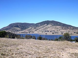
The D'Aguilar Range is a mountain range near Brisbane, Queensland, Australia. The town of Dayboro is situated on the lower foothills midway along the range and the Sunshine Coast Hinterland town of Mooloolah lies at the northernmost point of the range. Many residential areas line its eastern slopes including the town of Samford and the suburb of Ferny Hills. In the west, numerous ridges and gullies are heavily forested and designated as state forest or national park.
<span class="mw-page-title-main">Samford, Queensland</span> Town in Queensland, Australia

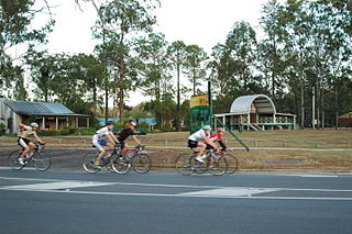
Samford is a town in Moreton Bay Region, South East Queensland, Australia. It consists of two localities, Samford Village and Samford Valley.

<span class="mw-page-title-main">Brisbane Bus Lines</span>

Brisbane Bus Lines is an Australian bus operator in the northern suburbs of Brisbane. It operates one service under contract to the Queensland Government under the Translink banner.

<span class="mw-page-title-main">City of Moreton Bay</span> Local government area in Queensland, Australia

The City of Moreton Bay, known until 2023 as the Moreton Bay Region, is a local government area in the north of the Brisbane metropolitan city in South East Queensland, Australia. Established in 2008, it replaced three established local government areas, the City of Redcliffe and the Shires of Pine Rivers and Caboolture.

<span class="mw-page-title-main">Locations in Australia with a Scottish name</span>

This is a list of placenames in Scotland which have subsequently been applied to parts of Australia by Scottish emigrants or explorers.

<span class="mw-page-title-main">Tourism in Brisbane</span>

Tourism in Brisbane is an important industry for the Queensland economy, being the third-most popular destination for international tourists after Sydney and Melbourne.
<span class="mw-page-title-main">England Creek, Queensland</span> Rural locality split between the City of Brisbane and Somerset Region

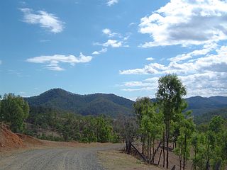
England Creek is a rural locality split between Somerset Region and City of Brisbane, Queensland, Australia. In the 2016 census, England Creek had a population of 33 people.

<span class="mw-page-title-main">City of Brisbane</span> Local government area in Queensland, Australia

The City of Brisbane is a local government area (LGA) which comprises the inner portion of the metropolitan area of Brisbane, the capital of Queensland, Australia. Its governing body is the Brisbane City Council. Unlike LGAs in the other mainland state capitals, which are generally responsible only for the central business districts and inner neighbourhoods of those cities, the City of Brisbane administers a significant portion of the Brisbane metropolitan area, serving almost half of the population of the Brisbane Greater Capital City Statistical Area (GCCSA). As such, it has a larger population than any other local government area in Australia. The City of Brisbane was the first Australian LGA to reach a population of more than one million. Its population is roughly equivalent to the populations of Tasmania, the Australian Capital Territory and the Northern Territory combined. In 2016–2017, the council administered a budget of over $3 billion, by far the largest budget of any LGA in Australia.

<span class="mw-page-title-main">Cedar Creek, Queensland (Moreton Bay)</span> Suburb of Moreton Bay Region, Queensland, Australia

Cedar Creek is a rural locality in the Moreton Bay Region, Queensland, Australia. In the 2016 census, Cedar Creek had a population of 745 people.

Dundas is a rural locality in the Somerset Region, Queensland, Australia. In the 2016 census Dundas had a population of 77 people.

<span class="mw-page-title-main">Geography of Brisbane</span> Geography of the city of Brisbane in Queensland, Australia

The geography of Brisbane is characterised by its coastal location in the south eastern corner of the Queensland state of Australia. It is located halfway up the Australian east coast with longitudinal and latitudinal coordinates of 27.5° south and 153° east. The city resides within the Moreton Bay Floodplain, stretching from Caboolture to the north, Beenleigh to the south and as far as Ipswich to the west whilst being bordered by the Pacific Ocean to the east.

References

  1. Greater Capital City Statistical Areas - Australian Bureau of Statistics
  2. "3218.0 – Regional Population Growth, Australia, 2018-19: Population Estimates by Local Government Area (ASGS 2019), 2017 to 2018". Australian Bureau of Statistics. 27 March 2019. Retrieved 25 October 2019. Estimated resident population, 30 June 2018.
  3. Brisbane suburbs – Brisbane City Council

Commons-logo.svg Media related to Suburbs of Brisbane at Wikimedia Commons