Bald Hills, Queensland

Last updated

Bald Hills
Brisbane,  Queensland
Bald Hills park.jpg
Harold Kielly Park with ABC Radio Tower
Australia Queensland location map.svg
Red pog.svg
Bald Hills
Coordinates 27°18′30″S153°00′44″E / 27.3083°S 153.0122°E / -27.3083; 153.0122 (Bald Hills (centre of suburb))
Population7,000 (SAL 2021) [1]
Established1857
Postcode(s) 4036
Area12.9 km2 (5.0 sq mi)
Time zone AEST (UTC+10:00)
Location
LGA(s) City of Brisbane
(Bracken Ridge Ward) [2]
State electorate(s)
Federal division(s) Petrie
Suburbs around Bald Hills:
Strathpine Murrumba Downs Griffin
Brendale Bald Hills Bracken Ridge
Bridgeman Downs Carseldine Fitzgibbon

Bald Hills is the northernmost suburb in the City of Brisbane, Queensland, Australia. [3] In the 2021 census, Bald Hills had a population of 7,000 people. [4]

Contents

Geography

Erection of the Bald Hills radio transmitter, 1942 StateLibQld 1 259711 Erection of the Bald Hills radio transmitter, 1942.jpg
Erection of the Bald Hills radio transmitter, 1942

Bald Hills is a largely residential suburb. It is mostly surrounded by bushland, but in the last few years some of the bush areas have been cleared to make way for new residential areas. It also borders onto the Bald Hills Flats – a large flood plain on the western side of the suburb that is used for cattle grazing. The South Pine River flows through the flood plain and forms the western border of the suburb. The South Pine River converges with the North Pine River and the combined flow, Pine River, forms the northern border. Along the banks of Pine River within Bald Hills is a large environmental park called the Tinchi Tamba Wetlands Reserve. The Pine River empties into Bramble Bay, between Redcliffe and Brighton.[ citation needed ]

The Bruce Highway goes between Bald Hills to Woree in Cairns and is 1,656 kilometres (1,029 mi) long.[ citation needed ]

Preliminary supports for the radio transmitter mast at Bald Hills, 1942 StateLibQld 1 259723 Preliminary supports for the new radio transmitter mast at Bald Hills, 1942.jpg
Preliminary supports for the radio transmitter mast at Bald Hills, 1942

The most prominent structure is the Bald Hills Radiator, the ABC's 198 metre tall AM radio transmission tower located on the eastern side of the suburb.[ citation needed ]

History

Bald Hills is situated in the Yugarabul traditional Aboriginal country. [5]

The suburb is named after the two small hills in the South Pine River Valley floor. [3]

The first land sales in the area occurred in 1857. [6] Land sales around the Bald Hills railway station were advertised in April 1886. At the time the journey from Brisbane was described as "after travelling across the Downfall and Cabbage Tree Creeks, the traveller arrives at a long stretch of road, at the extremity of which rises a lofty knoll, round the brow of which the road winds, when the Bald Hills are reached". [7]

In 1888, the "Bald Hills Railway Station Estate" made up of 500 allotments was advertised to be auctioned by Arthur Martin & Co., auctioneers. A map advertising the auction indicates that the land is situated near Bald Hills railway station and special trains will be provided on the day of the sale. [8] [9]

Bald Hills State School began enrolling students on 30 April 1866 with the first school building opened on 24 September 1866. [10] [11] [12]

St Paul's School opened on 31 January 1961. [11]

Demographics

In the 2016 census, Bald Hills recorded a population of 6,502 people, 50.8% female and 49.2% male. This indicates an increase of 9% or 537 in population since the 2011 census. [13] In 2016, the median age of the Bald Hills population was 36 years of age, 2 years below the Australian median of 38. 76.7% of people living in Bald Hills were born in Australia, compared to the national average of 66.7%; the next most common countries of birth were New Zealand 4%, England 3.4%, Philippines 1.8%, India 1.7%, Fiji 0.7%. 88.8% of people spoke only English at home; the next most popular languages were 0.9% Tagalog, 0.6% Punjabi, 0.6% Spanish, 0.5% Telugu, 0.5% Hindi. [13] The most common ancestry backgrounds of at least one of the parents for Bald Hills residents were English 27.5%, Australian 26.9%, Irish 7.9%, Scottish 7.7% and German 4.5%. [14] The median weekly incomes for residents of Bald Hills aged 15 years and over was reported to be $725 which was higher than the Australian and Queensland personal incomes (at $662 and $660 respectively). This wealthier-than-average income was reflected in a higher-tha- average household income for residents of this suburb. In Bald Hills, median household income was $1,584, compared to $1,438 in Australia and $1,402 in Queensland. [13]

In the 2021 census, Bald Hills had a population of 7,000 people. [4]

Heritage listings

Bald Hills has a number of heritage-listed sites, including:

Education

Bald Hills State School, 2019 Bald Hills State School, 2019.jpg
Bald Hills State School, 2019

Bald Hills State School is a government primary (Prep–6) school for boys and girls at 2156 Gympie Road ( 27°19′12″S153°00′24″E / 27.3200°S 153.0068°E / -27.3200; 153.0068 (Bald Hills State School) ). [18] [19] It includes a special education program. [18] In 2018, the school had an enrolment of 621 students with 42 teachers (38 full-time equivalent) and 29 non-teaching staff (17 full-time equivalent). [20] In 2022, the school had an enrolment of 616 students. [21]

St Paul's Anglican School is a private primary and secondary (Prep–12) school for boys and girls at 34 Strathpine Road ( 27°18′59″S153°00′15″E / 27.3164°S 153.0042°E / -27.3164; 153.0042 (St Paul's School) ). [18] [22] In 2018, the school had an enrolment of 1,206 students with 96 teachers (90 full-time equivalent) and 73 non-teaching staff (64 full-time equivalent). [20] In 2019, it won the Australian School of the Year Award. [23] [24] In 2022, the school had an enrolment of 1,282 students. [25]

There is no government secondary school in Bald Hills. The nearest government secondary schools are Bracken Ridge State High School in neighbouring Bracken Ridge to the east, Pine Rivers State High School in neighbouring Strathpine to the north-west, and Aspley State High School in Aspley to the south. [26]

Facilities

Bald Hills is home to the breeding and training centre for Guide Dogs for the Blind Association of Queensland.[ citation needed ]

Amenities

Bald Hills is the home of the Bald Hills-Lawnton Lions Cricket Club, as well as Ridge Hills United Football Club.[ citation needed ]

Bald Hills Uniting Church is at 2131 Gympie Road ( 27°19′18″S153°00′33″E / 27.3216°S 153.0092°E / -27.3216; 153.0092 (Bald Hills Uniting Church) ). [27] [28]

Due to proximity to North Pine River, Bald Hills has a large number of green and open spaces. [29] Parks include, but not limited to:[ citation needed ]

Transport

Bald Hills railway station provides access to regular Queensland Rail City network services to Brisbane and Springfield Central, as well as Kippa-Ring. There are also many buses serving the area. The suburb is crossed by both Gympie Road and the northern end of the Gateway Motorway. The southern end of the Bruce Highway is located here as well.[ citation needed ]

Brisbane City Council runs a Personalised Public Transport (PPT) service in Bald Hills. [30] Personalised Public Transport (PPT) is a low-cost hail and ride service that helps connect residents to their local transport hubs. This service runs Monday to Friday, except public holidays. Maximum journey time one-way is 15 minutes.[ citation needed ]

There are over 50 Translink bus stops around Bald Hills that provide a number of regular bus services with connections running to Brisbane CBD, Redcliffe and beyond.[ citation needed ]

Related Research Articles

<span class="mw-page-title-main">Sandgate, Queensland</span> Suburb of Brisbane, Queensland, Australia

Sandgate is a northern coastal suburb in the City of Brisbane, Queensland, Australia. In the 2021 census, Sandgate had a population of 4,926 people.

<span class="mw-page-title-main">Aspley, Queensland</span> Suburb of Brisbane, Queensland, Australia

Aspley is a suburb in the City of Brisbane, Queensland, Australia. In the 2016 census, Aspley had a population of 12,108 people.

<span class="mw-page-title-main">Bowen Hills, Queensland</span> Suburb of Brisbane, Queensland, Australia

Bowen Hills is an inner north-eastern suburb in the City of Brisbane, Queensland, Australia. In the 2021 census, Bowen Hills had a population of 4,898 people.

<span class="mw-page-title-main">Bracken Ridge, Queensland</span> Suburb of Brisbane, Queensland, Australia

Bracken Ridge is a northern suburb in the City of Brisbane, Queensland, Australia. In the 2016 census, Bracken Ridge had a population of 16,936 people.

<span class="mw-page-title-main">Shire of Pine Rivers</span> Local government area in Queensland

The Shire of Pine Rivers was a local government area about 20 kilometres (12 mi) north of Brisbane in the Moreton Bay region of South East Queensland, Australia. The shire covered an area of 771 square kilometres (297.7 sq mi), and existed as a local government entity from 1888 until 2008, when it amalgamated with councils further north and east to form the Moreton Bay Region, renamed in July 2023 as the City of Moreton Bay.

<span class="mw-page-title-main">Sunnybank Hills, Queensland</span> Suburb of Brisbane, Queensland, Australia

Sunnybank Hills is an outer southern suburb in the City of Brisbane, Queensland, Australia. In the 2021 census, Sunnybank Hills had a population of 18,085 people.

<span class="mw-page-title-main">Carseldine, Queensland</span> Suburb of Brisbane, Queensland, Australia

Carseldine is a suburb in the City of Brisbane, Queensland, Australia. In the 2016 census, Carseldine had a population of 9,541 people.

<span class="mw-page-title-main">Chermside West, Queensland</span> Suburb of Brisbane, Queensland, Australia

Chermside West is a suburb in the City of Brisbane, Queensland, Australia. In the 2016 census, Chermside West had a population of 6,458 people. Parts of Chermside West were formerly known as Craigslea.

<span class="mw-page-title-main">Warner, Queensland</span> Suburb of City of Moreton Bay, Queensland, Australia

Warner is a suburb in the City of Moreton Bay, Queensland, Australia. In the 2016 census, Warner had a population of 11,411 people.

<span class="mw-page-title-main">South Pine River</span> River in Queensland, Australia

The South Pine River is a minor river in South East Queensland, Australia. It rises on the D'Aguilar Range and passes through the Samford Valley in the City of Moreton Bay local government area.

<span class="mw-page-title-main">Spring Hill, Queensland</span> Suburb of Brisbane, Queensland, Australia

Spring Hill is an inner northern suburb in the City of Brisbane, Queensland, Australia. In the 2016 census, Spring Hill had a population of 5,974 people.

<span class="mw-page-title-main">Strathpine, Queensland</span> Suburb of City of Moreton Bay, Queensland, Australia

Strathpine is a suburb in the City of Moreton Bay, Queensland, Australia. In the 2016 census, Strathpine had a population of 9,503 people. It is home to the Pine Rivers District offices of the City of Moreton Bay, as well as many businesses. The area is home to Strathpine Centre, a medium-sized urban shopping centre.

<span class="mw-page-title-main">Fitzgibbon, Queensland</span> Suburb of Brisbane, Queensland, Australia

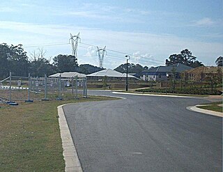
Fitzgibbon is a northern suburb of the City of Brisbane, Queensland, Australia. In the 2016 census, Fitzgibbon had a population of 5,656 people.

<span class="mw-page-title-main">Bridgeman Downs, Queensland</span> Suburb of Brisbane, Queensland, Australia

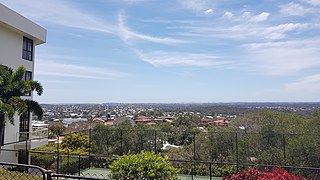
Bridgeman Downs is a northern suburb in the City of Brisbane, Queensland, Australia. It is located 15.2 kilometres (9.4 mi) from the city centre and borders City of Moreton Bay to the west.

<span class="mw-page-title-main">Bray Park, Queensland</span> Suburb of Moreton Bay, Queensland, Australia

Bray Park is a suburb in the City of Moreton Bay, Queensland, Australia. In the 2016 census, Bray Park had a population of 10,246 people.

<span class="mw-page-title-main">Belmont, Queensland</span> Suburb of Brisbane, Queensland, Australia

Belmont is an outer suburb in the City of Brisbane, Queensland, Australia. In the 2016 census, Belmont had a population of 4,374 people.

<span class="mw-page-title-main">Carina Heights, Queensland</span> Suburb of Brisbane, Queensland, Australia

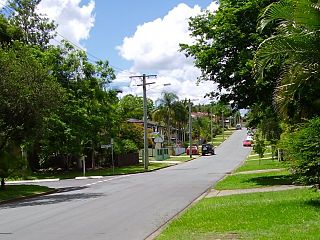
Carina Heights is both a hill and a suburb in the City of Brisbane, Queensland, Australia. In the 2016 census, Carina Heights had a population of 6,732 people.

<span class="mw-page-title-main">Brendale, Queensland</span> Suburb of City of Moreton Bay, Queensland, Australia

Brendale is a suburb in the City of Moreton Bay, Queensland, Australia. In the 2016 census, Brendale had a population of 2,758 people.

<span class="mw-page-title-main">Gympie Road</span> Road in Brisbane, Australia

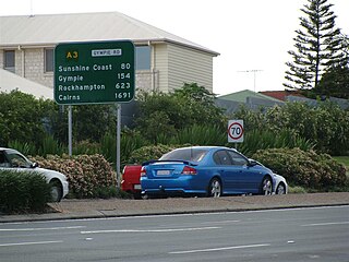
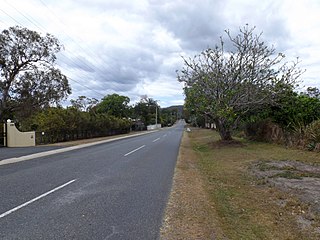
Gympie Road is a major road in the northern suburbs of Brisbane, Queensland, Australia. The road forms part of the main road route from the Brisbane Central Business District (CBD) to the northern suburbs, Sunshine Coast and east coast of Queensland.

<span class="mw-page-title-main">Lawnton, Queensland</span> Suburb of Moreton Bay, Queensland, Australia

Lawnton is a suburb in the City of Moreton Bay, Queensland, Australia. In the 2016 census, Lawnton had a population of 5,658 people.

References

  1. Australian Bureau of Statistics (28 June 2022). "Bald Hills (Qld) (suburb and locality)". Australian Census 2021 QuickStats. Retrieved 28 June 2022.  OOjs UI icon edit-ltr-progressive.svg
  2. "Bracken Ridge Ward". Brisbane City Council. Archived from the original on 4 February 2017. Retrieved 12 March 2017.
  3. 1 2 "Bald Hills – suburb in City of Brisbane (entry 46574)". Queensland Place Names. Queensland Government . Retrieved 26 December 2020.
  4. 1 2 Australian Bureau of Statistics (28 June 2022). "Bald Hills (SAL)". 2021 Census QuickStats. Retrieved 28 February 2023. OOjs UI icon edit-ltr-progressive.svg
  5. "AIATSIS code E66: Yugarabul". Federal government. Australian Institute of Aboriginal and Torres Strait Islander Studies. 26 July 2019. Archived from the original on 13 August 2020. Retrieved 31 July 2020.
  6. Brian Williams (31 October 2013). "Secrets of Brisbane's suburbs: B". The Courier Mail. News Corp. Retrieved 20 October 2016.
  7. "The Brisbane Courier Saturday 10 April 1886 - The Railway Estate". Archived from the original on 6 December 2017. Retrieved 6 December 2017.
  8. "Bald Hills railway station estate". State Library of Queensland. 1888. Archived from the original on 15 May 2022. Retrieved 1 June 2021.
  9. "Classified Advertising". The Brisbane Courier . Vol. XLIV, no. 9, 419. Queensland, Australia. 23 March 1888. p. 8. Archived from the original on 15 May 2022. Retrieved 1 June 2021 via National Library of Australia.
  10. "Opening and closing dates of Queensland Schools". Queensland Government . Retrieved 18 April 2019.
  11. 1 2 Queensland Family History Society (2010), Queensland schools past and present (Version 1.01 ed.), Queensland Family History Society, ISBN   978-1-921171-26-0
  12. "Agency ID 159, Bald Hills State School". Queensland State Archives . Retrieved 26 March 2021.
  13. 1 2 3 Australian Bureau of Statistics (27 June 2017). "Bald Hills (SSC)". 2016 Census QuickStats. Retrieved 20 October 2018. OOjs UI icon edit-ltr-progressive.svg
  14. "2016 Census QuickStats – Bald Hills, Queensland". abs.gov.au. Australian Bureau of Statistics. Archived from the original on 4 February 2020. Retrieved 4 February 2020.
  15. "National Broadcasting Service Radio Transmission Centre". Brisbane Heritage Register. Brisbane City Council . Retrieved 29 December 2014.
  16. "Hoop Pines (entry 602346)". Queensland Heritage Register . Queensland Heritage Council. Retrieved 6 July 2013.
  17. "Bald Hills Presbyterian Church". Brisbane Heritage Register. Brisbane City Council . Retrieved 29 December 2014.
  18. 1 2 3 "State and non-state school details". Queensland Government. 9 July 2018. Archived from the original on 21 November 2018. Retrieved 21 November 2018.
  19. "Bald Hills State School". Archived from the original on 16 March 2021. Retrieved 26 March 2021.
  20. 1 2 "ACARA School Profile 2018". Australian Curriculum, Assessment and Reporting Authority. Archived from the original on 27 August 2020. Retrieved 28 January 2020.
  21. "School annual report 2022" (PDF). Bald Hills State School. p. 2. Archived (PDF) from the original on 27 July 2023. Retrieved 27 July 2023.
  22. "St Paul's School". Archived from the original on 18 January 2019. Retrieved 21 November 2018.
  23. "Revealed: Australian Education Awards 2019 winners". www.theeducatoronline.com. Archived from the original on 1 April 2023. Retrieved 27 July 2023.
  24. "2019 Australian Education Awards". St Paul's School. 19 August 2019. Archived from the original on 21 March 2023. Retrieved 27 July 2023.
  25. "2022 Annual Report" (PDF). St Paul's Anglican School. p. 1. Archived (PDF) from the original on 27 July 2023. Retrieved 27 July 2023.
  26. "Queensland Globe". State of Queensland . Retrieved 26 March 2021.
  27. "Bald Hills Uniting Church – Servicing the Bald Hills and nearby Communities". Archived from the original on 16 April 2021. Retrieved 7 May 2021.
  28. "Find a church". Uniting Church in Australia, Queensland Synod. Archived from the original on 24 October 2020. Retrieved 6 May 2021.
  29. "Bald Hills parks". www.brisbane.qld.gov.au. Brisbane City Council. Archived from the original on 22 June 2019. Retrieved 22 June 2019.
  30. "Personalised Public Transport". www.brisbane.qld.gov.au. Brisbane City Council. Archived from the original on 22 June 2019. Retrieved 22 June 2019.

Further reading