
The Brisbane River is the longest river in South East Queensland, Australia, and flows through the city of Brisbane, before emptying into Moreton Bay on the Coral Sea. John Oxley, the first European to explore the river, named it after the Governor of New South Wales, Sir Thomas Brisbane in 1823. The penal colony of Moreton Bay later adopted the same name, eventually becoming the present city of Brisbane. The river is a tidal estuary and the water is brackish from its mouth through the majority of the Brisbane metropolitan area westward to the Mount Crosby Weir. The river is wide and navigable throughout the Brisbane metropolitan area.
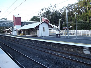
Petrie railway station is located on the North Coast line in Queensland, Australia. It serves the suburb of Petrie in the City of Moreton Bay. It opened as North Pine railway station in1888 after the nearby North Pine River and was renamed Petrie railway station in 1911.
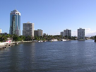
The Nerang River is a perennial river in South East Queensland, Australia. Its catchment lies within the Gold Coast local government area and covers an area of 490 square kilometres (190 sq mi). The river is approximately 62 kilometres (39 mi) in length.

The Shire of Pine Rivers was a local government area about 20 kilometres (12 mi) north of Brisbane in the Moreton Bay region of South East Queensland, Australia. The shire covered an area of 771 square kilometres (297.7 sq mi), and existed as a local government entity from 1888 until 2008, when it amalgamated with councils further north and east to form the Moreton Bay Region, renamed in July 2023 as the City of Moreton Bay.
The D'Aguilar Range is a mountain range near Brisbane, Queensland, Australia. The town of Dayboro is situated on the lower foothills midway along the range and the Sunshine Coast Hinterland town of Mooloolah lies at the northernmost point of the range. Many residential areas line its eastern slopes including the town of Samford and the suburb of Ferny Hills. In the west, numerous ridges and gullies are heavily forested and designated as state forest or national park.

Brisbane Forest Park, is located on parts of the D'Aguilar Range. The large nature reserve lies on the western boundary of City of Brisbane into the City of Moreton Bay, Queensland, Australia, in Enoggera Reservoir, adjacent to The Gap and between the Mount Coot-tha Reserve on the Taylor Range and higher peaks to the north. Brisbane Forest Park supports plants and animals and is essential to their survival. The main entrance is located in the suburb of The Gap although there are a number of other access points.

The South Pine River is a minor river in South East Queensland, Australia. It rises on the D'Aguilar Range and passes through the Samford Valley in the City of Moreton Bay local government area.

Strathpine is a suburb in the City of Moreton Bay, Queensland, Australia. In the 2016 census, Strathpine had a population of 9,503 people. It is home to the Pine Rivers District offices of the City of Moreton Bay, as well as many businesses. The area is home to Strathpine Centre, a medium-sized urban shopping centre.

The Mary River is a major river system in the South East and Wide Bay–Burnett regions of Queensland, Australia. The Mary River is unique in that it flows south to north.
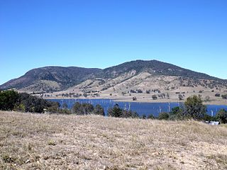
The North Pine Dam is a mass concrete gravity dam with earth-fill embankments on abutments with a gated spillway across the North Pine River that is located in the South East region of Queensland, Australia. The main purpose of the dam is for supply of potable water for the Moreton Bay region and Brisbane's northern suburbs. The impounded reservoir is called Lake Samsonvale.

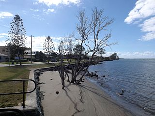
Bramble Bay is an embayment of Moreton Bay in South East Queensland, Australia. The Brisway map reference is 12 H5, or see page 91 G19 in Refidex.
The Pine River is a small river in South East Queensland, Australia.

Lawnton is a suburb in the City of Moreton Bay, Queensland, Australia. In the 2016 census, Lawnton had a population of 5,658 people.

The City of Moreton Bay, known until July 2023 as the Moreton Bay Region, is a local government area in the north of the Brisbane metropolitan city in South East Queensland, Australia. Established in 2008, it replaced three established local government areas, the City of Redcliffe and the Shires of Pine Rivers and Caboolture.
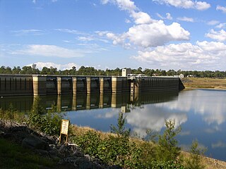
The Sideling Creek Dam is an earth-fill embankment dam with an un-gated spillway across the Sideling Creek in Kurwongbah, City of Moreton Bay, Queensland, Australia. The main purposes of the dam are for potable water supply of the City of Moreton Bay and for recreation. The impounded reservoir is called Lake Kurwongbah.

The Caboolture River is a small river in South East Queensland, Australia.
The Kolan River is a river in the Bundaberg Region, Queensland, Australia.

Dayboro Times and Moreton Mail was a weekly English language newspaper published in Dayboro, Queensland, Australia.

The geography of Brisbane is characterised by its coastal location in the south eastern corner of the Queensland state of Australia. It is located halfway up the Australian east coast with longitudinal and latitudinal coordinates of 27.5° south and 153° east. The city resides within the Moreton Bay Floodplain, stretching from Caboolture to the north, Beenleigh to the south and as far as Ipswich to the west whilst being bordered by the Pacific Ocean to the east.
Brisbane–Woodford Road is the official name for a continuous 60.5-kilometre (37.6 mi) road route in the Moreton Bay local government area of Queensland, Australia. It is designated as part of State Route 58. It is a state-controlled road part regional and part district, rated as a local road of regional significance (LRRS).

