Isaac River

Last updated

Isaac
Australia Queensland relief location map.jpg
Red pog.svg
Location of Isaac River mouth in Queensland
EtymologyFrederick Nevil Isaac [1]
Location
Country Australia
State Queensland
Region Central Queensland
Physical characteristics
Source 
  locationbelow Moranbah North
  coordinates 21°27′03″S148°11′40″E / 21.45083°S 148.19444°E / -21.45083; 148.19444
  elevation245 m (804 ft)
Mouth confluence with the MacKenzie River
  coordinates
22°52′19″S149°20′01″E / 22.87194°S 149.33361°E / -22.87194; 149.33361
  elevation
85 m (279 ft)
Length457 km (284 mi)
Basin size22,364 km2 (8,635 sq mi)
Basin features
River system Fitzroy River
Tributaries 
  left Connors River
[2] [3]

The Isaac River is a river and anabranch in Central Queensland, Australia.

Contents

Course

The headwaters of the river rise south east of Glenden, Queensland and flow in a generally southern direction, crossing the Peak Downs Highway near Moranbah. It continues past Iffley and veers eastward at Leichhardt Downs forming a series of braided channels, and veers south east again and flows past the eastern edge of Junee State Forest and then discharges into the MacKenzie River of which it is a tributary. [2]

The river has a catchment area of 22,364 square kilometres (8,635 sq mi) of which an area of 474 square kilometres (183 sq mi) is composed of riverine wetlands. [4]

History

Yetimarala (also known as Jetimarala, Yetimaralla, and Bayali) is an Australian Aboriginal language of Central Queensland. Its traditional language region is within the local government areas of Central Highlands Region, on the Boomer Range and Broadsound Range and the Fitzroy River, Killarney Station, Mackenzie River and Isaac River. [5]

The river was named for the pastoralist Frederick Nevil Isaac by the explorer Ludwig Leichhardt who came across the river during his 1845 expedition through the area to Port Essington (now Darwin). Isaac owned Gowrie Station on the Darling Downs and was a keen supporter of Leichhardt. [1]

See also

Related Research Articles

<span class="mw-page-title-main">Burdekin River</span> River in Queensland, Australia

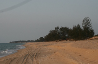
The Burdekin River is a river in North and Far North Queensland, Australia. The river rises on the northern slopes of Boulder Mountain at Valley of Lagoons, part of the western slope of the Seaview Range, and flows into the Coral Sea at Upstart Bay over 200 kilometres (124 mi) to the southeast of the source, with a catchment area of approximately 130,000 square kilometres (50,000 sq mi). The Burdekin River is Australia's largest river by (peak) discharge volume.

<span class="mw-page-title-main">Mitchell River (Queensland)</span> River in Queensland, Australia

The Mitchell River is a river in Far North Queensland, Australia. The river rises on the Atherton Tableland about 50 kilometres (31 mi) northwest of Cairns and flows about 750 kilometres (470 mi) northwest across Cape York Peninsula from Mareeba to the Gulf of Carpentaria.

<span class="mw-page-title-main">Coen River</span> River in Queensland, Australia

The Coen River is a river in the Cape York Peninsula in Queensland, Australia.

<span class="mw-page-title-main">Pennefather River</span> River in Queensland, Australia

The Pennefather River is a river located on the western Cape York Peninsula in Far North Queensland, Australia.

<span class="mw-page-title-main">Dawson River (Queensland)</span> River in Queensland, Australia

The Dawson River is a river in Central Queensland, Australia.

<span class="mw-page-title-main">Mackenzie River (Queensland)</span> Tributary of Fitzroy River in Queensland

The Mackenzie River is a river in Central Queensland, Australia. The Mackenzie River is a major tributary of the Fitzroy River, part of the largest river catchment flowing to the eastern coast of Australia.

<span class="mw-page-title-main">Gilbert River (Queensland)</span> River in Queensland, Australia

The Gilbert River is located in Far North Queensland, Australia. When combined with the Einasleigh River, the river system is the largest river system in northern Australia.

<span class="mw-page-title-main">Belyando River</span> River in Queensland, Australia

The Belyando River, including the Belyando River (Western Branch), is a river system in Central Queensland, Australia. At 1,054 kilometres (655 mi) in length and with a catchment area of 35,000 square kilometres (14,000 sq mi), the Belyando River system is one of the longest rivers in Queensland.

<span class="mw-page-title-main">Comet River</span> River in Queensland, Australia

The Comet River is a river in Central Queensland, Australia.

<span class="mw-page-title-main">Mulgrave River</span> River in Queensland, Australia

The Mulgrave River, incorporating the East Mulgrave River and the West Mulgrave River, is a river system in Far North Queensland, Australia. The 70-kilometre (43 mi)-long river flows towards the Coral Sea and is located approximately 50 kilometres (31 mi) south of Cairns.

The Nicholson River is a river in the Northern Territory and the state of Queensland, Australia.

<span class="mw-page-title-main">Lynd River</span> River in Australia

The Lynd River is a river located on the Cape York Peninsula in Far North Queensland, Australia.

The Coleman River is a river on the Cape York Peninsula in Far North Queensland, Australia.

The Haughton River is a river in North Queensland, Australia.

The Baffle Creek is a creek in Central Queensland, Australia.

The Barratta Creek is a creek in North Queensland, Australia.

The Kendall River is a river in Far North Queensland, Australia.

<span class="mw-page-title-main">Mossman River</span> River in Far North Queensland, Australia

The Mossman River is a river in lower Cape York Peninsula, Queensland, Australia.

The Pascoe River is a river in Far North Queensland, Australia.

The Connors River is a river and anabranch in Central Queensland, Australia.

References

  1. 1 2 "Isaac River (entry 16856)". Queensland Place Names. Queensland Government . Retrieved 26 July 2015.
  2. 1 2 "Map of Isaac River, QLD". Bonzle Digital Atlas of Australia. Retrieved 25 July 2015.
  3. "Map of Isaac River, QLD (anabranch)". Bonzle Digital Atlas of Australia. Retrieved 20 November 2015.
  4. "Isaac River drainage basin". WetlandInfo. Queensland Government . Retrieved 25 July 2015.
  5. CC BY icon-80x15.png This Wikipedia article incorporates CC-BY-4.0 licensed text from: "Yetimarala". Queensland Aboriginal and Torres Strait Islander languages map. State Library of Queensland . Retrieved 30 January 2020.