Mackenzie River (Queensland)

Last updated

Mackenzie
Mackenzie River crossing Duaringa January 2018.jpg
Apis Creek Road crossing at the Mackenzie River near Foleyvale Station north of Duaringa
Australia Queensland relief location map.jpg
Red pog.svg
Location of Mackenzie River mouth in Queensland
Location
Country Australia
State Queensland
Region Central Queensland
Township Rolleston; Comet
Physical characteristics
Source Expedition Range
Source confluence Comet River and Nogoa River
  locationnorth of Comet
  coordinates 23°33′21″S148°32′11″E / 23.55583°S 148.53639°E / -23.55583; 148.53639
  elevation144 m (472 ft)
Mouth confluence with the Dawson River to form the Fitzroy River
  location
east of Duaringa
  coordinates
23°37′39″S149°46′02″E / 23.62750°S 149.76722°E / -23.62750; 149.76722
  elevation
65 m (213 ft)
Length275 km (171 mi)
Basin size12,992 km2 (5,016 sq mi)
Basin features
River system Fitzroy River
Tributaries 
  left Isaac River, Connors River, Funnel Creek
National park Goodedulla National Park
[1] [2] [3] [4]

The Mackenzie River is a river in Central Queensland, Australia. The Mackenzie River is a major tributary of the Fitzroy River, part of the largest river catchment flowing to the eastern coast of Australia. [5]

Contents

Course and features

Formed by the confluence of the Comet and Nogoa rivers flowing from the Expedition Range, the river rises north of Comet and flows generally north by east towards the Broadsound Range. North of the settlement of Royles, the river flows south by east and west of the Goodedulla National Park towards Duaringa and splits as an anabranch on multiple occasions. The river is joined by twenty-four tributaries including the Isaac and Connors rivers and Funnel Creek. [6] Northeast of Duaringa, the Mackenzie is joined by the Dawson River and together they form the Fitzroy River. From source to mouth, the Mackenzie River descends 79 metres (259 ft) over its 275-kilometre (171 mi) course. [2] [3] [4] [7]

The Bingegang Weir near Middlemount contains barramundi, southern saratoga and golden perch. [6] The Bedford Weir and Tartrus Weir are also stocked with barramundi. Bedford Weir is popular with water-skiers and camping is permitted adjacent to the reservoir. [6]

History

Yetimarala (also known as Jetimarala, Yetimaralla, and Bayali) is an Australian Aboriginal language of Central Queensland. Its traditional language region is within the local government areas of Central Highlands Region, on the Boomer Range and Broadsound Range and the Fitzroy River, Killarney Station, Mackenzie River and Isaac River. [8] Garingbal, a language of Central Queensland was also spoken in this region, primarily around the Bowen Basin. The Garingbal language region includes the landscape within the local government boundaries of Central Highlands Regional Council. [9]

The first European to discover the river was Ludwig Leichhardt in 1844; he was a German explorer who explored many parts of Queensland and the Northern Territory. [10]

See also

Related Research Articles

<span class="mw-page-title-main">Fitzroy River (Queensland)</span> River in Queensland, Australia

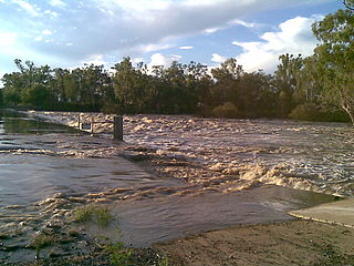
The Fitzroy River is a river in Central Queensland, Australia. Its catchment covers an area of 142,665 square kilometres (55,083 sq mi), making it the largest river catchment flowing to the eastern coast of Australia. It is also the largest river basin that discharges onto the Great Barrier Reef.

<span class="mw-page-title-main">Burdekin River</span> River in Queensland, Australia

The Burdekin River is a river in North and Far North Queensland, Australia. The river rises on the northern slopes of Boulder Mountain at Valley of Lagoons, part of the western slope of the Seaview Range, and flows into the Coral Sea at Upstart Bay over 200 kilometres (124 mi) to the southeast of the source, with a catchment area of approximately 130,000 square kilometres (50,000 sq mi). The Burdekin River is Australia's largest river by (peak) discharge volume.

<span class="mw-page-title-main">Mitchell River (Queensland)</span> River in Queensland, Australia

The Mitchell River is a river in Far North Queensland, Australia. The river rises on the Atherton Tableland about 50 kilometres (31 mi) northwest of Cairns and flows about 750 kilometres (470 mi) northwest across Cape York Peninsula from Mareeba to the Gulf of Carpentaria.

<span class="mw-page-title-main">Central Queensland</span> Region in Queensland, Australia

Central Queensland is an imprecisely-defined geographical division of Queensland that centres on the eastern coast, around the Tropic of Capricorn. Its major regional centre is Rockhampton. The region extends from the Capricorn Coast west to the Central Highlands at Emerald, north to the Mackay Regional Council southern boundary, and south to Gladstone. The region is also known as Capricornia. It is one of Australia's main coal exporting regions.

<span class="mw-page-title-main">Dawson River (Queensland)</span> River in Queensland, Australia

The Dawson River is a river in Central Queensland, Australia.

<span class="mw-page-title-main">Central Highlands Region</span> Local government area in Queensland, Australia

Central Highlands Region is a local government area in Queensland, Australia.

<span class="mw-page-title-main">Bloomfield River</span> River in Far North Queensland, Australia

The Bloomfield River is a river in the Wet Tropics of Far North Queensland, Australia, noted for its Bloomfield River cod fish species, found only in the river.

<span class="mw-page-title-main">Wenlock River</span> River in Queensland, Australia

The Wenlock River is a river located on the Cape York Peninsula in Far North Queensland, Australia.

<span class="mw-page-title-main">Moonie River</span> River in Queensland and New South Wales, Australia

The Moonie River (Mooni River) is a river in Shire of Balonne, Queensland and Walgett Shire, New South Wales, both in Australia. It is a perennial river of the Barwon catchment within the Murray–Darling basin.

<span class="mw-page-title-main">Belyando River</span> River in Queensland, Australia

The Belyando River, including the Belyando River (Western Branch), is a river system in Central Queensland, Australia. At 1,054 kilometres (655 mi) in length and with a catchment area of 35,000 square kilometres (14,000 sq mi), the Belyando River system is one of the longest rivers in Queensland.

The Suttor River is a river in Central Queensland, Australia. The Belyando River is its main tributary. The river has its origins in the Leichhardt Range, north west of Glenden. It flows into Lake Dalrymple, becoming a tributary of the Burdekin River.

<span class="mw-page-title-main">Nogoa River</span> River in Queensland, Australia

The Nogoa River is a river in Central Queensland, Australia.

<span class="mw-page-title-main">Comet River</span> River in Queensland, Australia

The Comet River is a river in Central Queensland, Australia.

<span class="mw-page-title-main">Mulgrave River</span> River in Queensland, Australia

The Mulgrave River, incorporating the East Mulgrave River and the West Mulgrave River, is a river system in Far North Queensland, Australia. The 70-kilometre (43 mi)-long river flows towards the Coral Sea and is located approximately 50 kilometres (31 mi) south of Cairns.

<span class="mw-page-title-main">Carnarvon Range</span> Mountain range in Queensland, Australia

The Carnarvon Range is a mountain range in Central Queensland, Australia. It is a plateau section of the Great Dividing Range. The Carnarvon Range is 160 km in length.

The Coleman River is a river on the Cape York Peninsula in Far North Queensland, Australia.

The Haughton River is a river in North Queensland, Australia.

The Isaac River is a river and anabranch in Central Queensland, Australia.

The Don River is a river in Central Queensland, Australia.

<span class="mw-page-title-main">Fitzroy Developmental Road</span>

The Fitzroy Developmental Road is a designated road in the Central Highlands Region of Queensland consisting of three separate sections. The general direction is from south to north.

References

  1. "Comet, Nogoa and Mackenzie rivers". State of the Rivers report. Department of Environment and Resource Management, Queensland Government. 23 October 2008. Archived from the original on 20 May 2009. Retrieved 20 May 2009.
  2. 1 2 "Map of Mackenzie River, QLD (1)". Bonzle Digital Atlas of Australia. Retrieved 17 November 2015.
  3. 1 2 "Map of Mackenzie River, QLD (2)". Bonzle Digital Atlas of Australia. Retrieved 17 November 2015.
  4. 1 2 "Map of Mackenzie River, QLD (3)". Bonzle Digital Atlas of Australia. Retrieved 17 November 2015.
  5. Fitzroy Basin Association (2005). Central Queensland Strategy for Sustainability: 2004 and beyond. Rockhampton, Qld.: The Fitzroy Basin Association Inc. ISBN   0-9758172-0-5.
  6. 1 2 3 Harrison, Rod; Ernie James; Chris Sully; Bill Classon; Joy Eckermann (2008). Queensland Dams. Bayswater, Victoria: Australian Fishing Network. p. 157. ISBN   978-1-86513-134-4.
  7. "Mackenzie River". Britannica. Retrieved 31 October 2006.
  8. CC BY icon-80x15.png This Wikipedia article incorporates CC-BY-4.0 licensed text from: "Yetimarala". Queensland Aboriginal and Torres Strait Islander languages map. State Library of Queensland . Retrieved 30 January 2020.
  9. CC BY icon-80x15.png This Wikipedia article incorporates CC-BY-4.0 licensed text from: "Garingbal". Queensland Aboriginal and Torres Strait Islander languages map. State Library of Queensland . Retrieved 5 February 2020.
  10. "Ludwig Leichhardt". David Reilly. Retrieved 18 March 2010.