Bohle River

Last updated

Bohle
Burdell QLD 4818, Australia - panoramio.jpg
Bruce Highway crossing the Bohle River at Burdell, 2015
Australia Queensland relief location map.jpg
Red pog.svg
Location of Bohle River mouth in Queensland
Etymology drover Henry Mackinnon Bohle [1]
Location
Country Australia
State Queensland
Region North Queensland
Physical characteristics
Source Hervey Range
  elevation76 m (249 ft)
Mouth Halifax Bay, Coral Sea
  location
near Bushland Beach
  coordinates
19°11′01″S146°41′57″E / 19.18361°S 146.69917°E / -19.18361; 146.69917
  elevation
1 m (3 ft 3 in)
Length37 km (23 mi)
Basin size368 km2 (142 sq mi) to 242.1 km2 (93.5 sq mi) [2]
Discharge 
  locationNear mouth
  average2.9 m3/s (92 GL/a) [2]
[3]

The Bohle River is a river in North Queensland, Australia.

Contents

Course and features

A turbid waterhole sustaining fish populations in the Bohle River, 2022 A turbid waterhole sustaining fish populations. Bohle River. Townsville, 2022.jpg
A turbid waterhole sustaining fish populations in the Bohle River, 2022

The headwaters of the river rise in the Hervey Range [4] south of Townsville and flows north along the coastal plain west of Lake Ross and then north, parallel with Ross River. The Hervey Range Developmental Road crosses the river east of Thuringowa and then the Ingham Connection Road crosses the river west of Townsville. It then enters the Bohle River Fish Habitat Area and the Townsville Town Common Conservation Park and discharges into the Halifax Bay near Bushland Beach, and then empties into the Coral Sea. Tributaries include Middle Creek, Stony Creek ( 19°12′13″S146°42′13″E / 19.2035°S 146.7035°E / -19.2035; 146.7035 (Stony Creek (mouth)) ), [5] Stag Creek, the Little Bohle River and Garner Creek. The river descends 75 metres (246 ft) over its 37-kilometre (23 mi) course. [3]

The catchment area of the river occupies 368 square kilometres (142 sq mi) of which an area of 26 square kilometres (10 sq mi) is composed of estuarine wetlands. [6] The river drains most of the coastal plain west of Townsville. [7]

The river supports recreational fishing, particularly of barramundi. [8] The Bohle is located approximately 10 kilometres (6 mi) west of Townsville. Popular for river fishing, the Bohle River is also good for collecting bait. Yabbies are found from time to time in the muddy banks. Typical fish species found in the river are barramundi, red bream, mangrove jack and grunter. [8]

The rivers is named after the drover Henry Mackinnon Bohle who worked for a pioneer of the area John Melton Black. Bohle overlanded a mob of cattle to Fanning Downs in 1863 and moved stock to the Cleveland Bay area in 1864 for Black. [1]

See also

Related Research Articles

<span class="mw-page-title-main">City of Thuringowa</span> Local government area in Queensland, Australia

The City of Thuringowa was a city and local government area in North Queensland, Australia covering the northern and western parts of what is now Townsville. The suburb of Thuringowa Central is the main business centre in this area.

<span class="mw-page-title-main">Townsville Ring Road</span> Road in Queensland, Australia

The Townsville Ring Road is a motorway in Townsville, Queensland, Australia. The road has been constructed as the new A1/M1 route that bypasses the inner metro area of Townsville. The road was built in 5 stages with the first stage, the Douglas Arterial Road, opened in April 2005 and the most recent section opened in October 2023. Stage 5 commenced construction in July 2021 which included the duplication of the remaining 6-kilometre 2-lane undivided section between Vickers Bridge and Shaw Road in Thuringowa. There is no toll for the use of this motorway.

<span class="mw-page-title-main">Ross River (Queensland)</span> River in Queensland, Australia

The Ross River is a river in North Queensland, Australia. The 49-kilometre (30 mi) long river flows through the city of Townsville and empties into the Coral Sea. It is the major waterway flowing through Townsville and the city's main source of drinking water.

<span class="mw-page-title-main">Thuringowa Central, Queensland</span> Suburb of Townsville, Queensland, Australia

Thuringowa Central is a suburb of Townsville in the City of Townsville, Queensland, Australia. In the 2016 census Thuringowa Central had a population of 2,023 people.

<span class="mw-page-title-main">Bushland Beach, Queensland</span> Suburb of Townsville, Queensland, Australia

Bushland Beach is a coastal suburb in the northern beaches area of Townsville in the City of Townsville, Queensland, Australia. In the 2016 census Bushland Beach had a population of 6,181 people.

Condon is a suburb of Townsville in the City of Townsville, Queensland, Australia. In the 2016 census, Condon had a population of 5,779 people.

<span class="mw-page-title-main">Kelso, Queensland</span> Suburb of Townsville, Queensland, Australia

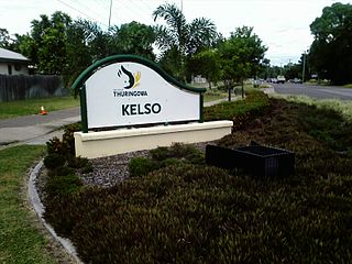
Kelso is a suburb in the City of Townsville, Queensland, Australia. In the 2021 census, Kelso had a population of 10,599 people.

<span class="mw-page-title-main">Suburbs of Thuringowa City</span>

This article is a list of the suburbs that used to make up the City of Thuringowa in Queensland, Australia, before the March 2008 amalgamation, which saw the City of Townsville merge with Thuringowa to form the new city of Townsville. Also listed are the former suburbs that became part of Townsville due to other boundary changes that have taken place over the years. The suburbs are listed below in order of postcode and order of years the boundaries were changed:

Saunders Beach is a coastal town and suburb of Townsville in the City of Townsville, Queensland, Australia. In the 2016 census, the suburb of Saunders Beach had a population of 409 people.

Toolakea is a coastal town and suburb in the City of Townsville, Queensland, Australia. In the 2016 census, Toolakea had a population of 205 people.

<span class="mw-page-title-main">Balgal Beach, Queensland</span> Suburb of Townsville, Queensland, Australia

Balgal Beach is a coastal suburb and a beach in the City of Townsville, Queensland, Australia. The town of Balgal is within the locality. In the 2021 census, Balgal Beach had a population of 998 people.

Toomulla is a coastal town and suburb in the City of Townsville, Queensland, Australia. In the 2021 census, the suburb of Toomulla had a population of 193 people.

<span class="mw-page-title-main">Bohle Plains, Queensland</span> Suburb of Townsville, Queensland, Australia

Bohle Plains is a locality in Townsville in the City of Townsville, Queensland, Australia. In the 2016 census Bohle Plains had a population of 3,205 people.

The Black River is a river in North Queensland, Australia.

The Haughton River is a river in North Queensland, Australia.

<span class="mw-page-title-main">Burdell, Queensland</span> Suburb of Townsville, Queensland, Australia

Burdell is a suburb of Townsville in the City of Townsville, Queensland, Australia. In the 2021 census, Burdell had a population of 7,171 people.

Granite Vale is a rural locality in the City of Townsville, Queensland, Australia. In the 2016 census, Granite Vale had a population of 0 people.

Gumlow is a peri-urban locality in the City of Townsville, Queensland, Australia. In the 2021 census, Gumlow had a population of 142 people.

Hervey Range Developmental Road is a continuous 125-kilometre (78 mi) road route in the Townsville and Charters Towers local government areas of Queensland, Australia. It is designated as State Route 72. It is a state-controlled regional road.

Townsville road network is a group of roads that provide access to the urban areas of Townsville in Queensland, Australia, and enable travel between the communities. Most of the roads retain their original road or street names, and are not well known by their official names.

References

  1. 1 2 "Bohle River (entry 3478)". Queensland Place Names. Queensland Government . Retrieved 19 July 2015.
  2. 1 2 "East Coastal Watersheds". riversnetwork.org. Archived from the original on 5 November 2023. Retrieved 19 January 2024.
  3. 1 2 "Map of Bohle River, QLD". Bonzle Digital Atlas of Australia. Archived from the original on 29 August 2016. Retrieved 19 July 2015.
  4. "Haughton & Ross Rivers Flood Warning Network". Australian Government Bureau of Meteorology. Archived from the original on 31 March 2013.
  5. "Stony Creek – watercourse in the City of Townsville (entry 32521)". Queensland Place Names. Queensland Government . Retrieved 14 April 2021.
  6. "Barratta Creek drainage basin". WetlandInfo. Queensland Government . Retrieved 19 July 2015.[ permanent dead link ]
  7. "Flood Warning System For The Ross, Bohle & Black Rivers". Bureau of Meteorology. Archived from the original on 22 February 2014. Retrieved 18 February 2014.
  8. 1 2 "The Bohle River Area". Explore Townsville. 2011. Archived from the original on 21 July 2015. Retrieved 19 July 2015.