
The Fitzroy River is a river in Central Queensland, Australia. Its catchment covers an area of 142,665 square kilometres (55,083 sq mi), making it the largest river catchment flowing to the eastern coast of Australia. It is also the largest river basin that discharges onto the Great Barrier Reef.

The Burdekin River is a river in North and Far North Queensland, Australia. The river rises on the northern slopes of Boulder Mountain at Valley of Lagoons, part of the western slope of the Seaview Range, and flows into the Coral Sea at Upstart Bay over 200 kilometres (124 mi) to the southeast of the source, with a catchment area of approximately 130,000 square kilometres (50,000 sq mi). The Burdekin River is Australia's largest river by (peak) discharge volume.

Cape York Peninsula is a peninsula located in Far North Queensland, Australia. It is the largest wilderness in northern Australia. The land is mostly flat and about half of the area is used for grazing cattle. The relatively undisturbed eucalyptus-wooded savannahs, tropical rainforests and other types of habitat are now recognised and preserved for their global environmental significance. Although much of the peninsula remains pristine, with a diverse repertoire of endemic flora and fauna, some of its wildlife may be threatened by industry and overgrazing as well as introduced species and weeds.
The Pennefather River is a river located on the western Cape York Peninsula in Far North Queensland, Australia.

The Palmer River is a river in Far North Queensland, Australia. The area surrounding the river was the site of a gold rush in the late 19th century which started in 1873.
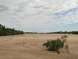
The Staaten River is a river in northern Queensland, Australia, rising in the Great Dividing Range and flowing northwest into the Gulf of Carpentaria.
The Gilbert River is located in Far North Queensland, Australia. When combined with the Einasleigh River, the river system is the largest river system in northern Australia.

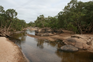
The Bloomfield River is a river in the Wet Tropics of Far North Queensland, Australia, noted for its Bloomfield River cod fish species, found only in the river.

The Jardine River, formally known as Deception River, is the largest river of the Cape York Peninsula in Far North Queensland, Australia.
The Archer River is a river located on the Cape York Peninsula, Far North Queensland, Australia.
The Ducie River is a river located on the Cape York Peninsula in Far North Queensland, Australia.

Jackey Jackey, Aboriginal name Galmahra, was the Aboriginal Australian guide and companion to surveyor Edmund Kennedy. He survived Kennedy's fatal 1848 expedition into Cape York Peninsula and was subsequently formally recognized for heroic deeds by the Colony of New South Wales in words engraved on a solid silver breastplate or gorget, which read as follows:
Presented by His Excellency Sir Charles Augustus FitzRoy K.D. Governor of New South Wales, to Jackey Jackey, an Aboriginal native of that colony. In testimony of the fidelity with which he followed the late Assistant Surveyor E.B.C. Kennedy, throughout the exploration of York Peninsula in the year 1848; the noble daring with which he supported that lamented gentleman, when mortally wounded by the Natives of Escape River, the courage with which after having affectionately tended the last moments of his Master, he made his way through hostile Tribes and an unknown Country, to Cape York; and finally the unexampled sagacity with which he conducted the succour that there awaited the Expedition to the rescue of the other survivors of it, who had been left at Shelbourne Bay.
The Robinson River is a river in Australia's Northern Territory.
The Nicholson River is a river in the Northern Territory and the state of Queensland, Australia.
The Alice River is a river located on the Cape York Peninsula of Far North Queensland, Australia.

The Lynd River is a river located on the Cape York Peninsula in Far North Queensland, Australia.

The Coleman River is a river on the Cape York Peninsula in Far North Queensland, Australia.
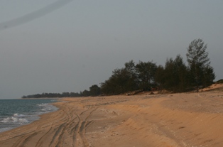
The Jeannie River is a river in Far North Queensland, Australia.
The Kendall River is a river in Far North Queensland, Australia.
The Proserpine River is a river in Whitsunday Region of Queensland, Australia.
