South Pine River

Last updated

South Pine
Eden
Gympie Rd flood gates nr South Pine.jpg
Gympie Road crossing, 2013
Australia Queensland relief location map.jpg
Red pog.svg
Location of the South Pine River mouth in Queensland
Location
Country Australia
State Queensland
Region South East Queensland
Physical characteristics
Source Mount Glorious, D'Aguilar Range
  locationnear Highvale
  coordinates 27°22′01″S152°47′59″E / 27.36694°S 152.79972°E / -27.36694; 152.79972
  elevation297 m (974 ft)
Mouth confluence with the North Pine River to form the Pine River
  location
Lawnton
  coordinates
27°17′16″S153°00′57″E / 27.28778°S 153.01583°E / -27.28778; 153.01583
  elevation
10 m (33 ft)
Length41 km (25 mi)
Basin features
River system Pine River catchment
Tributaries 
  left Dawson Creek
[1]

The South Pine River is a minor river in South East Queensland, Australia. It rises on the D'Aguilar Range and passes through the Samford Valley in the City of Moreton Bay local government area.

Contents

Location and features

Reflections, South Pine River. Albany Creek, 2022 Reflections, South Pine River. Albany Creek, 2022.jpg
Reflections, South Pine River. Albany Creek, 2022

The South Pine River rises in the D'Aguilar Range below Mount Glorious near Highvale, northwest of Brisbane, and flows generally east, to form its confluence with the North Pine River at Lawnton, where the river forms the Pine River. The river flows mostly through the City of Moreton Bay; it is joined by Dawson Creek, [2] Samford Creek and Cedar Creek before snaking through the outer northwestern suburbs of Brisbane where it divides the suburbs of Eatons Hill and Brendale to the north and Albany Creek to the south. Meeting with Albany Creek in the suburb of the same name, it carries the city council boundary between the Moreton Bay City Council and the Brisbane City Council down to its confluence. To the northwest of the South Pine River are the Pine Rivers suburbs of Strathpine and Lawnton, while on the southeast are Brisbane City Council suburbs Bridgeman Downs and Bald Hills. The river descends 287 metres (942 ft) over its 41-kilometre (25 mi) course. [1] A sewage treatment plant is located at Brendale. [3]

On early maps the river was called Eden River. [2] The Pine Rivers Shire draws its name from the South Pine, North Pine and Pine Rivers. Small steamships traversed the river to deliver molasses from local mills. [4]

Fauna

The river is home to the platypus. [3]

See also

Related Research Articles

<span class="mw-page-title-main">Shire of Pine Rivers</span> Local government area in Queensland

The Shire of Pine Rivers was a local government area about 20 kilometres (12 mi) north of Brisbane in the Moreton Bay region of South East Queensland, Australia. The shire covered an area of 771 square kilometres (297.7 sq mi), and existed as a local government entity from 1888 until 2008, when it amalgamated with councils further north and east to form the Moreton Bay Region, renamed in July 2023 as the City of Moreton Bay.

<span class="mw-page-title-main">D'Aguilar Range</span> Mountain range in Australia

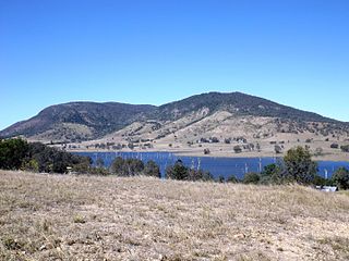
The D'Aguilar Range is a mountain range near Brisbane, Queensland, Australia. The town of Dayboro is situated on the lower foothills midway along the range and the Sunshine Coast Hinterland town of Mooloolah lies at the northernmost point of the range. Many residential areas line its eastern slopes including the town of Samford and the suburb of Ferny Hills. In the west, numerous ridges and gullies are heavily forested and designated as state forest or national park.

<span class="mw-page-title-main">Warner, Queensland</span> Suburb of City of Moreton Bay, Queensland, Australia

Warner is a suburb in the City of Moreton Bay, Queensland, Australia. In the 2016 census, Warner had a population of 11,411 people.

<span class="mw-page-title-main">Brisbane Forest Park</span> Protected area in Queensland, Australia

Brisbane Forest Park, is located on parts of the D'Aguilar Range. The large nature reserve lies on the western boundary of City of Brisbane into the City of Moreton Bay, Queensland, Australia, in Enoggera Reservoir, adjacent to The Gap and between the Mount Coot-tha Reserve on the Taylor Range and higher peaks to the north. Brisbane Forest Park supports plants and animals and is essential to their survival. The main entrance is located in the suburb of The Gap although there are a number of other access points.

<span class="mw-page-title-main">Strathpine, Queensland</span> Suburb of City of Moreton Bay, Queensland, Australia

Strathpine is a suburb in the City of Moreton Bay, Queensland, Australia. In the 2016 census, Strathpine had a population of 9,503 people. It is home to the Pine Rivers District offices of the City of Moreton Bay, as well as many businesses. The area is home to Strathpine Centre, a medium-sized urban shopping centre.

<span class="mw-page-title-main">Samford, Queensland</span> Town in Queensland, Australia

Samford is a town in the City of Moreton Bay, South East Queensland, Australia. It consists of two localities, Samford Village and Samford Valley.

<span class="mw-page-title-main">Brendale, Queensland</span> Suburb of City of Moreton Bay, Queensland, Australia

Brendale is a suburb in the City of Moreton Bay, Queensland, Australia. In the 2016 census, Brendale had a population of 2,758 people.

<span class="mw-page-title-main">Bramble Bay</span> River in Queensland, Australia

Bramble Bay is an embayment of Moreton Bay in South East Queensland, Australia. The Brisway map reference is 12 H5, or see page 91 G19 in Refidex.

<span class="mw-page-title-main">Pine River (Queensland)</span> River in Queensland, Australia

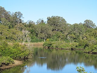
The Pine River is a small river in South East Queensland, Australia.

<span class="mw-page-title-main">North Pine River</span> River in Queensland, Australia

The North Pine River is a minor river in South East Queensland, Australia.

<span class="mw-page-title-main">Lawnton, Queensland</span> Suburb of Moreton Bay, Queensland, Australia

Lawnton is a suburb in the City of Moreton Bay, Queensland, Australia. In the 2016 census, Lawnton had a population of 5,658 people.

<span class="mw-page-title-main">Kedron Brook</span> River in Queensland, Australia

The Kedron Brook is a creek that flows through the northern suburbs of Brisbane in the south-east region of Queensland, Australia.

<span class="mw-page-title-main">City of Moreton Bay</span> Local government area in Queensland, Australia

The City of Moreton Bay, known until July 2023 as the Moreton Bay Region, is a local government area in the north of the Brisbane metropolitan city in South East Queensland, Australia. Established in 2008, it replaced three established local government areas, the City of Redcliffe and the Shires of Pine Rivers and Caboolture.

<span class="mw-page-title-main">Locations in Australia with a Scottish name</span>

This is a list of placenames in Scotland which have subsequently been applied to parts of Australia by Scottish emigrants or explorers.

<span class="mw-page-title-main">Breakfast Creek</span> River in Queensland, Australia

The Breakfast Creek is a small urban stream that is a tributary of the Brisbane River, located in suburban Brisbane in the South East region of Queensland, Australia.

<span class="mw-page-title-main">Clear Mountain, Queensland</span> Suburb of Moreton Bay, Queensland, Australia

Clear Mountain is a rural locality in the City of Moreton Bay, Queensland, Australia. In the 2016 census, Clear Mountain had a population of 730 people.

<span class="mw-page-title-main">Geography of Brisbane</span> Geography of the city of Brisbane in Queensland, Australia

The geography of Brisbane is characterised by its coastal location in the south eastern corner of the Queensland state of Australia. It is located halfway up the Australian east coast with longitudinal and latitudinal coordinates of 27.5° south and 153° east. The city resides within the Moreton Bay Floodplain, stretching from Caboolture to the north, Beenleigh to the south and as far as Ipswich to the west whilst being bordered by the Pacific Ocean to the east.

Brisbane–Woodford Road is the official name for a continuous 60.5-kilometre (37.6 mi) road route in the Moreton Bay local government area of Queensland, Australia. It is designated as part of State Route 58. It is a state-controlled road part regional and part district, rated as a local road of regional significance (LRRS).

There are two roads named South Pine Road to the north of Brisbane in Queensland, Australia. They are two separate roads rather than a disconnected single road. It is likely that the duplicate naming is the result of actions by two former local authorities, the Shire of Enoggera and the Shire of Pine Rivers.

References

  1. 1 2 "Map of South Pine River, QLD". Bonzle Digital Atlas of Australia. Retrieved 7 October 2015.
  2. 1 2 Horton, Helen (1988). Brisbane's Back Door: The story of the D'Aguilar Range. Bowen Hills, Queensland: Boolarong Publications. p. 1. ISBN   0-86439-036-X.
  3. 1 2 "Pine Catchment Story". Department of Environment and Science. Government of Queensland. Retrieved 22 May 2023.
  4. "Strathpine history". Moreton Bay Regional Council. Retrieved 23 May 2023.