Charlton, New York

Last updated

Charlton
Town of Charlton
Charlton NY Locator Map.png
Map highlighting Charlton's location within Saratoga County.
USA New York location map.svg
Red pog.svg
Charlton
Location within the state of New York
Coordinates: 42°57′1″N73°59′27″W / 42.95028°N 73.99083°W / 42.95028; -73.99083
Country United States
State New York
County Saratoga
Named for Charlton, Worcestershire
Area
[1]
  Total32.96 sq mi (85.37 km2)
  Land32.77 sq mi (84.88 km2)
  Water0.19 sq mi (0.49 km2)
Elevation
663 ft (202 m)
Population
 (2010)
  Total4,133
  Estimate 
(2016) [2]
4,171
  Density127.27/sq mi (49.14/km2)
Time zone UTC-5 (Eastern (EST))
  Summer (DST) UTC-4 (EDT)
ZIP code
12019
Area code 518
FIPS code 36-13926
GNIS feature ID0978812

Charlton is a town in Saratoga County, New York, United States. The population was 3,954 at the 2000 census. The town is named after a notable physician.[ citation needed ]

Contents

The Town of Charlton is located in the southwestern part of the county and is north of Schenectady. The town is home to the Charlton Historic District, which is home to many historic buildings.

History

The region was first settled circa 1680 by travelers from the small village of Charlton, located in Worcestershire, United Kingdom. The town was formed in 1792 from the Town of Ballston, immediately after Saratoga County was established. The town was previously known as "Freehold" due to the number of settlers from New Jersey.

Notable people

Geography

According to the United States Census Bureau, the town has a total area of 32.8 square miles (85 km2), of which 32.8 square miles (85 km2) is land and 0.04 square miles (0.10 km2) (0.06%) is water.

The southern town line is the border of Schenectady County, and the western town boundary is the border of Montgomery County.

New York State Route 67 (Amsterdam Road) is an east-west highway which intersects New York State Route 147, a north-south highway, north of West Charlton.

The town borders Galway to the North, Ballston to the east, Glenville to the south, and Amsterdam to the west.

Demographics

Historical population
CensusPop.Note
1820 1,953
1830 2,0233.6%
1840 1,933−4.4%
1850 1,902−1.6%
1860 1,752−7.9%
1870 1,607−8.3%
1880 1,474−8.3%
1890 1,175−20.3%
1900 1,109−5.6%
1910 1,030−7.1%
1920 914−11.3%
1930 9787.0%
1940 1,0638.7%
1950 1,29822.1%
1960 3,024133.0%
1970 3,77224.7%
1980 4,0196.5%
1990 3,984−0.9%
2000 3,954−0.8%
2010 4,1334.5%
2016 (est.)4,171 [2] 0.9%
U.S. Decennial Census [3]

As of the census [4] of 2000, there were 3,954 people, 1,429 households, and 1,204 families residing in the town. The population density was 120.5 inhabitants per square mile (46.5/km2). There were 1,464 housing units at an average density of 44.6 per square mile (17.2/km2). The racial makeup of the town was 98.46% White, 0.28% African American, 0.15% Native American, 0.32% Asian, 0.10% from other races, and 0.68% from two or more races. Hispanic or Latino of any race were 0.96% of the population.

There were 2,429 households, out of which 34.7% had children under the age of 18 living with them, 75.4% were married couples living together, 5.3% had a male householder with no wife present, and 15.7% were non-families. 12.9% of all households were made up of individuals, and 6.6% had someone living alone who was 65 years of age or older. The average household size was 2.74 and the average family size was 3.00.

In the town, the population was spread out, with 25.2% under the age of 18, 5.4% from 18 to 24, 24.2% from 25 to 44, 31.9% from 45 to 64, and 13.3% who were 65 years of age or older. The median age was 42 years. For every 100 females, there were 95.2 males. For every 100 females age 18 and over, there were 96.0 males.

The median income for a household in the town was $63,396, and the median income for a family was $66,250. Males had a median income of $47,813 versus $30,208 for females. The per capita income for the town was $27,924. About 0.6% of families and 1.2% of the population were below the poverty line, including none of those under age 18 and 3.3% of those age 65 or over.

Communities and locations in Charlton

Related Research Articles

Davenport is a town in Delaware County, New York, United States. The population was 2,955 at the 2020 census. The town is in the northeastern part of the county.
<span class="mw-page-title-main">Middletown, Delaware County, New York</span> Town in New York, United States

Middletown is a town in Delaware County, New York, United States. The population was 3,336 at the 2020 census. The town is in the southeastern part of the county.

Northampton is a town in Fulton County, New York, United States. The population was 2,670 at the 2010 census. The name comes from an original land patent. Northampton is in the northeastern corner of the county and is northeast of Gloversville. The town is known for the village of Northville, a major Adirondack community; and the Great Sacandaga Lake, which composes around 40% of the town.

<span class="mw-page-title-main">Darien, New York</span> Town in Genesee County, New York

Darien is a town in Genesee County, New York, United States. The population was 3,010 at the 2020 census. Darien lies in the southwestern part of Genesee County, southwest of Batavia.

<span class="mw-page-title-main">Pavilion, New York</span> Town in New York, United States

Pavilion is a town in Genesee County, New York, United States. The population was 2,495 at the 2010 census. The town was named after a hotel in Saratoga Springs, New York, by an early resident. The town of Pavilion is in the southeastern corner of Genesee County and is southeast of the city of Batavia.

<span class="mw-page-title-main">Schroeppel, New York</span> Town in New York, United States

Schroeppel is a town in Oswego County, New York, United States. The population was 8,501 at the 2010 census. The name derives from the Schroeppel family, early land owners of the area. Schroeppel is located in the southeast part of the county.

<span class="mw-page-title-main">Roseboom, New York</span> Town in New York, United States

Roseboom is a town in Otsego County, New York, United States. The population was 711 at the 2010 census. The name of the town is taken from those of early landowners and settlers Abram and John Roseboom.

<span class="mw-page-title-main">Ballston, New York</span> Town in New York, United States

Ballston is a town in Saratoga County, New York, United States. The population was 11,831 at the 2020 census. The name is derived from an early settler, Eliphalet Ball, a Presbyterian minister who relocated there from Westchester County, New York in 1770. The town is in the southern part of the county, and is north of Schenectady.

<span class="mw-page-title-main">Ballston Spa, New York</span> Village in New York, United States

Ballston Spa is a village and the county seat of Saratoga County, New York, United States, located southwest of Saratoga Springs. It is part of the Capital Region. The population of the village, named after Rev. Eliphalet Ball, a Congregationalist clergyman and an early settler, was 5,111 at the 2020 census. Ballston Spa lies on the border of two towns, situated partly in the Town of Ballston and partly in the Town of Milton. The Ballston Spa School District encompassing most of the combined towns of Milton, Malta, and Ballston is often referred to locally as ‘Ballston Spa’ with the village proper being referred to as ‘The Village’ or 'Town'.
<span class="mw-page-title-main">Clifton Park, New York</span> Town in New York, United States

Clifton Park is a suburban town in Saratoga County, New York, United States. It is the largest municipality in the county, with a 2020 population of 38,029, according to the 2020 census. The name is derived from an early land patent. The town is in the southern part of Saratoga County, approximately 12 miles (19 km) north of Albany, 7 miles (11 km) northeast of Schenectady, and 10 miles (16 km) south of Saratoga Springs.
<span class="mw-page-title-main">Greenfield, New York</span> Town in New York, United States

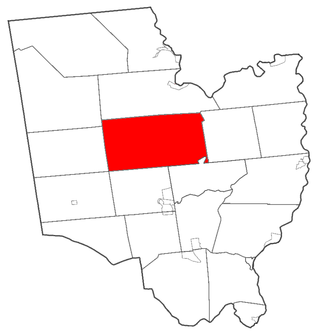
Greenfield is a town in Saratoga County, New York, United States. It is located northwest of Saratoga Springs, and is the largest by area in the county. Students living in Greenfield attend schools of the Saratoga Springs City School District. The Palmertown, and Kayaderosseras Ranges pass through the town, the town is located at the foothills of the Adirondack Mountains.

<span class="mw-page-title-main">Malta, New York</span> Town in New York, United States

Malta is a town in Saratoga County, New York, United States. The town is in the central part of the county and is south of Saratoga Springs. The population was 17,130 as of the 2020 census.

<span class="mw-page-title-main">Glenville, New York</span> Town in New York, United States

Glenville is a town in Schenectady County, New York, United States. It was incorporated in 1821 from Schenectady. As of the 2020 census, the town population was 29,326.

Pattersonville-Rotterdam Junction was a census-designated place (CDP) in Schenectady County, New York, United States. The population was 918 at the 2000 census. The area was not delineated as a CDP for the 2010 census.
<span class="mw-page-title-main">Princetown, New York</span> Town in New York, United States

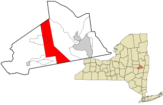
Princetown is a town in Schenectady County, New York, United States. The population was 2,115 at the 2010 census. It is in the central part of the county, west of the town of Rotterdam.

Pulteney is a town in Steuben County, New York, United States. The population was 1,260 at the 2020 census. The name is derived from the name of the original pioneer tract of land.

<span class="mw-page-title-main">Thompson, New York</span> Town in New York, United States

Thompson is a town in the southern part of Sullivan County, New York, United States. The population was 16,550 at the 2020 census. The town is named after William Thompson, an early settler.

<span class="mw-page-title-main">Galway, New York</span> Town in New York, United States

Galway is a town located in Saratoga County, New York, United States. As of the 2020 census, the town had a total population of 3,525. The town contains a village also named Galway. Both the town and village are located in the western part of the county, north of Schenectady.

<span class="mw-page-title-main">Milton, Saratoga County, New York</span> Town in New York, United States

Milton is a town in Saratoga County, New York, United States. The population was 18,800 at the 2020 census. Some believe that the town was named after the poet, John Milton, while other sources state that it is a shortening of "Mill-town" for the early mill activity.

<span class="mw-page-title-main">Esperance, New York</span> Town in New York, United States

Esperance is a town in Schoharie County, New York, United States. The population was 1,806 at the 2020 census. The town was given the name of the principal village, which was named for "hope" in French.

References

  1. "2016 U.S. Gazetteer Files". United States Census Bureau. Retrieved July 5, 2017.
  2. 1 2 "Population and Housing Unit Estimates" . Retrieved June 9, 2017.
  3. "Census of Population and Housing". Census.gov. Retrieved June 4, 2015.
  4. "U.S. Census website". United States Census Bureau . Retrieved January 31, 2008.
  5. 1 2 "National Register Information System". National Register of Historic Places . National Park Service. March 13, 2009.

42°56′00″N73°58′08″W / 42.93333°N 73.96889°W / 42.93333; -73.96889