Greenfield, New York

Last updated

Greenfield
Town of Greenfield
Flag of Greenfield NY.png
Seal of Greenfield NY.png
Greenfield NY Locator Map.png
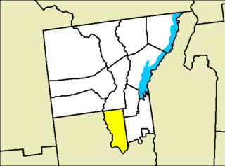
Map highlighting Greenfield's location within Saratoga County.
New York Adirondack.svg
Red pog.svg
Greenfield
Location within the state of New York
Coordinates: 43°7′20″N73°52′18″W / 43.12222°N 73.87167°W / 43.12222; -73.87167
Country United States
State New York
County Saratoga
Named for Greenfield, New Hampshire
Area
[1]
  Total67.69 sq mi (175.31 km2)
  Land67.39 sq mi (174.54 km2)
  Water0.30 sq mi (0.77 km2)
Elevation
591 ft (180 m)
Population
 (2010)
  Total7,775
  Estimate 
(2016) [2]
7,737
  Density114.81/sq mi (44.33/km2)
Time zone UTC-5 (Eastern (EST))
  Summer (DST) UTC-4 (EDT)
ZIP code
12833
Area code 518
FIPS code 36-30444
GNIS feature ID0979019
Website Town website

Greenfield is a town in Saratoga County, New York, United States. It is located northwest of Saratoga Springs, and is the largest by area in the county. Students living in Greenfield attend schools of the Saratoga Springs City School District. The Palmertown, and Kayaderosseras Ranges pass through the town, [3] the town is located at the foothills of the Adirondack Mountains.

Contents

Etymology

The town is named after Greenfield, New Hampshire.

History

The area was first settled circa 1786, and in 1793, the town was formed from parts of the Milton and Saratoga. Its land area was reduced in 1794 by contributions of some of its territory to the newly formed towns of Day, Corinth, and Hadley. [4]

Geography

Greenfield is the largest town in the county by area. According to the United States Census Bureau, the town has a total area of 67.7 square miles (175 km2), of which 67.4 square miles (175 km2) is land and 0.3 square miles (0.78 km2) (0.46%) is water.

Route 9N, a north–south highway, passes through the eastern part of the town.

Demographics

Historical population
CensusPop.Note
1820 3,024
1830 3,1514.2%
1840 2,803−11.0%
1850 2,8903.1%
1860 2,9702.8%
1870 2,698−9.2%
1880 2,448−9.3%
1890 2,169−11.4%
1900 1,837−15.3%
1910 1,552−15.5%
1920 1,481−4.6%
1930 1,5444.3%
1940 1,69810.0%
1950 1,96115.5%
1960 2,54829.9%
1970 4,37871.8%
1980 5,10416.6%
1990 6,33824.2%
2000 7,36216.2%
2010 7,7755.6%
2016 (est.)7,737 [2] −0.5%
U.S. Decennial Census [5]

As of the census [6] of 2000, there were 7,362 people, 2,761 households, and 2,007 families residing in the town. The population density was 109.2 inhabitants per square mile (42.2/km2). There were 3,222 housing units at an average density of 47.8 per square mile (18.5/km2). The racial makeup of the town was 97.45% White, 0.65% African American, 0.14% Native American, 0.34% Asian, 0.22% from other races, and 1.21% from two or more races. Hispanic or Latino of any race were 1.13% of the population.

There were 2,761 households, out of which 38.1% had children under the age of 18 living with them, 58.2% were married couples living together, 9.5% had a female householder with no husband present, and 27.3% were non-families. 20.4% of all households were made up of individuals, and 7.4% had someone living alone who was 65 years of age or older. The average household size was 2.66 and the average family size was 3.05.

In the town, the population was spread out, with 27.2% under the age of 18, 7.3% from 18 to 24, 32.4% from 25 to 44, 23.6% from 45 to 64, and 9.5% who were 65 years of age or older. The median age was 36 years. For every 100 females, there were 100.3 males. For every 100 females age 18 and over, there were 98.4 males.

The median income for a household in the town was $44,784, and the median income for a family was $48,299. Males had a median income of $35,112 versus $27,127 for females. The per capita income for the town was $20,014. About 4.3% of families and 6.1% of the population were below the poverty line, including 8.5% of those under age 18 and 3.4% of those aged 65 or over.

Communities and locations in Greenfield

Notable people

Related Research Articles

<span class="mw-page-title-main">AuSable, New York</span> Town in New York, United States

Au Sable, or Ausable, is a town in Clinton County, New York, United States. The population was 3,146 at the 2010 census. The name is from the Ausable River that flows through the town and means "of sand".

<span class="mw-page-title-main">Black Brook, New York</span> Town in New York, United States

Black Brook is a town in Clinton County, New York, United States. The population was 1,497 at the 2010 census. It is named after a stream that flows through the town.

<span class="mw-page-title-main">Crown Point, New York</span> Town in New York, United States

Crown Point is a town in Essex County, New York, United States, located on the west shore of Lake Champlain. The population was 2,024 at the 2010 census. The name of the town is a direct translation of the original French name, Pointe à la Chevelure.

<span class="mw-page-title-main">Elizabethtown, New York</span> Town in New York, United States

Elizabethtown is a town in Essex County, New York, United States. The population was 1,163 at the 2010 census. The county seat of Essex County is the hamlet of Elizabethtown, located in the northern part of the town. The name is derived from Elizabeth Gilliland, the wife of an early settler.

<span class="mw-page-title-main">Ticonderoga, New York</span> Town in New York, United States

Ticonderoga is a town in Essex County, New York, United States. The population was 5,042 at the 2010 census. The name comes from the Mohawk tekontaró:ken, meaning "it is at the junction of two waterways".

<span class="mw-page-title-main">Pavilion, New York</span> Town in New York, United States

Pavilion is a town in Genesee County, New York, United States. The population was 2,495 at the 2010 census. The town was named after a hotel in Saratoga Springs, New York, by an early resident. The town of Pavilion is in the southeastern corner of Genesee County and is southeast of the city of Batavia.
<span class="mw-page-title-main">Charlton, New York</span> Town in New York, United States

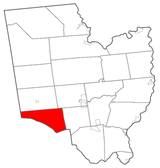
Charlton is a town in Saratoga County, New York, United States. The population was 3,954 at the 2000 census. The town is named after a notable physician.
<span class="mw-page-title-main">Clifton Park, New York</span> Town in New York, United States

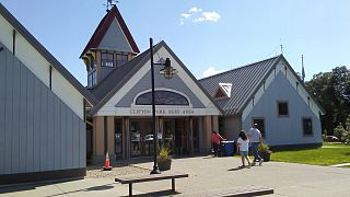
Clifton Park is a suburban town in Saratoga County, New York, United States. It is the largest municipality in the county, with a 2020 population of 38,029, according to the 2020 census. The name is derived from an early land patent. The town is in the southern part of Saratoga County, approximately 12 miles (19 km) north of Albany, 7 miles (11 km) northeast of Schenectady, and 10 miles (16 km) south of Saratoga Springs.

<span class="mw-page-title-main">Hadley, New York</span> Town in New York, United States

Hadley is a town in Saratoga County, New York, United States. The population was 1,971 at the 2000 census. The town was named after Hadley, Massachusetts.

<span class="mw-page-title-main">Malta, New York</span> Town in New York, United States

Malta is a town in Saratoga County, New York, United States. The town is in the central part of the county and is south of Saratoga Springs. The population was 17,130 as of the 2020 census.

<span class="mw-page-title-main">Moreau, New York</span> Town in New York, United States

Moreau is a town in Saratoga County, New York, United States. The population was 16,202 at the 2020 census. The town is located in the northeast part of the county, north of Saratoga Springs. Moreau is named after Jean Victor Moreau, a French general, who visited the area just before the town was formed. The town contains a village called South Glens Falls.
<span class="mw-page-title-main">Providence, New York</span> Town in New York, United States

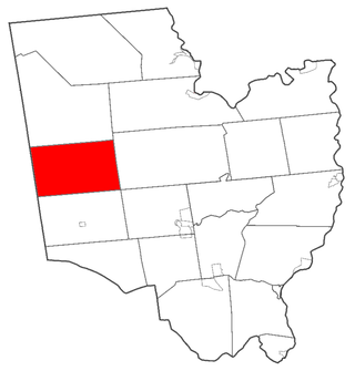
Providence is a town in Saratoga County, New York, United States. The Town of Providence is on the county's western border and is northwest of Saratoga Springs. More than half the town is located within the Adirondack Park, the town also borders the Great Sacandaga Lake.
<span class="mw-page-title-main">Saratoga, New York</span> Town in New York, United States

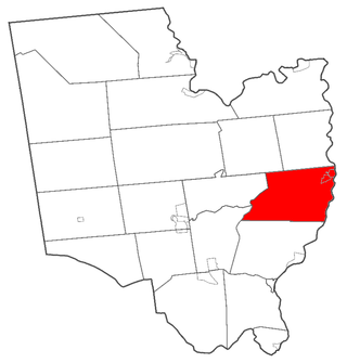
Saratoga is a town in Saratoga County, New York, United States. The population was 5,808 at the 2020 census. It is also the commonly used, but not official, name for the neighboring and much more populous city, Saratoga Springs. The major village in the town of Saratoga is Schuylerville, which is often, but not officially, called Old Saratoga. Saratoga contains a second village, named Victory.
<span class="mw-page-title-main">Lake Luzerne, New York</span> Town in New York, United States

Lake Luzerne, formerly the Town of Fairfield and then Luzerne, is a town in southern Warren County, New York, United States. The town is located within the Adirondack Park. The town is part of the Glens Falls Metropolitan Statistical Area. Lake Luzerne is west of the city of Glens Falls. The town population was 3,079 at the 2020 census.

Broadalbin is a town in Fulton County, New York, on the eastern border of the county and northwest of Albany. The town was named after the Breadalbane Region in Scotland by an early settler. The town contains a village also called Broadalbin. The population was 5,260 at the 2010 census.

<span class="mw-page-title-main">Corinth, New York</span> Town in New York, United States

Corinth is a town in Saratoga County, New York, United States. The population was 6,500 at the 2020 census. The town contains a village also named Corinth. The town is on the northeastern border of the county, north of Saratoga Springs. The town is noted as "the snowshoe capital of the world" and is home to Palmer Falls where the Hudson River passes through the Palmertown Range.

<span class="mw-page-title-main">Galway, New York</span> Town in New York, United States

Galway is a town located in Saratoga County, New York, United States. As of the 2020 census, the town had a total population of 3,525. The town contains a village also named Galway. Both the town and village are located in the western part of the county, north of Schenectady.

<span class="mw-page-title-main">Milton, Saratoga County, New York</span> Town in New York, United States

Milton is a town in Saratoga County, New York, United States. The population was 18,800 at the 2020 census. Some believe that the town was named after the poet, John Milton, while other sources state that it is a shortening of "Mill-town" for the early mill activity.

<span class="mw-page-title-main">Stillwater, New York</span> Town in New York, United States

Stillwater is a town in Saratoga County, New York, United States, with a population of 8,287 at the 2010 census. The town contains a village called Stillwater. The town is at the eastern border of the county, southeast of Saratoga Springs and borders both Rensselaer and Washington counties. Saratoga National Historical Park is located within the town's limits. There is a hamlet in Minerva, Essex County, New York, with the same name which has nothing to do with this town.

Waddington is a town in St. Lawrence County, New York, United States. The population was 2,266 at the 2010 census. The town was named after its principal village.

References

  1. "2016 U.S. Gazetteer Files". United States Census Bureau. Retrieved July 5, 2017.
  2. 1 2 "Population and Housing Unit Estimates" . Retrieved June 9, 2017.
  3. "New York State Library Digital Collections".
  4. SYLVESTER, NATHANIEL BARTLETT. "HISTORY OF SARATOGA COUNTY, NEW YORK". Saratoga NYGenWeb Project.
  5. "Census of Population and Housing". Census.gov. Retrieved June 4, 2015.
  6. "U.S. Census website". United States Census Bureau . Retrieved January 31, 2008.
  7. "Ballou Cemetery (Saratoga County, NY)".
  8. "Glass Factory Historical Marker".
  9. Feulner, Ron (December 2016). "Historian's Corner" (PDF). The Town of Greenfield Historical Society Newsletter. Vol. 17, no. 4. p. 3. Archived from the original (PDF) on January 31, 2023.
  10. Who Was Who in America, Historical Volume, 1607-1896. Marquis Who's Who. 1967.
  11. Library of Congress Transcript (January 10, 2017). "Catalogue of Students in Williams' College, November 1800" (PDF). cdn.loc.gov/. Washington, DC: Library of Congress. p. 4.
  12. General Catalogue of the Non-graduates of Williams College, 1796-1920. Williamstown, MA: Williams College. 1920. p. 6.

43°06′13″N73°51′50″W / 43.10361°N 73.86389°W / 43.10361; -73.86389