County of Forty Mile No. 8

Last updated

County of Forty Mile No. 8
Logo of the County of Forty Mile, Alberta, Canada.png
Forty Mile County AB welcome sign.jpg
AB locator COUNTY OF FORTY MILE NO 8.svg
Location within Alberta
CountryCanada
Province Alberta
Region Southern Alberta
Planning region South Saskatchewan
Established1954
Incorporated1958
Government
[1]
   Reeve Steven Wikkerink
  Governing bodyCounty of Forty Mile Council
   Administrative office Foremost
Area
 (2021) [2]
  Land7,163.61 km2 (2,765.89 sq mi)
Population
 (2021) [2]
  Total3,471
  Density0.5/km2 (1/sq mi)
Time zone UTC−7 (MST)
  Summer (DST) UTC−6 (MDT)
Website 40mile.ca

The County of Forty Mile No. 8 is a municipal district in south eastern Alberta, Canada. It is located in Census Division 1, southwest of Medicine Hat. Its municipal office is located in the Village of Foremost.

Contents

The "Future Home of Kmart" sign located inside of the abandoned locality of Nemiskam inside of Forty Mile No. 8 County Future Home of Kmart -- Nemiskam, Alberta.png
The "Future Home of Kmart" sign located inside of the abandoned locality of Nemiskam inside of Forty Mile No. 8 County

The County of Forty Mile is filled with several ghost towns such as Nemiskam, Orion, Conquerville, Altorado, Conrad, and the partially abandoned Etzikom.

Geography

Communities and localities

The following localities are located within the County of Forty Mile No. 8. [4]

Localities
Other places

Demographics

In the 2021 Census of Population conducted by Statistics Canada, the County of Forty Mile No. 8 had a population of 3,471 living in 861 of its 994 total private dwellings, a change of

In the 2016 Census of Population conducted by Statistics Canada, the County of Forty Mile No. 8 had a population of 3,581 living in 865 of its 968 total private dwellings, a

See also

Related Research Articles

<span class="mw-page-title-main">Foothills County</span> Municipal district in Alberta, Canada

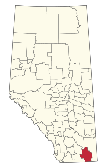
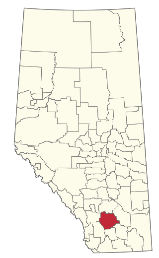
Foothills County is a municipal district in southern Alberta, Canada adjacent to the south side of Calgary in Census Division No. 6. Despite sharing a common border with the City of Calgary, it does not form part of the Calgary census metropolitan area (CMA) as defined by Statistics Canada. It is however a member municipality of the Calgary Metropolitan Region Board.

<span class="mw-page-title-main">County of Grande Prairie No. 1</span> Municipal district in Alberta, Canada

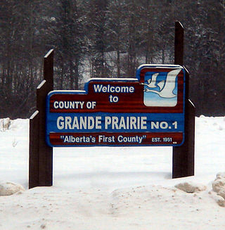
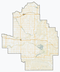
The County of Grande Prairie No. 1 is a municipal district in northwestern Alberta, Canada in Census Division No. 19.

<span class="mw-page-title-main">Red Deer County</span> Municipal district in Alberta, Canada

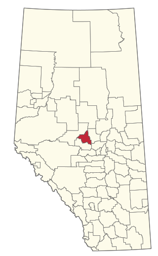
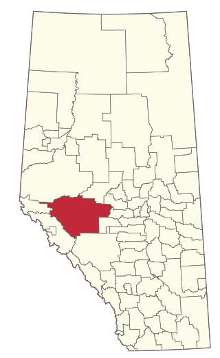
Red Deer County is a municipal district in central Alberta, Canada within Census Division No. 8 and surrounding the City of Red Deer. The neighbouring municipalities of Red Deer County are Clearwater County to the west, Lacombe County to the north, the County of Stettler No. 6 to the east, Kneehill County to the southeast and Mountain View County to the south. It is located approximately midway between Edmonton and Calgary, bisected by the Queen Elizabeth II Highway and bounded on the north and east by the Red Deer River.

<span class="mw-page-title-main">Leduc County</span> Municipal district in Alberta, Canada

Leduc County is a municipal district in Alberta, Canada that is immediately south of the City of Edmonton. It spans 105 km (65 mi) east to west and 32 km (20 mi) north to south, and has a population of 14,416. The municipal district is home to prairie parkland and several lakes and is home to the Edmonton International Airport, the Nisku Industrial Business Park and the Genesee Generating Station.

<span class="mw-page-title-main">Athabasca County</span> Municipal district in Alberta, Canada

Athabasca County is a municipal district in north central Alberta, Canada. It is located northeast of Edmonton and is in Census Division No. 13. Prior to an official renaming on December 1, 2009, Athabasca County was officially known as the County of Athabasca No. 12.

<span class="mw-page-title-main">County of Barrhead No. 11</span> Municipal district in Alberta, Canada

The County of Barrhead No. 11 is a municipal district in north central Alberta, Canada. It is located northwest of Edmonton and is in Census Division No. 13.

<span class="mw-page-title-main">Yellowhead County</span> Municipal district in Alberta, Canada

Yellowhead County is a municipal district in west central Alberta, Canada. It is the only municipal district within Alberta census division No. 14.

<span class="mw-page-title-main">Thorhild County</span> Municipal district in Alberta, Canada

Thorhild County is a municipal district located in the central part of northern Alberta, Canada in Census Division 13. It was incorporated in 1955. It changed its name from the County of Thorhild No. 7 to Thorhild County on March 20, 2013.

<span class="mw-page-title-main">Beaver County, Alberta</span> Municipal district in Alberta, Canada

Beaver County is a municipal district in central-east Alberta, Canada. It is centred on Holden in the western part of Census Division No. 10. Its municipal office is located in Ryley.

<span class="mw-page-title-main">Big Lakes County</span> Municipal district in Alberta, Canada

Big Lakes County, formerly the Municipal District of Big Lakes, is a municipal district in north-central Alberta, Canada.

<span class="mw-page-title-main">Camrose County</span> Municipal district in Alberta, Canada

Camrose County is a municipal district in central Alberta, Canada. It is located in Census Division 10, around the City of Camrose.

<span class="mw-page-title-main">Cardston County</span> Municipal district in Alberta, Canada

Cardston County is a municipal district in southern Alberta, Canada. It is located in Census Division 3 around the Town of Cardston.

<span class="mw-page-title-main">Woodlands County</span> Municipal district in Alberta, Canada

Woodlands County is a municipal district in north-central Alberta, Canada. Located in Census Division No. 13, its municipal office is located outside but adjacent to the Town of Whitecourt. A second municipal office is located in the Hamlet of Fort Assiniboine.

<span class="mw-page-title-main">Mackenzie County</span> Specialized municipality in Alberta, Canada

Mackenzie County is a specialized municipality in northern Alberta, Canada. It is located in Census Division 17, along the Mackenzie Highway. The municipal office is located in the hamlet of Fort Vermilion.

<span class="mw-page-title-main">County of Northern Lights</span> Municipal district in Alberta, Canada

The County of Northern Lights is a municipal district in northwest Alberta, Canada. Located in Census Division 17, its municipal office is located in the Town of Manning.

<span class="mw-page-title-main">Municipal District of Peace No. 135</span> Municipal district in Alberta, Canada

The Municipal District of Peace No. 135 is a municipal district (MD) in northwestern Alberta, Canada. Located in Census Division No. 19, its municipal office is located outside but adjacent to the Village of Berwyn.

<span class="mw-page-title-main">County of Newell</span> Municipal district in Alberta, Canada

The County of Newell is a municipal district in southern Alberta, Canada. Located in Census Division No. 2, its municipal office is located south of the City of Brooks.

<span class="mw-page-title-main">Municipal District of Wainwright No. 61</span> Municipal district in Alberta, Canada

The Municipal District of Wainwright No. 61 is a municipal district (MD) in eastern Alberta, Canada. Located in Census Division No. 7., its municipal office is located in the Town of Wainwright. The municipal district is bisected north-south by the Buffalo Trail and east-west by the Poundmaker Trail.

<span class="mw-page-title-main">Vulcan County</span> Municipal district in Alberta, Canada

Vulcan County is a municipal district in Alberta, Canada. Located in Census Division No. 5, its municipal office is located in the Town of Vulcan.

<span class="mw-page-title-main">Smoky Lake County</span> Municipal district in Alberta, Canada

Smoky Lake County is a municipal district in north-eastern Alberta, Canada. Located in Census Division No. 12, its municipal office is located in the Town of Smoky Lake.

References

  1. "Municipal Officials Search". Alberta Municipal Affairs. May 9, 2019. Retrieved October 1, 2021.
  2. 1 2 3 "Population and dwelling counts: Canada, provinces and territories, and census subdivisions (municipalities)". Statistics Canada. February 9, 2022. Retrieved February 9, 2022.
  3. 1 2 "Specialized and Rural Municipalities and Their Communities" (PDF). Alberta Municipal Affairs. January 12, 2022. Retrieved January 21, 2022.
  4. "Standard Geographical Classification (SGC) 2006, Economic Regions: 4801008 - Forty Mile County No. 8, geographical codes and localities, 2006". Statistics Canada. March 5, 2010. Archived from the original on May 25, 2013. Retrieved August 11, 2012.
  5. "Population and dwelling counts, for Canada, provinces and territories, and census subdivisions (municipalities), 2016 and 2011 censuses – 100% data (Alberta)". Statistics Canada. February 8, 2017. Retrieved February 8, 2017.