
Monmouth County is a county located on the northern part of the Jersey Shore in the U.S. state of New Jersey. The county is part of the New York metropolitan area. As of the 2020 United States census, the county was the state's fifth-most-populous county with a population of 643,615, its highest decennial count ever and an increase of 13,235 (+2.1%) from the 2010 census count of 630,380, which in turn reflected an increase of 15,079 from 615,301 at the 2000 census. As of 2010, the county fell to the fifth-most populous county in the state, having been surpassed by Hudson County. Monmouth County's geographic area comprises 30% water.
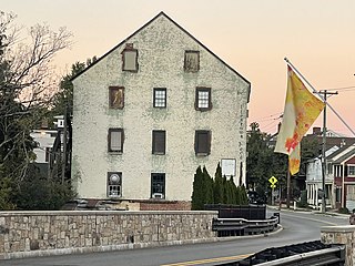
Allentown is a borough, located in western Monmouth County, in the U.S. state of New Jersey, bordering nearby Mercer County. As of the 2020 United States census, the borough's population was 1,734, a decrease of 94 (−5.1%) from the 2010 census count of 1,828, which in turn reflected a decline of 54 (−2.9%) from the 1,882 counted in the 2000 census. The borough is nestled within central New Jersey, and is roughly equidistant between New York City and Philadelphia.
Colts Neck Township is a township in Monmouth County, in the U.S. state of New Jersey. It is located in the New York Metropolitan Area. As of the 2020 United States census, the township's population was 9,957, a decrease of 185 (−1.8%) from the 2010 census count of 10,142, which in turn reflected a decline of 2,189 (−17.8%) from the 12,331 counted in the 2000 census.

Englishtown is a rapidly growing borough in western Monmouth County, in the U.S. state of New Jersey. The community is located within the Raritan Valley region. As of the 2020 United States census, the borough's population was 2,346, its highest decennial count ever and an increase of 499 (+27.0%) from the 2010 census count of 1,847, which in turn reflected reflected an increase of 83 (+4.7%) from the 1,764 counted in the 2000 census.

Farmingdale is a borough in Monmouth County, in the U.S. state of New Jersey. As of the 2020 United States census, the borough's population was 1,504, an increase of 175 (+13.2%) from the 2010 census count of 1,329, which in turn reflected a decline of 258 (−16.3%) from the 1,587 counted in the 2000 census.

Freehold is a borough and the county seat of Monmouth County, in the U.S. state of New Jersey. Known for its Victorian era homes and rich colonial history, the borough is located in the Raritan Valley region within the New York Metropolitan Area, located about 33 miles (53 km) from Manhattan and 17 miles (27 km) from Staten Island. The borough has grown to become a commuter town of New York City. As of the 2020 United States census, the borough's population was 12,538, an increase of 486 (+4.0%) from the 2010 census count of 12,052, which in turn reflected an increase of 1,076 (+9.8%) from the 10,976 counted in the 2000 census.

Freehold Township is a township in Monmouth County, in the U.S. state of New Jersey. Located in Central New Jersey and crisscrossed by several major highways, the township is known for being the regional commercial hub for Monmouth County and as a suburban bedroom community of New York City, located within the Raritan Valley region of the much larger New York Metropolitan Area. The township is located roughly 38 miles (61 km) away from Manhattan and about 20 miles (32 km) away from Staten Island. As of the 2020 United States census, the township's population was 35,369, a decrease of 815 (−2.3%) from the 2010 census count of 36,184, which in turn reflected an increase of 4,647 (+14.7%) from the 31,537 counted in the 2000 census.
Howell Township is a township in Monmouth County, in the U.S. state of New Jersey. The township is the largest municipality in the county by total area, comprised of about 61.21 square miles (158.5 km2). It is located in the New York metropolitan area and has been a steadily growing bedroom community of New York City. As of the 2020 United States census, the township's population was 53,537, its highest decennial count ever and an increase of 2,462 (+4.8%) from the 2010 census count of 51,075, which in turn reflected an increase of 2,172 (+4.4%) from the 48,903 counted in the 2000 census.
Millstone Township is a township in western Monmouth County, in the U.S. state of New Jersey. The Township is located within the Raritan Valley region and is a part of the New York metropolitan area. As of the 2020 United States census, the township's population was 10,376, a decrease of 190 (−1.8%) from the 2010 census count of 10,566, which in turn reflected an increase of 1,596 (+17.8%) from the 8,970 counted in the 2000 census.

Upper Freehold Township is a township in Monmouth County, in the U.S. state of New Jersey. As of the 2020 United States census, the township's population was 7,273, an increase of 371 (+5.4%) from the 2010 census count of 6,902, which in turn reflected an increase of 2,620 (+61.2%) from the 4,282 counted in the 2000 census.

West Freehold is an unincorporated community and census-designated place (CDP) within Freehold Township, in Monmouth County, New Jersey, United States. As of the 2010 United States Census, the CDP's population was 13,613. Due to the community's close proximity to the Battle of Monmouth, West Freehold is home to several important historical structures, which have been preserved in the 'West Freehold Village Historic District'. The historically preserved Monmouth Battlefield, along with the historic villages of Clarksburg, Englishtown, Smithburg and Tennent are a short distance away.

Port Elizabeth is an unincorporated community located within Maurice River Township in Cumberland County, New Jersey, United States. The area is served as United States Postal Service ZIP code 08348.

Basking Ridge is an unincorporated community and census-designated place (CDP) located within Bernards Township in the Somerset Hills region of Somerset County, in the U.S. state of New Jersey.
Allentown High School is a public high school that serves students in ninth through twelfth grades from three communities in Monmouth County, in the U.S. state of New Jersey, operating as part of the Upper Freehold Regional School District. The school serves students from Allentown Borough and Upper Freehold Township. Millstone Township sends students to the district's high school as part of a sending/receiving relationship. The school has been accredited by the Middle States Association of Colleges and Schools Commission on Elementary and Secondary Schools since 1959.
Oak Ridge is an unincorporated community located along the border of West Milford Township in Passaic County and Jefferson Township in Morris County, in the U.S. state of New Jersey. The area is served as United States Postal Service ZIP Code 07438.
Dorothy is an unincorporated community and census-designated place located in Weymouth Township in Atlantic County, in the U.S. state of New Jersey. The area is served as United States Postal Service ZIP Code 08317.

Barclay Farm is an unincorporated community and census-designated place (CDP) located within Cherry Hill, in Camden County, in the U.S. state of New Jersey, that had been part of the Barclay-Kingston CDP until 2000, which was split to form the CDPs of Barclay and Kingston Estates as of the 2010 Census. Until the 2000 census, Barclay was included as part of the Barclay-Kingston CDP. As of the 2010 United States Census, the CDP's population was 4,428.

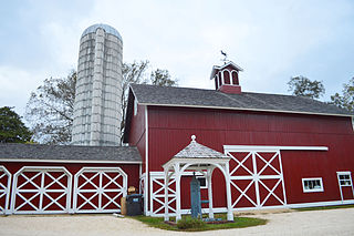
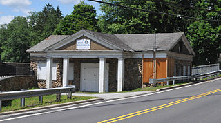
Coxs Corner, also known as Cox's Corner or Wrightsville, is an unincorporated community located within Upper Freehold Township, in Monmouth County, New Jersey, United States. Named for congressman and brigadier general James Cox (1753–1810), who had lived here at the family home of "Box Grove", it is at the juncture of County Route 524 and County Route 43. The Upper Freehold Historic Farmland Byway passes through the area.
Ross Scheuerman is a former professional Canadian football running back. He played college football at Lafayette. Scheuerman was signed by the Pittsburgh Steelers as an undrafted free agent in 2015. He has also been a member of the Green Bay Packers and Philadelphia Eagles. He last played for the Hamilton Tiger-Cats of the Canadian Football League (CFL).

Melinda Konover Meirs, known as Linda K. Meirs, was an American Red Cross and Army nurse during World War I. She was one of the first six American recipients of the Florence Nightingale Medal, awarded by the International Committee of the Red Cross in 1920.


