
Ewing Township is a township in Mercer County, in the U.S. state of New Jersey. The township falls within the New York metropolitan area as defined by the U.S. Census Bureau. It borders the Philadelphia metropolitan area and is part of the Federal Communications Commission's Philadelphia Designated Market Area. As of the 2020 United States census, the township's population was 37,264, its highest decennial count ever and an increase of 1,474 (+4.1%) from the 35,790 recorded at the 2010 census, which in turn reflected an increase of 83 (+0.2%) from the 35,707 counted in the 2000 census.

New Monmouth is an unincorporated community located within Middletown Township in Monmouth County, in the U.S. state of New Jersey. The area is served as United States Postal Service ZIP Code 07748.

Scobeyville is an unincorporated community located within Colts Neck Township in Monmouth County, in the U.S. state of New Jersey. The settlement is named for the Scobey family which has inhabited the township since the 1700s. The site housed a one-room schoolhouse, a post office, and a general store. It was known for good fishing on the Yellow Brook which has its basin in Scobyville.
Montrose is an unincorporated community located near the intersection of Dutch Lane Road and Boundary Road along the border of Colts Neck and Marlboro townships in Monmouth County, in the U.S. state of New Jersey. The town was located in "Atlantic Township" at one time prior to the name being changed to "Colts Neck". Prior to being called Montrose, the area was called "Barrentown".

Prospertown is an unincorporated community located within the New Jersey townships of Jackson and Plumsted in Ocean County and Upper Freehold in Monmouth County. The community is home to Prospertown Lake and is adjacent to Six Flags Great Adventure, both located on County Route 537. The center of the community is located at the intersection of CR 537, Hawkin Road, and Emleys Hill Road. Most of the area consists of pine forests but there are some homes along the roads in the area.

Cranbury Station is an unincorporated community located within Cranbury Township in Middlesex County, in the U.S. state of New Jersey. The area immediately around the site of the former railroad station along the Camden and Amboy Railroad contains agricultural businesses and small homes. Hightstown-Cranbury Station Road is the main road through the settlement paralleling the railroad and Station Road as a major road heading east and west through the area. Modern warehouses line Station Road and the nearby New Jersey Turnpike west of the station while large housing developments are located east of here in Monroe Township.
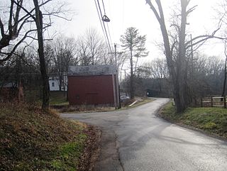
Bowne is an unincorporated community located at the intersection of the boundaries of Delaware, East Amwell and West Amwell townships in Hunterdon County, in the U.S. state of New Jersey.

Hoffman is an unincorporated community located within Monroe Township in Middlesex County, in the U.S. state of New Jersey. The settlement is located at the site of a former railroad station on the Freehold and Jamesburg Agricultural Railroad. Today, most of the area is made up of homes and housing developments along Hoffman Station Road and Gravel Hill-Spotswood Road. Forestland and the Manalapan Brook valley make up the remainder of the area.
Half Acre is an unincorporated community located within Monroe Township in Middlesex County, in the U.S. state of New Jersey. The settlement is located roughly at the intersection of Prospect Plains Road and Half Acre Road in the center of the township. Some single-family homes and small businesses are located along those two roads and Cranbury-Half Acre Road but most of the area is made up of age-restricted housing developments including Concordia, Clearbrook Park, Greenbriar at Whittingham, and Encore at Monroe.

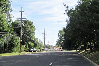
Prospect Plains is an unincorporated community located within Monroe Township in Middlesex County, in the U.S. state of New Jersey. The settlement is located at the intersection of Prospect Plains Road and Applegarth Road. Retail businesses generally line the two aforementioned county roads in the area but some single-family houses are clustered around the site of the Camden & Amboy railroad crossing of Prospect Plains Road.

Dutchtown is an unincorporated community located within Montgomery Township in Somerset County, in the U.S. state of New Jersey. The area consists mainly of forested land with some houses grouped around the intersection of Dutchtown-Zion Road and Belle Mead-Blawenberg Road in the northern portion of the township. Also nearby are the Unionville Cemetery and a rock quarry. The Dirck Gulick House was added to the National Register of Historic Places in 2003.

Union Valley is an unincorporated community located within Monroe Township in Middlesex County, in the U.S. state of New Jersey. Two large age-restricted communities lie within the settlement today, Clearbrook Park and Concordia. Other than those two communities, the only other buildings in the area are medical offices and facilities and some single-family homes along Union Valley Road.

Bergerville is an unincorporated community located within Howell Township in Monmouth County, in the U.S. state of New Jersey. The area was originally developed as a resort bungalow community in the first half of the 20th century.

Ely is an unincorporated community located within Millstone Township in Monmouth County, in the U.S. state of New Jersey. The settlement is named for the Ely family that owned property in the area and operated the Charleston Springs hotel. Today, the settlement is located along Stage Coach Road, County Route 524, in the eastern portion of the township. Most of the area consists of large single-family homes though some farmland and the township-owned Brandywine Soccer Complex are located in the near the settlement.

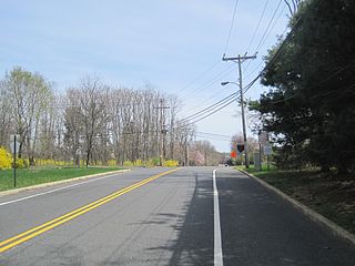
Fairfield is an unincorporated community located within Howell Township in Monmouth County, in the U.S. state of New Jersey. The community is centered on the intersection of County Route 524 (CR 524) and Ketchum Road, where the Colonial Era Our House Tavern is located. The area includes several small businesses, township offices and schools. There are also small farms and residential developments in the area. Fairfield was a stop on the Freehold and Jamesburg Agricultural Railroad.

West Farms is an unincorporated community located within Howell Township in Monmouth County, in the U.S. state of New Jersey. The settlement is centered on the intersection of West Farms Road and Casino Drive, located to the west of Farmingdale and to the north of the Manasquan Reservoir. It was once home Jewish farmers who settled there in the early 20th century. The rural area is mostly made up of wooded areas with some houses and churches dotted along the two aforementioned roads. Numerous small farms are also located throughout the area.

Beaverville is an unincorporated community located within Southampton Township in Burlington County, in the U.S. state of New Jersey. The area is composed of single-family homes, small businesses and warehouses, forest, and farmland. The community is located along Red Lion Road two miles (3.2 km) south of Vincentown, to the west of U.S. Route 206, and southeast of the Red Lion Airport. Originally, the settlement was the site of a one-room schoolhouse.

Bullock is an unincorporated community that straddles Woodland Township, Burlington County and Manchester Township, Ocean County in the middle of the New Jersey Pine Barrens. Much of the area surrounding Bullock is a part of the Brendan T. Byrne State Forest though there are some clearings for small houses along Savoy Boulevard in Woodland Township and Pasadena Road in Manchester Township. The settlement is located where these two roads, the New Jersey Southern Railroad, and the Keith line converge.

Davisville is an unincorporated community located within Chesterfield Township in Burlington County, in the U.S. state of New Jersey. The settlement, located at the intersection of County Route 528 and Chesterfield-Arneytown Road, is in a rural area in the eastern portion of the township. It consists mainly of farmland with some houses dotting the few roads that pass through the area.

Red Lion is an unincorporated community located within Southampton Township in Burlington County, in the U.S. state of New Jersey.


