Leonardo, New Jersey | |
---|---|
Location in Monmouth County Location in New Jersey | |
Coordinates: 40°25′09″N74°03′37″W / 40.419287°N 74.060197°W | |
Country | United States |
State | New Jersey |
County | Monmouth |
Township | Middletown |
Named for | Henry and James Leonard |
Area | |
• Total | 0.60 sq mi (1.56 km2) |
• Land | 0.59 sq mi (1.54 km2) |
• Water | 0.01 sq mi (0.02 km2) 1.38% |
Elevation | 16 ft (5 m) |
Population | |
• Total | 2,549 |
• Density | 4,291.25/sq mi (1,655.60/km2) |
Time zone | UTC−05:00 (Eastern (EST)) |
• Summer (DST) | UTC−04:00 (Eastern (EDT)) |
ZIP Code | 07737 [4] |
Area code(s) | 732/848 |
FIPS code | 34-39990 [5] [6] [7] |
GNIS feature ID | 02390059 [5] [8] |
Leonardo is an unincorporated community and census-designated place (CDP) [9] located within Middletown Township, in Monmouth County, in the U.S. state of New Jersey. It is part of the Jersey Shore region of the state. [10] [11] [12] As of the 2010 United States census, the CDP's population was 2,757. [13] The ZIP Code for Leonardo is 07737. [4]
Leonardo is named for Henry and James Leonard, the first ironmasters of New Jersey. [14]
During World War II, the large dock complex of Naval Weapons Station Earle was built to supply ammunition to the forces.
Leonardo is known as the site of the only casualties of the US Nike Missile program. On May 22, 1958, an Ajax missile exploded at the Nike missile base in Leonardo, killing six soldiers and four civilians. [15] [16] Since the Project Nike shutdown in 1974, the Leonardo launch base, designated NY-53, has been redeveloped into single-family home sites.
Leonardo is located on the south shore of Raritan Bay. According to the United States Census Bureau, Leonardo had a total area of 0.603 square miles (1.562 km2), including 0.595 square miles (1.540 km2) of land and 0.008 square miles (0.021 km2) of water (1.38%). [5] [17]
Climate data for Leonardo, NJ (2018-present) | |||||||||||||
---|---|---|---|---|---|---|---|---|---|---|---|---|---|
Month | Jan | Feb | Mar | Apr | May | Jun | Jul | Aug | Sep | Oct | Nov | Dec | Year |
Mean daily maximum °F (°C) | 38 (3) | 41 (5) | 48 (9) | 60 (16) | 70 (21) | 79 (26) | 85 (29) | 83 (28) | 75 (24) | 65 (18) | 53 (12) | 44 (7) | 62 (17) |
Mean daily minimum °F (°C) | 25 (−4) | 26 (−3) | 32 (0) | 40 (4) | 50 (10) | 59 (15) | 67 (19) | 65 (18) | 57 (14) | 48 (9) | 37 (3) | 29 (−2) | 45 (7) |
Average precipitation inches (mm) | 3.2 (81) | 2.4 (61) | 3.5 (89) | 3.2 (81) | 3.6 (91) | 3.5 (89) | 3.9 (99) | 3.9 (99) | 3.6 (91) | 3.0 (76) | 2.7 (69) | 3.5 (89) | 40 (1,015) |
Source: Leonardo Marina Station [18] |
Census | Pop. | Note | %± |
---|---|---|---|
1990 | 3,788 | — | |
2000 | 2,823 | −25.5% | |
2010 | 2,757 | −2.3% | |
2020 | 2,549 | −7.5% | |
Population sources: 1990-2010 [10] 2000 [19] 2010 [13] 2020 [3] |
The 2010 United States census counted 2,757 people, 1,001 households, and 742 families in the CDP. The population density was 4,636.1 per square mile (1,790.0/km2). There were 1,055 housing units at an average density of 1,774.1 per square mile (685.0/km2). The racial makeup was 95.47% (2,632) White, 1.02% (28) Black or African American, 0.15% (4) Native American, 1.02% (28) Asian, 0.00% (0) Pacific Islander, 0.91% (25) from other races, and 1.45% (40) from two or more races. Hispanic or Latino of any race were 6.49% (179) of the population. [13]
Of the 1,001 households, 31.0% had children under the age of 18; 57.6% were married couples living together; 12.1% had a female householder with no husband present and 25.9% were non-families. Of all households, 20.0% were made up of individuals and 5.8% had someone living alone who was 65 years of age or older. The average household size was 2.75 and the average family size was 3.21. [13]
22.8% of the population were under the age of 18, 8.7% from 18 to 24, 25.1% from 25 to 44, 33.0% from 45 to 64, and 10.4% who were 65 years of age or older. The median age was 40.2 years. For every 100 females, the population had 94.2 males. For every 100 females ages 18 and older there were 95.3 males. [13]
As of the 2000 United States Census [6] there were 2,823 people, 987 households, and 753 families living in the CDP. The population density was 1,758.0/km2 (4,523.1/mi2). There were 1,017 housing units at an average density of 633.3/km2 (1,629.5/mi2). The racial makeup of the CDP was 95.85% White, 0.53% African American, 0.25% Native American, 0.50% Asian, 0.11% Pacific Islander, 0.46% from other races, and 0.89% from two or more races. Hispanic or Latino of any race were 4.85% of the population. [19]
There were 987 households, out of which 35.9% had children under the age of 18 living with them, 61.5% were married couples living together, 10.4% had a female householder with no husband present, and 23.7% were non-families. 19.1% of all households were made up of individuals, and 4.9% had someone living alone who was 65 years of age or older. The average household size was 2.86 and the average family size was 3.31. [19]
In the CDP the population was spread out, with 25.9% under the age of 18, 7.7% from 18 to 24, 33.3% from 25 to 44, 24.7% from 45 to 64, and 8.4% who were 65 years of age or older. The median age was 37 years. For every 100 females, there were 100.4 males. For every 100 females age 18 and over, there were 98.8 males. [19]
The median income for a household in the CDP was $64,432, and the median income for a family was $66,750. Males had a median income of $49,716 versus $30,400 for females. The per capita income for the CDP was $23,422. About 3.4% of families and 4.1% of the population were below the poverty line, including 5.7% of those under age 18 and 3.8% of those age 65 or over. [19]
The area is served by the Middletown Township Public School District.
Leonardo is home to Bayshore Middle School and Leonardo Elementary School. Bayshore Middle School has a population of 623 students [20] and is ranked the 267th middle school out of 745 in the State of New Jersey. Leonardo Elementary school has a population of 285 students and is ranked 790th out of 1360 elementary schools in New Jersey. [20]
New Jersey Transit offers local bus service on the 834 route. [21]
People who were born in, residents of, or otherwise closely associated with Leonardo include:
Fictional characters associated with Leonardo:
The community is best known as the site of the Quick Stop convenience store and RST Video store (located at 58 Leonard Avenue, just north of Route 36) that was the main location for the 1994 film Clerks , directed by Kevin Smith, who worked at the store at the time. The same store was also used by Smith in his films Chasing Amy (1997), Jay and Silent Bob Strike Back (2001), Clerks II (2006) and Jay and Silent Bob Reboot (2019), and was part of a deleted scene from his film Mallrats (1995).[ citation needed ] The location was also used in Kevin Smith's short-lived television show Clerks: The Animated Series (2000), which ran for six episodes on ABC before its abrupt cancellation in mid-2000. The program's character Leonardo Leonardo (voiced by actor Alec Baldwin) was named after the town, and several of the characters resided and/or worked in Leonardo. The video store is now closed and only used for storage. [26] [27]
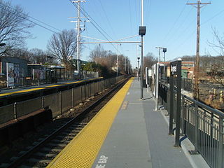
Avenel is an unincorporated community and census-designated place (CDP) located within Woodbridge Township, in Middlesex County, in the U.S. state of New Jersey. Avenel is approximately 25 miles (40 km) southwest of Midtown Manhattan along the North Jersey Coast rail line
Cliffwood Beach is an unincorporated community and census-designated place (CDP) located within Aberdeen Township in Monmouth County, in the U.S. state of New Jersey. As of the 2010 U.S. census, the CDP's population was 3,194.
East Freehold is an unincorporated community and census-designated place (CDP) located within Freehold Township, in Monmouth County, in the U.S. state of New Jersey. As of the 2010 United States Census, the CDP's population was 4,894.
Fairview is an unincorporated community and census-designated place (CDP) located within Middletown Township, in Monmouth County, in the U.S. state of New Jersey. As of the 2010 United States Census, the CDP's population was 3,806.
Keansburg is a borough in Monmouth County, in the U.S. state of New Jersey. As of the 2020 United States census, the borough's population was 9,755, a decrease of 350 (−3.5%) from the 2010 census count of 10,105, which in turn reflected a decline of 627 (−5.8%) from 10,732 in the 2000 census.
Lincroft is an unincorporated community and census-designated place (CDP) within Middletown Township, in Monmouth County, in the U.S. state of New Jersey. As of the 2020 United States census, the CDP had a population of 7,060, reflecting a 15.1% increase from the 6,135 residents enumerated at the 2010 U.S. Census, in turn a decline of 120 residents (-1.9%) from the 6,255 counted in the 2000 U.S. Census.
Middletown Township is a township in northern Monmouth County, in the U.S. state of New Jersey. As of the 2020 United States census, the township was the state's 20th-most-populous municipality and the largest in the county, with a population of 67,106, an increase of 584 (+0.9%) from the 2010 census count of 66,522, which in turn reflected an increase of 195 residents (0.3%) from its population of 66,327 in the 2000 census, when it was the state's 17th-most-populous municipality.
Morganville is an unincorporated community and census-designated place (CDP) within Marlboro Township, in Monmouth County, New Jersey. As of the 2010 United States Census, the CDP's population was 5,040.
Navesink is an unincorporated community and census-designated place (CDP) located on the northernmost stretch of the Jersey Shore in Middletown Township in Monmouth County, in the U.S. state of New Jersey. As of the 2020 United States census, the CDP's population was 2,004, reflecting a decrease of 16 (-0.8%) from thd 2,020 residents enumerated at the 2010 U.S. census.
North Middletown is an unincorporated community and census-designated place (CDP) within Middletown Township, in Monmouth County, in the U.S. state of New Jersey. As of the 2010 United States Census, the CDP's population was 3,295.
Port Monmouth is an unincorporated community and census-designated place (CDP) within Middletown Township, in Monmouth County, in the U.S. state of New Jersey. At the 2010 census, the CDP's population was 3,818.
Shrewsbury Township is a township situated in the Jersey Shore region, within Monmouth County, in the U.S. state of New Jersey. As of the 2020 United States census, the township's population was 1,076, a decrease of 65 (−5.7%) from the 2010 census count of 1,141, which in turn reflected an increase of 43 (+3.9%) from the 1,098 counted in the 2000 census.
West Belmar is an unincorporated community and census-designated place (CDP) within Wall Township, in Monmouth County, in the U.S. state of New Jersey. At the 2010 census, the CDP's population was 2,493.
West Freehold is an unincorporated community and census-designated place (CDP) within Freehold Township, in Monmouth County, New Jersey, United States. As of the 2010 United States Census, the CDP's population was 13,613. Due to the community's close proximity to the Battle of Monmouth, West Freehold is home to several important historical structures, which have been preserved in the 'West Freehold Village Historic District'. The historically preserved Monmouth Battlefield, along with the historic villages of Clarksburg, Englishtown, Smithburg and Tennent are a short distance away.
Allenwood is an unincorporated community and census-designated place (CDP) located within Wall Township, in Monmouth County, in the U.S. state of New Jersey. As of the 2010 United States Census, the CDP's population was 925.
Belford is an unincorporated community and census-designated place (CDP) located within Middletown Township, in Monmouth County, in the U.S. state of New Jersey. As of the 2010 United States census, the CDP's population was 1,768.
Shrewsbury is a borough in eastern Monmouth County, in the U.S. state of New Jersey. Located within the heart of the northern Shore region, the borough is a bedroom community of New York City. As of the 2020 United States census, the borough's population was 4,184, its highest decennial count ever and an increase of 375 (+9.8%) from the 2010 census count of 3,809, which in turn reflected an increase of 219 (+6.1%) from the 3,590 counted in the 2000 census.
Yorketown is an unincorporated community and census-designated place (CDP) within Manalapan Township, in Monmouth County, in the U.S. state of New Jersey. At the 2020 census, the CDP's population was 6,739.
Forked River is an unincorporated community and census-designated place (CDP) located within Lacey Township, in Ocean County, in the U.S. state of New Jersey. As of the 2020 United States census, the CDP's population was 5,274, an increase of 30 (+0.6%) from the 5,244 enumerated at the 2010 census, which in turn reflected an increase of 330 (+6.7%) from the 4.914 counted in the 2000 census.
Pomona is an unincorporated community and census-designated place (CDP) located within Galloway Township, in Atlantic County, in the U.S. state of New Jersey. As of the 2010 United States Census, the CDP's population was 7,124. The area is served as United States Postal Service ZIP Code 08240.