Cutler, Ohio

Last updated

Location of Cutler, Ohio OHMap-doton-Cutler.png
Location of Cutler, Ohio
Houses and the general store, seen from the south Cutler overview from south.jpg
Houses and the general store, seen from the south

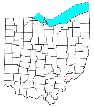
Cutler is an unincorporated community in southwestern Fairfield Township, Washington County, Ohio, United States. [1] It has a post office with the ZIP code 45724. [2] It lies at the intersection of State Route 555 and County Road 59 near Gilbert Run, a subsidiary of the Little Hocking River, which meets the Ohio River at Little Hocking to the southeast. [3]

Contents

History

Cutler was originally called Harshaville, and under the latter name was laid out in 1857, and named for Dr. John M. Harsha, the original owner of the town site. [4] The present name honors William P. Cutler, an early settler. [4] A post office called Cutler has been in operation since 1863. Was recently closed. [5]

Education

Cutler is a part of the Warren Local School System.

Related Research Articles

<span class="mw-page-title-main">Oregonia, Ohio</span> Unincorporated community in Ohio, US

Oregonia is an unincorporated community in northwestern Washington Township, Warren County, Ohio, United States, on the east shore of the Little Miami River about five miles northeast of Lebanon and six miles south of Waynesville. The ZIP Code for Oregonia is 45054.

<span class="mw-page-title-main">Long Bottom, Ohio</span> Unincorporated community in Ohio, U.S.

Long Bottom is an unincorporated community in southern Olive Township, Meigs County, Ohio, United States. It has a post office with the ZIP code 45743.

<span class="mw-page-title-main">Chester, Ohio</span> Unincorporated community in Ohio, U.S.

Chester is an unincorporated community in central Chester Township, Meigs County, Ohio, United States. It lies along the Shade River at the intersection of State Routes 7 and 248. It has a post office with the ZIP code 45720.

<span class="mw-page-title-main">Union Furnace, Ohio</span> Unincorporated community in Ohio, U.S.

Union Furnace is an unincorporated community in northern Starr Township, Hocking County, Ohio, United States. It has a post office with the ZIP code 43158. It is located along State Route 328, which forms the main street in Union Furnace.

<span class="mw-page-title-main">Haydenville, Ohio</span> United States historic place

Haydenville is an unincorporated community and census-designated place (CDP) in southern Green Township, Hocking County, Ohio, United States. As of the 2020 census the population of the CDP was 337.

<span class="mw-page-title-main">Sharpsburg, Athens County, Ohio</span> Unincorporated community in Ohio, U.S.

Sharpsburg is an unincorporated community in northwestern Bern Township, Athens County, Ohio, United States. There is a convenience store there, with gas pumps, and also containing the post office with the ZIP code 45777. Additionally there is a church, the Bern Township office, and a few houses.

<span class="mw-page-title-main">Shade, Ohio</span> Unincorporated community in Ohio, U.S.

Shade is an unincorporated community in southern Lodi Township, Athens County, Ohio, United States. It has a post office with the ZIP code 45776. It lies along U.S. Route 33.

<span class="mw-page-title-main">Hockingport, Ohio</span> Census-designated place in Ohio, United States

Hockingport is a census-designated place in southeastern Troy Township, Athens County, Ohio, United States. As of the 2020 census it had a population of 205. It has a post office with the ZIP code 45739. It is located at the intersection of State Routes 124 and 144.

<span class="mw-page-title-main">Guysville, Ohio</span> Unincorporated community in Ohio, U.S.

Guysville is an unincorporated community in southern Rome Township, Athens County, Ohio, United States. It has a post office with the ZIP code 45735.

<span class="mw-page-title-main">Carbondale, Ohio</span> Unincorporated community in Ohio, U.S.

Carbondale is an unincorporated community in northwestern Waterloo Township, Athens County, Ohio, United States. It has a post office with the ZIP code 45717. It is located a short distance north of State Route 56.

<span class="mw-page-title-main">New Plymouth, Ohio</span> Unincorporated community in Ohio, U.S.

New Plymouth is an unincorporated community in northwestern Brown Township, Vinton County, Ohio, United States. It has a post office with the ZIP code 45654. It is located at the intersection of State Routes 56 and 328.

<span class="mw-page-title-main">Jasper, Ohio</span> Unincorporated community in Ohio, U.S.

Jasper is an unincorporated community in eastern Newton Township, Pike County, Ohio, United States. It has a post office with the ZIP code 45642. It lies at the intersection of State Routes 32, 104, and 124 along the banks of the Scioto River.

<span class="mw-page-title-main">Wingett Run, Ohio</span> Unincorporated community in Ohio, U.S.

Wingett Run is an unincorporated community in western Ludlow Township, Washington County, Ohio, United States. It has a post office with the ZIP code 45789. It is located along State Route 26 and the Little Muskingum River.

<span class="mw-page-title-main">Whipple, Ohio</span> Unincorporated community in Ohio, U.S.

Whipple is an unincorporated community in southern Salem Township, Washington County, Ohio, United States. Although it is unincorporated, it once had a post office, with the ZIP code 45788. It lies on State Route 821 south of the village of Lower Salem, at the junction of Whipple Run with Duck Creek. The community took its name from nearby Whipple Run.

<span class="mw-page-title-main">Little Hocking, Ohio</span> Census-designated place in Ohio, US

Little Hocking is a census-designated place in southern Belpre Township, Washington County, Ohio, United States. It has a post office with the ZIP code 45742. The population of the CPD was 244 at the 2020 census.

<span class="mw-page-title-main">Bartlett, Ohio</span> Unincorporated community in Ohio, U.S.

Bartlett is an unincorporated community in southwestern Wesley Township, Washington County, Ohio, United States. It has a post office with the ZIP code 45713. It sits at the intersection of State Routes 550 and 555 near Coal Run, a subsidiary of Wolf Creek, which meets the Muskingum River at Waterford to the north. Near Bartlett is located the Shinn Covered Bridge, which spans Wolf Creek.

<span class="mw-page-title-main">Barlow, Ohio</span> Unincorporated community in Ohio, U.S.

Barlow is an unincorporated community in western Barlow Township, Washington County, Ohio, United States. Although it is unincorporated, it has a ZIP code 45712. It lies at the intersection of State Routes 339 and 550 near the South Fork of Wolf Creek, which meets the Muskingum River at Waterford to the north.

<span class="mw-page-title-main">Londonderry, Ross County, Ohio</span> Unincorporated community in Ohio, U.S.

Londonderry is an unincorporated community in eastern Liberty Township, Ross County, Ohio, United States. It has a post office with the ZIP code 45647. It lies along U.S. Route 50 at its intersection with State Route 327.

<span class="mw-page-title-main">Chandlersville, Ohio</span> Unincorporated community in Ohio, U.S.

Chandlersville is an unincorporated community in western Salt Creek Township, Muskingum County, Ohio, United States. It has a post office with the ZIP code 43727. It lies along State Route 146 at its intersection with State Routes 284 and 313.

<span class="mw-page-title-main">Little Hocking River</span> River in Ohio, United States

The Little Hocking River is a small tributary of the Ohio River, 18.4 miles (29.6 km) long, in southeastern Ohio in the United States. Via the Ohio River, it is part of the watershed of the Mississippi River, draining an area of 102 square miles (260 km2) on the unglaciated portion of the Allegheny Plateau. The river flows for its entire length in southwestern Washington County; its tributaries also drain a small area of southeastern Athens County.

References

  1. U.S. Geological Survey Geographic Names Information System: Cutler, Ohio
  2. Zip Code Lookup Archived 2007-10-08 at the Wayback Machine
  3. DeLorme, Ohio Atlas & Gazetteer, 7th ed. Yarmouth, Maine, 2004, p. 71 ISBN   0-89933-281-1
  4. 1 2 History of Washington County, Ohio: With Illustrations and Biographical Sketches. H.Z. Williams. 1881. pp. 729–730.
  5. "Washington County". Jim Forte Postal History. Archived from the original on January 18, 2016. Retrieved December 29, 2015.

39°21′15″N81°47′24″W / 39.35417°N 81.79000°W / 39.35417; -81.79000