Reno, Ohio

Last updated

Reno, Ohio
CDP
OHMap-doton-Reno.png
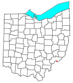
Location of Reno, Ohio
Coordinates: 39°22′28″N81°23′37″W / 39.37444°N 81.39361°W / 39.37444; -81.39361
Country United States
State Ohio
County Washington
Township Marietta
Elevation
[1]
650 ft (200 m)
Population
 (2020) [2]
  Total1,129
Time zone UTC-5 (Eastern (EST))
  Summer (DST) UTC-4 (EDT)
ZIP code
45773
GNIS feature ID2633221 [1]

Reno is a census-designated place in southern Marietta Township, Washington County, Ohio, United States. It has a post office with the ZIP code 45773. [3] It is located on the Ohio River a short distance south of the county seat of Marietta. State Route 7 forms its main street. [4] The population was 1,129 at the 2020 census.

Contents

History

Reno was originally called Jericho; the present name, honoring United States Army officer Jesse L. Reno, was adopted when at the time the post office was established. [5] A post office called Reno has been in operation since 1887. [6]

Related Research Articles

<span class="mw-page-title-main">Washington County, Ohio</span> County in Ohio, United States

Washington County is a county located in the southeastern part of the U.S. state of Ohio. As of the 2020 census, the population was 59,711. Its county seat is Marietta. The county, the oldest in the state, is named for George Washington. Washington County comprises the Marietta, OH Micropolitan Statistical Area, which is also included in the Parkersburg-Marietta-Vienna, WV-OH Combined Statistical Area.

<span class="mw-page-title-main">Devola, Ohio</span> CDP in Ohio, United States

Devola is a census-designated place (CDP) in Washington County, Ohio, United States, along the Muskingum River. It is part of the Parkersburg-Marietta-Vienna, WV-OH Metropolitan Statistical Area. The population was 2,639 at the 2020 census.

<span class="mw-page-title-main">Marietta Township, Washington County, Ohio</span> Township in Ohio, United States

Marietta Township is one of the twenty-two townships of Washington County, Ohio, United States. The 2020 census found 4,265 people in the township.

<span class="mw-page-title-main">Vickery, Ohio</span> CDP in Ohio, United States

Vickery is an unincorporated community and a census-designated place in western Townsend Township, Sandusky County, Ohio, United States. It has a post office with the ZIP code 43464 and a volunteer fire department called Townsend Township FD. The population of the CPD was 101 at the 2020 census.

<span class="mw-page-title-main">Tippecanoe, Ohio</span> Census-designated place in Ohio, United States

Tippecanoe is an unincorporated community and census-designated place (CDP) in central Washington Township, Harrison County, Ohio, United States. It is located along State Route 800 in the valley of Stillwater Creek, a north-flowing tributary of the Tuscarawas River. It had a post office until 2011 with the ZIP code 44699. The population was 83 at the 2020 census.

<span class="mw-page-title-main">Dola, Ohio</span> Census-designated place in Ohio, United States

Dola is a census-designated place in central Washington Township, Hardin County, Ohio, United States. As of the 2020 United States Census it had a population of 143. It has a post office with the ZIP code 45835.

Buffalo is an unincorporated community and census-designated place in eastern Valley Township, Guernsey County, Ohio, United States. As of the 2020 census it had a population of 373. It has a post office with the ZIP code 43722. It lies along State Route 313.

<span class="mw-page-title-main">Lansing, Ohio</span> Unincorporated community and census-designated place in Ohio, United States

Lansing is a census-designated place in northern Pease Township, Belmont County, Ohio, United States, along Wheeling Creek. As of the 2020 census it had a population of 596. It has a post office with the ZIP code 43934.

<span class="mw-page-title-main">Rockbridge, Ohio</span> Census-designated place in Ohio, United States

Rockbridge is an unincorporated community and census-designated place (CDP) in eastern Good Hope Township, Hocking County, Ohio, United States. It has a post office with the ZIP code 43149. It is located at the interchange of U.S. Route 33 and State Route 374, between Logan and Lancaster. As of the 2020 census the population of the CDP was 160.

<span class="mw-page-title-main">East Rochester, Ohio</span> Census-designated place in Ohio, United States

East Rochester is an unincorporated community and census-designated place (CDP) in southern West Township, Columbiana County, Ohio, United States. The population was 224 as of the 2020 census. It lies along U.S. Route 30, and has a post office with the ZIP code 44625. It is a part of the Salem micropolitan area, about 20 miles (32 km) east of Canton.

<span class="mw-page-title-main">Stewart, Ohio</span> Census-designated place in Ohio, United States

Stewart is an unincorporated community and census-designated place in central Rome Township, Athens County, Ohio, United States. The population was 221 at the 2020 census. It has a post office with the ZIP code 45778.

<span class="mw-page-title-main">Hockingport, Ohio</span> Census-designated place in Ohio, United States

Hockingport is a census-designated place in southeastern Troy Township, Athens County, Ohio, United States. As of the 2020 census it had a population of 205. It has a post office with the ZIP code 45739. It is located at the intersection of State Routes 124 and 144.

<span class="mw-page-title-main">Sardis, Ohio</span> Census-designated place in Ohio, United States

Sardis is a census-designated place (CDP) in southeastern Lee Township, Monroe County, Ohio, United States. It is unincorporated, but has a post office with the ZIP code of 43946. As of the 2020 census, it had a population of 522.

<span class="mw-page-title-main">Whipple, Ohio</span> Unincorporated community in Ohio, U.S.

Whipple is an unincorporated community in southern Salem Township, Washington County, Ohio, United States. Although it is unincorporated, it once had a post office, with the ZIP code 45788. It lies on State Route 821 south of the village of Lower Salem, at the junction of Whipple Run with Duck Creek. The community took its name from nearby Whipple Run.

<span class="mw-page-title-main">Waterford, Ohio</span> Census-designated place in Ohio, US

Waterford is a census-designated place in central Waterford Township, Washington County, Ohio, United States. It is located on State Route 339 across the Muskingum River from the village of Beverly, slightly below where Wolf Creek meets the Muskingum. The population was 384 at the 2020 census.

<span class="mw-page-title-main">Vincent, Ohio</span> Census-designated place in Ohio, US

Vincent is a census-designated place in southern Barlow Township, Washington County, Ohio, United States. It lies along State Route 339 near Tupper Creek, a subsidiary of the Little Hocking River, which in turn meets the Ohio River at Little Hocking to the south. The population was 329 at the 2020 census.

<span class="mw-page-title-main">Newport, Washington County, Ohio</span> CDP in Ohio, United States

Newport is a census-designated place in eastern Newport Township, Washington County, Ohio, United States. It has a post office with the ZIP code 45768. Newport lies along the Ohio River several miles above the county seat of Marietta. Today its main street is designated as State Route 7. The population of the CPD was 895 at the 2020 census.

<span class="mw-page-title-main">Little Hocking, Ohio</span> Census-designated place in Ohio, US

Little Hocking is a census-designated place in southern Belpre Township, Washington County, Ohio, United States. It has a post office with the ZIP code 45742. The population of the CPD was 244 at the 2020 census.

<span class="mw-page-title-main">Coal Run, Ohio</span> Unincorporated community in Ohio, US

Coal Run is an unincorporated community in northeastern Waterford Township, Washington County, Ohio, United States. It has a post office with the ZIP code 45721. It is located along State Route 60 between the villages of Beverly and Lowell. The Muskingum River flows past the community.

<span class="mw-page-title-main">Bartlett, Ohio</span> Unincorporated community in Ohio, U.S.

Bartlett is an unincorporated community in southwestern Wesley Township, Washington County, Ohio, United States. It has a post office with the ZIP code 45713. It sits at the intersection of State Routes 550 and 555 near Coal Run, a subsidiary of Wolf Creek, which meets the Muskingum River at Waterford to the north. Near Bartlett is located the Shinn Covered Bridge, which spans Wolf Creek.

References

  1. 1 2 U.S. Geological Survey Geographic Names Information System: Reno, Ohio
  2. "Reno CPD, Ohio - Census Bureau Profile". United States Census Bureau. Retrieved September 10, 2023.
  3. Zip Code Lookup
  4. DeLorme, Ohio Atlas & Gazetteer, 7th ed., 2004, p. 81 ISBN   0-89933-281-1
  5. "How communities got their names". Marietta Times. February 19, 2013. Retrieved December 29, 2015.
  6. "Washington County". Jim Forte Postal History. Retrieved December 29, 2015.

See also