Vincent, Ohio

Last updated

Vincent, Ohio
CDP
OHMap-doton-Vincent.png
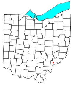
Location of Vincent, Ohio
Coordinates: 39°22′34″N81°40′11″W / 39.37611°N 81.66972°W / 39.37611; -81.66972
Country United States
State Ohio
County Washington
Township Barlow
Elevation
[1]
764 ft (233 m)
Population
 (2020) [2]
  Total329
Time zone UTC-5 (Eastern (EST))
  Summer (DST) UTC-4 (EDT)
ZIP code
45784
GNIS feature ID2628983 [1]

Vincent is a census-designated place in southern Barlow Township, Washington County, Ohio, United States. It lies along State Route 339 near Tupper Creek, a subsidiary of the Little Hocking River, which in turn meets the Ohio River at Little Hocking to the south. [3] The population was 329 at the 2020 census.

Contents

History

Vincent had its start when the Marietta & Cincinnati Railroad was extended to that point. [4] The community was founded as Vincents Station in 1853 by Henry Earle Vincent, and named for him. [5] A post office called Vincent has been in operation since 1857. [6]

Education

Related Research Articles

<span class="mw-page-title-main">Washington County, Ohio</span> County in Ohio, United States

Washington County is a county located in the southeastern part of the U.S. state of Ohio. As of the 2020 census, the population was 59,711. Its county seat is Marietta. The county, the oldest in the state, is named for George Washington. Washington County comprises the Marietta, OH Micropolitan Statistical Area, which is also included in the Parkersburg-Marietta-Vienna, WV-OH Combined Statistical Area.

<span class="mw-page-title-main">Hocking County, Ohio</span> County in Ohio, United States

Hocking County is a county located in the U.S. state of Ohio. As of the 2020 census, the population was 28,050. Its county seat is Logan. The county was organized on March 1, 1818, from land given by Athens, Fairfield, and Ross counties. Its name is from the Hocking River, the origins of which are disputed but is said to be a Delaware Indian word meaning "bottle river". Hocking County is included in the Columbus, OH Metropolitan Statistical Area.

<span class="mw-page-title-main">Athens County, Ohio</span> County in Ohio, United States

Athens County is a county in southeastern Ohio. As of the 2020 census, the population was 62,431. Its county seat and largest city is Athens. The county was formed in 1805 from Washington County. Because Ohio's first state university, Ohio University, was established here in 1804, the town and the county are named for the ancient center of learning, Athens, Greece.

<span class="mw-page-title-main">Chauncey, Ohio</span> Village in Ohio, United States

Chauncey is a village in Athens County, Ohio, United States. The population was 959 at the 2020 census. The village is located near The Plains.

<span class="mw-page-title-main">Devola, Ohio</span> CDP in Ohio, United States

Devola is a census-designated place (CDP) in Washington County, Ohio, United States, along the Muskingum River. It is part of the Parkersburg-Marietta-Vienna, WV-OH Metropolitan Statistical Area. The population was 2,639 at the 2020 census.

<span class="mw-page-title-main">Marietta, Ohio</span> City in Ohio, United States

Marietta is a city in, and the county seat of, Washington County, Ohio, United States. It is located in southeastern Ohio at the confluence of the Muskingum and Ohio Rivers, 11 miles (18 km) northeast of Parkersburg, West Virginia. As of the 2020 census, Marietta has a population of 13,385 people. It is the principal city of the Marietta micropolitan area, which includes all of Washington County, and is the second-largest city in the Parkersburg–Marietta–Vienna combined statistical area.

<span class="mw-page-title-main">Northwest Territory</span> United States territory (1787–1803)

The Northwest Territory, also known as the Old Northwest and formally known as the Territory Northwest of the River Ohio, was formed from unorganized western territory of the United States after the American Revolution. Established in 1787 by the Congress of the Confederation through the Northwest Ordinance, it was the nation's first post-colonial organized incorporated territory.

<span class="mw-page-title-main">Washington Township, Warren County, Ohio</span> Township in Ohio, United States

Washington Township is one of the eleven townships of Warren County, Ohio, United States. Located in the east-central part of the county, it is the only one of the eleven that does not contain a municipality. The population was 2,752 at the 2020 census.

<span class="mw-page-title-main">Wayne Township, Warren County, Ohio</span> Township in Ohio, United States

Wayne Township is one of the eleven townships of Warren County, Ohio, United States. It is located in the northeast part of the county and includes the village of Waynesville, Ohio. The population was 8,658 at the 2020 census. Caesar Creek State Park is located in the township.

<span class="mw-page-title-main">Hamilton Township, Warren County, Ohio</span> Township in Ohio, United States

Hamilton Township is one of the eleven townships of Warren County, Ohio, United States. It is located in the south central portion of the county. The population was 30,587 at the 2020 census.

<span class="mw-page-title-main">Warren Township, Washington County, Ohio</span> Township in Ohio, United States

Warren Township is one of the twenty-two townships of Washington County, Ohio, United States. The 2020 census found 3,948 people in the township.

<span class="mw-page-title-main">Marietta Township, Washington County, Ohio</span> Township in Ohio, United States

Marietta Township is one of the twenty-two townships of Washington County, Ohio, United States. The 2020 census found 4,265 people in the township.

<span class="mw-page-title-main">Muskingum Township, Washington County, Ohio</span> Township in Ohio, United States

Muskingum Township is one of the twenty-two townships of Washington County, Ohio, United States. The 2020 census found 4,424 people in the township.

<span class="mw-page-title-main">Hockingport, Ohio</span> Census-designated place in Ohio, United States

Hockingport is a census-designated place in southeastern Troy Township, Athens County, Ohio, United States. As of the 2020 census it had a population of 205. It has a post office with the ZIP code 45739. It is located at the intersection of State Routes 124 and 144.

<span class="mw-page-title-main">Waterford, Ohio</span> Census-designated place in Ohio, US

Waterford is a census-designated place in central Waterford Township, Washington County, Ohio, United States. It is located on State Route 339 across the Muskingum River from the village of Beverly, slightly below where Wolf Creek meets the Muskingum. The population was 384 at the 2020 census.

<span class="mw-page-title-main">Reno, Ohio</span> Census-designated place in Ohio, US

Reno is a census-designated place in southern Marietta Township, Washington County, Ohio, United States. It has a post office with the ZIP code 45773. It is located on the Ohio River a short distance south of the county seat of Marietta. State Route 7 forms its main street. The population was 1,129 at the 2020 census.

<span class="mw-page-title-main">Newport, Washington County, Ohio</span> CDP in Ohio, United States

Newport is a census-designated place in eastern Newport Township, Washington County, Ohio, United States. It has a post office with the ZIP code 45768. Newport lies along the Ohio River several miles above the county seat of Marietta. Today its main street is designated as State Route 7. The population of the CPD was 895 at the 2020 census.

<span class="mw-page-title-main">Little Hocking, Ohio</span> Census-designated place in Ohio, US

Little Hocking is a census-designated place in southern Belpre Township, Washington County, Ohio, United States. It has a post office with the ZIP code 45742. The population of the CPD was 244 at the 2020 census.

<span class="mw-page-title-main">Cutler, Ohio</span> Unincorporated community in Ohio, U.S.

Cutler is an unincorporated community in southwestern Fairfield Township, Washington County, Ohio, United States. It has a post office with the ZIP code 45724. It lies at the intersection of State Route 555 and County Road 59 near Gilbert Run, a subsidiary of the Little Hocking River, which meets the Ohio River at Little Hocking to the southeast.

Layman is an unincorporated community in northeastern Fairfield Township, Washington County, Ohio, United States. It lies where Brownrigg Road and Tick Ridge Road intersect with State Route 550.

References

  1. 1 2 U.S. Geological Survey Geographic Names Information System: Vincent, Ohio
  2. "Vincent CPD, Ohio - Census Bureau Profile". United States Census Bureau. Retrieved September 10, 2023.
  3. DeLorme, Ohio Atlas & Gazetteer, 7th ed., 2004, p. 81 ISBN   0-89933-281-1
  4. "How communities got their names". Marietta Times. February 19, 2013. Retrieved December 29, 2015.
  5. History of Washington County, Ohio: With Illustrations and Biographical Sketches. H.Z. Williams. 1881. p. 719.
  6. "Washington County". Jim Forte Postal History. Retrieved December 29, 2015.