This article's factual accuracy may be compromised due to out-of-date information.(April 2013) |
The list of demographic data on each Toronto neighbourhood is taken from the 2006 Canadian census.
This article's factual accuracy may be compromised due to out-of-date information.(April 2013) |
The list of demographic data on each Toronto neighbourhood is taken from the 2006 Canadian census.
Neighbourhood boundaries are approximated to the nearest census tract. The colours indicate the former municipality (FM):
| Name | FM | Census Tracts | Population | Land area (km2) | Density (people/km2) | % Change in Population since 2001 | Average Income | Transit Commuting % | % Renters | Second most common language (after English) by name | Second most common language (after English) by percentage | Map |
|---|---|---|---|---|---|---|---|---|---|---|---|---|
| Crescent Town | EY | 0190.01 | 8,157 | 0.4 | 20,393 | -10.0 | 23,021 | 24.5 | 20.3 | Bengali (18.1%) | 18.1% Bengali |  |
| Governor's Bridge/Bennington Heights | EY | 0186.00 | 2,112 | 1.87 | 1129 | 4.0 | 129,904 | 7.1 | 13.3 | Polish (1.4%) | 01.4% Polish |  |
| Leaside | EY | 0195.00, 0196.00 | 13,876 | 2.81 | 4938 | 3.0 | 82,670 | 9.7 | 10.5 | Bulgarian (0.4%) | 00.4% Bulgarian | |
| O'Connor–Parkview | EY | 0189.00, 0190.02, 0191.00, 0192.00, 0193.00 | 17,740 | 4.94 | 3591 | -6.1 | 33,517 | 15.8 | 19.4 | Urdu (3.2%) | 03.2% Urdu |  |
| Old East York | EY | 0180.00, 0181.01, 0181.02, 0182.00, 0183.00, 0184.01, 0184.02, 0185.01, 0185.02, 0187.00, 0188.00 | 52,220 | 7.94 | 6577 | -4.6 | 33,172 | 22.0 | 19.1 | Greek (4.3%) | 04.3% Greek |  |
| Thorncliffe Park | EY | 0194.01, 0194.02, 0194.03, 0194.04 | 17,949 | 3.09 | 5809 | 9.1 | 25,340 | 16.7 | 32.5 | Urdu (21.5%) | 21.5% Urdu |  |
| Name | FM | Census Tracts | Population | Land area (km2) | Density (people/km2) | % Change in Population since 2001 | Average Income | Transit Commuting % | % Renters | Second most common language (after English) by name | Second most common language (after English) by percentage | Map |
|---|---|---|---|---|---|---|---|---|---|---|---|---|
| Alderwood | E | 0211.00, 0212.00 | 11,656 | 4.94 | 2360 | -4.0 | 35,239 | 8.8 | 8.5 | Polish (6.2%) | 06.2% Polish | |
| Centennial | E | 0236.01, 0236.02 | 12,565 | 4.94 | 2544 | 0.5 | 34,867 | 11.5 | 8.8 | Polish (2.7%) | 02.7% Polish | |
| Clairville | E | 0248.03, 0249.03 | 8,506 | 6.71 | 1268 | -3.3 | 26,610 | 13.2 | 7.2 | Punjabi (12.0%) | 12.0% Punjabi |  |
| Eatonville | E | 0213.00, 0221.02, 0222.01, 0222.02 | 19,131 | 11.26 | 1699 | 4.3 | 36,206 | 12.6 | 13.4 | Serbian (3.2%) | 03.2% Serbian |  |
| Humber Bay Shores | E | 0200.00, 0201.00 | 10,775 | 1.42 | 7588 | -5.7 | 39,186 | 15.7 | 31.6 | Russian (5.2%) | 05.2% Russian | |
| Humber Heights | E | 0241.00, 0242.00 | 4,674 | 1.69 | 2766 | 8.3 | 39,738 | 10.1 | 9.7 | Spanish (4.1%) | 04.1% Spanish | |
| Humberwood | E | 0247.01 | 7,319 | 17.4 | 421 | 8.0 | 29,576 | 7.9 | 7.0 | Punjabi (26.7%) | 26.7% Punjabi | |
| Humber Valley Village | E | 0230.01, 0230.02. 0231.00 | 14,453 | 5.45 | 2652 | -0.1 | 80,618 | 12.0 | 17.8 | Ukrainian (3.9%) | 03.9% Ukrainian |  |
| Islington – Six Points | E | 0223.00, 0224.00, 0225.01, 0225.02 | 16,508 | 4.02 | 4106 | 3.7 | 43,570 | 17.1 | 22.2 | Korean (4.9%) | 04.9% Korean |  |
| Kingsview Village | E | 0239.00, 0243.01, 0243.02 | 16,254 | 4.05 | 4013 | -6.2 | 32,004 | 11.8 | 14.6 | Somali (7.0%) | 07.0% Somali |  |
| Long Branch | E | 0206.01, 0206.02 | 9,625 | 2.22 | 4336 | -7.4 | 37,288 | 14.2 | 23.0 | Polish (4.5%) | 04.5% Polish | |
| Markland Wood | E | 0220.00, 0221.01 | 10,240 | 2.92 | 3507 | 1.0 | 51,695 | 9.2 | 9.7 | Polish (3.4%) | 03.4% Polish |  |
| Mimico | E | 0202.00, 0203.00, 0209.00, 0210.00 | 14,198 | 5.4 | 2629 | 15.4 | 47,011 | 11.6 | 15.5 | Polish (3.6%) | 03.6% Polish | |
| New Toronto | E | 0204.00, 0207.00, 0208.00 | 10,455 | 2.71 | 3858 | -5.8 | 33,415 | 13.0 | 25.6 | Polish (4.6%) | 04.6% Polish | |
| Princess Gardens | E | 0232.00, 0233.00 | 9,288 | 4.13 | 2249 | 1.0 | 80,607 | 7.2 | 5.8 | Korean (2.4%) | 02.4% Korean | 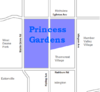 |
| Name | FM | Census Tracts | Population | Land area (km2) | Density (people/km2) | % Change in Population since 2001 | Average Income | Transit Commuting % | % Renters | Second most common language (after English) by name | Second most common language (after English) by percentage | Map |
|---|
| Name | FM | Census Tracts | Population | Land area (km2) | Density (people/km2) | % Change in Population since 2001 | Average Income | Transit Commuting % | % Renters | Second most common language (after English) by name | Second most common language (after English) by percentage | Map |
|---|
| Name | FM | Census Tracts | Population | Land area (km2) | Density (people/km2) | % Change in Population since 2001 | Average Income | Transit Commuting % | % Renters | Second most common language (after English) by name | Second most common language (after English) by percentage | Map |
|---|---|---|---|---|---|---|---|---|---|---|---|---|
| Toronto CMA Average | All | 5,113,149 | 5903.63 | 866 | 9.0 | 40,704 | 10.6 | 11.4 | ||||
| Agincourt | S | 0377.01, 0377.02, 0377.03, 0377.04, 0378.02, 0378.08, 0378.14, 0378.23, 0378.24 | 44,577 | 12.45 | 3580 | 4.6 | 25,750 | 11.1 | 5.9 | Cantonese (19.3%) | 19.3% Cantonese | 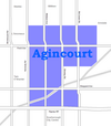 |
| Alexandra Park | OCoT | 0039.00 | 4,355 | 0.32 | 13,609 | 0.0 | 19,687 | 13.8 | 28.0 | Cantonese (17.9%) | 17.9% Cantonese |  |
| Allenby | OCoT | 0140.00 | 2,513 | 0.58 | 4333 | -1.0 | 245,592 | 5.2 | 3.4 | Russian (1.4%) | 01.4% Russian | |
| Amesbury | NY | 0280.00, 0281.01, 0281.02 | 17,318 | 3.51 | 4,934 | 1.1 | 27,546 | 16.4 | 19.7 | Spanish (6.1%) | 06.1% Spanish |  |
| Armour Heights | NY | 0298.00 | 4,384 | 2.29 | 1914 | 2.0 | 116,651 | 10.8 | 16.1 | Russian (9.4%) | 09.4% Russian | 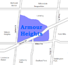 |
| Banbury | NY | 0267.00 | 6,641 | 2.72 | 2442 | 5.0 | 92,319 | 6.1 | 4.8 | Unspecified Chinese (5.1%) | 05.1% Unspecified Chinese | |
| Bathurst Manor | NY | 0297.01, 0310.01, 0310.02 | 14,945 | 4.69 | 3187 | 12.3 | 34,169 | 13.4 | 18.6 | Russian (9.5%) | 09.5% Russian |  |
| Bay Street Corridor | OCoT | 0062.01 | 4,787 | 0.11 | 43,518 | 3.0 | 40,598 | 17.1 | 49.3 | Mandarin (9.6%) | 09.6% Mandarin | |
| Bayview Village | NY | 0305.01, 305.02 | 12,280 | 4.14 | 2,966 | 41.6 | 46,752 | 14.4 | 15.6 | Cantonese (8.4%) | 08.4% Cantonese | 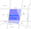 |
| Bayview Woods – Steeles | NY | 0323.01, 0323.02, 0324.01 | 13,298 | 4.07 | 3267 | -1.5 | 41,485 | 11.2 | 13.9 | Cantonese (9.3%) | 09.3% Cantonese |  |
| Bedford Park | OCoT | 0141.01, 0141.02, 0142.00 | 13,749 | 2.27 | 6057 | -1.4 | 80,827 | 15.2 | 10.1 | Greek (0.7%) | 00.7% Greek |  |
| Bendale | S | 0353.02, 0354.00, 0367.02, 0368.00, 0369.00 | 28,945 | 8.49 | 3409 | 12.9 | 29,723 | 13.0 | 10.4 | Tamil (3.7%) | 03.7% Tamil | 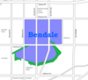 |
| Birch Cliff | S | 0338.00, 0339.00 | 12,266 | 3.48 | 3525 | -3.0 | 48,965 | 11.4 | 15.2 | Unspecified Chinese (0.9%) | 00.9% Unspecified Chinese |  |
| Bloor West Village | OCoT | 0104.00 | 5,175 | 0.74 | 6993 | -2.0 | 55,578 | 20.7 | 8.3 | Ukrainian (3.6%) | 03.6% Ukrainian | |
| Bracondale Hill | OCoT | 0114.00 | 5,343 | 0.62 | 8618 | -3.0 | 41,605 | 18.2 | 24.2 | Greek (4.8%) | 04.8% Greek |  |
| Branson | NY | 0309.00, 0317.05 | 8,017 | 1.25 | 6414 | -3.8 | 27,156 | 18.0 | 27.2 | Russian (24.1%) | 24.1% Russian |  |
| Bridle Path | NY | 0264.00 | 1,540 | 3.46 | 445 | 11.0 | 314,107 | 7.1 | 2.3 | Cantonese (12.0%) | 12.0% Cantonese |  |
| Brockton | OCoT | 0046.00, 0053.00 | 9,039 | 1.1 | 8217 | -9.5 | 27,260 | 22.3 | 17.3 | Portuguese (19.9%) | 19.9% Portuguese |  |
| Cabbagetown | OCoT | 0066.00, 0067.00, 0068.00 | 11,120 | 1.4 | 7943 | 5.3 | 50,398 | 18.5 | 29.6 | Unspecified Chinese (1.6%) | 01.6% Unspecified Chinese |  |
| Caribou Park | NY | 0277.00 | 4,097 | 1.02 | 4017 | -2.0 | 103,703 | 8.4 | 7.6 | Tagalog (2.9%) | 02.9% Tagalog | |
| Carleton Village | OCoT | 0108.00 | 6,544 | 0.74 | 8843 | -4.0 | 23,301 | 19.0 | 19.9 | Portuguese (17.0%) | 17.0% Portuguese |  |
| Casa Loma | OCoT | 0118.00 | 3,597 | 0.67 | 5369 | 23.0 | 82,203 | 18.1 | 32.9 | Korean (1.8%) | 01.8% Korean |  |
| Chaplin Estates | OCoT | 0129.00 | 4,906 | 0.93 | 5275 | 1.0 | 81,288 | 22.7 | 24.5 | French (1.2%) | 01.2% French |  |
| Christie Pits | OCoT | 0094.00 | 5,124 | 0.64 | 8006 | -5.0 | 30,556 | 18.8 | 15.3 | Portuguese (11.9%) | 11.9% Portuguese | |
| Church and Wellesley | OCoT | 0063.01, 0063.02 | 13,397 | 0.55 | 24,358 | 8.8 | 37,653 | 25.1 | 57.0 | Spanish (1.8%) | 01.8% Spanish |  |
| Clairlea | S | 0340.00, 0348.00 | 11,104 | 3.58 | 3102 | 1.8 | 33,392 | 18.1 | 12.7 | Filipino (4.3%) | 04.3% Filipino |  |
| Cliffcrest | S | 0333.00, 0334.00, 0335.00 | 14,531 | 7.01 | 2073 | -2.9 | 38,182 | 12.5 | 12.2 | Tamil (1.5%) | 01.5% Tamil |  |
| Cliffside | S | 0336.00, 0337.00 | 9,386 | 2.45 | 3831 | -6.3 | 32,701 | 14.8 | 11.4 | Cantonese (2.3%) | 02.3% Cantonese |  |
| Corktown | OCoT | 0016.00 | 4,484 | 0.67 | 6693 | 77.0 | 54,681 | 15.5 | 17.6 | Spanish (2.1%) | 02.1% Spanish |  |
| Cricket Club | NY | 0275.00 | 5,504 | 1.96 | 2808 | 3.0 | 104,362 | 8.7 | 15.4 | Filipino (1.4%) | 01.4% Filipino | |
| Davenport | OCoT | 0109.00, 0115.00 | 8,781 | 0.99 | 8870 | -6.9 | 28,335 | 19.8 | 18.2 | Portuguese (17.1%) | 17.1% Portuguese |  |
| Davisville | OCoT | 0126.00, 0127.00, 0128.02, 0128.03, 0128.04 | 23,727 | 3.14 | 7556 | 4.5 | 55,735 | 26.0 | 31.7 | Persian (1.5%) | 01.5% Persian |  |
| Deer Park | OCoT | 0121.00, 0122.00, 0123.00, 0124.00 | 15,165 | 1.46 | 10,387 | 5.2 | 80,704 | 26.4 | 41.3 | Russian (1.1%) | 01.1% Russian |  |
| Discovery District | OCoT | 0035.00 | 7,262 | 0.66 | 6998 | 8.0 | 41,998 | 12.7 | 32.1 | Unspecified Chinese (6.5%) | 06.5% Unspecified Chinese |  |
| Distillery District/West Don Lands | OCoT | 0017.00 | 6,378 | 1.33 | 4795 | -1.0 | 40,617 | 19.5 | 37.5 | French (2.5%) | 02.5% French |  |
| Don Mills | NY | 0263.02, 0263.03, 0263.04, 0268.00, 0269.02 | 21,372 | 8.99 | 2377 | 11.9 | 47,515 | 10.8 | 18.6 | Unspecified Chinese (3.9%) | 03.9% Unspecified Chinese |  |
| Don Valley Village | NY | 0303.00, 0304.01, 0304.02, 0304.03, 0304.04, 0304.05, 0304.06 | 29,740 | 5.16 | 5764 | -1.3 | 30,442 | 17.1 | 16.6 | Unspecified Chinese (9.7%) | 09.7% Unspecified Chinese | 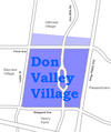 |
| Dorset Park | S | 0352.00, 0370.02, 0370.03 | 14,189 | 4.26 | 3331 | 7.8 | 26,525 | 15.2 | 9.6 | Tamil (9.5%) | 09.5% Tamil | 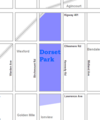 |
| Dovercourt Park | OCoT | 0095.00, 0096.00 | 8,497 | 0.87 | 9767 | -9.2 | 28,311 | 21.9 | 15.1 | Portuguese (13.1%) | 13.1% Portuguese |  |
| Downsview | NY | 0289.00, 0290.00, 0291.01, 0291.02, 0292.00, 0294.01, 0294.02, 0295.00, 0296.00 | 36,613 | 16.13 | 2270 | -5.0 | 26,751 | 14.4 | 18.3 | Italian (11.7%) | 11.7% Italian |  |
| Dufferin Grove | OCoT | 0045.00, 0054.00 | 9,875 | 0.99 | 9975 | -7.1 | 27,961 | 23.8 | 28.4 | Portuguese (15.2%) | 15.2% Portuguese |  |
| Earlscourt | OCoT | 0107.00, 0110.00, 0111.00, 0112.00 | 17,240 | 2.24 | 7696 | -1.7 | 26,672 | 17.7 | 8.5 | Portuguese (18.9%) | 18.9% Portuguese |  |
| East Danforth | OCoT | 0075.00, 0076.00, 0080.01, 0080.02, 0081.00, 0082.00 | 21,440 | 2.5 | 8576 | -6.3 | 33,847 | 24.2 | 18.3 | Cantonese (4.2%) | 04.2% Cantonese |  |
| Eglinton East | S | 0353.03, 0353.04, 0355.02, 0355.03, 0355.04 | 22,387 | 3.23 | 6931 | -1.0 | 25,307 | 19.4 | 19.1 | Tamil (9.7%) | 09.7% Tamil |  |
| Elia (Jane and Finch) | NY | 0312.02, 0312.03, 0312.04, 0312.05, 0312.06, 0312.07, 0316.01, 0316.03, 0316.04, 0316.05, 316.06 | 48,003 | 7.66 | 6267 | -10.0 | 22,691 | 13.0 | 18.8 | Vietnamese (6.9%) | 06.9% Vietnamese | |
| Fashion District | OCoT | 0011.00 | 4,642 | 0.98 | 4737 | 123.0 | 63,282 | 15.5 | 26.2 | Portuguese (1.1%) | 01.1% Portuguese |  |
| Financial District | OCoT | 0014.00 | 548 | 0.47 | 1166 | 6.0 | 63,952 | 18.2 | 17.3 | Japanese (1.8%) | 01.8% Japanese |  |
| Flemingdon Park | NY | 0260.01, 0260.03, 0260.04, 0260.05 | 21,287 | 2.43 | 8760 | -6.0 | 23,471 | 16.6 | 19.6 | Urdu (6.3%) | 06.3% Urdu |  |
| Forest Hill | OCoT | 0130.00, 0131.00, 0132.00, 0133.00, 0134.00 | 24,056 | 4.35 | 5530 | -0.2 | 101,631 | 14.8 | 21.9 | Russian (2.4%) | 02.4% Russian |  |
| Fort York/Liberty Village | OCoT | 0008.00 | 3,821 | 2.13 | 1794 | 126.0 | 46,086 | 22.8 | 27.9 | Hindi (1.7%) | 01.7% Hindi |  |
| Garden District | OCoT | 0034.00 | 8,240 | 0.52 | 15,846 | 17.0 | 37,614 | 17.0 | 35.5 | Unspecified Chinese (3.0%) | 03.0% Unspecified Chinese |  |
| Glen Park | NY | 0278.00, 0279.01, 0279.02 | 18,426 | 4.13 | 4462 | 4.4 | 35,022 | 13.6 | 17.0 | Italian (9.3%) | 09.3% Italian |  |
| Grange Park | OCoT | 0036.00, 0037.00 | 9,007 | 0.84 | 10,793 | -1.0 | 35,277 | 13.3 | 35.6 | Unspecified Chinese (14.8%) | 14.8% Unspecified Chinese |  |
| Graydon Hall | NY | 0269.01 | 4,714 | 0.71 | 6639 | -15.0 | 23,350 | 15.6 | 35.2 | Persian (11.8%) | 11.8% Persian | |
| Guildwood | S | 0330.00, 0331.01, 0331.04 | 12,820 | 4.77 | 2688 | -2.0 | 40,806 | 11.6 | 8.0 | Persian (1.2%) | 01.2% Persian |  |
| Harbord Village | OCoT | 0059.00, 0060.00 | 5,906 | 0.64 | 9,228 | 2.4 | 45,792 | 16.8 | 24.0 | Portuguese (4.1%) | 04.1% Portuguese |  |
| Harbourfront / CityPlace | OCoT | 0012.00, 0013.00 | 14,368 | 1.87 | 9228 | 94.3 | 69,232 | 16.0 | 31.3 | Unspecified Chinese (2.4%) | 02.4% Unspecified Chinese | |
| Harwood | Y | 0155.00 | 3,375 | 0.78 | 4327 | 0.0 | 22,136 | 12.3 | 17.8 | Portuguese (19.0%) | 19.0% Portuguese | |
| Henry Farm | NY | 0301.01 | 2,790 | 0.91 | 3066 | -6.0 | 56,395 | 15.6 | 15.9 | Mandarin (3.9%) | 03.9% Mandarin |  |
| High Park North | OCoT | 0099.00, 0100.00, 0102.01, 0102.02, 0102.03, 0103.00 | 22,746 | 2.18 | 10,434 | -1.6 | 46,437 | 27.5 | 32.8 | Polish (3.0%) | 03.0% Polish |  |
| Highland Creek | S | 0362.02, 0362.03 | 12,853 | 5.13 | 2505 | -0.1 | 33,640 | 9.7 | 1.8 | Tamil (5.1%) | 05.1% Tamil |  |
| Hillcrest | NY | 0324.02, 0324.03, 0324.05, 0324.06 | 18,327 | 5.35 | 3426 | -0.4 | 33,465 | 12.0 | 8.0 | Unspecified Chinese (13.9%) | 13.9% Unspecified Chinese |  |
| Hoggs Hollow | NY | 0266.00 | 3,123 | 2.76 | 1132 | 2.0 | 222,560 | 4.3 | 2.9 | Unspecified Chinese (2.4%) | 02.4% Unspecified Chinese |  |
| Humber Summit | NY | 0315.01, 0315.02, 0315.03 | 12,766 | 7.89 | 1618 | 2.1 | 26,117 | 7.3 | 7.6 | Italian (15.1%) | 15.1% Italian |  |
| Humberlea | NY | 0293.00 | 4,327 | 2.0 | 2164 | -2.0 | 30,907 | 8.7 | 7.9 | Italian (11.1%) | 11.1% Italian | |
| Humbermede | NY | 0313.00, 0314.01, 0314.02 | 14,778 | 4.35 | 3397 | 1.1 | 24,297 | 11.8 | 14.6 | Punjabi (9.7%) | 09.7% Punjabi |  |
| Humewood–Cedarvale | Y | 0164.00, 0165.00, 0166.00, 0167.01, 0167.02, 0168.00 | 27,515 | 3.19 | 8624 | -7.8 | 40,404 | 24.2 | 26.0 | Spanish (3.6%) | 03.6% Spanish | |
| Ionview | S | 0346.02, 0351.01, 0351.02 | 13,025 | 1.94 | 6714 | -4.0 | 25,078 | 21.1 | 22.5 | Filipino (6.5%) | 06.5% Filipino |  |
| Junction Triangle | OCoT | 0098.00 | 6,666 | 0.72 | 9258 | -6.0 | 28,067 | 20.0 | 18.8 | Portuguese (13.0%) | 13.0% Portuguese |  |
| Kensington Market | OCoT | 0038.00 | 3,740 | 0.36 | 10,389 | 3.0 | 23,335 | 15.0 | 25.1 | Cantonese (14.3%) | 14.3% Cantonese |  |
| Lambton | Y | 0151.00, 0154.00 | 9,654 | 2.74 | 3523 | -3.2 | 30,920 | 14.2 | 15.9 | Portuguese (3.9%) | 03.9% Portuguese |  |
| L'Amoreaux | S | 0375.01, 0375.04, 0375.05, 0376.01, 0376.02, 0376.08, 0376.11,0376.12 | 45,862 | 7.15 | 6414 | 0.9 | 26,375 | 13.4 | 11.4 | Unspecified Chinese (13.9%) | 13.9% Unspecified Chinese |  |
| Lansing | NY | 299.00 | 10,052 | 3.06 | 3285 | 35.0 | 46,631 | 18.7 | 17.0 | Persian (4.7%) | 04.7% Persian |  |
| Lawrence Heights | NY | 286.00 | 3,769 | 3.2 | 1178 | 15.0 | 29,867 | 15.0 | 13.9 | Italian (15.0%) | 15.0% Italian |  |
| Lawrence Manor | NY | 0287.01, 0287.02 | 13,750 | 2.14 | 6425 | 7.4 | 36,361 | 15.9 | 23.8 | Filipino (7.2%) | 07.2% Filipino |  |
| Lawrence Park | OCoT | 0138.00, 0265.00 | 6,653 | 3.64 | 1828 | -5.1 | 214,110 | 8.3 | 4.6 | French (0.8%) | 00.8% French |  |
| Ledbury Park | NY | 0276.01, 0276.02 | 12,360 | 2.5 | 4944 | 3.5 | 83,853 | 9.5 | 12.2 | Filipino (1.4%) | 01.4% Filipino |  |
| Leslieville | OCoT | 0026.00, 0027.00, 0028.00, 0073.00, 0074.00 | 23,567 | 2.69 | 8761 | -7.3 | 30,886 | 19.9 | 15.4 | Cantonese (9.4%) | 09.4% Cantonese |  |
| Little Italy | OCoT | 0041.00, 0042.00 | 7,917 | 0.81 | 9774 | -6.1 | 31,231 | 15.5 | 17.0 | Portuguese (17.4%) | 17.4% Portuguese |  |
| Little Portugal | OCoT | 0044.00 | 5,013 | 0.49 | 10,231 | -10.0 | 29,224 | 16.6 | 21.6 | Portuguese (23.8%) | 23.8% Portuguese |  |
| Lytton Park | OCoT | 0139.00 | 6,494 | 1.28 | 5073 | 5.0 | 127,356 | 15.1 | 12.9 | Serbian (0.9%) | 00.9% Serbian |  |
| Malvern | S | 0378.03, 0378.04, 0378.05, 0378.06, 0378.11, 0378.12, 0378.16, 0378.17 | 44,324 | 8.86 | 5003 | 1.5 | 25,677 | 13.6 | 8.2 | Tamil (12.2%) | 12.2% Tamil | |
| Maple Leaf | NY | 0283.01, 0283.02, 0284.00, 285.00 | 20,313 | 4.59 | 4425 | 1.4 | 27,611 | 11.8 | 18.8 | Italian (13.0%) | 13.0% Italian |  |
| Maryvale | S | 0372.00, 0373.00 | 8,800 | 2.28 | 3860 | -3.2 | 30,944 | 12.3 | 11.4 | Filipino (4.1%) | 04.1% Filipino |  |
| Milliken | S | 0377.06, 0377.07, 0378.18, 0378.19, 0378.20, 0378.21, 0378.22 | 26,272 | 7.19 | 3654 | -2.0 | 25,243 | 12.3 | 3.9 | Cantonese (26.6%) | 26.6% Cantonese | 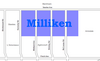 |
| Moore Park | OCoT | 0125.00 | 4,474 | 1.13 | 3959 | -2.0 | 154,825 | 11.0 | 7.5 | French (1.1%) | 01.1% French |  |
| Morningside | S | 0363.02, 0363.04, 0363.05 | 11,472 | 2.79 | 4112 | 0.3 | 27,139 | 14.9 | 13.2 | Tamil (10.8%) | 10.8% Tamil |  |
| Mount Dennis | Y | 0156.01, 0156.02, 0157.00, 0173.00, 0174.00 | 21,284 | 3.29 | 6469 | -3.1 | 23,910 | 18.2 | 19.9 | Spanish (7.3%) | 07.3% Spanish |  |
| Newtonbrook | NY | 0318.00, 0319.00, 0320.01, 0320.02, 0321.01, 0321.02, 0322.00 | 36,046 | 8.77 | 4110 | 0.3 | 33,428 | 16.6 | 14.3 | Russian (8.8%) | 08.8% Russian | 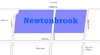 |
| Niagara | OCoT | 0010.02 | 6,524 | 0.55 | 11,862 | -4.0 | 44,611 | 21.2 | 21.4 | Portuguese (4.0%) | 04.0% Portuguese |  |
| North York City Centre | NY | 0307.01 | 10,427 | 0.28 | 37,239 | 33.0 | 34,330 | 19.0 | 19.5 | Unspecified Chinese (10.1%) | 10.1% Unspecified Chinese |  |
| Oakridge | S | 0341.02, 0341.03, 0341.04 | 13,368 | 1.86 | 7187 | -2.3 | 21,155 | 20.8 | 27.1 | Bengali (12.6%) | 12.6% Bengali |  |
| Old Mill/Baby Point | Y | 0150.00 | 4,010 | 1.07 | 3748 | 1.0 | 110,372 | 16.1 | 10.7 | Ukrainian (4.1%) | 04.1% Ukrainian |  |
| Parkdale | OCoT | 0004.00, 0005.00, 0007.01, 0007.02, 0047.01, 0047.02 | 28,367 | 2.03 | 13,974 | -8.0 | 26,314 | 22.2 | 39.0 | Polish (2.9%) | 02.9% Polish |  |
| Parkway Forest | NY | 0301.03, 0301.04 | 8,498 | 1.71 | 4970 | -2.8 | 24,333 | 21.7 | 24.2 | Unspecified Chinese (8.5%) | 08.5% Unspecified Chinese | |
| Parkwoods | NY | 0270.01, 0270.02, 0271.01, 0271.02, 0272.01, 0272.02 | 26,533 | 4.96 | 5349 | -3.7 | 34,811 | 14.0 | 22.5 | Unspecified Chinese (3.4%) | 03.4% Unspecified Chinese |  |
| Pelmo Park | NY | 0282.00 | 4,402 | 2.2 | 2001 | 14.0 | 32,002 | 9.4 | 3.6 | Italian (6.7%) | 06.7% Italian | |
| Playter Estates | OCoT | 0085.00 | 3,968 | 0.5 | 7936 | -2.0 | 44,557 | 26.8 | 35.0 | Unspecified Chinese (1.8%) | 01.8% Unspecified Chinese |  |
| Pleasant View | NY | 0302.01, 0302.02, 0302.03 | 16,615 | 3.04 | 5465 | -2.1 | 29,250 | 13.2 | 8.2 | Unspecified Chinese (12.7%) | 12.7% Unspecified Chinese |  |
| Port Lands | OCoT | 0001.00 | 571 | 6.1 | 94 | -9.0 | 36,243 | 14.9 | 10.5 | Mandarin (3.5%) | 03.5% Mandarin |  |
| Port Union | S | 0361.01, 0361.02 | 12,450 | 5.39 | 2310 | -1.7 | 48,117 | 11.1 | 2.0 | Filipino (1.6%) | 01.6% Filipino |  |
| Regal Heights | OCoT | 0113.00 | 2,719 | 0.38 | 7155 | -8.0 | 36,652 | 24.5 | 19.7 | Spanish (5.5%) | 05.5% Spanish | |
| Regent Park/Trefann Court | OCoT | 0030.00, 0031.00 | 10,387 | 0.64 | 16,230 | -7.1 | 19,521 | 16.0 | 31.2 | Bengali (10.5%) | 10.5% Bengali |  |
| Richview | E | 0237.01, 0237.02, 0237.03, 0238.01, 0238.02, 0240.01 | 26,053 | 6.51 | 4002 | -4.0 | 34,579 | 10.6 | 16.3 | Italian (4.2%) | 04.2% Italian |  |
| Riverdale | OCoT | 0018.00, 0019.00, 0029.00, 0069.00, 0070.00, 0071.00, 0072.01, 0072.02 | 31,007 | 3.99 | 7771 | -5.5 | 40,139 | 20.0 | 17.8 | Cantonese (6.7%) | 06.7% Cantonese |  |
| Rockcliffe–Smythe | Y | 0153.00 | 4,681 | 0.97 | 4826 | -5.0 | 28,723 | 16.3 | 9.0 | Spanish (8.2%) | 08.2% Spanish | |
| Roncesvalles | OCoT | 0048.00, 0049.00, 0051.00, 0052.00 | 15,996 | 1.98 | 8079 | -4.9 | 46,820 | 21.9 | 22.7 | Polish (4.4%) | 04.4% Polish |  |
| Rosedale | OCoT | 0086.00, 0087.00 | 7,672 | 2.72 | 2821 | 4.8 | 213,941 | 11.3 | 11.9 | Unspecified Chinese (1.0%) | 01.0% Unspecified Chinese |  |
| Rouge | S | 0378.10 | 22,724 | 28.72 | 791 | 175.0 | 29,230 | 12.1 | 2.7 | Tamil (15.6%) | 15.6% Tamil | |
| Rouge Hill | S | 0362.01, 0362.04 | 11,167 | 3.88 | 2878 | 0.9 | 32,858 | 13.5 | 8.6 | Filipino (2.4%) | 02.4% Filipino | |
| Runnymede | Y | 0152.00 | 4,382 | 0.85 | 5155 | -3.0 | 42,635 | 17.3 | 7.1 | Ukrainian (2.2%) | 02.2% Ukrainian | |
| Scarborough Junction | S | 0342.00, 0343.00, 0344.01, 0344.02, 0345.00, 0346.01, 0347.00 | 25,780 | 7.41 | 3479 | -3.6 | 25,405 | 18.2 | 15.7 | Tamil (4.2%) | 04.2% Tamil |  |
| Scarborough City Centre | S | 0363.06, 0370.01 | 16,403 | 2.58 | 6358 | 22.9 | 26,756 | 14.6 | 15.6 | Tamil (10.3%) | 10.3% Tamil | 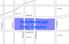 |
| Scarborough Village | S | 0331.03, 0332.00 | 12,796 | 2.03 | 6303 | -9.0 | 24,413 | 16.2 | 22.0 | Tamil (11.4%) | 11.4% Tamil |  |
| Seaton Village | OCoT | 0093.00 | 5,259 | 0.62 | 8482 | -6.0 | 41,506 | 19.1 | 17.3 | Portuguese (5.0%) | 05.0% Portuguese |  |
| Silverthorn | Y | 0158.00, 0159.01, 0159.02, 0171.00, 0172.00 | 17,757 | 3.52 | 5045 | -3.0 | 26,291 | 15.8 | 16.6 | Portuguese (11.8%) | 11.8% Portuguese |  |
| Smithfield | E | 0248.02, 0248.04, 0248.05, 0249.01, 0249.04, 0249.05, 0250.04 | 34,996 | 6.45 | 5426 | -7.2 | 24,387 | 12.8 | 12.7 | Punjabi (11.8%) | 11.8% Punjabi |  |
| South Hill | OCoT | 0117.00, 0119.00 | 6,218 | 1.26 | 4935 | -3.8 | 120,453 | 16.1 | 29.8 | French (1.0%) | 01.0% French |  |
| St. James Town | OCoT | 0065.00 | 14,666 | 0.23 | 63,765 | -10.0 | 22,341 | 27.4 | 46.2 | Filipino (8.1%) | 08.1% Filipino |  |
| Steeles | S | 0376.04, 0376.05, 0376.09, 0376.13, 0376.14 | 24,696 | 4.52 | 5464 | 1.9 | 26,660 | 10.5 | 5.1 | Cantonese (23.7%) | 23.7% Cantonese |  |
| Summerhill | OCoT | 0090.00, 0120.00 | 5,100 | 0.65 | 7846 | 3.0 | 88,937 | 17.5 | 24.1 | Unspecified Chinese (1.1%) | 01.1% Unspecified Chinese |  |
| Sunnylea | E | 0216.00, 0217.00, 0218.00, 0219.00 | 17,602 | 5.23 | 3366 | -1.1 | 51,398 | 13.0 | 17.1 | Polish (5.2%) | 05.2% Polish | |
| Swansea | OCoT | 0050.01, 0050.02 | 11,133 | 3.76 | 2961 | 0.5 | 58,681 | 18.3 | 12.8 | Polish (3.0%) | 03.0% Polish | 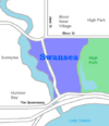 |
| Tam O'Shanter – Sullivan | S | 0374.01, 0374.02, 0374.03, 0375.02, 0375.03, 0376.07 | 27,235 | 5.44 | 5006 | 3.4 | 27,717 | 12.2 | 15.3 | Unspecified Chinese (12.6%) | 12.6% Unspecified Chinese |  |
| The Annex | OCoT | 0091.01, 0091.02, 0092.00 | 15,602 | 1.47 | 10,614 | -2.3 | 63,636 | 22.1 | 41.9 | Spanish (1.3%) | 01.3% Spanish |  |
| The Beaches | OCoT | 0020.00, 0021.00, 0022.00, 0023.00, 0024.00 | 20,416 | 3.57 | 5719 | 7.8 | 67,536 | 13.8 | 16.2 | Cantonese (0.7%) | 00.7% Cantonese |  |
| The Danforth | OCoT | 83.00, 84.00 | 7,849 | 0.87 | 9022 | -1.0 | 44,979 | 23.3 | 19.0 | Greek (7.4%) | 07.4% Greek |  |
| The Elms | E | 0244.01, 0244.02 | 9,437 | 2.86 | 3300 | -3.3 | 28,014 | 12.6 | 13.7 | Spanish (6.1%) | 06.1% Spanish |  |
| The Junction | OCoT | 0101.00, 0105.00, 0106.00 | 11,391 | 2.36 | 4827 | 22.8 | 34,906 | 18.0 | 17.0 | Portuguese (4.1%) | 04.1% Portuguese | 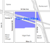 |
| The Kingsway | E | 0226.00, 0227.00, 0228.00, 0229.00 | 8,780 | 2.58 | 3403 | 7.9 | 110,944 | 11.8 | 6.2 | Ukrainian (1.8%) | 01.8% Ukrainian |  |
| The Queensway | E | 0215.00 | 6,207 | 2.62 | 2369 | 3.0 | 38,944 | 12.9 | 9.0 | Italian (4.1%) | 04.1% Italian | |
| Thistletown | E | 0250.01, 0250.02, 0250.05 | 16,790 | 3.97 | 4229 | 1.4 | 28,955 | 11.2 | 13.7 | Punjabi (8.6%) | 08.6% Punjabi |  |
| Toronto Islands | OCoT | 0002.00 | 627 | 3.17 | 198 | -5.0 | 43,344 | 18.3 | 5.6 | None (0%) | 0% any | |
| Trinity–Bellwoods | OCoT | 0040.00, 0043.00 | 8,687 | 0.92 | 9442 | -3.1 | 31,106 | 17.7 | 16.5 | Portuguese (13.6%) | 13.6% Portuguese |  |
| Upper Beaches | OCoT | 0025.00, 0077.00, 0078.00, 0079.00 | 19,830 | 2.92 | 6791 | 0.5 | 44,346 | 18.6 | 17.4 | Cantonese (0.7%) | 00.7% Cantonese | 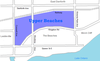 |
| Victoria Village | NY | 0261.00, 0262.01, 0262.02 | 17,047 | 4.72 | 3612 | 2.5 | 29,657 | 15.6 | 23.4 | Urdu (3.2%) | 03.2% Urdu |  |
| Wallace Emerson | OCoT | 0097.01, 0097.02 | 10,338 | 0.88 | 11,748 | -1.8 | 25,029 | 22.8 | 23.0 | Portuguese (19.2%) | 19.2% Portuguese |  |
| West Deane Park | E | 0234.00 | 4,395 | 2.13 | 2063 | 1.0 | 41,582 | 8.3 | 4.9 | Ukrainian (2.3%) | 02.3% Ukrainian | |
| West Hill | S | 0358.01, 0358.02, 0358.03, 0359.00, 0360.00 | 25,632 | 9.58 | 2676 | -4.1 | 27,936 | 14.6 | 14.7 | Tamil (3.0%) | 03.0% Tamil |  |
| West Rouge | S | 0802.01, 0802.02 | 9,300 | 4.45 | 2090 | -1.8 | 44,605 | 14.1 | 0.8 | Cantonese (2.8%) | 02.8% Cantonese |  |
| Westminster | NY | 0317.02, 0317.03, 0317.04 | 16,386 | 2.37 | 6914 | 0.8 | 27,826 | 14.6 | 23.4 | Russian (31.4%) | 31.4% Russian | |
| Westmount | E | 0240.02 | 5,857 | 1.04 | 5932 | 5.0 | 35,183 | 9.6 | 23.4 | Ukrainian (10.6%) | 10.6% Ukrainian | |
| Weston | Y | 0175.01, 0175.02, 0176.00 | 16,476 | 2.51 | 6564 | -5.6 | 27,446 | 15.5 | 26.5 | Spanish (7.0%) | 07.0% Spanish |  |
| Wexford | S | 0349.00, 0350.00, 0371.00 | 17,844 | 7.97 | 2239 | -3.2 | 28,556 | 14.0 | 15.1 | Filipino (4.5%) | 04.5% Filipino |  |
| Willowdale | NY | 0300.00, 0306.01, 0306.02, 0307.02, 0308.01, 0308.02 | 43,144 | 7.68 | 5618 | 62.3 | 39,895 | 15.6 | 12.9 | Cantonese (7.9%) | 07.9% Cantonese |  |
| Wilson Heights | NY | 0288.00, 0297.02 | 13,732 | 4.14 | 3317 | 1.9 | 37,978 | 15.9 | 18.0 | Filipino (6.2%) | 06.2% Filipino | |
| Woburn | S | 0356.00, 0357.01, 0357.02, 0363.07, 0364.01, 0364.02, 0365.00, 0366.00, 0367.01 | 48,507 | 13.34 | 3636 | -1.5 | 26,190 | 13.3 | 16.0 | Gujarati (9.1%) | 09.1% Gujarati |  |
| Wychwood | OCoT | 0116.00 | 4,182 | 0.68 | 6150 | -2.0 | 53,613 | 17.1 | 20.1 | Portuguese (2.7%) | 02.7% Portuguese | 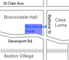 |
| York Mills | NY | 0273.01, 0273.02, 0274.01, 0274.02 | 17,564 | 7.29 | 2409 | 2.0 | 92,099 | 10.0 | 11.8 | Korean (4.0%) | 04.0% Korean | 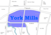 |
| York University Heights | NY | 0311.02, 0311.03, 0311.04, 0311.05, 0311.06 | 26,140 | 13.21 | 1979 | -1.2 | 24,432 | 15.2 | 20.4 | Italian (6.6%) | 06.6% Italian |  |
| Yorkville | OCoT | 0088.00, 0089.00 | 6,045 | 0.56 | 10,795 | 62.6 | 105,239 | 18.3 | 27.9 | French (1.9%) | 01.9% French |  |
| Features | |||||||
|---|---|---|---|---|---|---|---|
| History | |||||||
| Geography | |||||||
| Economy | |||||||
| Politics | |||||||
| Public services | |||||||
| Education |
| ||||||
| Culture | |||||||
| Transportation |
| ||||||

Parkdale—High Park is a federal electoral district in Ontario, Canada, that has been represented in the House of Commons of Canada since 1979. It was created during the 1976 electoral boundaries redistribution from parts of Parkdale, High Park—Humber Valley, Davenport and Spadina districts. As of the October 19, 2015, Canadian general election, the current Member of Parliament (MP) is Liberal member Arif Virani. According to the 2016 census, Parkdale—High Park has the lowest percentage of visible minorities (26.2%) among all City of Toronto ridings; it also has the highest percentage of people of Irish (20.0%), German (9.8%), and French (8.9%) ethnic origin of all City of Toronto ridings.

York Mills is a neighbourhood in Toronto, Ontario, Canada. It is centred around Yonge Street and York Mills Road located in the district of North York. In 2010, it encompassed the fourth and seventh most affluent postal codes in Canada. It is recognized as a millionaires' mile, alongside the other Toronto neighbourhoods of The Bridlepath, Forest Hill, and Rosedale.
St. James Town is a neighbourhood of Toronto, Ontario, Canada. It lies in the northeast corner of the downtown area. The neighbourhood covers the area bounded by Jarvis Street to the west, Bloor Street East to the north, Parliament Street to the east, and Wellesley Street East to the south.
Dovercourt Park or Dovercourt Village is a neighbourhood in Toronto, Ontario, Canada situated north of Bloor Street between Christie Street to the east, the CPR railway lines to the north, and Dufferin Street to the west.

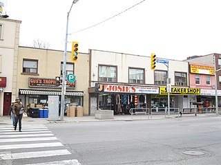
Scarborough—Agincourt is a federal electoral district in Toronto, Ontario, Canada that has been represented in the House of Commons of Canada since 1988. It covers the area of the City of Toronto bounded by Steeles Avenue East to the north, Highway 401 to the south, Victoria Park Avenue to the west, and Midland Avenue to the east.
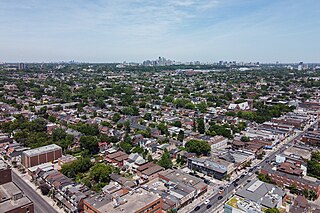
The demographics of Toronto, Ontario, Canada make Toronto one of the most multicultural and multiracial cities in the world. In 2021, 57.0 percent of the residents of the metropolitan area belonged to a visible minority group, compared with 51.4 percent in 2016, and 13.6 percent in 1981. Toronto also has established ethnic neighbourhoods such as the multiple Chinatowns, Corso Italia, Little Italy, Little India, Greektown, Koreatown, Little Tokyo, Little Jamaica, Little Portugal, Little Malta, Roncesvalles (Polish), and Bloor West Village (Ukrainian), all of which celebrate the city's multiculturalism. Data from the suburban municipalities are also included for some metrics as most of these municipalities are part of the Toronto CMA.

Cooksville is a neighbourhood in Mississauga in the Greater Toronto Area region of Ontario, Canada. It is centred around the intersection of Dundas Street and Hurontario Street near the eponymous Cooksville Creek.

Davisville Village is a neighbourhood of Toronto, Ontario, Canada. It is located near the intersection of Davisville Avenue and Yonge Street. There is a subway station named Davisville at this intersection. The area directly abuts Mount Pleasant Cemetery, and has many massive apartment and condominium complexes built between the 1970s and the 2000s, as well as a number of office buildings. The area is within Midtown Toronto between St Clair and Eglinton. Davisville Village is represented at Toronto City Council by Councillor Josh Matlow.
Amesbury or Brookhaven-Amesbury is a neighbourhood in Toronto, Ontario, Canada. The neighbourhood is located in northern Toronto in the former suburb of North York. It is part of federal and provincial electoral district York South—Weston, and Toronto electoral wards 11: York South—Weston (West) and 12: York South—Weston (East).

Lansing is a neighbourhood in Toronto, Ontario, Canada. It originated as a minor settlement of a store, other services and a post office at the corner of Yonge Street and Sheppard Avenue and later got consolidated with Toronto as sprawling development took place. A larger area was designated as the postal village of Lansing. The City of Toronto labels it as Lansing-Westgate for neighbourhood planning purposes with the boundaries Yonge Street to the east, Highway 401 to the south, Bathurst Street to the west and Burnett Avenue to the north.

Bayview Woods-Steeles is a neighbourhood located in the northern tip of the city of Toronto, Ontario, Canada in the district of North York. It is part of federal and provincial electoral district Don Valley North, and Toronto electoral ward 17: Don Valley North. In 2006, it had a population of 13,295. The area is divided by a series of ravines, and is often not considered a neighbourhood unto itself. Rather the sections are more often divided between the neighbouring areas of Hillcrest Village, Bayview Village, and Newtonbrook.
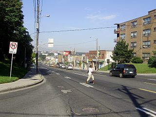
Fairbank is a neighbourhood in Toronto, Ontario, Canada. The area is centred on the intersection of Dufferin Street and Eglinton Avenue West. Fairbank includes the neighbourhoods of Briar Hill–Belgravia and Caledonia–Fairbank. The western border is the CNR lines. The northern and southern borders are the former borders of the City of York and the eastern border is Dufferin Street.
Silverthorn, often misspelled as Silverthorne, is a neighbourhood and former postal village in Toronto, Ontario, Canada. The approximate boundaries are the GO Transit Barrie line railway tracks to the east, Black Creek Drive and the CP railway line to the west and the former boundaries of the City of York to the north and south. The neighbourhood west of Keele Street is known as Keelesdale. For demographic purposes, the city breaks the area down into two neighbourhoods Keelesdale-Eglinton West, south of Eglinton, and Beechborough-Greenbrook north of Eglinton. It was originally a postal village to serve the then-agricultural York Township.

Harbord Village is a neighbourhood in Toronto, Ontario, Canada. It lies just to the west of the University of Toronto, with its most commonly accepted borders being Bloor Street on the north, Spadina Avenue on the east, College Street to the south, and Bathurst Street to the west. Areas west of Bathurst, as far as Ossington are also sometimes included, though they are not covered by the residents' association. The area was previously known as Sussex-Ulster, after two of the major east west streets in the area. In 2000 the residents' association decided to rename itself and the area Harbord Village, after the main street running through the middle of the community. The street's name origin is unclear but could be named for abolitionist Edward Harbord, 3rd Baron Suffield.
The following outline is provided as an overview of and topical guide to Toronto:
Toronto has a large Italian Canadian community, with 30.3 per cent of the ethnic Italians in Canada living in the Greater Toronto Area (GTA) as of 2021. Toronto is home to the fourth largest population of people of Italian descent after Buenos Aires, São Paulo and New York City, respectively. As of the Canada 2021 Census, there were 468,970 Italian Canadians located in the Greater Toronto Area, with 444,755 located within the Toronto CMA.
The Greeks of Toronto comprises Greek immigrants and their descendants living in Toronto, Canada.