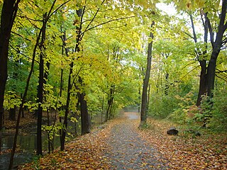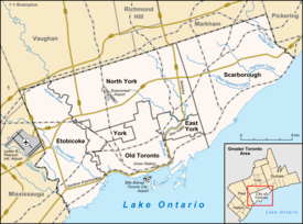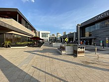
Etobicoke is an administrative district and former city within Toronto, Ontario, Canada. Comprising the city's west-end, Etobicoke is bordered on the south by Lake Ontario, on the east by the Humber River, on the west by Etobicoke Creek, the cities of Brampton, and Mississauga, the Toronto Pearson International Airport, and on the north by the city of Vaughan at Steeles Avenue West.

The Kingsway is a residential neighbourhood in Toronto, Ontario, Canada. It is bounded by Bloor Street to the south, Dundas Street to the north, the Mimico Creek to the west and the Humber River to the east. The neighbourhood was officially known as Kingsway Park, which later became replaced by its nickname, The Kingsway. For planning purposes, the neighbourhood is known by the City of Toronto as "Kingsway South" to differentiate it from a more recent extension of The Kingsway north of Dundas Street. "Kingsway South" is not used by residents, due to confusion with the South Kingsway, a street located east of the Humber River and extending south from Bloor Street.

Bloordale Village is a Business Improvement Area (BIA) located along Bloor Street from Dufferin Street to Lansdowne Avenue, west of downtown in Toronto, Ontario, Canada. It sits on the southern border of the Wallace Emerson neighbourhood and the northern border of the Brockton Village neighbourhood. The district is home to various and unique shops including restaurants, bars, vintage and thrift stores.

Bloor Street is a major east–west residential and commercial thoroughfare in Toronto, Ontario, Canada. Bloor Street runs from the Prince Edward Viaduct, which spans the Don River Valley, westward into Mississauga where it ends at Central Parkway. East of the viaduct, Danforth Avenue continues along the same right-of-way. The street, approximately 25 kilometres (16 mi) long, contains a significant cross-sample of Toronto's ethnic communities. It is also home to Toronto's famous shopping street, the Mink Mile.

Richview, formally known as Willowridge-Martingrove-Richview, is a neighbourhood in the city of Toronto, Ontario, Canada. It is bounded on the west by Highway 401 and on the north by the highway and by Dixon Road, Royal York Road on the east, and Eglinton Avenue West along the south. Richview was originally established as a postal village within the then-agricultural Etobicoke Township, which later became the suburb of Etobicoke.

The Etobicoke Civic Centre in the Eatonville neighbourhood of Toronto, Ontario, Canada, once housed the municipal government of the former City of Etobicoke.

Brockton Village is a former town, and now the name of a neighbourhood, in Toronto, Ontario, Canada. It comprises a section of the old Town of Brockton which was annexed by the City of Toronto in 1884.

Markland Wood is a residential neighbourhood in Toronto, Ontario, Canada. It is located west of the central core, in the former suburb of Etobicoke and is the westernmost residential community in Toronto along Bloor Street West. It's located on the border of Mississauga and bounded by Etobicoke Creek to the west, Elmcrest Creek to the east, Burnhamthorpe to the North, and surrounded by the Markland Wood Golf Club; approximately 2/3 is north of Bloor Street, and 1/3 south. Markland Wood is part of the Etobicoke Centre riding for federal and provincial governments and Ward 2 for the municipal council.

Smithfield is a neighbourhood and former village in Toronto, Ontario, Canada. Some new residents of Toronto and new immigrants to Canada are attracted to this neighbourhood, mainly because there is a large amount of affordable public housing. It is named after the former village of Smithfield that was located at the intersection of Albion Road and Martin Grove Road. The neighbourhood is located north of the west branch of the Humber River and west of Kipling Avenue.

Eringate-Centennial-West Deane is a neighbourhood in the city of Toronto, Canada. Eringate-Centennial-West Deane borders the city of Mississauga.

Islington-City Centre West is a commercial and residential neighbourhood in Toronto, Ontario, Canada. One of four central business districts outside Downtown Toronto, it is bounded by Rathburn Road to the north, Islington Avenue to the east, Bloor Street to the south, Mimico Creek to the west.

The Queensway–Humber Bay, known officially as Stonegate–Queensway, is a neighbourhood in the southwest of Toronto, Ontario, Canada. It is located in the southeast area of the former City of Etobicoke.

Burnhamthorpe Collegiate Institute and Adult Learning Centre is an adult and alternative high school in Toronto, Ontario, Canada. It is located in the Eatonville neighbourhood of the former suburb of Etobicoke. It has operated since 1956, currently by the Toronto District School Board, originally part of the Etobicoke Board of Education. It offers credit courses to adult learners and to young adults (18-20). The motto for Burnhamthorpe is Quisque Praestet Officium which translates to "No matter whose attention offers".

Wallace Emerson is a neighbourhood in Toronto, Ontario, Canada situated north of Bloor Street between Dufferin Street to the east, the CPR railway lines to the north and the CPR railway lines to the west.

Honeydale Mall was a community shopping mall in Toronto, Ontario, Canada. It was located at the intersection of Dundas Street and The East Mall Crescent. It served the Eatonville neighbourhood of Etobicoke district.

Cloverdale Mall is a community shopping centre located in the Etobicoke area of Toronto, Ontario, Canada, at 250 The East Mall northeast of the intersection of Dundas Street West and Highway 427). It opened in 1956 as an open-air shopping plaza on what was part of the Eatonville farm.

Burnhamthorpe Road is a major arterial road in the cities of Toronto and Mississauga, Ontario; beginning at Dundas Street, near Islington Avenue, running west and becoming a rural road in the Town of Oakville, where it terminates at Tremaine Road, where it changes name.

Applewood is a suburban district consisting of a collection of neighbourhoods in the city of Mississauga, Ontario, Canada. It is bordered by Burnhamthorpe Road, Cawthra Road, the Queen Elizabeth Way, and the Etobicoke Creek. It is named for the apple orchards which predominated in the area prior to its development.


