Little Italy, Toronto

Last updated

Little Italy
Neighbourhood
College St at Grace St 2023.jpg
Street view of Little Italy from Grace St and College Street
Little Italy map.PNG
Approximate Little Italy boundaries
Toronto map.png
Red pog.svg
Location within Toronto
Coordinates: 43°39′18″N79°24′47″W / 43.655°N 79.413°W / 43.655; -79.413
CountryFlag of Canada (Pantone).svg  Canada
ProvinceFlag of Ontario.svg  Ontario
City Toronto

Little Italy, sometimes referred to as College Street West, is a district in Toronto, Ontario, Canada. It is known for its Italian Canadian restaurants and businesses. There is also a significant Latin-Canadian and Portuguese-Canadian community in the area. The district is centred on a restaurant/bar/shopping strip along College Street, centred on College Street, imprecisely between Harbord Street and Dundas Street, and spreading out east and west between Bathurst Street and Ossington Avenue. It is contained within the larger city-recognized neighbourhood of Palmerston-Little Italy.

Contents

History

The Royal Cinema is a theatre that was opened in 1939. Royal Cinema.JPG
The Royal Cinema is a theatre that was opened in 1939.

College Street was fully laid out in the area by 1900 and the area was filled with buildings from the early 1900s. College Street is fronted by two- and three-storey buildings, with commercial uses on the ground floor and residential or storage uses on the upper floors.

A statue of Johnny Lombardi, who launched Canada's first multicultural radio station in 1966 from Little Italy. Grace - College Parkette 2023.jpg
A statue of Johnny Lombardi, who launched Canada's first multicultural radio station in 1966 from Little Italy.

Italians arrived in Toronto in large numbers during the early 20th century. Italians first settled in an area then known as The Ward, centred on University Avenue and College Street. [1] Approximately 40,000 Italians came to Canada during the interwar period of 1914 to 1918, predominantly from Southern Italy where an economic depression and overpopulation had left many families in poverty. [2] Son to Italian immigrants, Johnny Lombardi was born in The Ward in 1915, and went on to found one of the first multilingual radio stations in Canada, CHIN in 1966, in Palmerston–Little Italy. [3] [4] By the 1920s, most Italians had moved west of Bathurst Street and the College-Clinton area had emerged as the city's major Little Italy. [1] [5] They mainly immigrated to Toronto—increasing from 4,900 Italians in 1911, to 9,000 in 1921, constituting almost two percent of Toronto's population. [5]

A tourist attraction of the area is the Italian Walk of Fame. Granite and brass stars line the sidewalk with the names of noteworthy Italian Canadians. At Clinton Street, on the north side, is the Royal Cinema, which was recently renovated and has an upgraded projection system as it is used for movie editing purposes during the day and repertory cinema in the evenings. While the commercial units are dominated by cafes and restaurants, there are numerous other small businesses serving the neighbourhood.

The side streets are mostly detached or semi-detached single family homes dating to the early-1900s Edwardian period, with front porches and smaller lots, as was the custom at the time.

As early as 1961, the presence of new immigrants had already started changing Little Italy. [6] That year, 15,000 Italians, 12,000 being immigrants, lived in Little Italy (35 percent of the population), declining to 8,000 in 1971, and further to 3,600 in 1991 (13 percent of the population). [6] Since the 1970s, Italian immigrants from Little Italy moved northward to Corso Italia on St. Clair Avenue West. [6] Much of the Italian population subsequently moved to the suburbs northwest of Toronto, in particular, Vaughan, King, and Caledon. [7] Although the character of the neighbourhood is still has several Italian restaurants and bakeries, the demographics of this neighbourhood have changed drastically with a smaller Italian population than originally.

Landmarks

Portuguese Canadian Walk of Fame Portuguese Canadian Walk of Fame 2023.jpg
Portuguese Canadian Walk of Fame
Street sign in Little Italy typically include colours of the Italian flag. College street sign Toronto.jpeg
Street sign in Little Italy typically include colours of the Italian flag.

Education

Central Toronto Academy is a public secondary school in Little Italy. Central Commerce Collegiate.jpg
Central Toronto Academy is a public secondary school in Little Italy.

Secular and Catholic schools for Anglophones, as well as a secular public school for French speakers, are operated in Little Italy by the Toronto District School Board, Toronto Catholic District School Board, and Conseil scolaire Viamonde, respectively.

Public primary schools in the area include:

Public high schools in the area, all operated by the TDSB, include:

Television and film productions are occasionally filmed in the neighbourhood. Movies filmed nearby include Chloe , Police Academy , [8] Scott Pilgrim vs. the World, The F Word, and The Long Kiss Goodnight . In December 2013 and 2014 the TV series Beauty & the Beast decorated the corner of College St. and Markham St. with a New York City Subway entrance, emergency vehicles, and newspaper stands. [9]

A 2018 romantic comedy titled Little Italy takes place in Toronto's Little Italy. The film was also featured on an episode of How Did This Get Made?

See also

Related Research Articles

<span class="mw-page-title-main">Bendale</span> Neighbourhood in Toronto, Ontario, Canada

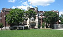
Bendale, also called Cedarbrae and Midland Park, is a residential neighbourhood in the eastern part of Toronto, Ontario, Canada. It is located in the former suburb of Scarborough. It is centred on the intersection of Lawrence Avenue East and Brimley Road. Its boundaries, as defined by the City, are Midland Avenue from Lawrence, north to Highway 401, east to McCowan, south to Lawrence, east to West Highland Creek, south-west along West Highland Creek, then follow several side streets parallel to the Creek, north to Midland Avenue. The area north of Ellesmere is typically considered the Scarborough City Centre district, and is not considered in this neighbourhood article.

<span class="mw-page-title-main">Downsview</span> Neighbourhood in Toronto, Ontario, Canada

Downsview is a neighbourhood in the north end of Toronto, Ontario, Canada, located in the district of North York. The area takes its name from the Downs View farm established around 1842 near the present-day intersection of Keele Street and Wilson Avenue. It now extends beyond the intersection of Sheppard Avenue and Dufferin Street, though it is popularly seen as including the areas to the north right up to the Toronto city limit at Steeles Avenue. The area includes several large post-World War II subdivisions. Within the area is Downsview Airport, the former site of Canadian Forces Base Downsview, which has since been largely converted following the end of the Cold War into an urban park known as Downsview Park. The airport is still used as a manufacturing and testing facility for Bombardier Aerospace. As of the 2021 census, the Downsview-Roding-CFB neighbourhood was split into the two neighbourhoods of Downsview and Oakdale–Beverley Heights.

<span class="mw-page-title-main">Johnny Lombardi</span> Canadian broadcaster

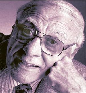
Johnny Lombardi, was a pioneer of multicultural broadcasting in Canada. He founded CHIN in 1966 and CHIN-FM in 1967.

<span class="mw-page-title-main">Earlscourt</span> Neighbourhood in Toronto, Ontario, Canada

Earlscourt is a neighbourhood in Toronto, Ontario, Canada. It is centred on St. Clair Avenue West, with Dufferin Street, Davenport Road, and Old Weston Road forming its boundaries. It is contained within the larger city-recognized neighbourhood of Corso Italia-Davenport.

<span class="mw-page-title-main">Brockton Village</span> Neighbourhood in Toronto, Ontario, Canada

Brockton Village is a former town, and now the name of a neighbourhood, in Toronto, Ontario, Canada. It comprises a section of the old Town of Brockton which was annexed by the City of Toronto in 1884.

<span class="mw-page-title-main">Corso Italia (Toronto)</span> Neighbourhood in Toronto, Ontario, Canada

Corso Italia is a neighbourhood in Toronto, Ontario, Canada, situated on St. Clair Avenue West, between Westmount Avenue and Lansdowne Avenue. It is contained within the larger city-recognized neighbourhood of Corso Italia-Davenport.

<span class="mw-page-title-main">Pelmo Park-Humberlea</span> Neighbourhood in Toronto, Ontario, Canada

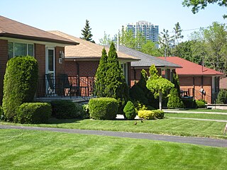
Pelmo Park-Humberlea is a neighbourhood in Toronto, Ontario, Canada. It is located north-west of the central core, in the former suburb of North York. Many of the neighbourhoods in this quadrant of the city can aptly be described as family neighbourhoods with access to parks, green space and a slower pace than found closer to downtown.

Amesbury or Brookhaven-Amesbury is a neighbourhood in Toronto, Ontario, Canada. The neighbourhood is located in northern Toronto in the former suburb of North York. It is part of federal and provincial electoral district York South—Weston, and Toronto electoral wards 11: York South—Weston (West) and 12: York South—Weston (East).

<span class="mw-page-title-main">Clanton Park, Toronto</span> Neighbourhood in Toronto, Ontario, Canada

Clanton Park is a neighbourhood in Toronto, Ontario, Canada. Located in the district of North York, it is part of federal and provincial electoral district York Centre, and Toronto electoral wards 9: York Centre (West) and 10: York Centre (East). In 2016, it had a population of 16,472, a 12.7% rise from 2011.

<span class="mw-page-title-main">Westminster-Branson</span> Neighbourhood in Toronto, Ontario, Canada

Westminster-Branson is a neighbourhood in the city of Toronto, Ontario, Canada. It is in the northernmost part of the city within the area of North York.

<span class="mw-page-title-main">Pleasant View, Toronto</span> Neighbourhood in Toronto, Ontario, Canada

Pleasant View is a neighbourhood in the city of Toronto, Ontario, Canada that is located in the district of North York at the northern end of the city. It is bordered by Victoria Park to the East, Sheppard Avenue to the South, Highway 404 to the west and the Finch hydro corridor to the north. The neighbourhood is home to several high-rise apartment and condominium buildings, such as The Clippers.

<span class="mw-page-title-main">Don Valley Village</span> Neighbourhood in Toronto, Ontario, Canada

Don Valley Village is a neighbourhood in the city of Toronto, Ontario, Canada. It is located in the former suburb of North York. Located north of Highway 401 and bisected by Don Mills Road, it is bounded by Sheppard Avenue to the south, Leslie Street to the west, Finch Avenue to the north and Highway 404 to the east. Like the nearby Don River Valley, the neighbourhood has hill and dale topography.

<span class="mw-page-title-main">Bayview Woods-Steeles</span> Neighbourhood in Toronto, Ontario, Canada

Bayview Woods-Steeles is a neighbourhood located in the northern tip of the city of Toronto, Ontario, Canada in the district of North York. It is part of federal and provincial electoral district Don Valley North, and Toronto electoral ward 17: Don Valley North. In 2006, it had a population of 13,295. The area is divided by a series of ravines, and is often not considered a neighbourhood unto itself. Rather the sections are more often divided between the neighbouring areas of Hillcrest Village, Bayview Village, and Newtonbrook.

<span class="mw-page-title-main">Fairbank, Toronto</span> Neighbourhood in Toronto, Ontario, Canada

Fairbank is a neighbourhood in Toronto, Ontario, Canada. The area is centred on the intersection of Dufferin Street and Eglinton Avenue West. Fairbank includes the neighbourhoods of Briar Hill–Belgravia and Caledonia–Fairbank. The western border is the CNR lines. The northern and southern borders are the former borders of the City of York and the eastern border is Dufferin Street.

<span class="mw-page-title-main">Palmerston-Little Italy</span> Neighbourhood in Toronto, Ontario, Canada

Palmerston-Little Italy is a neighbourhood in central Toronto, Ontario, Canada. Its boundaries, according to the City of Toronto, are by Bathurst Street to the east, Bloor Street to the north, Dovercourt Road to the west and College Street to the south. It is a mature downtown neighbourhood. Within this official neighbourhood of the City of Toronto are two neighbourhoods, Palmerston and Little Italy and the commercial enclave of Mirvish Village.

<span class="mw-page-title-main">The Ward, Toronto</span>

The Ward was a neighbourhood in central Toronto, Ontario, Canada, in the 19th and early 20th centuries. Many new immigrants first settled in the neighbourhood; it was at the time widely considered a slum.

<span class="mw-page-title-main">Harbord Street Bridge</span> Bridge in Toronto, Canada

The Harbord Street Bridge is one of two known bridges that once spanned Harbord Street over Garrison Creek in Toronto and was partially buried intact in the 20th Century.

<span class="mw-page-title-main">Trinity-Bellwoods</span> Neighbourhood in Toronto, Ontario, Canada

Trinity-Bellwoods is an inner city neighbourhood in Toronto, Ontario, Canada. It is bounded on the east by Bathurst Street, on the north by College Street, on the south by Queen Street West, and by Dovercourt Road on the west. It has a large Portuguese and Brazilian community, and many local Portuguese-Canadian businesses are located along Dundas Street West, continuing west into Little Portugal; this stretch further west along Dundas is known as Rua Açores.

<span class="mw-page-title-main">Italian Canadians in the Greater Toronto Area</span>

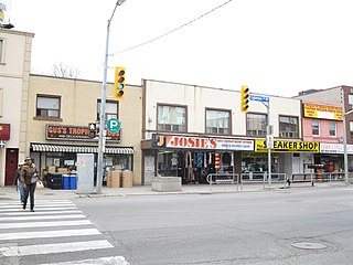
Toronto has a large Italian Canadian community, with 30.3 per cent of the ethnic Italians in Canada living in the Greater Toronto Area (GTA) as of 2021. Toronto is home to the fourth largest population of people of Italian descent after Buenos Aires, São Paulo and New York City, respectively. As of the Canada 2021 Census, there were 468,970 Italian Canadians located in the Greater Toronto Area, with 444,755 located within the Toronto CMA.

<span class="mw-page-title-main">Markham Street, Toronto</span> Street in Toronto, Ontario, Canada

Markham Street is a north–south residential street located in the city of Toronto, Ontario, Canada, one block west of Bathurst Street. Its northern end starts in the Seaton Village neighbourhood and it passes through Mirvish Village, Palmerston–Little Italy, Trinity–Bellwoods and ends at West Queen Street West at its south end.

References

  1. 1 2 Zucchi, p. 36.
  2. "History - Pier 21". www.pier21.ca.
  3. "Media legend Johnny Lombardi dies at 86". CTV News. March 19, 2002. Archived from the original on December 4, 2005. Retrieved April 11, 2010. Prime Minister Jean Chretien praised Lombardi's accomplishments upon hearing of his death. "I think he's done a lot to establish multiculturalism in Toronto and he will be missed by a lot of people," Chretien said.
  4. "Johnny Lombardi". www.chinradio.com.
  5. 1 2 Sturino, Franc (1990). Forging the chain: a case study of Italian migration to North America, 2000-1930. Toronto: Multicultural History Society of Ontario. p.  168. ISBN   0-919045-45-6.
  6. 1 2 3 Jordan Stanger-Ross (2010). Staying Italian: Urban Change and Ethnic Life in Postwar Toronto and Philadelphia (Historical Studies of Urban America). University of Chicago Press. ISBN   9780226770765.
  7. "The littlest Little Italy slowly fades away". theglobeandmail.com. August 26, 2005.
  8. "Awesome Movies Filmed in Toronto". Archived from the original on August 6, 2015. Retrieved January 26, 2015.
  9. Burpee, Matthew. "We're now in New York City" . Retrieved December 12, 2013.