
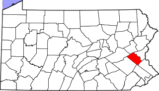
Lehigh County is a county in the Commonwealth of Pennsylvania. As of the 2020 census, the county's population was 374,557. Its county seat is Allentown, the state's third-largest city after Philadelphia and Pittsburgh.

Coplay is a borough in Lehigh County, Pennsylvania. Coplay's population was 3,348 at the 2020 census. It is located six miles (10 km) northwest of Allentown. The borough is part of the Lehigh Valley metropolitan area, which had a population of 861,899 and was the 68th-most populous metropolitan area in the U.S. as of the 2020 census.

Fullerton is an unincorporated area and census-designated place (CDP) in Whitehall Township in Lehigh County, Pennsylvania. The population of Fullerton was 16,588 as of the 2020 census.
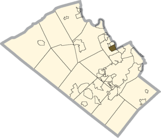
Hokendauqua is an unincorporated community and census-designated place (CDP) in Whitehall Township in Lehigh County, Pennsylvania, United States. The population of Hokendauqua was 3,340 as of the 2020 census. Hokendauqua is a suburb of Allentown, Pennsylvania in the Lehigh Valley metropolitan area, which had a population of 861,899 and was the 68th-most populous metropolitan area in the U.S. as of the 2020 census.

Schnecksville is an unincorporated community and census-designated place (CDP) in North Whitehall Township in Lehigh County, Pennsylvania. The population of Schnecksville was 2,935 at the 2010 census.

Whitehall Township is a township with home rule status in Lehigh County, Pennsylvania. The township's population was 26,738 as of the 2010 census.
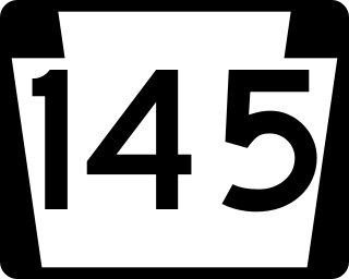
Pennsylvania Route 145 is a 20.89 mi (33.62 km) long north–south state highway in the Lehigh Valley area of eastern Pennsylvania. It connects Interstate 78 (I-78) and PA 309 in Lanark, Lehigh County, north to PA 248 in Lehigh Gap, Northampton County.

Area codes 610, 484, and 835 are telephone area codes in the North American Numbering Plan (NANP) for the eastern and southeastern regions of Pennsylvania. The numbering plan area (NPA) includes regions to the west of Philadelphia and the cities Allentown, Bethlehem, and Reading. It includes much of the Delaware Valley, including almost all of Delaware County, most of the Philadelphia Main Line, and all of the Lehigh Valley.

Summit Lawn is a small unincorporated village that is located in Lehigh County, Pennsylvania. It is part of the Lehigh Valley, which has a population of 861,899 and is the 68th-most populous metropolitan area in the U.S. as of the 2020 census.
Lanark is a small unincorporated village located in Upper Saucon Township in Lehigh County, Pennsylvania. It is part of the Lehigh Valley, the third-largest metropolitan area in Pennsylvania.

Egypt is an unincorporated community and census-designated place (CDP) in Whitehall Township in Lehigh County, Pennsylvania, United States. The population of Egypt was 2,588 as of the 2020 census.

Cementon is an unincorporated area and census-designated place (CDP) in Lehigh County, Pennsylvania. The town is in Whitehall Township, 7 miles (11 km) north of Allentown. As of the 2020 census, the population of Cementon was 1,657. Cementon is part of the Lehigh Valley metropolitan area, which had a population of 861,899 and was the 68th-most populous metropolitan area in the U.S. as of 2020. It uses the Whitehall Township ZIP Code of 18052.

Whitehall Mall is a shopping mall located in Whitehall, Pennsylvania. It is anchored by Kohl's. Whitehall Mall was one of the Lehigh Valley's first malls and is located across from the Lehigh Valley Mall.
West Catasauqua is an unincorporated village in Whitehall Township in Lehigh County, Pennsylvania. Once a port and station along the busy Lehigh Canal, it is colloquially known as West Catty. It is part of the Lehigh Valley, which has a population of 861,899 and is the 68th-most populous metropolitan area in the U.S. as of the 2020 census.
Walbert is a small village that hosts the municipal offices of South Whitehall Township in Lehigh County, Pennsylvania. It is part of the Lehigh Valley, which has a population of 861,899 and is the 68th-most populous metropolitan area in the U.S. as of the 2020 census.
Ironton is a village in North Whitehall Township in Lehigh County, Pennsylvania. It is part of the Lehigh Valley, which has a population of 861,899 and was the 68th-most populous metropolitan area in the U.S. as of the 2020 census.
Scherersville is an unincorporated community in Lehigh County, Pennsylvania. It is located on Jordan Creek, mainly in South Whitehall Township and also in Whitehall Township. Schereresville is part of the Lehigh Valley, which has a population of 861,899 and is the 68th-most populous metropolitan area in the U.S. as of the 2020 census.
The Ironton Rail Trail is a rail trail that spans 9 mi (14 km) in Lehigh County, Pennsylvania. The trail was made from tracks of the defunct Ironton Railroad and includes a paved 5 mi (8.0 km) loop.

The Whitehall Parkway is a 110-acre park situated near the center of Whitehall Township, Pennsylvania in the Lehigh Valley region of eastern Pennsylvania. The parkway serves as a preserved green space in the center of the Township after the Township government acquired the property in 1990 and sought to preserve a mix of Whitehall's history, spanning from early settlers to recent cement and mining companies centered on the Coplay Creek, a tributary of the area's Lehigh River.

