
Lehigh County is a county in the Commonwealth of Pennsylvania. As of the 2020 census, the county's population was 374,557. Its county seat is Allentown, the state's third-largest city after Philadelphia and Pittsburgh.

Salisbury Township is a township in Lehigh County, Pennsylvania. The township's population was 13,505 at the 2010 census. The township borders Allentown, Pennsylvania's third-largest city, Bethlehem, and Emmaus, in the Lehigh Valley, which had a population of 861,899 and was the 68th-most populous metropolitan area in the U.S. as of the 2020 census.

Bethlehem is a city in Northampton and Lehigh Counties in the Lehigh Valley region of eastern Pennsylvania, United States. As of the 2020 census, Bethlehem had a total population of 75,781. Among its total population as of 2020, 55,639 were in Northampton County and 19,343 were in Lehigh County. It is Pennsylvania's seventh-most populous city. The city is located along the Lehigh River, a 109-mile-long (175 km) tributary of the Delaware River.
Dorneyville is a census-designated place in Lehigh County, Pennsylvania. As of the 2020 census the population was 4,850. Dorneyville is located just west of Allentown in South Whitehall Township and Salisbury Township.

Pennsylvania Route 309 is a state highway that runs for 134 miles (216 km) through eastern Pennsylvania. The route runs from an interchange between PA 611 and Cheltenham Avenue on the border of Philadelphia and Cheltenham Township north to an intersection with PA 29 in Bowman Creek, a village in Monroe Township in Wyoming County. The highway connects Philadelphia and its northern suburbs to Allentown and the Lehigh Valley, and Hazleton and Wilkes-Barre in the Wyoming Valley.

Little Lehigh Creek is approximately 24.0 miles (38.6 km) long and is located in the Lehigh Valley region of eastern Pennsylvania. It is sometimes referred to as the Little Lehigh River. It is the largest tributary of the Lehigh River.

Pennsylvania Route 378 (PA 378) is a north-to-south road in Lehigh and Northampton counties in the Lehigh Valley region of the U.S. state of Pennsylvania. The southern terminus is at PA 309 in Center Valley. Its northern terminus is at U.S. Route 22 (US 22) in Bethlehem. The route heads north from PA 309 as a two-lane undivided road through Upper Saucon Township and Lower Saucon Township before crossing South Mountain into the city of Bethlehem. Here, PA 378 follows city streets through Bethlehem's South Side, intersecting the northern terminus of PA 412. The route crosses the Lehigh River and becomes a four-lane freeway that continues north to US 22. PA 378 is the only highway from US 22 to Center City Bethlehem, and a quick route for visitors traveling to the Wind Creek Bethlehem casino resort on the city's South Side.
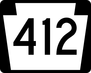
Pennsylvania Route 412 is a 17.75-mile-long (28.57 km) north–south state route located in Northampton and Bucks counties in southeastern Pennsylvania. Its southern terminus is at PA 611 in the Nockamixon Township community of Harrow. Its northern terminus is at PA 378 in Bethlehem.
Summit Lawn is a small unincorporated village in Lehigh County, Pennsylvania. Summit Lawn is part of the Lehigh Valley, which has a population of 861,899 and is the 68th=most populous metropolitan area in the U.S. as of the 2020 census.

State Route 1002(SR 1002), locally known as Tilghman Street and Union Boulevard, is a major 13.8 mi (22.2 km) long east–west road in the Lehigh Valley area of the U.S. state of Pennsylvania. The majority of the roadway is the former alignment of U.S. Route 22, maintained by the Pennsylvania Department of Transportation as a Quadrant Route, and is not signed except on small white segment markers.

Geryville is a village located mainly in Milford Township, Bucks County but also in Upper Hanover Township, Montgomery County, Pennsylvania, United States. The first letter of the name is pronounced as a hard "g." It is located just north of Route 663 and is split between the East Greenville zip code of 18041 and the Pennsburg zip code of 18073. Originally known as Aurora, the village received its name from the postmaster Jesse Gery in 1865. The Publick House on the corner of Sleepy Hollow Road and Geryville Pike played a prominent role in Fries's Rebellion of 1799. It is drained via the Macoby Creek southward into the Perkiomen Creek and Schuylkill River.

Schoenersville is a suburban village split between Hanover Township in Lehigh County and Hanover Township in Northampton County, Pennsylvania. It is pronounced "SHOO-nerz-vil" and is part of the Lehigh Valley metropolitan area, which has a population of 861,899 and is the 68th-most populous metropolitan area in the U.S. as of the 2020 census.

Swabia Creek is a tributary of Little Lehigh Creek in Berks and Lehigh Counties in the eastern Pennsylvania region of the Lehigh Valley.
Andreas is a village in the southeast corner of Schuylkill County, Pennsylvania, in West Penn Township on Route 895. A small part of Andreas is also in East Penn Township in Carbon County. The Lizard Creek flows eastward through the village to the Lehigh River. Andreas lies at the northern foot of Blue Mountain in ZIP Code 18211.

The Lehigh Line is a railroad line in Central New Jersey, Northeastern Pennsylvania, and the Lehigh Valley region of eastern Pennsylvania. It is owned and operated by the Norfolk Southern Railway. The line runs west from the vicinity of the Port of New York and New Jersey in Manville, New Jersey via Conrail's Lehigh Line to the southern end of Wyoming Valley's Coal Region in Lehigh Township, Pennsylvania.

Catasauqua Creek is an ENE–SSW oriented creek draining 6.6 miles (10.6 km) from springs of the Blue Mountain barrier ridge several miles below the Lehigh Gap in the ridge-and-valley Appalachians located upriver and opposite from Allentown in Lehigh and Northampton counties in the Lehigh Valley region of eastern Pennsylvania.
East Branch Saucon Creek is a tributary of Saucon Creek in Northampton County, Pennsylvania, in the United States. It is approximately 5.9 miles (9.5 km) long and flows through Lower Saucon Township and Bethlehem. The watershed of the creek has an area of 10.3 square miles (27 km2). A reach of the creek is designated as an impaired waterbody. However, the upper reaches are relatively unimpacted by development and the wetlands at its headwaters are designated as Exceptional Value and are home to numerous amphibians. The creek is also inhabited by wild trout.
Black River is a tributary of Saucon Creek in Lehigh and Northampton counties in the US state of Pennsylvania. It is approximately 4.6 miles (7.4 km) long and flows through Upper Saucon and Salisbury townships in Lehigh County and Lower Saucon Township and Bethlehem in Northampton County. The watershed of the river has an area of 4.49 square miles (11.6 km2). It is designated as a Coldwater Fishery and a Migratory Fishery and contains wild trout. The river is a very small limestone stream and flows in the vicinity of Lehigh University's Saucon Fields.
Corning is a village in far southern Lehigh County, Pennsylvania located in both Upper Milford and Lower Milford Townships. It borders Berks and Montgomery Counties.


