Alburtis, Pennsylvania

Last updated

Alburtis, Pennsylvania
George F. Schlicher Hotel.JPG
George F. Schlicher Hotel in Alburtis in December 2012
Alburtis Seal.png
Lehigh County Pennsylvania Incorporated and Unincorporated areas Alburtis Highlighted.svg
Location of Alburtis in Lehigh County, Pennsylvania (left) and of Lehigh County in Pennsylvania (right)
USA Pennsylvania location map.svg
Red pog.svg
Alburtis
Location of Alburtis in Pennsylvania
Usa edcp location map.svg
Red pog.svg
Alburtis
Alburtis (the United States)
Coordinates: 40°30′36″N75°36′07″W / 40.51000°N 75.60194°W / 40.51000; -75.60194
Country Flag of the United States.svg  United States
State Flag of Pennsylvania.svg  Pennsylvania
County Lehigh
Area
[1]
   Borough 0.71 sq mi (1.83 km2)
  Land0.71 sq mi (1.83 km2)
  Water0.00 sq mi (0.00 km2)
Elevation
472 ft (144 m)
Population
 (2020) [2]
   Borough 2,596
  Density3,671.85/sq mi (1,417.85/km2)
   Metro
865,310 (US: 68th)
Time zone UTC-5 (EST)
  Summer (DST) UTC-4 (EDT)
ZIP Code
18011
Area code(s) 610
FIPS code 42-00660
Primary airport Lehigh Valley International Airport
Major hospital Lehigh Valley Hospital–Cedar Crest
School district East Penn
Website http://www.alburtis.org

Alburtis is a borough in Lehigh County, Pennsylvania, United States. The borough's population was 2,596 as of the 2020 census. It is a suburb of Allentown, the third largest city in Pennsylvania. It is part of the Lehigh Valley metropolitan area, which had a population of 861,899 and was the 68th-most populous metropolitan area in the U.S. as of the 2020 census.

Contents

Geography

According to the U.S. Census Bureau, the borough has a total area of 0.7 square miles (1.8 km2), all land. The Alburtis ZIP Code (18011) comprises two separate areas stretching from south of Trexlertown into the district township in neighboring Berks County. [3] Alburtis has a hot-summer humid continental climate (Dfa) and is in hardiness zone 6b. Average monthly temperatures range from 29.1 °F in January to 73.6 °F in July. [4]

History

Alburtis was incorporated on May 9, 1913 by the merger of two villages, Alburtis and Lock Ridge, both of which were settled in the mid-1800s. [5] Alburtis was named for Edward K. Alburtis, a civil engineer involved in the construction of the East Pennsylvania Branch of the Philadelphia and Reading Railway. When a railroad station was established in the village in 1859, the railroad's board of directors named the town in his honor. [6] [5]

A tract adjacent to Alburtis was purchased by the Lockridge Iron Company for the construction of blast furnaces in the late 1860s. This area, which grew into a separate village, is known as Lock Ridge Park. [5]

The Thomas Iron Company and George F. Schlicher Hotel, both in Alburtis, have been named to the National Register of Historic Places in recognition of their historical significance to the nation. [7]

Demographics

Historical population
CensusPop.Note
1880 500
1920 795
1930 8233.5%
1940 8857.5%
1950 97910.6%
1960 1,08610.9%
1970 1,1425.2%
1980 1,42825.0%
1990 1,415−0.9%
2000 2,11749.6%
2010 2,36111.5%
2020 2,59610.0%
Sources: [8] [9] [2]

As of the 2000 census, [10] there were 2,117 people, 774 households and 593 families residing in the borough. The population density was 2,993.2 inhabitants per square mile (1,155.7/km2). There were 799 housing units at an average density of 1,129.7 per square mile (436.2/km2). The racial makeup of the borough was 97.21% White, 0.33% African American, 0.05% Native American, 1.42% Asian, 0.24% Pacific Islander, 0.24% from other races, and 0.52% from two or more races. Hispanic or Latino of any race were 0.85% of the population.

There were 774 households, of which 42.6% had children under the age of 18 living with them, 62.5% were married couples living together, 9.2% had a female householder with no husband present, and 23.3% were non-families. 18.9% of all households were made up of individuals, and 5.6% had someone living alone who was 65 years of age or older. The average household size was 2.74 and the average family size was 3.13.

In the borough, the population was spread out, with 29.7% of the population under the age of 18, 6.5% from 18 to 24, 38.6% from 25 to 44, 17.9% from 45 to 64, and 7.3% who were 65 years of age or older. The median age was 33 years. For every 100 females there were 99.5 males. For every 100 females age 18 and over, there were 97.7 males. The median income for a household in the borough was $52,361, and the median income for a family was $57,863. Males had a median income of $36,915 compared with $27,094 for females. The per capita income for the borough was $20,611. About 2.8% of families and 3.4% of the population were below the poverty line, including 3.4% of those under age 18 and 8.8% of those age 65 or over.

Education

Alburtis is served by East Penn School District. Emmaus High School in Emmaus serves grades nine through twelve. Eyer Middle School and Lower Macungie Middle School, both in Macungie, serve grades six through eight. One of the district's seven elementary schools, Alburtis Elementary School, is located in Alburtis.

Recreation

Lock Ridge Park is the predominant public park in Alburtis. Swabia Creek flows through the park and borough. The borough also includes a community center, pool, and several baseball fields. [11]

Alburtis is the current home of the Frankford Radio Club, [12] a long-running amateur radio club founded at Frankford High School in Philadelphia around 1927. [13] [14] [15]

Transportation

Main Street in Alburtis in September 2022 2022-09-24 15 11 02 View northwest along Main Street just northwest of Penn Avenue in Alburtis, Lehigh County, Pennsylvania.jpg
Main Street in Alburtis in September 2022

As of 2011, there were 8.49 miles (13.66 km) of public roads in Alburtis, of which 2.27 miles (3.65 km) were maintained by the Pennsylvania Department of Transportation (PennDOT) and 6.22 miles (10.01 km) were maintained by the borough. [16]

No numbered highways served Alburtis directly. Main thoroughfares through the borough include Franklin Street, Main Street, Penn Avenue and Front Street. The nearest numbered highway is Pennsylvania Route 100.

Notable person

Related Research Articles

<span class="mw-page-title-main">Boyertown, Pennsylvania</span> Borough in Pennsylvania, United States

Boyertown is a borough in Berks County, Pennsylvania, United States. The population was 4,264 at the 2020 census. Boyertown is known for the many painted fiberglass bears that can be found throughout the town and borough.

<span class="mw-page-title-main">Maxatawny Township, Pennsylvania</span> Township in Pennsylvania, United States

Maxatawny Township is a township in Berks County, Pennsylvania, United States. The population was 7,906 at the 2010 census.

<span class="mw-page-title-main">Topton, Pennsylvania</span> Borough in Pennsylvania, United States

Topton is a borough in Berks County, Pennsylvania, United States. The population was 2,041 at the 2020 census.

<span class="mw-page-title-main">Palmerton, Pennsylvania</span> Borough in Pennsylvania, United States

Palmerton is a borough in Carbon County, Pennsylvania, United States. It is part of Northeastern Pennsylvania. The borough's population was 5,414 at the 2010 census.

Ancient Oaks is a census-designated place (CDP) in Lower Macungie Township in Lehigh County, Pennsylvania, United States. It is named after the housing subdivision named Ancient Oaks, located off PA Route 100 just north of Macungie. The population of Ancient Oaks was 6,995 at the 2020 census.

<span class="mw-page-title-main">Emmaus, Pennsylvania</span> Borough in Pennsylvania, United States

Emmaus is a borough in Lehigh County, Pennsylvania, United States. As of the 2020 U.S. census, it had a population of 11,652. Emmaus is located in the Lehigh Valley, the third-largest metropolitan area in Pennsylvania and 68th-largest metropolitan area in the nation.

<span class="mw-page-title-main">Lower Macungie Township, Pennsylvania</span> Township in Pennsylvania, United States

Lower Macungie Township is a township in Lehigh County, Pennsylvania, United States. The township's population was 31,964 as of the 2020 census, making it the second-largest population center in Lehigh County after Allentown and the third-largest population center in the Lehigh Valley metropolitan area after Allentown and Bethlehem.

<span class="mw-page-title-main">Lowhill Township, Pennsylvania</span> Township in Pennsylvania, United States

Lowhill Township is a township in Lehigh County, Pennsylvania, United States. The population of Lowhill Township was 2,173 at the 2010 census. It is a suburb of Allentown, in the Lehigh Valley, which had a population of 861,899 and was the 68th-most populous metropolitan area in the U.S. as of the 2020 census.

<span class="mw-page-title-main">Macungie, Pennsylvania</span> Borough in Pennsylvania, United States

Macungie is the second oldest borough in Lehigh County, Pennsylvania, United States. As of the 2020 census, Macungie had a population of 3,257.

<span class="mw-page-title-main">Salisbury Township, Lehigh County, Pennsylvania</span> Township in Pennsylvania, United States

Salisbury Township is a township in Lehigh County, Pennsylvania, United States. The township's population was 13,621 at the 2020 census. The township borders Allentown, Pennsylvania's third-largest city, Bethlehem, and Emmaus, in the Lehigh Valley, which had a population of 861,899 and was the 68th-most populous metropolitan area in the U.S. as of the 2020 census.

<span class="mw-page-title-main">South Whitehall Township, Pennsylvania</span> Township in Pennsylvania, United States

South Whitehall Township is a township in Lehigh County, Pennsylvania, United States. The township's population was 19,180 at the 2010 census. It is a suburb of Allentown and is part of the Lehigh Valley, which had a population of 861,899 and was the 68th-most populous metropolitan area in the U.S. as of the 2020 census.

<span class="mw-page-title-main">Upper Macungie Township, Pennsylvania</span> Township in Pennsylvania, United States

Upper Macungie Township is a township in Lehigh County, Pennsylvania, United States. The population of Upper Macungie Township was 26,377 as of the 2020 U.S. census, making it the fourth-fastest growing municipality of any category in Pennsylvania in terms of total population growth between 2010 and 2020.

<span class="mw-page-title-main">Upper Milford Township, Pennsylvania</span> Township in Pennsylvania, United States

Upper Milford Township is a township in Lehigh County, Pennsylvania, United States. The township's population was 7,292 at the 2010 census. Upper Milford Township is a rural area southwest of Allentown in the Lehigh Valley, which had a population of 861,899 and was the 68th-most populous metropolitan area in the U.S. as of the 2020 census.

<span class="mw-page-title-main">Upper Saucon Township, Pennsylvania</span> Township in Pennsylvania, United States

Upper Saucon Township is a township in Lehigh County, Pennsylvania, United States. It is part of the Lehigh Valley metropolitan area, which had a population of 861,899 and was the 68th-most populous metropolitan area in the U.S. as of the 2020 census. The township had a population of 16,973 as of the 2020 census.

<span class="mw-page-title-main">Rockledge, Pennsylvania</span> Borough in Pennsylvania, United States

Rockledge is a borough in Montgomery County, Pennsylvania, United States. The population was 2,638 as of the 2020 census. Rockledge is surrounded by Abington Township and the city of Philadelphia, and shares a ZIP code with Jenkintown.

<span class="mw-page-title-main">Freemansburg, Pennsylvania</span> Place in Pennsylvania, United States

Freemansburg is a borough in Northampton County, Pennsylvania. The population of Freemansburg was 2,875 as of the 2020 census. The Lehigh River, a 109-mile-long (175 km) tributary of the Delaware River, flows through Freemansburg.

<span class="mw-page-title-main">Moore Township, Pennsylvania</span> Place in Pennsylvania, United States

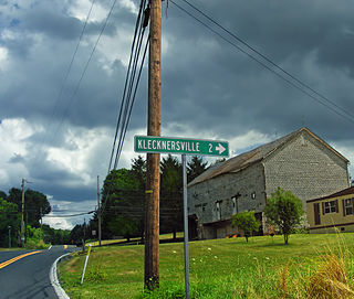
Moore Township is a township in Northampton County, Pennsylvania, United States. The population of Moore Township was 9,198 at the 2010 census. The township is located in the Lehigh Valley, which had a population of 861,899 and was the 68th-most populous metropolitan area in the U.S. as of the 2020 census.

<span class="mw-page-title-main">Pen Argyl, Pennsylvania</span> Borough in Pennsylvania, United States

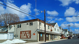
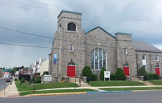
Pen Argyl is a borough in Northampton County, Pennsylvania. The borough's population was 3,510 as of the 2020 census.

<span class="mw-page-title-main">Stockertown, Pennsylvania</span> Place in Pennsylvania, United States

Stockertown is a borough in Northampton County, Pennsylvania. The borough's population was 927 as of the 2010 census. It is part of the Lehigh Valley metropolitan area, which had a population of 861,899 and was the 68th-most populous metropolitan area in the U.S. as of the 2010 census.

Hensingersville, also known as New Hensingersville, is an unincorporated community located mostly in southwestern Lower Macungie Township in Lehigh County, Pennsylvania. It also extends into Longswamp Township in Berks Township near the intersections of Pennsylvania Route 201, Pennsylvania Route 3001, Chestnut Road, and Reservoir Hill Road.

References

  1. "ArcGIS REST Services Directory". United States Census Bureau. Retrieved October 12, 2022.
  2. 1 2 "Census Population API". United States Census Bureau. Retrieved October 12, 2022.
  3. "Google Maps". Google.com. Retrieved February 9, 2016.
  4. Oregon State University
  5. 1 2 3 "Alburtis and Lock Ridge History". alhs18011.org. Alburtis Lock Ridge Historical Society. Retrieved May 10, 2022.
  6. "History, Borough of Alburtis". Alburtis.org. Retrieved December 14, 2011.
  7. "National Register Information System". National Register of Historic Places . National Park Service. July 9, 2010.
  8. "Census of Population and Housing: Decennial Censuses". United States Census Bureau . Retrieved March 4, 2012.
  9. "Incorporated Places and Minor Civil Divisions Datasets: Subcounty Resident Population Estimates: April 1, 2010 to July 1, 2012". Population Estimates. U.S. Census Bureau. Archived from the original on June 11, 2013. Retrieved December 11, 2013.
  10. "U.S. Census website". United States Census Bureau . Retrieved January 31, 2008.
  11. Center, Alburtis Area Community. "Alburtis Area Community Center". WELCOME TO THE ALBURTIS AREA COMMUNITY CENTER. Retrieved March 27, 2020.
  12. "Frankford Radio Club: Proficiency Through Competition".
  13. "FRC History Introduction".
  14. "QST". 55. American Radio Relay League. 1971: 54–56.{{cite journal}}: Cite journal requires |journal= (help)
  15. George, J. K. (2016). Contact Sport: A Story of Champions, Airwaves, and a One-Day Race Around the World. Greenleaf Book Group Press. pp. 64, 80. ISBN   978-1626342361.
  16. "Alburtis Borough map" (PDF). PennDOT. Retrieved March 17, 2023.