Salisbury Township, Lehigh County, Pennsylvania

Last updated

Salisbury Township
Salisbury Township Bldg, LehighCo PA 01.JPG
Salisbury Township Office in June 2015
Salisbury Township Seal.png
Lehigh county - Salisbury.png
Location of Salisbury Township in Lehigh County, Pennsylvania
USA Pennsylvania location map.svg
Red pog.svg
Salisbury Township
Location of Salisbury Township in Pennsylvania
Usa edcp location map.svg
Red pog.svg
Salisbury Township
Location in the United States
Coordinates: 40°34′46″N75°30′09″W / 40.57944°N 75.50250°W / 40.57944; -75.50250
Country Flag of the United States.svg  United States
State Flag of Pennsylvania.svg  Pennsylvania
County Lehigh
Area
[1]
   Township 11.27 sq mi (29.19 km2)
  Land11.17 sq mi (28.93 km2)
  Water0.10 sq mi (0.26 km2)
Elevation
354 ft (108 m)
Population
 (2020) [2]
   Township 13,621
  Estimate 
(2022) [3]
13,585
  Density1,232.03/sq mi (475.67/km2)
   Metro
865,310 (US: 68th)
Time zone UTC-5 (EST)
  Summer (DST) UTC-4 (EDT)
ZIP Codes
18015, 18049, and 18103
Area code(s) 610 and 484
FIPS code 42-077-67576
Primary airport Lehigh Valley International Airport
Major hospital Lehigh Valley Hospital–Cedar Crest
School district Salisbury Township
Website www.salisburytownshippa.org

Salisbury Township is a township in Lehigh County, Pennsylvania. The township's population was 13,621 at the 2020 census. [2] The township borders Allentown, Pennsylvania's third-largest city, Bethlehem, and Emmaus, in the Lehigh Valley, which had a population of 861,899 and was the 68th-most populous metropolitan area in the U.S. as of the 2020 census.

Contents

Salisbury Township is located 3.8 miles (6.1 km) southeast of Allentown, 56.6 miles (91.1 km) north of Philadelphia, and 87.6 miles (141.0 km) west of New York City. [4] South Mall, an enclosed shopping mall, is located on Lehigh Street in the township.

Demographics

Historical population
CensusPop.Note
2000 13,498
2010 13,5050.1%
2020 13,6210.9%
2022 (est.)13,585 [3] −0.3%
U.S. Decennial Census [5]

As of the census [6] of 2010, there were 13,505 people, 5,595 households, and 3,832 families residing in the township. The population density was 1,224.9 inhabitants per square mile (472.9/km2). There were 5,595 housing units at an average density of 495.1 per square mile (191.2/km2). The racial makeup of the township was 91.39% White, 2.93% African American, 0.03% Native American, 1.60 Asian, 0.02% Pacific Islander, 2.40% from other races, and 1.63% from two or more races. Hispanic or Latino of any race were 2.14% of the population.

There were 5,333 households, out of which 24.79% had children under the age of 18 living with them, 60.25% were married couples living together, 7.61% had a female householder with no husband present, and 28.15% were non-families. 23.53% of all households were made up of individuals, and 12.11% had someone living alone who was 65 years of age or older. The average household size was 2.47 and the average family size was 2.91.

In the township, the population was spread out, with 18.84% under the age of 18, 7.02% from 18 to 24, 21.22% from 25 to 44, 32.90% from 45 to 64, and 20.01% who were 65 years of age or older. The median age was 48.2 years. For every 100 females, there were 99.1 males. For every 100 females age 18 and over, there were 96.5 males. The estimated median income for a household in the township in 2014 was $69,685, and the estimated median income for a family was $84,429. Males had an estimated median income of $54,869 versus $39,024 for females. The estimated per capita income for the township was $35,133. In 2014 it was estimated that 4.1% of families and 5.8% of the population were below the poverty line, including 8.0% of those under age 18 and 5.5% of those age 65 or over.

Geography

South Mall's main entrance in Salisbury Township in June 2015 South Mall, Allentown PA 06.JPG
South Mall's main entrance in Salisbury Township in June 2015
Salisbury High School in June 2015 Salisbury High School, LehighCo PA.JPG
Salisbury High School in June 2015
I-78 West at PA Route 309 in Salisbury Township 2022-09-23 11 08 57 View west along Interstate 78 and north along Pennsylvania State Route 309 from the overpass for Rock Road in Salisbury Township, Lehigh County, Pennsylvania.jpg
I-78 West at PA Route 309 in Salisbury Township

According to the U.S. Census Bureau, the township has a total area of 11.3 square miles (29.2 km2), of which 11.2 square miles (28.9 km2) are land and 0.1 square miles (0.3 km2), or 0.87%, are water. [1] It is drained by the Lehigh River, which separates it from Bethlehem and the east side of Allentown, and borders Upper Saucon Township on South Mountain. Elevations range from approximately 220 feet (67 m) above sea level on the river to 1,030 feet (310 m) in Big Rock County Park.

Emmaus and Allentown share a border, separating Salisbury into two demographically distinct non-contiguous portions. The township's villages of Farmington, Gauff Hill and Summit Lawn are in the eastern portion. The CDP of Dorneyville is in both the extreme northwestern part of the township and in South Whitehall Township.

Climate

Salisbury Township has a hot-summer humid continental climate (Dfa) and is in hardiness zone 6b. The average monthly temperature in the vicinity of South Mall ranges from 29.0 °F (−1.7 °C) in January to 73.7 °F (23.2 °C) in July. [7]

Adjacent municipalities

Education

The township is served by the Salisbury Township School District. Salisbury High School serves grades 9 through 12.

Notable people

Transportation

As of 2022, there were 77.68 miles (125.01 km) of public roads in Salisbury Township, of which 12.64 miles (20.34 km) were maintained by the Pennsylvania Department of Transportation (PennDOT) and 65.04 miles (104.67 km) were maintained by the township. [8]

Salisbury's major thoroughfares include Interstate 78/Pennsylvania Route 309, Pennsylvania Route 29, Pennsylvania Route 145 (Pike Avenue), Emmaus Avenue, Susquehanna Street/Broadway, Lehigh Street, 24th Street, and Cedar Crest Boulevard. The township is served by multiple LANta bus routes.

Related Research Articles

<span class="mw-page-title-main">Lehigh County, Pennsylvania</span> County in Pennsylvania, United States

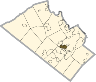
Lehigh County is a county in the Commonwealth of Pennsylvania. As of the 2020 census, the county's population was 374,557. Its county seat is Allentown, the state's third-largest city after Philadelphia and Pittsburgh.

<span class="mw-page-title-main">Springfield Township, Bucks County, Pennsylvania</span> Township in Pennsylvania, United States

Springfield Township is a township in Bucks County, Pennsylvania, United States. The population was 5,035 at the 2010 census.

<span class="mw-page-title-main">Coopersburg, Pennsylvania</span> Borough in Pennsylvania, United States

Coopersburg is a borough in Lehigh County, Pennsylvania, United States. The population of Coopersburg was 2,447 as of the 2020 census. It is a suburb of Allentown and is located 7 miles (11 km) miles southeast of Allentown, 40 miles (64 km) north of Philadelphia, and 76 miles (122 km) west of New York City.

<span class="mw-page-title-main">Emmaus, Pennsylvania</span> Borough in Pennsylvania, United States

Emmaus is a borough in Lehigh County, Pennsylvania. As of the 2020 U.S. census, it had a population of 11,652. Emmaus is located in the Lehigh Valley, the third-largest metropolitan area in Pennsylvania and 68th-largest metropolitan area in the nation.

<span class="mw-page-title-main">Hanover Township, Lehigh County, Pennsylvania</span> Township in Pennsylvania, United States

Hanover Township is a township in Lehigh County, Pennsylvania. As of the 2010 census, the township had a population of 1,571. It is a suburb of Allentown and Bethlehem and part of the Lehigh Valley metropolitan area, which had a population of 861,899 and was the 68th-most populous metropolitan area in the U.S. as of the 2020 census.

<span class="mw-page-title-main">Lower Macungie Township, Pennsylvania</span> Township in Pennsylvania, United States

Lower Macungie Township is a township in Lehigh County, Pennsylvania. The township's population was 31,964 as of the 2020 census, making it the second-largest population center in Lehigh County after Allentown and the third-largest population center in the Lehigh Valley metropolitan area after Allentown and Bethlehem.

<span class="mw-page-title-main">Lower Milford Township, Pennsylvania</span> Township in Pennsylvania, United States

Lower Milford Township is a township in Lehigh County, Pennsylvania. The population of Lower Milford Township was 3,775 at the 2010 census. It is a suburb of Allentown in the Lehigh Valley region of eastern Pennsylvania.

<span class="mw-page-title-main">Macungie, Pennsylvania</span> Borough in Pennsylvania, United States

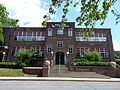
Macungie is the second oldest borough in Lehigh County, Pennsylvania. As of the 2020 census, Macungie had a population of 3,257.

<span class="mw-page-title-main">South Whitehall Township, Pennsylvania</span> Township in Pennsylvania, United States

South Whitehall Township is a township in Lehigh County, Pennsylvania. The township's population was 19,180 at the 2010 census. It is a suburb of Allentown and is part of the Lehigh Valley, which had a population of 861,899 and was the 68th-most populous metropolitan area in the U.S. as of the 2020 census.

<span class="mw-page-title-main">Upper Macungie Township, Pennsylvania</span> Township in Pennsylvania, United States

Upper Macungie Township is a township in Lehigh County, Pennsylvania. The population of Upper Macungie Township was 26,377 as of the 2020 U.S. census, making it the fourth-fastest growing municipality of any category in Pennsylvania in terms of total population growth between 2010 and 2020.

<span class="mw-page-title-main">Upper Milford Township, Pennsylvania</span> Township in Pennsylvania, United States

Upper Milford Township is a township in Lehigh County, Pennsylvania. The township's population was 7,292 at the 2010 census. Upper Milford Township is a rural area southwest of Allentown in the Lehigh Valley, which had a population of 861,899 and was the 68th-most populous metropolitan area in the U.S. as of the 2020 census.

<span class="mw-page-title-main">Upper Saucon Township, Pennsylvania</span> Township in Pennsylvania, United States

Upper Saucon Township is a township in Lehigh County, Pennsylvania. It is part of the Lehigh Valley metropolitan area, which had a population of 861,899 and was the 68th-most populous metropolitan area in the U.S. as of the 2020 census. The township had a population of 16,973 as of the 2020 census.

<span class="mw-page-title-main">Whitehall Township, Pennsylvania</span> Township in Pennsylvania, United States

Whitehall Township is a township with home rule status in Lehigh County, Pennsylvania. The township's population was 26,738 as of the 2010 census.

<span class="mw-page-title-main">Bethlehem Township, Pennsylvania</span> Place in Pennsylvania, United States

Bethlehem Township is a township in Northampton County, Pennsylvania, United States. The population of Bethlehem Township was 23,730 at the 2010 census. It is a suburb of Bethlehem and is part of the Lehigh Valley metropolitan statistical area, which had a population of 861,899 and was the 68th-most populous metropolitan area in the U.S. as of the 2020 census.

<span class="mw-page-title-main">Hanover Township, Northampton County, Pennsylvania</span> Place in Pennsylvania, United States

Hanover Township is a township in Northampton County, Pennsylvania. The population of Hanover Township was 10,866 at the 2010 census.

<span class="mw-page-title-main">Hellertown, Pennsylvania</span> Place in Pennsylvania, United States

Hellertown is a borough in Northampton County, Pennsylvania. Its population was 6,131 at the 2020 census. Hellertown is part of the Lehigh Valley metropolitan area, which had a population of 861,899 and was the 68th-most populous metropolitan area in the U.S. as of 2020.

<span class="mw-page-title-main">Lower Saucon Township, Pennsylvania</span> Place in Pennsylvania, United States

Lower Saucon Township is a township in Northampton County, Pennsylvania, United States. The township's population was 10,772 as of the 2010 census. The township is part of the Lehigh Valley metropolitan area, which had a population of 861,899 and was the 68th-most populous metropolitan area in the U.S. as of the 2020 census.

<span class="mw-page-title-main">Moore Township, Pennsylvania</span> Place in Pennsylvania, United States

Moore Township is a township in Northampton County, Pennsylvania. The population of Moore Township was 9,198 at the 2010 census. The township is located in the Lehigh Valley, which had a population of 861,899 and was the 68th-most populous metropolitan area in the U.S. as of the 2020 census.

<span class="mw-page-title-main">Lehigh Valley</span> Metropolitan Statistical Area in the United States

The Lehigh Valley, known colloquially as The Valley, is a geographic and metropolitan region formed by the Lehigh River in Lehigh and Northampton counties in eastern Pennsylvania. It is a component valley of the Great Appalachian Valley bounded to its north by Blue Mountain, to its south by South Mountain, to its west by Lebanon Valley, and to its east by the Delaware River and Warren County, New Jersey. The Valley is about 40 miles (64 km) long and 20 miles (32 km) wide. The Lehigh Valley's largest city is Allentown, the third-largest city in Pennsylvania and the county seat of Lehigh County, with a population of 125,845 residents as of the 2020 census.

<span class="mw-page-title-main">Dorneyville, Pennsylvania</span> Census-designated place in Pennsylvania, United States

Dorneyville is a census-designated place in Lehigh County, Pennsylvania. As of the 2020 census the population was 4,850. Dorneyville is located just west of Allentown in South Whitehall Township and Salisbury Township.

References

  1. 1 2 "2016 U.S. Gazetteer Files". United States Census Bureau. Retrieved August 14, 2017.
  2. 1 2 "Total Population: 2010 Census DEC Summary File 1 (P1), Salisbury township, Lehigh County, Pennsylvania". data.census.gov. U.S. Census Bureau. Retrieved October 21, 2020.
  3. 1 2 "Population and Housing Unit Estimates" . Retrieved June 9, 2017.
  4. "The Official Borough of Emmaus Pennsylvania". www.borough.emmaus.pa.us. Retrieved December 20, 2016.
  5. "Census of Population and Housing". Census.gov. Retrieved June 4, 2016.
  6. Bureau, U.S. Census. "U.S. Census website". United States Census Bureau . Retrieved February 24, 2016.
  7. Prism at Oregon State University
  8. "Salisbury Township map" (PDF). PennDOT. Retrieved March 17, 2023.