East End Park, Leeds

Last updated

East End Park
East End Park Welcome 13 August 2017.jpg
East End Park welcome sign
Leeds UK location map.svg
Red pog.svg
East End Park
West Yorkshire UK location map.svg
Red pog.svg
East End Park
Location within West Yorkshire
Metropolitan borough
Metropolitan county
Region
Country England
Sovereign state United Kingdom
Post town LEEDS
Postcode district LS9
Dialling code 0113
Police West Yorkshire
Fire West Yorkshire
Ambulance Yorkshire
List of places
UK
England
Yorkshire
53°47′39″N1°31′32″W / 53.7943°N 1.5256°W / 53.7943; -1.5256 Coordinates: 53°47′39″N1°31′32″W / 53.7943°N 1.5256°W / 53.7943; -1.5256

East End Park is an inner city area of east Leeds, West Yorkshire, England. It is situated between Burmantofts to the north west, Harehills to the north east (although not a direct neighbour), Halton Moor to the east, Richmond Hill to the west and Cross Green to the south west. It blends into the Halton Moor/Osmondthorpe area and is 1 mile to the east of Leeds city centre in the LS9 Leeds postcode area.

Contents

General description

The area is situated in the vicinity of the A64 York Road, east Leeds' main thoroughfare, and is also home to a large park dating back from Victorian times which was purchased by Leeds City Council in the late 19th century, when it was waste land. Housing in the area is made up of nineteenth-century through terraced housing, some back-to-back terraced housing. Semi-detached and detached houses are also found in the area. Many of the back-to-back terraced houses in the area were due to be demolished as part of the £1.3 billion EASEL regeneration scheme in east and south-east Leeds. However these plans were withdrawn in 2010 with Leeds City Council citing the recession debilitating the private sector's ability to build as the main reason. [1] [2] [3] [4]

Crime is unevenly distributed across East End Park. The Glensdales, Templeviews and Charltons are a small cluster of predominately back-to-back streets noted for the majority of the area's crime and have subsequently become a priority area of West Yorkshire Police, crime in the rest of the estate is much less common. The same group of streets are a focus of some regeneration in the area. [3]

The area is home to one of the major Irish communities in Leeds, and is home to the prestigious music venue 'Leeds Irish Centre', the first purpose built Irish Centre in Britain. The centre opened on 20 January 1970, although the official opening ceremony was held on 8 June 1970. [5] A blue plaque calls it "The Crucible of Darts", being the location for televised darts matches in 1973. There also a Buddhist temple in a former school by the park. [6]

The Park

East End Park was originally part of the grounds of a mansion, Osmondthorpe Hall (destroyed by fire in 1924), sold to the city in 1886. [7] It is now managed by Parks and Countryside, part of the Learning and Leisure Department, Leeds City Council. It offers has bowling greens, tennis courts, football pitches and a basketball court. There are plenty of open spaces in the park and areas of well established woodland. There are also seating areas amongst rose and shrub beds. The park hosts many events throughout the year including an annual bonfire and fun fair which attracts up to 10,000 visitors. A tennis camp is held each August for young people. [8]

In March 2009, Trees for Cities and Leeds City Council planted 3,000 whips at East End Park in order to create new areas of urban woodland to help screen the park from the railway line that runs behind it. The planting follows planting in 2007 when, with the help of the local community, 18 large trees were planted to replace those lost in September 2006 when a freak tornado struck the city. [9] [10] [11]

Transport

East End Park is situated in the vicinity of the A64 York Road, east Leeds' main thoroughfare, providing the area with a well established and reliable bus service. Most bus routes are operated by First Leeds and Arriva Yorkshire. The 19 and 19A run to Garforth, Colton, Halton, the city centre, Headingley, West Park, Ireland Wood and Tinshill. The 5 runs to Halton Moor, Osmondthorpe and the city centre. The 40 and 40A run to Seacroft, Swarcliffe, Cross Gates, Halton and the city centre. The 56 runs to Whinmoor, Seacroft, Killingbeck, Hyde Park, the University of Leeds, Headingley and Moor Grange. The 163 and 166 run from the city centre to Castleford, as well as services that run along the A64 to the east coast. The closest railway station is Leeds railway station.

Location grid

Related Research Articles

Whitkirk Human settlement in England

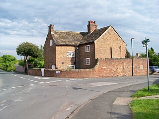
Whitkirk is a suburb of east Leeds, situated between Cross Gates to the north, Austhorpe to the east, Killingbeck to the west, Colton to the south-east and Halton to the south-west. The Temple Newsam estate lies directly south of the area.

Seacroft Suburb of Leeds, West Yorkshire, England

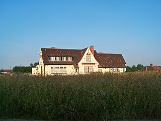
Seacroft is an outer-city suburb/township consisting mainly of council estate housing covering an extensive area of east Leeds, West Yorkshire, England. It lies in the LS14 Leeds postcode area, around 4 miles (6.4 km) east of Leeds city centre.

Hyde Park, Leeds Human settlement in England

Hyde Park is an inner-city residential area of north-west Leeds, West Yorkshire, England, situated between the University of Leeds and Headingley.

Whinmoor Human settlement in England

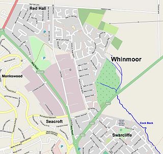
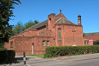
Whinmoor is residential area of east Leeds, West Yorkshire, England.

West Park, Leeds Human settlement in England

West Park is a suburb of north-west Leeds, West Yorkshire, England, north of Headingley. It is a mixed area of private suburban housing and suburban council estates. The name derives from its main park containing playing fields together with a conservation area of grassy meadow ending in woodland. The largest housing estate in West Park is Moor Grange.

Cross Gates Suburb in east Leeds, West Yorkshire, England

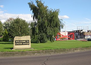
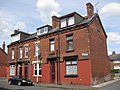
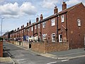
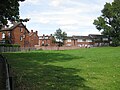
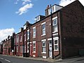
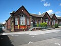
Cross Gates is a suburb in east Leeds, West Yorkshire, England.

Leeds East (UK Parliament constituency) Parliamentary constituency in the United Kingdom

Leeds East is a constituency represented in the House of Commons of the UK Parliament since 2015 by Richard Burgon of the Labour Party.

Colton, Leeds Human settlement in England

Colton is a district of east Leeds, West Yorkshire, England, situated between Cross Gates to the north, Halton and Halton Moor to the west, Whitkirk to the north-west and Austhorpe to the north-east. Temple Newsam lies directly south of the estate.

Richmond Hill, Leeds Human settlement in England

Richmond Hill is a district of Leeds, West Yorkshire, England. The district lies a mile to the east of the city centre between York Road, East End Park and Cross Green. The appropriate City of Leeds ward is Burmantofts and Richmond Hill.

Killingbeck District of Leeds, West Yorkshire, England

Killingbeck is a district of east Leeds, West Yorkshire, England that is situated between Seacroft to the north, Cross Gates and Whitkirk to the east, Gipton to the west, Halton Moor to the south, Halton to the south-east and Osmondthorpe to the south-west.

Halton Moor District of Leeds, West Yorkshire, England

Halton Moor is a district of east Leeds, West Yorkshire, England, about three miles east of Leeds city centre close to the A63. It is situated between Killingbeck to the north, Temple Newsam to the south, Osmondthorpe to the west and Halton and Colton to the east.

Burley, Leeds Area of Leeds, West Yorkshire, England

Burley is an inner city area of Leeds, West Yorkshire, England, 1 mile (1.6 km) north-west of Leeds city centre, between the A65 Kirkstall Road at the south and Headingley at the north, in the Kirkstall ward.

Osmondthorpe

Osmondthorpe a district of east Leeds in West Yorkshire, England is considered part of the Halton Moor district.

Swarcliffe Area of the City of Leeds, West Yorkshire, England

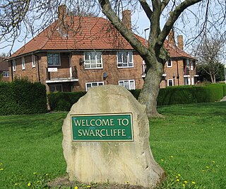
Swarcliffe, originally the Swarcliffe Estate, is a district of Leeds, West Yorkshire, England. It is 4.9 miles (8 km) east of Leeds city centre, and within the LS14 and LS15 Leeds postcode area. The district falls within the Cross Gates and Whinmoor ward of the Leeds Metropolitan Council.

Architecture of Leeds Buildings of Leeds, West Yorkshire, England

The architecture of Leeds, a city and metropolitan borough in West Yorkshire, England, encompasses a wide range of architectural styles and notable buildings. As with most northern industrial centres, much of Leeds' prominent architecture is of the Victorian era. However, the City of Leeds also contains buildings from as early as the Middle Ages such as Kirkstall Abbey, one of Britain's best preserved ruined Cistercian monasteries, as well as examples of 20th century industrial architecture, particularly in the districts of Hunslet and Holbeck.

History of Seacroft

Seacroft pre-dates the Domesday book, with evidence of a settlement in the area from the Neolithic Age. Seacroft remained largely unchanged for centuries as a small Yorkshire village, until in the 1950s the area was developed into Leeds' largest council estate. In the 1960s and 1970s the building of Whinmoor and Swarcliffe enclosed Seacroft within other suburbs.

Chapel Allerton Suburb of Leeds in West Yorkshire, England

Chapel Allerton is an inner suburb of north-east Leeds, West Yorkshire, England, 2 miles (3.2 km) from the city centre.

References

  1. "East and South East Leeds (EASEL) Regeneration". Archived from the original on 23 January 2010. Retrieved 16 August 2009.
  2. "EASEL". Archived from the original on 20 February 2012. Retrieved 2 February 2010.
  3. 1 2 "Neighbourhood Proposals" (PDF). Archived from the original (PDF) on 10 June 2011. Retrieved 29 March 2010.
  4. "EASEL Area Action Plan". Archived from the original on 30 August 2012. Retrieved 13 December 2013.
  5. "About Us". Archived from the original on 25 June 2009. Retrieved 16 August 2009.
  6. "Wat Machimmaram Temple Londesboro Terrace Osmondthorpe Leeds LS9 9NE". leeds.gov.uk. Retrieved 14 August 2017.
  7. "Osmondthorpe Old Hall, Osmondthorpe Lane". www.leodis.net. Retrieved 30 December 2017.
  8. "East End Park". Archived from the original on 20 August 2009. Retrieved 16 August 2009.
  9. "East End Park | Trees for Cities". Archived from the original on 21 June 2010. Retrieved 2 February 2010.
  10. "Stormy weather" . Retrieved 2 February 2010.
  11. "Terror storm hits Leeds". Yorkshire Evening Post. 15 September 2006. Archived from the original on 6 October 2012. Retrieved 15 June 2022.