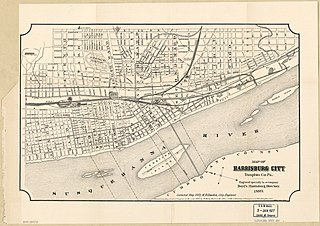
Harrisburg is the capital city of the Commonwealth of Pennsylvania, United States, and the seat of Dauphin County. With a population of 50,135 as of 2021, Harrisburg is the ninth-largest city and 15th-largest municipality in Pennsylvania. Harrisburg is situated on the east bank of the Susquehanna River. It is the larger principal city of the Harrisburg–Carlisle metropolitan statistical area, also known as the Susquehanna Valley, which had a population of 591,712 as of 2020, making it the fourth-most populous metropolitan area in Pennsylvania after the Philadelphia, Pittsburgh, and Lehigh Valley metropolitan areas.
Dauphin County is a county in the Commonwealth of Pennsylvania. As of the 2020 census, the population was 286,401. The county seat and the largest city is Harrisburg, Pennsylvania's state capital and ninth largest city. The county was created on March 4, 1785, from part of Lancaster County and was named after Louis Joseph, Dauphin of France, the first son of King Louis XVI.

Lower Paxton Township is a township of the second class in Dauphin County, Pennsylvania, United States. The population was 53,501 at the 2020 census. It is the most populous municipality in Dauphin County, exceeding that of Harrisburg, the state capital, and the 13th most populated municipality in the state.

Lower Swatara Township is a township in Dauphin County, Pennsylvania, United States. The population was 9,557 at the 2020 census. Harrisburg International Airport and Penn State Harrisburg are located within the township. It shares a ZIP Code with the nearby borough of Middletown, and all locations in the township have Middletown addresses.

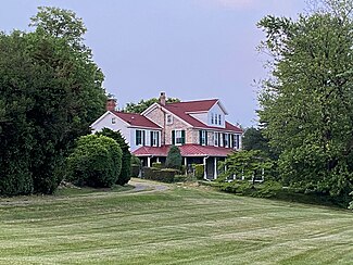
Paxtang is a borough in Dauphin County, Pennsylvania, United States. As of the 2020 census it had a population of 1,640. The borough is a suburb of Harrisburg and is one of the earliest colonial settlements in South Central Pennsylvania.

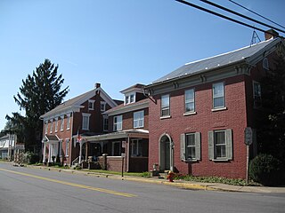
Penbrook is a borough in Dauphin County, Pennsylvania, United States, founded in 1861 and incorporated July 10, 1894. Penbrook was once named East Harrisburg and still maintains a Harrisburg postal ZIP code. The population was 3,268 at the 2020 census.
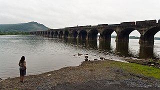
Susquehanna Township is a township in Dauphin County, Pennsylvania, United States. The population was 26,736 at the time of the 2020 census. This represents a 9.8% increase from the 2000 census count of 21,895. Susquehanna Township has the postal ZIP codes 17109 and 17110, which maintain the Harrisburg place name designation. The township is a suburb of Harrisburg and is connected to Marysville by the Rockville Bridge, the world's longest stone-arch rail bridge at the time of its completion.
Selinsgrove is the largest borough in Snyder County, Pennsylvania, United States. The population is estimated to be 5,761 for the 2020 Census.

Germantown is an area in Upper Northwest, Philadelphia, United States. Founded by German, Quaker, and Mennonite families in 1683 as an independent borough, it was absorbed into Philadelphia in 1854. The area, which is about six miles northwest from the city center, now consists of two neighborhoods: 'Germantown' and 'East Germantown'.
Carnegie Hill is a neighborhood within the Upper East Side, in the borough of Manhattan in New York City. Its boundaries are 86th Street on the south, Fifth Avenue on the west, with a northern boundary at 98th Street that continues just past Park Avenue and turns south to 96th Street and proceeds east up to, but not including, Third Avenue. The neighborhood is part of Manhattan Community District 8.
Springfield Gardens is a neighborhood in the southeastern area of the New York City borough of Queens, bounded to the north by St. Albans, to the east by Laurelton and Rosedale, to the south by John F. Kennedy International Airport, and to the west by Farmers Boulevard. The neighborhood is served by Queens Community Board 12. The area, particularly east of Springfield Boulevard, is sometimes also referred to as Brookville.

Uptown is a section of Harrisburg, Pennsylvania located North of the Midtown and Downtown neighborhoods.
Allison Hill is a neighborhood in Harrisburg, Pennsylvania, in the United States. It is located directly east of downtown Harrisburg on a bluff overlooking the older original borough along the Susquehanna River. The Hill comprises some sub-neighborhoods, such as Hillside Village; others have nicknames such as "The Ville" and the "Third Ward". Primarily, it can be separated into three smaller neighborhoods: North Allison Hill, Central Allison Hill, and South Allison Hill. It was named after William Allison, an early Harrisburg landowner who owned farms on the bluff outside of the then-Borough. First referred to as "Allison's Farm" or "Allison's Hill Farm", it finally became shortened to "Allison Hill" as the City expanded.
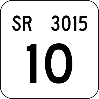
SR 3015 is a five-mile (8 km) long road where the southern terminus is at Derry Street. Progress Avenue has two major intersections: I-81, US 22. Major intersections for local roads are with Union Deposit Road in Susquehanna Township and Elmerton Avenue near Harrisburg. Its northern terminus is at Pennsylvania Route 39.
Columbus, the state capital and Ohio's largest city, has numerous neighborhoods within its city limits. Neighborhood names and boundaries are not officially defined. They may vary or change from time to time due to demographic and economic variables.

The Capital Area Greenbelt is a looping trail located in the area of Harrisburg, Pennsylvania. This 20-mile loop around Pennsylvania's capital city provides visitors and tourists with opportunities to hike, ride bicycles, skate, jog, fish, walk their dogs, spot rare birds, learn about history, enjoy native flora and fauna, and appreciate nature. While parts of the trail are shared with roads, most of the loop is a dedicated path. The Trail, as it is commonly referred to by locals, passes along the Susquehanna River through Reservoir Park, Riverfront Park, Five Senses Garden, and Wildwood Park and Nature Center. In addition to parks, the Capital Area Greenbelt passes alongside attractions including the grave site of John Harris Sr., the Governor's Mansion, Fort Hunter, Harrisburg State Hospital, and the National Civil War Museum.
East Harrisburg Cemetery is an historic cemetery located outside of the city limits of Harrisburg, Pennsylvania. The older, eastern section of the cemetery is located within the borough of Penbrook; the western section is located in Susquehanna Township, Dauphin County.
Portland, Maine, is home to many neighborhoods.
This is a timeline of the major events in the history of Harrisburg, Pennsylvania and vicinity.