
Tijuana is the largest city in the state of Baja California located on the northwestern Pacific Coast of Mexico. Tijuana is the municipal seat of the Tijuana Municipality and the hub of the Tijuana metropolitan area. It has a close proximity to the Mexico–United States border, which is part of the San Diego-Tijuana metro area.
San Ysidro is a district of the City of San Diego, immediately north of the Mexico–United States border. It neighbors Otay Mesa West to the north, Otay Mesa to the east, and Nestor and the Tijuana River Valley to the west; together these communities form South San Diego, a practical exclave of the City of San Diego. Major thoroughfares include Beyer Boulevard and San Ysidro Boulevard.

State Route 905 (SR 905), also known as the Otay Mesa Freeway, is an 8.964-mile-long (14.426 km) state highway in San Diego, in the southwestern part of the U.S. state of California. It connects I-5 and I-805 in San Ysidro to the Mexican border at Otay Mesa. The entire highway from I-5 to the international border is a freeway with a few exits that continues east from the I-805 interchange before turning southeast and reaching the border.

State Route 11 (SR 11) is a state highway in the U.S. state of California. The first phase of the highway opened in 2016, connecting SR 125 and SR 905 with Enrico Fermi Drive in the Otay Mesa area of San Diego. It is planned to be extended from Enrico Fermi Drive to the proposed U.S.–Mexico border crossing at Otay Mesa East. There are also plans for an interchange at Siempre Viva Road and to convert the highway to a toll road once the entire route is completed. Planning for the road began in the 1990s, and construction started in 2013.

Tijuana Municipality is a municipality in the Mexican state of Baja California. Its municipal seat is located in the city of Tijuana. According to the 2020 census, the municipality had a population of 1,922,523. Montserrat Caballero of the MORENA is the current mayor. The municipality comprises the largest part of the Tijuana metropolitan area.

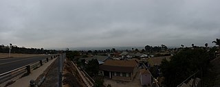
The South Bay, also known as South County, is a region in southwestern San Diego County, California consisting of the cities and unincorporated communities of Bonita, Chula Vista, East Otay Mesa, Imperial Beach, Lincoln Acres, National City, and South San Diego.
Otay Mesa is a community in the southern exclave of the city of San Diego, just north of the U.S.–Mexico border.
San Diego–Tijuana is an international transborder agglomeration, straddling the border of the adjacent North American coastal cities of San Diego, California, United States, and Tijuana, Baja California, Mexico. The 2020 population of the region was 5,456,577, making it the largest bi-national conurbation shared between the United States and Mexico, and the second-largest shared between the US and another country. The conurbation consists of the San Diego metropolitan area, in the United States and the municipalities of Tijuana, Rosarito Beach (126,980), and Tecate (108,440) in Mexico. It is the third most populous region in the California–Baja California region, smaller only than the metropolitan areas of Greater Los Angeles and the San Francisco Bay Area.
South San Diego is a district within the City of San Diego, and is in the larger South Bay region of southwestern San Diego County, California. South San Diego is a practical exclave of San Diego, having no land connection with the rest of the city. It is the only part of the city which borders Mexico. South San Diego includes four of the city's official community planning areas: Otay Mesa, Otay Mesa-Nestor, San Ysidro, and the Tijuana River Valley.

The Secure Electronic Network for Travelers Rapid Inspection (SENTRI) provides expedited U.S. Customs and Border Protection (CBP) processing, at the U.S.-Mexico border, of pre-approved travelers considered low-risk. Voluntarily applicants must undergo a thorough background check against criminal, customs, immigration, law enforcement, and terrorist databases; a 10-fingerprint law enforcement check; and a personal interview with a CBP Officer. The total enrollment fee is $122.50, and SENTRI status is valid for 5 years.

The San Ysidro Port of Entry is the largest land border crossing between San Ysidro and Tijuana, and the fourth-busiest land border crossing in the world with 70,000 northbound vehicles and 20,000 northbound pedestrians crossing each day, in addition to southbound traffic. It connects Mexican Federal Highway 1 on the Mexican side with Interstate 5 on the American side. The San Ysidro Port of Entry is one of three ports of entry in the San Diego–Tijuana metropolitan region.
Palm City is a neighborhood in the southern section of San Diego. Its neighbors are Otay Mesa West to the south and east, Egger Highlands and Nestor to the west, and Chula Vista to the north. It also serves as a gateway to the beach cities of Imperial Beach, and Coronado, by way of the Silver Strand isthmus, due to it being where California State Route 75 meets Interstate 5. Major thoroughfares include Coronado Avenue, Hollister Street, Beyer Boulevard, and Palm Avenue.
Otay Centenario is a borough of the municipality of Tijuana in Baja California, Mexico. It is the result of a merger between the former boroughs of Mesa de Otay and Centenario which took place on January 1, 2014.
The Otay Mesa Port of Entry is one of three ports of entry (POE) in the San Diego–Tijuana metropolitan region, in the U.S. state of California, connecting Otay Mesa in the City of San Diego with the Otay Centenario borough of Tijuana. The facility was opened in 1983, and was constructed primarily to divert growing commercial truck traffic from the busy San Ysidro Port of Entry, located 5.2 miles (8.4 km) west. Since then, significant passenger vehicle and pedestrian traffic has grown as development in the area around the crossing has grown. Commercial importations through Otay Mesa accounts for billions of dollars' worth of freight.

The Tecate Port of Entry is one three ports of entry in the San Diego–Tijuana metropolitan region. The land port is located between Tecate, California in San Diego County's Mountain Empire and Tecate Municipality in Baja California. It connects California State Route 188 with Paseo Lázaro Cárdenas, a spur of Mexico Federal Highway 2, as well as Federal Highway 3 to the south. It is a minor port in comparison to the larger San Ysidro Port of Entry and Otay Mesa Port of Entry. This is attributed in part to the fact that reaching the crossing on the US side requires driving on narrow, winding mountain roads.
Rancho Melijo, or Milijo, named after a local Kumeyaay village. It was later called Rancho La Punta for the location of the Arguello family ranch house, on a point of hills overlooking the south end of San Diego Bay, north of the Otay River and east of where the river entered the south bend of the bay. It was a Mexican land grant rancho, granted by Governor José Figueroa in 1833 to Santiago E. Argüello.
The Otay Mesa East Port of Entry is a planned border crossing between San Diego and Tijuana, approximately 2 miles east of the existing Otay Mesa Port of Entry. The crossing will connect the Otay Centenario borough of Tijuana with East Otay Mesa in unincorporated San Diego County, an as-yet undeveloped area slotted for future development including a business park. Although the crossing will allow cars and pedestrians, it is mainly designed for trucks and commercial vehicles.

Cross Border Xpress (CBX), historically also called the Tijuana Cross-border Terminal and the Puerta de las Californias, is an airport terminal and border crossing located in the Otay Mesa area of southern San Diego, California, United States, with an access bridge connecting it to the Tijuana International Airport in Tijuana, Baja California, Mexico. It opened on December 9, 2015. It makes Tijuana Airport a geographically binational airport. Unlike the binational airports serving the Swiss cities of Basel and Geneva, the CBX terminal is physically located in the United States but serves an airport whose main terminal and runways are in Mexico. A pedestrian bridge spans the United States–Mexico border and Via de la Juventud Oriente in Tijuana, connecting passenger terminals between the two countries. It was the creation of Ralph Nieders, who introduced the concept and infrastructure design in Mexico City in 1989 and San Diego in 1990. The structural scheme allows passengers originating in, and destined to the United States direct access to the Tijuana airport and equally gives Mexican and international carriers operating from the Tijuana airport direct access to the U.S. passenger market.
The 2015 opening of the Cross Border Xpress terminal and bridge to the Tijuana Airport, also referred to as the Tijuana Cross-border Terminal and the Puerta de las Californias, was preceded by a quarter century of negotiations that were impacted by political, economic and security issues.

