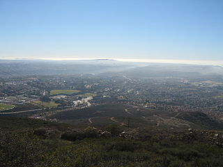
Wildomar is a city in southwest Riverside County, California, United States. The city was incorporated on July 1, 2008. As of the 2020 census, the population was 36,875. The community has grown quickly during the early 21st century; the population has more than doubled since the 2000 census, when the community was still an unincorporated census-designated place.

Escondido is a city in San Diego County, California, United States. Located in the North County region, it was incorporated in 1888, and is one of the oldest cities in San Diego County. It has a population of 151,038 as of the 2020 census.

San Marcos is a city in the North County region of San Diego County, California. As of the 2020 census, the city's population was 94,833. It is the site of California State University San Marcos and Palomar College. The city is bordered by Escondido to the east, Encinitas to the southwest, Carlsbad to the west, and Vista to the northwest. Lake San Marcos is an enclave, or county island, within the southwestern part of the city and its sphere of influence but is an unincorporated community.

North County is a region in the northern area of San Diego County, California. It is the second-most populous region in the county, with an estimated population of 869,322. North County is well known for its affluence, especially in Encinitas, Carlsbad, Del Mar, Rancho Santa Fe, Poway and Solana Beach, where house prices range, on average, above $1,000,000. Cities along the 78 freeway have more mixed incomes.

The Santa Ana River is the largest river entirely within Southern California in the United States. It rises in the San Bernardino Mountains and flows for most of its length through San Bernardino and Riverside counties, before cutting through the northern Santa Ana Mountains via Santa Ana Canyon and flowing southwest through urban Orange County to drain into the Pacific Ocean. The Santa Ana River is 96 miles (154 km) long, and its drainage basin is 2,650 square miles (6,900 km2) in size.

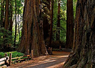
Henry Cowell Redwoods State Park is a state park of California, United States, preserving mainly forest and riparian areas in the watershed of the San Lorenzo River, including a grove of old-growth coast redwood. It is located in Santa Cruz County, primarily in the area between the cities of Santa Cruz and Scotts Valley, near the community of Felton and the University of California at Santa Cruz. The park includes a non-contiguous extension in the Fall Creek area north of Felton. The 4,623-acre (1,871 ha) park was established in 1953.

The San Bernardino Valley is a valley in Southern California located at the south base of the Transverse Ranges. It is bordered on the north by the eastern San Gabriel Mountains and the San Bernardino Mountains; on the east by the San Jacinto Mountains; on the south by the Temescal Mountains and Santa Ana Mountains; and on the west by the Pomona Valley. Elevation varies from 590 feet (180 m) on valley floors near Chino to 1,380 feet (420 m) near San Bernardino and Redlands. The valley floor is home to over 80% of the more than 4 million people in the Inland Empire region.

Black Mountain Open Space Park is a city park located in the suburbs of San Diego, California.

Rancho Bernardo is a master-planned community in the northern hills of the city of San Diego, California.
Rancho Santa Maria de Los Peñasquitos was a 8,486-acre (34.34 km2) Mexican land grant in present-day southwestern San Diego County, California given in 1823 to Francisco María Ruiz. The name means "Saint Mary of the Little Cliffs". It encompassed the present-day communities of Mira Mesa, Carmel Valley, and Rancho Peñasquitos in northern San Diego city, and was inland from the Torrey Pines State Natural Preserve bluffs.
Olivenhain is a neighborhood in the city of Encinitas, California, located in the North County area of San Diego County. It is the easternmost community of Encinitas, bordering the western portion of Rancho Santa Fe.

The Elfin Forest Natural Area is a nature preserve protecting a unique plant community in Los Osos-Baywood Park, San Luis Obispo County, central California. It consists of prehistoric sand dunes, rising 150 feet (46 m) above southern Morro Bay, on the north of Los Osos-Baywood Park.

Lake Hodges is a lake and reservoir located within the city limits of San Diego, California. It is about 31 miles (50 km) north of Downtown San Diego, just north of the Rancho Bernardo community, and just south of the city's border with Escondido. When full, the reservoir has 1,234 acres (4.99 km2), a maximum water depth of 115 feet (35 m), and 27 miles (43 km) of shoreline. Lake Hodges has a total capacity of 30,251 acre-feet of water. Lake Hodges is owned by the city of San Diego, supplies water to the San Dieguito Water District and Santa Fe Irrigation District, and its mailing city address is Escondido.

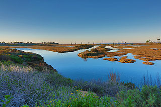
San Elijo Lagoon Ecological Reserve is one of the largest remaining coastal wetlands in San Diego County, California, United States.

The California Chaparral Institute is a non-profit organization for the research and conservation of chaparral habitats in California. It is based in Escondido, Southern California.
There are 34 routes assigned to the "S" zone of the California Route Marker Program, which designates county routes in California. The "S" zone includes county highways in Imperial, Orange, Riverside, San Diego, and Santa Barbara counties.

San Diego County, officially the County of San Diego, is a county in the southwestern corner of the U.S. state of California. As of the 2020 census, the population was 3,298,634, making it California's second-most populous county and the fifth-most populous in the United States. Its county seat is San Diego, the second-most populous city in California and the eighth-most populous city in the United States. It is the southwesternmost county in the 48 contiguous United States, and is a border county. It is also home to 18 Native American tribal reservations, the most of any county in the United States.

The Olivenhain Dam is a gravity dam near Escondido, California. The dam was constructed between 1998 and 2003 as part of San Diego's Emergency Storage Project with the primary purpose of water supply for municipal use. It does not sit on a river or stream but is supplied with water by a system of pumps and pipes. The dam is connected to Lake Hodges and the Second San Diego Aqueduct. It is constructed of roller-compacted concrete and is the first of its type in California.

Hollenbeck Canyon Wildlife Area is located near Jamul and Dulzura in California. The former cattle ranch was designated a wildlife area in 2001, and forms a wildlife corridor between Otay Mountain Wilderness and Jamul Mountains under the protection of the California Department of Fish and Wildlife. The approximately 6,100-acre area is open to the public for activities including hunting, equestrian use, hiking, mountain-biking, and (hunting) dog training.


